Tag Archives: Geology

Pearl Pass Part Two

North Side to Summit

North Side to Summit

In Part 1 I discussed the history of Pearl Pass and my family connection. I also covered the four wheel drive experience travelers have on the pass.  I have been rambling around the Rocky Mountains most of my life.  There is a lot of good country here.  I am fortunate to have spent time in some of the Rockies from New Mexico to Alberta.

Some of the best pieces of mountain country are the Elk Mountains. I have not spent much time there because of Aspen. A Western Colorado native, for many years I harbored a prejudice against ski area development.  Aspen is the ski town that started the Twentieth Century Gold Rush, this time mining tourist pockets.  The place is just too rich for a small town boy.  Over time I lost my bias, but still tended to avoid the Aspen area.  I have never been to the Maroon Bells.

Living along the Front Range influenced not visiting the Roaring Fork Valley as it is a four hour drive to Aspen from Denver. Rocky Mountain National Park and the Collegiate Peaks are a lot closer.  Recapturing my interest in my family history has drawn me to Pearl Pass.  If Grandmother Pearl could drive a wagon over the pass in 1887, I should do it as well.

Pearl Pass has seen no change in the last 130 years. Between Aspen and Ashcroft the road is paved and there is development, but once on the four wheel drive road it is as it was.  It goes between the Collegiate Peaks Wilderness and the Maroon Bells Snowmass Wilderness.  Together, they harbor the largest cluster of 14,000 foot high peaks in North America.

Sandstone

Sandstone

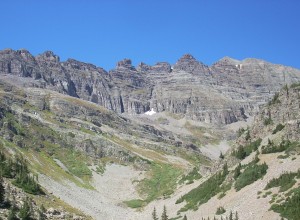
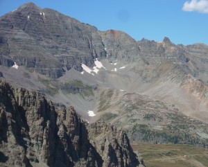
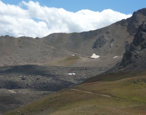
That huge area of high mountain wilderness means wild. Pearl Pass is one of the wildest places I have ever visited.  Up high, what you see is almost all above timberline.  To the east, the mountains are granite, what I am familiar with in Colorado.  To the west is sandstone.  Layered sandstone, capped with basalt.

To me, that layered rock seems wild, out of place. It is gray, with a hint of red.  When I see sandstone I expect red or tan.  The view is so striking and beautiful I am at a loss for words.  I have been trying for days to come up with a description that matches what I saw.  The pictures will give you an idea, but cannot portray the impact of so much wild space with little human influence.

One reason for the view is because the Elk Mountains are west of the central Colorado?????????? Mountains and get more moisture. The glacial cirques are huge, creating a series of basins surrounded by many high peaks 13,000- feet or higher.  The pass itself is 12,700 feet high, surpassed by Mosquito Pass for example, but unsurpassed in sheer majesty.
I am now committed to more exploration of the Elk Mountains. There are Taylor and Schofield Passes that are four wheel drive accessible.  A winter drive to the Maroon Bells is on my list.  I may even break down and get out and walk.  My backpacking days are over, but there are lots of day hikes.  Lots of people on the trails, but most of them are nice people.  The high passes are for solitude.
Freezing on Deadman’s Hill

Deadman's Hill Lookout Tower

Deadman’s Hill Lookout Tower

I did a ramble to Deadman’s Hill and some other places. I did survive, but it was not easy.

Deadman’s Hill is west of Redfeather Lakes on a road that ends on the Laramie River road.  This is one of the more remote mountain areas east of the Continental Divide in Colorado.  Redfeather is a resort community northwest of Fort Collins and north of Rustic, in Poudre Canyon.  There are lakes, a store and post office, a restaurant, and many cabins.  There is a year-round population of about 250 people.  It is a bit funky, and nothing like the ski resorts with their upscale condos.

I went to Colorado State in Ft. Collins, lived there for several years, and never got to the area.  I have had Deadman’s Hill on my list, and tried to go over the road last spring.  Alas, the road is closed from December to June.  I was too early, but not too early to see a bear feeding in a meadow just before the closed gate.

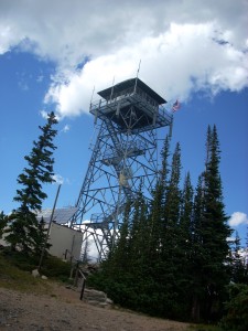
I went back last week, the road was open and well graded.  It climbs through a Lodgepole Pine forest to a spur leading up to a fire lookout tower that has a view of most everything from Rocky Mountain National Park to Wyoming and from the plains to the Rawah Wilderness in the Medicine Bow mountains.

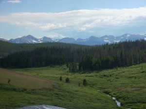
From the lookout tower I went down the hill a ways to a long meadow looking right at the Rawahs.  A little creek ran through the meadow and a pair of bull moose would drift out of the timber, feed for a while, and move back into the trees.

Meadow With the Rawah Mountains

Meadow With the Rawah Mountains

I got the tent up just in time for the first rainstorm, and had another storm a couple of hours later.  A pleasant and lovely late afternoon, with the solitude I always seek in the back country.

If it is not raining steadily, I set up my cot outside, with the sleeping bag inside a canvas bedroll along with a wool blanket.  I slept for a short while, got up to pee, got cold and stayed that way for the rest of the night.  I reached outside the bedroll and felt a layer of ice.  It seemed like my feet were as cold as those snowfields on the flanks of the Rawahs, and the rest of me had just come out of the water draining the snowfields.

I tried a few things that helped my body a little, but my feet got colder every time I left the sleeping bag.  Oh, and the sleeping bag zipper jammed.  No sleep, much misery.  At about 4:30 AM I climbed into my pickup and ran the heater to warm up.  Everything in the cab of that truck is lumpy or pokes you if you are trying to sleep.

At 5:30 I threw everything into the bed of the truck and went down the hill to the Laramie River road.  From there I went north to Woods Landing Wyoming, hoping to find coffee and food.  Closed.  On to Mountain Home, Wyoming, nothing there.  I went west to the road from North Park Colorado into Wyoming and south to Walden.

I found coffee, heat, food, and a semblance of civilization.  There were four old guys, retired ranchers from the look of them, sunning themselves on the patio in the 45 degree morning.  I saw some bicycles parked nearby and asked them if the bikes were theirs.  One shook his head, taking me literally at first.  None of them had been on a bicycle in at least 60 years.  You don’t ride bicycles if your headgear is a cowboy hat and your shirts have snaps, not buttons.

The bicycles belonged to some city folk having breakfast and fixing a flat tire.  They were in their 60’s.  Hardy people there, in Jackson County.

From Walden I went back north along the North Platte River into Wyoming.  The Platte and Laramie River valleys are what I think of as mountain ranch country.  Irrigated hayfields and pastures flanked by sagebrush hills rising into the timber.  Everyone waves at you.

Snowy Range

Snowy Range

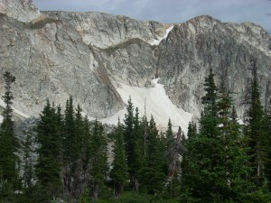
I then went east over the Medicine Bow Mountains, capped by the Snowy Range.  This is one of my favorite drives.  The mountains are snowy white, jagged, and have lovely lakes at their base.  The white rock is 4 billion year old quartzite, older than anything in Colorado.  Just off the highway on the way to a campground are some stromatolites, or petrified algae, some of the oldest evidence of life on earth.Deadmans Hill 2014 012

I had lunch in Laramie and decided to return to Redfeather and get a cabin for some sleep.  There were no cabins available, so I went to Poudre Canyon, where a cabin was too expensive.  By that time I was so tired I just went home.  A tired, cold trip in some fine country.

Geology on The Highway of Legends

Spanish Peaks and a Dike

Spanish Peaks and a Dike

I went on a tour of Southern Colorado’s Highway of Legends with a group from Colorado’s Cherokee Trail chapter of the Oregon California Trail Association. Berl Meyer, our chapter president, summers in Cotopaxi, on the Arkansas River.  He rambles around Colorado looking at the geology and the mountains.  He is from Kentucky, so has a need to get away from relentless green.

Berl organized the trip, having us meet in La Veta.  For me the trip had two segments.   Colorado geology is one of my interests, and the Highway of Legends country has some world famous geology.

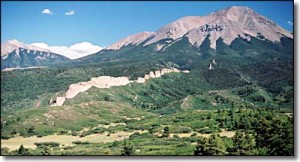
The Spanish Peaks south of La Veta, are relatively recent (geologically) igneous intrusions that rise to over 12,000 feet in elevation.  Located fairly far east for the Rockies, they served as important landmarks for early explorers and travelers.  When the intrusions barged in, they bulged and fractured the existing rock layers, and a series of vertical dikes radiate from the mountains.

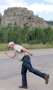
Cucharas Pass is between the Spanish Peaks and the Sangre de Cristo mountains.  At 9,995 feet, it is another lovely Colorado mountain pass.  There are lots of dikes, and on the south side of the pass is Stonewall, at first look another dike, but this feature is a vertical wall of Dakota sandstone, pushed on edge by the Spanish Peaks uplift.

???????????????????????We had a startling encounter at Stonewall.  We had stopped for a break and to look the stone wall over when we had a visit from a Greek god.  Most people don’t know, but the gods are still with us.  They travel the world keeping track of events and people.  This particular Greek god is one of the lesser ones, namely Hermes’ great uncle.  The photo shows him as he was leaving.

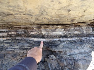
The road then enters the coal country west of Trinidad.  There is lots of history in that area, and a world famous geological feature.  On the road to Trinidad Lake just outside Trinidad is  an exposure of the K-P (formerly K-T) boundary that marks the end of the Mesozoic era and the beginning of the Cenozoic, or modern era.  It is called the K-P because it is the boundary between the Cretaceous period and the Paleogene period.  Below the boundary, dinosaurs.  Above the boundary, no dinosaurs.K-T Boundary

The boundary is a narrow band of whitish clay that fell when an asteroid struck off Yucatan and threw a tremendous cloud of material into the atmosphere, blocking the sun and cooling the entire planet.  75% of life on earth perished, including the dinosaurs.  In a road cut on the way to the lake you can put your hand on the boundary.

There are exposures in many places around the world, including North Table Mountain in Golden, but this one is the most accessible.  I have wanted to go there for a long time.

We went to the San Luis Valley, over La Veta Pass from La Veta.  The valley is our own rift valley, formed as the movement of the Pacific tectonic plate drags some of the North American plate north.  The motion pulls things apart, and a big block subsided, forming the rift valley.  The Arkansas River north of Poncha Pass and the Rio Grande River mark the rift. (Real geologists, including Berl, don’t get the vapors at this explanation.)

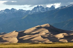
Great Sand Dunes

Great Sand Dunes

On the east side of the San Luis Valley is The Great Sand Dunes National Park, another world famous geological feature.  The sand for the dunes comes from the San Juan Mountains to the west.  Normally, the sand would just keep going, blown over the Sangres to the plains farther east.  In this case, a creek picks up the sand blown off the dunes and carries it back to the other side, replenishing them every spring.  The result is a mammoth dune field, good for viewing, climbing, and tumbling down.  The creek is good for play as long as it lasts into the summer.

Good geology, good scenery, and a good time.  The geology is not a legend, however.  It is the real thing, and students from geology departments all over the country visit and study in Colorado.


Colorado’s Front Range Floods

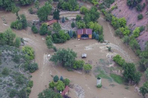
2013 flood

2013 Flood

Those of us who live along the eastern base of the Rocky Mountains enjoy a unique set of circumstances; a fine climate, mountain views, a mountain playground, and rivers that provide much of our water needs.  There are millions of people living in an urban area that runs from Pueblo to Fort Collins.

Most of the time, the physical setting and the climate combine to make the Front Range a fine place to live.  There is risk, however.  Most of the time we don’t have quite enough water for every need. The people are along the Front Range, and the water is on the western slope.  On occasion, we have way too much water.  We are subject to drought, our own waste of the water we have, and the floods that come out of the mountain canyons.

To understand these problems requires a look at two histories, the Rocky Mountain history for the last 75 million years and human history from 1859.  Around 75 million years ago the Rockies began to form.  As they grew, they also wore down.  The debris from the mountains spread from their base to as far as Nebraska.

The streams were bigger then.  Drive east to Bijou Creek and see the valley that obviously was not formed by the current flow in the creek.  The wind blew.  It still does, leaving eolian sand deposits.  Sand Creek, draining the area east through Stapleton and into Aurora is appropriately named.  You can identify the sand hills – they are grazing land, not good for farming.  That sand and dirt comes from as far as Utah and coats our cars.


Today, the Rockies are not eroding as fast as they did during the ice ages, but they are still coming down.  Back in the Precambrian when I took geology, the assumption was that erosion was a steady, gradual process.  Taking the long view, that is so, but on a human time scale, erosion is punctuated by periodic floods.  Some of the floods are from spring runoff from wet winters.  The catastrophic floods pound out of the canyons when storms park themselves over an area and it rains.  And rains.  Sometimes it rains more in a few hours than it does in several normal years.  Sometimes the rain is where the people are, just east of the mountains.

Large amounts of moist monsoonal air from the Gulf of Mexico move north along the Rockies and encounter a cold front coming from the west.  Sometimes the rains are short in a fairly small area.  At other times, as in 2013, the rain comes down over a large area, and it rains for days. To humans, these storms seem like unusual events, but they have been happening for millions of years.  Along with normal erosion, they have filled the Denver Basin with 13,000 feet of debris.  That is a lot of rocks and mud.


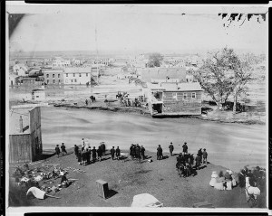
1864__Cherry-Creek-Flood~p1

1864 Cherry Creek Flood

One of the first recorded monsoonal floods was in 1864, not long after Denver was settled.  Cheyenne and Arapaho Indians told the settlers seeking fortune not to build where Cherry Creek and the South Platte meet.  The town builders built there anyway.  It was a logical town site.  Trails met, grass, trees, and water were available, and the gold-rich mountains just a short distance away.  Much of the new town went downstream.


The town was rebuilt in the same place.  Floods came again.  Denver flooded in 1876, 1885, 1894, 1912, 1921, 1933, and 1965.  Pueblo flooded in 1921, the Big Thompson in 1976, Manitou Springs and Colorado Springs in 2013, and much of the Front Range from Denver to Fort Collins in 2013.  The link is from the Atlantic Monthly, with dramatic images from the 2013 flooding.

Most vulnerable are towns at the base of the mountains: Manitou Springs, Palmer Lake, Morrison, Golden, Boulder, Lyons, Loveland, and Fort Collins.  Towns along the South Platte, St. Vrain, Cache La Poudre, and Big Thompson rivers are at special risk.

DSCN0960

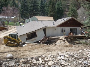
Jamestown 2014

Will people stop building there?  Rebuilding is underway in every area flooded in 2013.  While researching this piece I traveled to Boulder, Jamestown, Lyons, and the farmland along the St Vrain.   I saw travel trailers parked nest to damaged homes with building permits on the flood-damaged houses.

Some actions do prevent floods.  Denver has Cherry Creek, Bear Creek, and Chatfield dams.  They are flood control dams designed to capture floodwaters.  Let’s hope they are big enough.

The photo above has a lot of rock in the foreground.  The rocks range in size from sand and silt to head size.  They were exposed by the 2013 flood, but were deposited by a previous flood that had enough force to carry that debris and dump it there.  upstream, there are narrow gulches with the lower ends scoured down to bedrock.  That debris went further downstream.

The Rocky Mountains are on the way to the Mississippi river delta in Louisiana.  It will take many millions of years, but they will wear down and become Mississippi mud.  Floods will hasten the process.

Recent Entries »