Category Archives: Western Colorado

Western Colorado Road Trip

Recently I had a meeting in Gunnison, so I made a short trip of it.  From Denver I went up to Buena Vista and over Monarch Pass, but this time I went over the old Monarch Pass road, abandoned when the highway on upper reaches of the Pass was widened and straightened.  Modern mountain highways are expensive, moving mountainsides and filling low spots.  The older roads tended to follow the lay of the land more closely.  They were cheaper to build but slower and more dangerous.

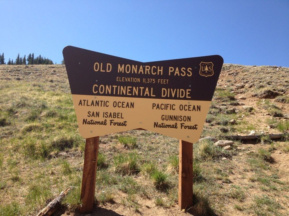
I like the old roads, even more if they aren’t paved.  Old Monarch Pass follows the recipe.  It’s narrow, winds around and goes up and down.  It had about three inches of partially melted snow, making for some slick spots and lots of mud, but not the mud that likes to trap unsuspecting cars.  I was going slow, so I got to enjoy the scenery and a pretty day.  I rolled the windows down, opening up my steel cocoon a bit.  Good thing.

I stayed in Gunnison, and next morning I drove up to Crested Butte, one of my favorite ski towns, with some of the flavor of an old mining town remaining, in contrast to the modern European Chalet style of Vail.  No  McDonald’s, no chain restaurants, and lots of local businesses.  I had coffee in a place without WiFi.

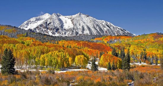
Kebler Pass during the Aspen Color

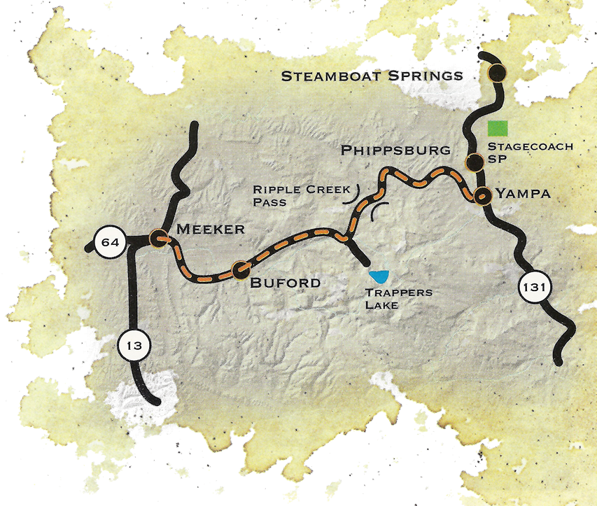
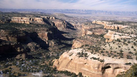
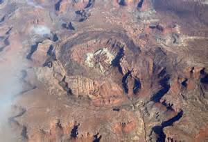
Next was Kebler Pass, one of the best drives in the state.  It goes from Crested Butte to east of Paonia, and is mixed gravel and pavement.  If you want the best fall aspen viewing in Colorado, Kebler Pass is the place.  Huge stands of quakies with good mountain backdrops.  The leaves were gone on this trip, but the beauty remains.  To the south are the West Elk mountains and and a large, mostly untraveled wilderness area.  The Elk Mountains are North and east, some of the wildest peaks in the state.

I was in big, beautiful, rugged country mostly empty of human development.  Emptiness and solitude, part of why I love Western Colorado.  The road comes out outside of Somerset, a coal mining town between Paonia and McClure Pass above Carbondale.  Big coal mines there, mostly shut down.  That’s mining in Colorado.  Dig lots of stuff, then go broke and leave a big mess behind.

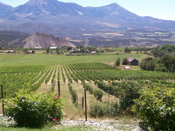
I like Paonia, fruit trees below mountains, no McDonalds, no Walmart, as it should be.  There is lots of pretty farm country from Paonia to the turnoff to Grand Mesa outside Delta.  The Grand Mesa road climbs to the top of the 10000 foot tall flat topped Mesa.  It’s wet country, catching the storms coming across the desert country to the west.  My main memories are going fishing there with my father.  Lots of lakes, mosquitoes, gnats, and

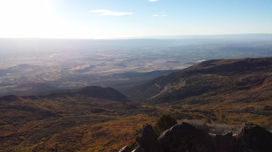
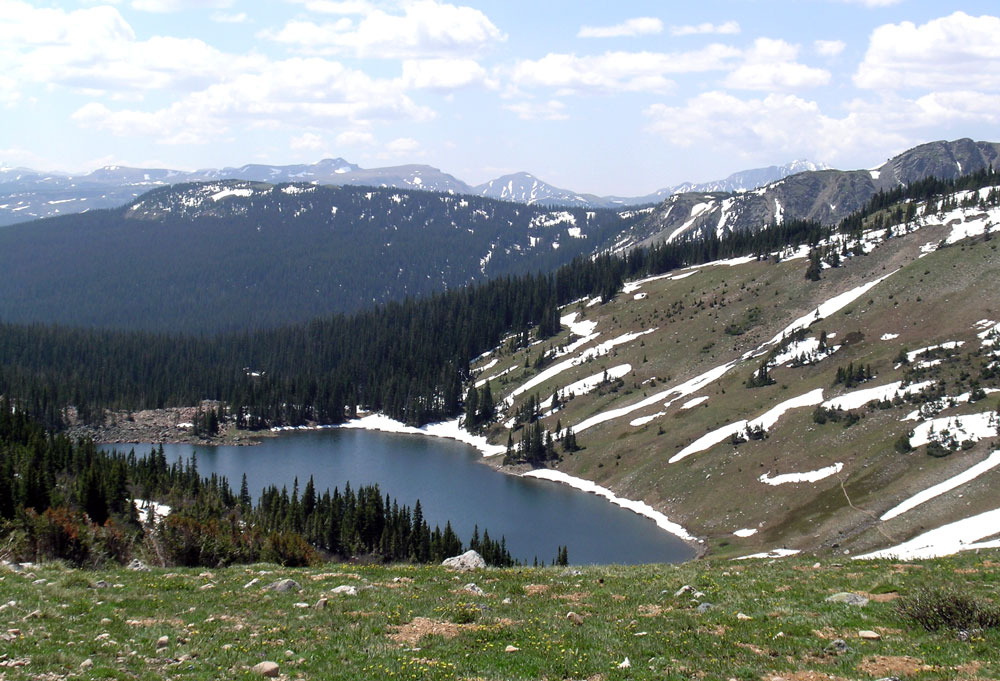
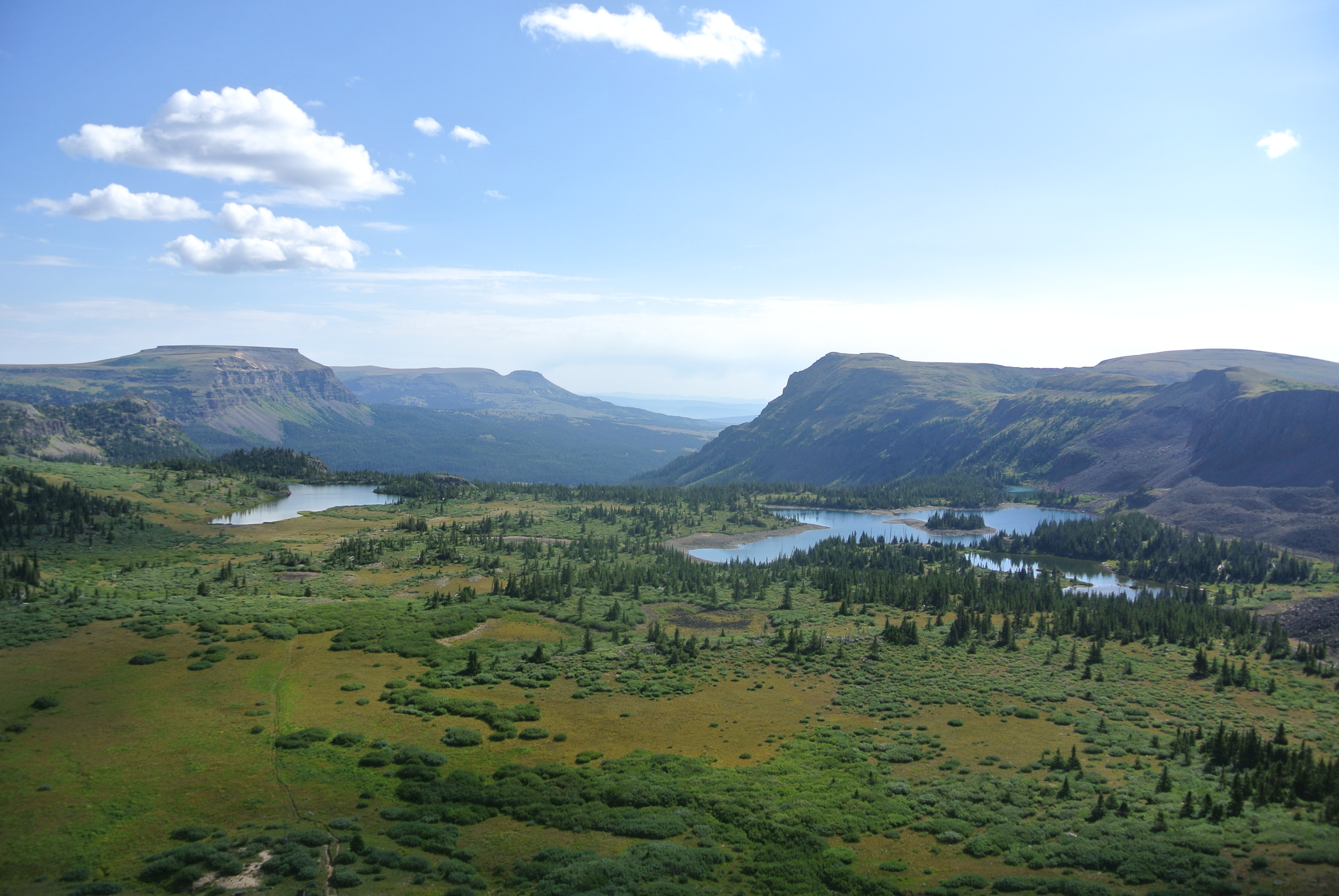
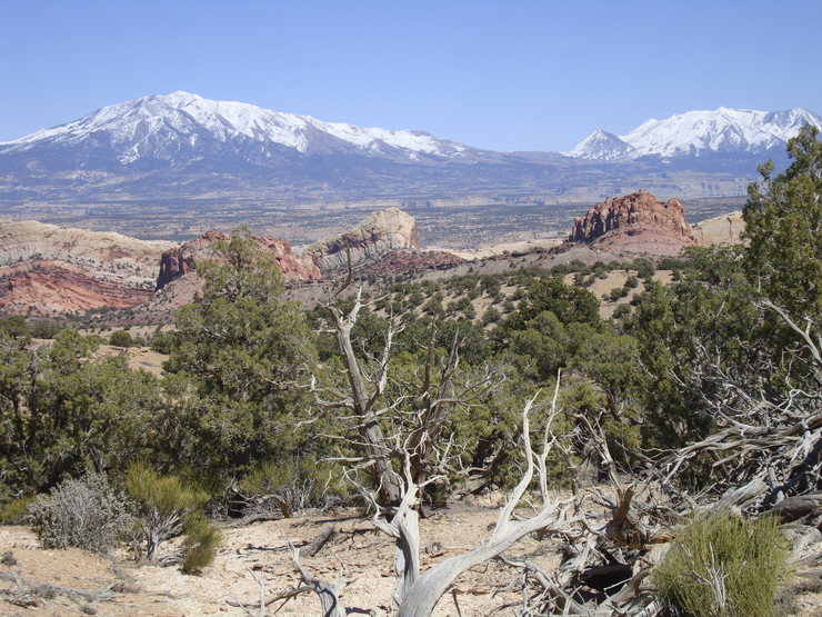
View From Lands End. Impossible to Photograph the Panorama

cold nights.  I did not become a fisherman.  The Land’s End road runs west from the highway to the rim of the Mesa.  The view is unsurpassed.  The San Juan’s to the south, the Uncompahgre Plateau across the Gunnison River valley to the west, and the Grand Valley of the Colorado under the Bookcliffs and the Roan Plateau.  You can see into Utah.  The road winds off the Mesa to Whitewater.  Steep and twisty gravel.  I’m saving that part for next time.

I went on over the mesa to Collbran, where I continued my search for the big landslide off the mesa that killed three men running a mile off the mountain.  I didn’t find it, but ran round some nice farm and ranch country while looking.  When I got home I printed out a map.  Duh.

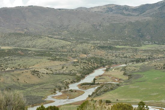
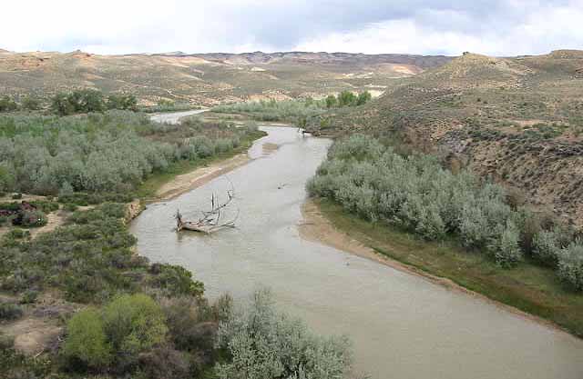
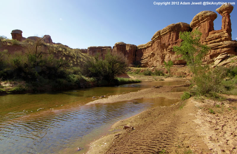
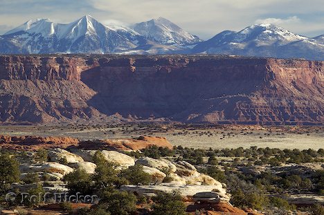
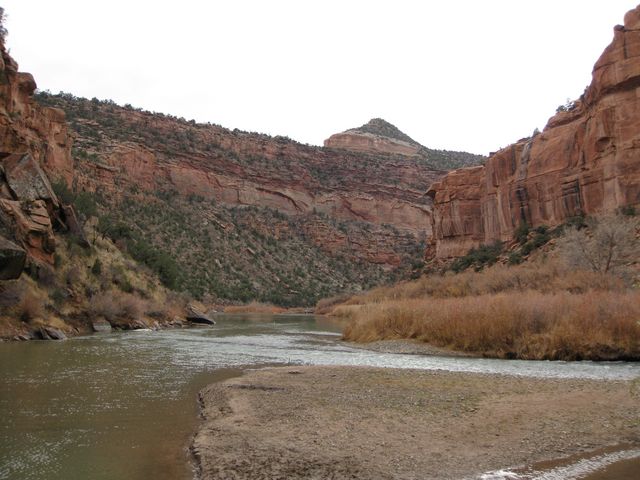
Colorado River Below Kremmling

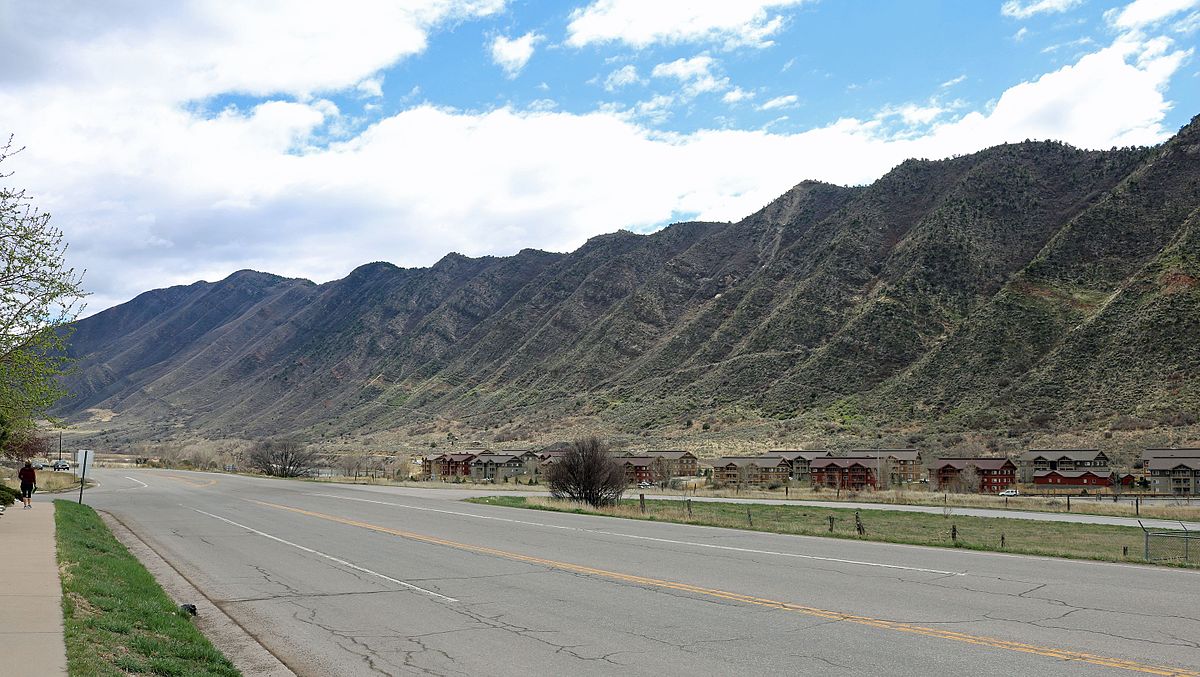
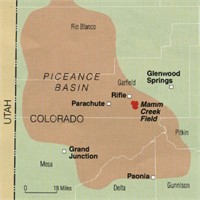
That night I stayed in Parachute off I-70 in oilfield country.  Enough about that.  Next day I followed the Colorado River from Dotsero to Highway 40 at Kremmling.   Again, I crossed a lot of wild country with a bit of development in spots.  The river runs in a succession of canyons and narrow valleys.  No spectacular mountains, just lots of good rugged country.

After Kremmling, Highway 40, Granby, Winter Park, and Berthoud Pass to eastern Colorado, and home.

Wildfire Revisited

Ventura Fire

Things are hot in Southern California.  Earlier, it was hot in Santa Rosa and the Napa Valley.  When there is a high pressure system over the Great Basin and a low develops off the California Coast, the pressure gradient gives rise to hot downslope winds blowing from east to west.  The Santa Ana.  Wildfires proliferate in the mountainous chaparral country.  As the population continues to grow, the urban areas extend into the brush country.

That Great Basin high is also a fire maker for Colorado, Utah, New Mexico, and Arizona.  Here in Colorado, low pressure systems move down the Plains and the pressure gradient creates winds similar to California’s Santa Ana.  As with most natural phenomena, it is not if, but when.

It’s gonna burn, folks.

The brush country is that way because frequent wildfires prevent any significant tree growth.  When the brush burns, it tends to return in just a few years.  With trees, not so much.

Rawah Burn. Over 100 Years, Trees Have Not Returned

I remember backpacking through a 100 year old burn in the Rawah Wilderness here in Colorado.  The trees had not returned, and the topsoil was eroded away on the hilltops.  Fires in Colorado’s chaparral country such as west of Glenwood Springs burn and in five or ten years the brush is back, ready to burn again.

I have seen this happen in my lifetime.  The  ridges south of the Colorado River and west of Glenwood have burned at least twice.  Lightning causes some of the fires, but once a fire spread from the town dump.  The tragic 1994 fire that killed fourteen firefighters was north of the river and just west of Glenwood.  The fuel load was greater because the area had not burned for some time.


Storm King


If you go back to the Storm King fire area, you will see the brush returning.  It’s not ready to burn yet, but given some time and a few wet years, it will be ready to go again.  The town of Glenwood has built up right to the brush on both sides of the river.

Brush Returning

Back to California, the towns have grown up to the brush and those wanting a view are living in the brushy areas.  The canyons are more heavily wooded and full of houses.  All the coastal mountains from San Diego north are in the chaparral zone.  All the urbanization is also in those areas.  Quick commute? Live just below the hills in a canyon.  Nice view, build your house on the ridge.

Those examples of the urban-woodland interface are not unique to Western Colorado and California.  The Colorado Front Range is another example.  Fires have burned from west of Fort Collins to south of Colorado Springs.

Waldo Canyon Fire


The Waldo Canyon fire burned into town on Colorado Springs’ west side and into Manitou Springs.  The Black Forest Fire was in a different climate zone with Ponderosa Pine , but with lots of brush.  That area is wetter, but is also subject to drought and wildfire, just less often.

Arizona and Utah have similar country, and fire killed 19 firefighters in mixed brush and timber just outside Prescott.  I am waiting for a big fire just west of Denver.  It’s only going to get worse.  People are moving into the brush country in increasing numbers,  if you move to Colorado or California from Chicago, you want the mountain experience.  The jobs are in the cities, and the closest mountain areas are brush country.  Four Mile Canyon outside Boulder and Ojai, California are examples of what fire does to development in the chaparral.

Young people looking for an exciting career should look into wildland firefighting.  It is a growth industry.  Oh, I haven’t even mentioned climate change.  It will increase job opportunities.

Wildfire

Some of the golden hills of California just turned black.  This time it is north around Santa Rosa and the wine country.  Usually it is the San Gabriel mountains or other Southern California areas.  The conditions leading to destructive wildfire are the same.  There are essentially two seasons; when it rains and when there is no rain.

This year there was a lot of rain in what passes for winter in all of California.  Everything greens up and grows.  It means good feed for cattle, and lots of fuel in the fall when it dries out.  You are probably familiar with the Santa Ana winds in Southern California.  The desert Great Basin east of the mountains cools off, creating an area of high pressure.  The pressure creates west-flowing winds, blowing to the coast.  As the winds hit the mountains, they rise, cool, then flow down the west side of the mountains, warming as they flow west.  Thus the Santa Ana winds, hot dry wind flowing west and drying all that foliage that grew during the rainy season.

In Northern California, the winds are called Diablo winds, after the local Diablo mountains.  The high pressure west of the coastal region originates from high pressure following storms blowing into the basin from the stormy northwest.  The high pressure again creates west flowing wind howling down the west side of the mountains.  The fires are set or lightning started, and burn across the valleys.  That means the golden hills, vineyards, and Santa Rosa suburbs.

The fire triangle: fuel, heat, and oxygen.  The fuel grew, much heat comes with the wind, which also supplies plenty of oxygen.  Add an ignition point, and it burns.  The wind and fire blows down canyons, and people like to live in the canyons.  When all the space in the canyons is full, people move into the hills.  It is called the urban-wildland interface.  The entire American West is growing in population, and the new people moving in want to experience some open space.  The open space is open because it periodically burns, thus no forest, just chaparral and grassland.  And houses.  Destruction.

Is climate change partly responsible?  You decide.  California has always had destructive fire blowing in from the west, but is climate change exacerbating the natural phenomena?

Here in Colorado, we also have destructive wildland fires fanned by downslope winds.  Here the winds are from the west, hit the mountains, rise, cool, and roar down the eastern side of the mountains, fanning fires.  People are moving into the areas where the fires have always burned, and their houses burn.  The Plains east of Denver see huge grassland fires, especially after a wet spring.

Storm King Fire, Glenwood Springs CO

Western Colorado also has wind accelerated fires.  Westerly winds encounter the west side of the Rockies, rise, cool, and descend into the area around Glenwood Springs.  The country is the Colorado equivalent of California Chaparral.  The brush burns got, killing firefighters and threatening towns.  It is only a matter of time before things get hot in Glenwood, Newcastle, and Carbondale.

The West is a wonderful place, with open space, mountains, deserts, and a harsh climate.  People moving there beware, the conditions are more violent than in the well-watered East.  Oh, and don’t forger the landslides and avalanches where it is steep, along with fire.  There is lots of steep country.   There is steep country just west of all the people living along the Front Range.  The fires just might burn into town, just like Santa Rosa.

Waldo Canyon Fire, Colorado Springs

Colorado Springs has seen fire, along with Boulder.  Some day a fire may want to go downtown in a Front Range city. It is also likely a mountain town like Evergreen or Estes Park will burn.  The Mountain Pine Beetle has left a lot of standing dead trees ready to burn.

Why do I seem to be writing about fire, earthquakes, hurricanes, and other means of destruction? Maybe because I am confronting my own mortality.  I just turned 75.  I know it is surprising because I look so young.

The Empty Quarter

Portion of Flat Tops Wilderness

Well, its not a quarter of Colorado, but it’s big and pretty empty.  North and west of the Colorado River and south and west of the Yampa River, the only towns of any size are Rifle, Silt, Newcastle, and Glenwood Springs along the Colorado; and Meeker in the middle.  Craig and Hayden are on the  Yampa.  I don’t count Rangely on the White River west of  Meeker as a real town.  It is just a bunch of oil field junk with a few forlorn people. I recently traveled through the heart of the region.

I am a Western Slope native, so I have been over the relatively well traveled roads.  I-70 (previously highways 6&24) and SH 13 from Rifle to Craig.  As a kid, I went fishing on Rifle Creek with my parents.  The

White River

White River drains the White River Plateau and The Flattops.  Piceance Creek drains the Piceance Basin and enters the White between Meeker and Rangely.

Meeker is a pretty town in the valley of the White River.  It’s a farm and ranch town with a sad past.  The Meeker Massacre in 1879 was the end of the Utes huge reservation  lands in Western Colorado. They were shipped to Eastern Utah.  The reason was the systematic U.S. Policy of cooping the Indians up or killing them.  There are grisly details, but it was just another example of the U.S. Policy of mistreating Native Americans that continues to this day.

Maybe you have heard of Trappers Lake.  It is an enclave surrounded by the Flattops Wilderness, a huge area of timberland dotted with many small lakes.  The only access is on horseback or backpacking.  It’s wet country, catching the storms as they leave the lower country to the west.  Hunters, fishermen, and tree huggers are the only travelers.

I never backpacked there, but two friends humped there way in years ago.  They talked about the beauty,  but mostly about the rain.  One of them had one of those convoluted open foam pads with no cover.  When the water came into the tent, he was lying on a sponge in a soaked down sleeping bag.  They left early.

West of SH 13, along the Grand Hogback,

Grand Hogback Between the Colorado Plateau and the Rocky Mountains

you are on the Colorado Plateau.  Go east, and you are in the Rocky Mountains, but not the Rockies you are used to.  The hogback is a remnant of the uplift that formed the Rockies.  The equivalent on the east side are those red rock hogbacks called the Flatirons, Red Rocks, and the Garden of the Gods.

No big mountains here, just a region of high plateaus.  The reason? Volcanism in the form of lava flows.  The White River Plateau was uplifted along with the rest of the Rockies, but instead of being eroded into those jagged peaks we are used to seeing, the basalt from the lava flows formed a resistant, flat caprock.  It’s not rugged mountains, but it has a beauty all it’s own.

Flat Tops Trail

The is a scenic byway between Meeker and Yampa I took for the first time,  At first, it is in the White River valley, then climbs up on the plateau and heads on east to Yampa.  The view to the south is where the Flattops drop down to the river.  It’s not a gentle slope.  The basalt caprock is underlain by the soft White River Formation.  The steep slope is subject to landslides, leaving large open, green slopes surrounded by timber.  It’s great summer range country for sheep and cattle.  It is also some of the prettiest country in our state.  I think I met two pickups on the road east of Buford, where the road turns off to Trappers Lake.  It’s gravel much of the way, but good gravel.

West of SH 13, on the edge of the Colorado Plateau, is the huge Piceance Basin.  It is a Structural basin next door to the Uinta Basin, mostly in Utah.  The basins are separated by the Douglas Arch, crossed by Douglas Pass, country where I spent a lot of time in my youth.  The arch is a western extension of the Laramide Orogeny, the mountain building period that formed the Rocky Mountains.  The edges of mountain ranges usually have foreland basins, areas of subsidence.   I am sitting over the Denver Basin.  The Piceance is the equivalent west of the mountains.  As the mountains rose, the fringes sank, creating huge synclines filled with the erosion products of the mountains.    The basins formed huge inland lakes which filled with sediment that became the Green River Formation, famous for its fossils and oil shale.

The Greater Piceance Basin

Because of all that rising and sinking, pockets form, trapping reservoirs of gas and oil.  The Piceance is one of the most productive natural gas fields in the country.  Rangely’s oil is also from the Piceance.  I drove the road running along Piceance Creek, which drains the basin to the west.  The area is all about natural gas, with some ranching along the creek.  There is a gas plant every few miles, and lots of truck traffic.  The basin used to be the home of a huge migratory deer herd, the deer summering in the Flattops and wintering in the basin.  The herd is still there, but all the drilling has greatly reduced the numbers.  Lots of elk there as well, their numbers increasing somewhat, probably due to less competition from deer.

The area is known as the Roan Plateau, which drops off to the Book Cliffs, an escarpment runnng from Palisade, CO to well past Greenriver UT.  It feels like home country to me, with memories of deer hunting in the Douglas pass area.  The scenery isn’t as dramatic as the red rock country to the south, but has its own beauty.  Plus, it isn’t as cluttered up with people.

Piceance, Uinta, Roan Plateau, Book Cliffs, all names for roughly the same country.  My list now includes going up into the basin proper, known mostly by Ute Indians, ranchers, oil field people, geologists, and aging wanderers.

Guns

gunsI am from Western Colorado-outdoor sportsman central.  Hunting big game, small game, ducks and geese, most any things that moves was a way of life.  I grew up around guns as my father hunted and fished.  I hunted as well, but fishing never appealed to me-too boring. 

I was always fascinated by guns.  I liked the mechanical precision, the looks, the way they felt in my hands.  There was, of course, another set of reasons for my fascination.

Guns are for killing.  When hunting, I was repelled and attracted to the act of killing. I would walk along hunting rabbits thinking “Why am I here, I don’t like the killing?”.  As soon as a rabbit jumped, the gun came up and I was shooting.  More than once I have sold all my guns, swearing off them, only to find myself in a gun shop. 

In Army basic training I became welded to the famous old M1 Garand rifle.  I still like the damn things, although I haven’t bought one as a civilian.  In Germany I got an M14, much like the M1, but holding 20 rounds instead of eight.   

.50 Caliber Machine Gun

.50 Caliber Machine Gun

When I got promoted I was given the responsibility for a .50 caliber Browning machine gun.  Completely assembled it weighs about 120 pounds and fires a cartridge about six inches long, with a bullet half an inch in diameter.  We went to Wildflecken, Germany, the traditional invasion route for eastern invaders, to shoot the thing across a canyon.  It sure was fun.  It sure did give me a significant hearing loss. 

The real reason for my fascination with guns, however, is fear.  I have been afraid for my safety for as long as I can remember.  The cause?  Probably some abuse I experienced at a young age.  I remember making a tent out of a card table and blankets in the living room when I was home alone.  I would get under there with my .22 rifle and dream about driving the invaders away.     

The gun magazines used to be mostly about hunting arms, now they are filled with articles about protecting your home from hostile invaders.  That is right down my alley, even though I live in a safe neighborhood and have never experienced any need for protecting myself with a gun for 73 years.  This is a big cognitive disconnect in my life.  I think the strategy is to not read that stuff.

To deal with my fear I am now using a mindful meditation technique.  I meditate watching my breath.  When any fear-related thoughts arise, I notice them, name them “fear, fear”, and watch them fade.  I also have the fear thoughts arise at other times, as when driving.  I say a short prayer, sometimes several times, until the fear thought fades.  I do this many times during the day.  It works. The thoughts leave, and they are not recurring with the same frequency.  I feel better, and have more energy for useful things.  I am not doing this to seek enlightenment, I am doing it to rid myself of wasteful thinking so I can focus on the good.

rat in cage two bottles

The World Famous Green River Formation, for oil shale, not beauty

The World Famous Green River Formation, for oil shale, not beauty

About fifty million years ago the Grand Canyon and the Colorado River did not exist.  The area was surrounded by the Wind River Mountains, the Uintah Mountains, the San Juans, the Uncompahgre Plateau, and the newly formed Rocky Mountains.  This huge area had no outlet to the sea.  The climate was similar to our current Gulf Coast, warm and moist.  During the six million years we are exploring, things changed.  Lakes formed and receded, land rose and subsided, and through all this the surrounding highlands were sending their sediment into the lakes.   

The Green River Formation is the result of all the sedimentation.  It is up to ten kilometers in depth, thinner at the margins.  At first the lakes were fresh water, but later became saline, leaving large deposits of carbonate rocks.  The trona deposits at Green River, Wyoming are some of the richest in the world.  The margins are sandstone and conglomerate interlaced with the fine silt that filled most of the basin.  The formation is rich in the fossils of the abundant life in the lakes.  They are world famous for their variety and abundance.   

There was an anoxic layer at the bottom that preserved the organisms settling there.  The lakes were abundant in blue-green algae.  The remains of the algae are the source of the oil shale deposits the region is known for.  The oil shale is there in millions of barrels, but it is expensive to extract the petroleum from the rock.  It may never be commercially viable, but the formation has been extensively studied as a result.  

Green River Formation Map

Green River Formation Map

Standing in my home town of Fruita looking north, the white cliffs behind the Book Cliffs are the Green River Formation.  The Roan Plateau is huge, but does not attract visitors like the red rock country to the south.  A huge exposure is the highlands west of I-70 from Rifle to DeBeque Canyon. 

My interest is from visiting ranchers and hunting in the Douglas Pass area in my youth.  Most of our visits were to ranches in the Green River Formation.  The elevations varied greatly.  The ranches were along West Salt Creek, but there were back country roads that went from sagebrush desert to piñon-juniper to oak brush shaly hillsides with sandstone rims to high country timber with world class mud.  In fact, the mud is world class everywhere in the region. 

Back before four wheel drive became common, there was a pile of rocks at the bottom of every big hill.  Load them in the back of your pickup, go where you planned, and unload them on the way home.  There is a network of canyons with side canyons branching off.  All of it is fine deer habitat.  My favorite places were at the head of a canyon with the wind in my face and a view of the LaSal Mountains and the Uncompahgre Plateau in the distance.  Flat, wooded country gives me the creeps. 

Access to a lot of the country is difficult.  Most of the land is BLM land, but the early ranchers homesteaded the choice land that had water.  The private land meant locked gates.  We knew some of the ranchers, family friends.  Hunting season was a big deal.  There were maybe a dozen or more people, hunting during the day and drinking and playing poker at night.  The big ranch house had a big kitchen with a wood burning stove along with the stove in the big main room.  There was a light plant in the shed next to the house.  It looked like no generator you see these days.  There were also lots of Coleman lanterns when the light plant failed.  Good times and lots of venison.  The unheated bunkhouse was upstairs. 

Douglas pass was up the main road, gravel in those days.  It isn’t that high by Colorado standards, but made up for it with the switchbacks up the head of the canyon to the summit up through that shale.  When the shale is wet, it moves.  The road trapped the runoff, wetting the soft shale, and most every spring one or more places slid.  The mountainside now is braided with old road cuts.  It wasn’t much of a main road in the 1950’s, but now there is so much oil and gas development that the road is a paved state highway that the highway department spends money on. 

The road crosses the desert above the Highline irrigation canal before it goes into the canyon.  It is on the Mancos shale, responsible for all that flat desert in Colorado and Utah that turns to grease when it is wet.  There was one hill the road went over then descended into the wash on the north side.  That meant the road was on a north facing slope for a distance.  That hill was named Coyote, because it could bite and gnaw on you if it was wet.  A bit farther north was a ten or twelve foot high rock on the side of the road, all by itself.  

The county employee maintaining the road in those days had his grader blade scrape on that rock every time he bladed the road.  It would leave a bump, so he would have to drag dirt over to level things out.  One day he got fed up and dug that rock up and moved it off the road.  It was probably a two day project, but he never had to fight that damn rock again. 

After I could drive, I ran around that desert quite a bit.  I learned how to drive a two wheel drive pickup in that greasy stuff from my father.  He was the telephone man in Fruita, responsible for maintaining the toll line as far as Cisco, Utah.  That meant navigating two ruts through the cheat grass and sagebrush.  He could put a two wheel drive pickup into places that were a challenge for a Jeep.  Rocks in the back, chains if needed, put it in second gear and putt along.  He seldom used the granny gear or used the gas pedal.  Those old Chevy sixes would just lug their way along.   

I am as guilty as any back country explorer for spending most of my time in the Rocky Mountains or the Utah red rock country, but the Mancos Shale and the Green River formation are calling me.  I just need to see if my tire chains are in good shape.  I think I will go over Douglas Pass, loop around and look the Piceance Basin over. From Rifle I will go down to Plateau Creek (my father and grandfather said platoo crick) and up to Collbran to look at the big slide.

The Colorado Plateau Part Two


Colorado Plateau Country

Colorado Plateau Country

There is a lot of beautiful country on the Colorado Plateau, but there is the other side.  The term many use is the stinking desert.  My home town has an annual rainfall of about eight inches.  Before the Utes were run out and ditches were dug, the Grand Valley was a sparse desert.  The irrigation projects made much of the valley green, but north of the Highline Canal is the desert.  It is a fairly barren desert, not like the Sonoran Desert with its green saguaro cactus.

Mancos Shale Soil

Mancos Shale Soil

The soil, if you can call it that, is fairly infertile, high in salts, and high in toxic selenium.  It’s called the Mancos Shale.  The Mancos Shale, called the Pierre Shale east of the Rockies, runs from South Dakota to central Utah.  It is an ancient sea floor, Cretaceous in age, of the inland sea covering much of North America.  Shale is mud rock, laid down as the sea advanced and retreated over millions of years.

The lower part of the Bookcliffs and the valley floors are Mancos Shale.  In its natural state it is a scrub grassland, supporting small populations of deer, antelope, prairie dogs, sage grouse, cottontails, and some Bison.  When the Northern European Americans arrived, they saw grazing land.  The sheep and cattle came.  The ranchers did well for a few years, but their expectations were unrealistic for such a dry area.  Soon, most of the good grass was gone, replaced by cheat grass and sagebrush.

The area between Delta and Grand Junction is a prime example.  My father, born in 1903, lived in Grand Junction after 1918.  He told me that at that time, there were extensive stands of tall bunch grasses.  They are gone.  That desert is one of the most barren stretches I am aware of.  It is hilly, so irrigation water went to flatter areas.  It is close to towns, so lots of ranchers grazed their stock on the land.

Much of the Mancos shale country is BLM land today.  In the old days, the Land Office and the Grazing Service leased land to ranchers.  There were allocations on the number of head allowed on each segment, but there was little enforcement.  The grass mostly disappeared.  Thus, the stinking desert.

I-70 from Palisade to the west of Green River, Utah is on the Mancos.  Highway Six from where I-70 veers south almost all the way to Price is on the Mancos.  Travelers on those highways have the bare Bookcliffs and the bare desert floor to look at for over 200 miles.  Their impression was what tended to keep the canyon country to the south relatively isolated.  Locals had all that magnificent country mostly to themselves.

Art in Salt Creek Canyon

Art in Salt Creek Canyon

The a uranium and oil and gas booms of the 1950s built a large network of roads and opened the canyon country up for tourism.  Those flat deserts remain empty, along with the mostly shale country of the Bookcliffs and the Tavaputs Plateau to the North.

When I went to Arches in the 1950s, we drove down two tracks winding through the sand.  This year during the height of the season, cars were lined up literally for miles.  Canyonlands National Park is also crowded, people lined up.  I remember going there and often seeing no one.

From Green River to Hanksville is mostly flat, dry desert, with 70 miles from the highway turnoff to the Maze District Ranger Station in Canyonlands.  The greater part of Navajo country in southern Utah, New Mexico, and Arizona is fairly flat desert.  Monument Valley is flat desert that happens to have some rocks sticking up.  Have you ever driven from Albuquerque to Flagstaff on I-40?  Flat desert.

Henry Mountains

Henry Mountains

The Colorado Plateau does have some other features.  Mountains, tall, green, and wet, supplying water to the desert.  Three ranges of mountains, the La Sals near Moab, the Abajos, known to locals as the Blues, and the Henry Mountains, near to nowhere.  The La Sals are the tallest, over 12,000 feet.  The Abajos and the Henrys stretch to 11,000 feet.  They stand in contrast to the red rock country surrounding them, and provide a welcome relief.  People go there in summer to cool off and enjoy the wildlife.

Geologically, the mountains are Laccoliths, formed by a neck of molten magma rising to a weaker junction between two layers of sandstone.  At that junction the magma moves laterally, forming a mushroom shaped dome of igneous rock in the domain of sandstone.  The overlying strata usually erode away, leaving the igneous core.  The Henrys are the type location for Laccoliths, being the subjects of the earliest study, and displaying the domed shape.

Salt Creek Canyon

Salt Creek Canyon

The three ranges are important to ranching, providing water, hay farming, and a summer range, with the stock wintering on the desert.  Salt Creek, draining north from the Blues, has a canyon with year-round water, arches, and Ancestral Puebloan ruins and rock art. The canyon also provides access to a park in the midst of the Needles District of Canyonlands.  I like that park because it was never grazed.  It provides a look at the land before cattle came, trampling or eating everything, mangling stream banks, and bringing alien species like cheat grass.  No I won’t tell you where it is.  Go look for yourself.


The Colorado Plateau Part One

Colorado Plateau Scenery

Colorado Plateau Scenery

I am a child of the Colorado Plateau.  I was born and grew up in Fruita, Colorado, and still think of Fruita as home, although I have lived along the Front Range of Colorado most of my life.  The Grand Valley of the Colorado River is near the Grand Hogback, the eastern extent of the plateau in that area.  The Grand Valley is green due to irrigation, but the annual precipitation averages around eight inches a La year, fairly typical of the Plateau.

I am sure that the center of the universe (well, my universe) is somewhere within 100 miles from the confluence of the Green and Colorado rivers.  It is fitting, therefore that the Plateau is somewhat unique geologically.  All those striking layers of varicolored rock formed into spectacular scenery by the work of the Colorado River and its tributaries are relatively undisturbed compared to the Plateau’s neighbors, the Rocky Mountains,  the Basin and Range, the Wasatch and Uintah mountains and the  Mogollan Rim in Arizona.   Pretty neat neighbors, eh?

Those places have been folded, faulted, stretched lifted, collapsed, and otherwise deformed.  The Plateau, on the other hand has remained relatively stable through much of geologic time.  It is this big slab, poked, lifted, twisted, drowned, buried, and eroded several times but still mostly intact.  There were just enough deformation and intrusion to make things interesting.

The reasons for this stability are still somewhat controversial, bit have to do with the Pacific Plate coming our way and north at about the rate your fingernails grow, and the North American Plate headed west at about the same speed.  At different times they have behaved in different ways that, coupled with the somewhat thicker crust under the Plateau, have resulted in this unique region.  I don’t have the space or understanding to explain all those processes, but we can see the result.

An interesting fact is that the entire plateau seems to be rotating clockwise as the Pacific Plate grinds along northward.  That movement is also what is pulling the Basin and Range province apart.  Don’t look for any big changes next week.  This process is really slow.  While all this plate movement is going on, our friends the Green and Colorado rivers just keep digging.  On rare occasions you can see the digging, when there are exceptionally big thunderstorms during the summer monsoon.  A lot of stuff goes into the rivers then.  Today, Lake Powell is catching it, and will become one huge mud flat until the dam eventually fails.

Looking at all these processes requires a different sense of time than how we live from day to day.  In geologic terms, sixty million years (60ma) is relatively brief.  We think of our world as stable (unless you live in the Bay Area) but in truth, everything is on the move, it is just a bit slow.

Upheaval Dome

Upheaval Dome

The Colorado River will eventually bring the entire plateau down to sea level.  Look at Grand Canyon or any of the tributary canyons to see how it works.  My favorite is the San Juan.  Some fine canyons and not as cluttered up with people.  Another place to see the processes of change is Upheaval Dome in Canyonlands National park.  A great big rock came along and smashed down, forming a huge crater and shaking everything up for a long way around.  You can see rocks turned to waves from that hit all the way to Dewey Bridge.

That big crater tried to form a lake, but it is dry there.  The water did make its way to the river, cutting as it went, and now the crater has an outlet.  The crater will get bigger as the cliffs erode back until it is just a depression, then, gone.

There is a plug of gypsum in the crater.  When all that rock was blown out by the impact, the pressure on the stuff under the crater was lowered.  Some of that stuff down there is salt, known as the Paradox Formation, which can flow.  The salt goes into the river, but gypsum isn’t quite as soluble and there it is.  The salt is from an ancient sea that alternated between filling and drying up as sea level rose and fell.  That left a lot of salt which was then buried under a lot of rock.

The Dolores River Leaving the Paradox Valley

The Dolores River Leaving the Paradox Valley

That salt moving around and being dissolved is responsible for much of the scenery in the Moab and surrounding areas.  As it dissolves, some of the overlying rock drops down, creating some fairly large valleys.  Paradox Valley, Sinbad Valley, Lisbon Valley (uranium, oil, and gas), Spanish Valley (Moab), Castle Valley, Fisher Valley, are all big grabens.  They are big blocks that dropped down as the salt leached away. Paradox Valley and Spanish Valley have rivers coming out of a canyon on one side, and going across the valley into a canyon on the other side.  Moab has the Colorado, Paradox has the Dolores.  That makes for some fine scenery.

Paradox Salt Disrupting Things

Paradox Salt Disrupting Things

The fins and arches in Arches and Canyonlands come from the same process on a smaller scale.  All that magnificent scenery is a result of that ancient sea floor full of salt being buried by a colorful succession of rocks that the rivers and the wind could work on.

An exception to the salt influencing the process resulting in fins and arches is Rattlesnake Canyon in Colorado near Fruita.  The river is solely responsible for the work.  The arches are just as cool, and not all full of people.

Next time, some of the other interesting things about the Colorado Plateau, one of the most interesting places on the planet.

Small Towns

Paonia

Paonia

I am a city boy now.  After leaving Fruita to go to college in Boulder, I have mostly lived in cities.  I like the culture, the business, and the amenities that come with the city.  Here I am in the coffee shop right nest to the Denver University campus, with the energy those young people bring.  It helps my writing.

I grew up in a small town, and they still exert a pull on me.  I spent a couple of summers in Keystone, South Dakota peddling turquoise jewelry to the tourists.  I got to know some of the locals during that brief time and enjoyed the Black Hills culture.  I get back to Fruita some, my 55th reunion is coming up, and like rekindling old friendships.

Last weekend I made a quick trip to Grand Junction and Fruita on family business.  There are a lot of memories there, and I enjoyed the feel of a much larger town than it was all those years ago.  Bad news: the pool halls are gone.  Good news:  you don’t have to settle for chicken fried steak in the restaurant.


After my adventure in Rattlesnake Canyon the day before, I decided to take a scenic route back to Denver.  My first stop was Collbran, a town on Plateau Creek I have always liked.  I was looking for the landslide that killed three men last spring, but went up the wrong creek (story of my life).  At the gas station, a local rancher and his son had their rubber boots, so we talked about irrigating for a while.

I went over Grand Mesa and drove through Cedaredge, another favorite small town.  I like Cedaredge for the view of the Uncompahgre Valley, the Uncompahgre Plateau,and the San Juans.  No view last Sunday, the smoke from all the fires in the northwest obscuring everything.  Cedaredge and Eckert right down the road are nice towns, but the highway runs right through town, as it does in Collbran.  The roads are noisy, busy, and sort of split the town.

I had lunch in Paonia, just about my all-time favorite town but for the fact that they usually killed us in football.  My senior year we lost so badly that I even got to play.  Paonia is off the highway and is the home of High Country News, a great magazine about the west.  The West Elk Mountains are just out of town, but the area’s economy is mostly farming and ranching.  They grow peaches, cherries, apples, and lately, wine grapes.  They have a nice mild climate right at the foot of the mountains.

I had a good hamburger in one of the restaurants and drove around a bit (that takes about fifteen minutes).  I was struck by the life in the town.  OnSunday morning families were out walking and kids from age six on up were riding their bikes all over town.  The last town I remember seeing that was Winslow, Arizona.

So, my main criteria for a good small town are no McDonalds, no Walmart, a farming economy, and school age kids on bicycles.  I don’t think I will ever leave the city, but if I do, it will be to a town like Paonia.

Rattlesnake Canyon

Dramatic

Dramatic

Rattlesnake Canyon is near Fruita, Colorado, where I grew up.  My friends and I  ran all over the hills north and west of the Colorado National Monument, but I had never been to

Rattlesnake Canyon.  It is a bit too far for kids on foot.  We got into the canyons just east of the canyon, now part of the Black Ridge Wilderness, but I did not know about the arches in Rattlesnake Canyon.

Close to town, the canyon is a bit tough to get to.  The Pollock Canyon trailhead near the river means an overnight backpack to do justice to the country.  The other route follows Black Ridge west from the Glade Park Store, and is for 4×4 vehicles or Subarus you are willing to bash around.  From the trailhead it is about four miles on the trail if you take the shortcut.

I have rambled around the Colorado Plateau off and on all my life.  From the Grand Canyon to Dinosaur and from the Grand Hogback to the Wasatch, the plateau offers some

Rattlesnake Canyon

Rattlesnake Canyon

of the most magnificent country anywhere.  Rattlesnake Canyon is up there with the best.  Arches has more arches, and there are bigger canyons (not that many), but Rattlesnake has it all.  The real bonuses are that it is close and not cluttered up with people.  With the exception of Grand Canyon, most anywhere else offered some solitude at one ime.  No longer.  Thirty miles from Grand Junction, with a competent high clearance vehicle you can be in wilderness in view of Fruita.

Ah, the sense of space.  I live in the city and it is impossible to have a sense of space, even with Mt. Evans looking down at you.  From those canyon rims the expanse opens my mind.  Grand Mesa, the Bookcliffs, and the Roan Cliffs rim the Grand Valley, quite a scene by itself.

The canyon walls are Wingate sandstone capped by harder Kayenta sandstone.  That cap rock forms a bench with the Entrada sandstone (slickrock) set back from the rim.  Rim Rock Drive in the Monument is mostly on that bench, and the trail to Rattlesnake drops down on the bench and curves around the canyon rim to the arches.  The arches are in the slickrock, ancient sand dunes turned to stone.  It is easy to see the rounded dunes in the rock.  Erosion works its way into the cliffs following the curve of the dunes, forming alcoves.  As the alcoves erode farther, sometimes the back of the alcove drops out, leaving an arch.  I saw six of them. Arches in Colorado, the second largest concentration in the country, maybe the world.

About that trail.  I got away from Denver at 6:00 AM, not my best time of day.  I filled my water bottle and left it on the kitchen counter.  I didn’t realize it until I was at the trailhead at about 1:30 PM.  I am also out of shape, my exercise restricted by a couple of broken ribs for five weeks.  Have I mentioned that I am 72 years old and impulsive?  I looked at the sign, 3 1/2 miles.  It was only 90 degrees or so, a piece of cake.

First Arch. Where I climbed up the rock through the arch.

First Arch. Where I climbed up the rock through the arch.

I covered about half of the trail when I realized I was getting a bit dry.  “Keep going, I can drink later”.  The arches were a progression along the bench and close to the trail.  With that row of arches on one side and that magnificent canyon with 400 foot sheer walls branching into side canyons on the other side, I was literally staggered by the beauty.   Well maybe the stagger was because I was tired and thirsty.  I caught up to a party of six people at the last arch, known as First Arch.  At First Arch was the sign saying End of Trail.  I didn’t know that, and by that time I was stopping to rest fairly often, so while resting I watched the party climb up the slickrock through the arch.  I knew the trailhead was only about 1/2 mile from the arch.  So, it was climb up the rock through that impressive arch or backtrack 3 1/2 miles.  I climbed.

I have done a lot of sandstone climbing, and used to be pretty good at it.  That was when I wasn’t 72, tired, getting sore, and thirsty.  I climbed anyway.  I would do about 20 feet, catch my breath, figure out my next moves, and climb again.  The proper way to climb that stuff is on your feet even if it is steep.  Feet have more traction than denim, and the work is easier than trying to slither up.  I slithered.  I was too weak to trust myself trying to walk up those steep slopes.

The rock has curves, little depressions, some tiny ridges, notches, and hollows to give one a way up.  I tried to pick the easiest route, but it was still pretty steep.  My knees paid the price, getting some good scrapes.  Up on the rim, that last half mile was tough.  It was uphill, but not too bad.  I stopped twice and flopped down in the shade for a few minutes while walking slowly back to the truck.

There was about 1/4 of a cup of coffee in the truck that sure tasted good.  I was lightheaded and pretty wobbly during the drive out.  I stopped at the Visitor Center in the Park and drank water for a while.  I got a motel room in Fruita about 6:00 PM, didn’t eat dinner, and drank water until lights out about 9:30.

Sunday morning I had breakfast, drank water, and took the scenic route back to Denver.  I drank water and went up Plateau Creek to Collbran, went over Grand Mesa to Paonia where I had lunch and drank water, then over McClure Pass to Glenwood and home on I-70.  I was fully rehydrated by Monday.

I didn't see a rattlesnake in Rattlesnake Canyon

I didn’t see a rattlesnake in Rattlesnake Canyon

After a few minor incidents in the backcountry over the years, I have developed several rules to follow when Out There.  Take water.  Take enough water for the other persons you come across who didn’t bring enough water.  Be in shape.  Research where you are going so you know what to expect.  Have a map. Carry the ten essentials in case you get into trouble.  Tell people where you are going.  You really should not go alone.  I broke every rule.

What the fuck is wrong with me?  I know.  I am an impulsive ADD.  When I got to the trailhead and saw I had no water I should have driven out.  But, I wouldn’t have this story to tell.  What I did do right was pace myself, not panic, and take my time getting out.  It is just that my brain didn’t kick in until three hours too late.


« Older Entries