rat in cage two bottles
The World Famous Green River Formation, for oil shale, not beauty
About fifty million years ago the Grand Canyon and the Colorado River did not exist. The area was surrounded by the Wind River Mountains, the Uintah Mountains, the San Juans, the Uncompahgre Plateau, and the newly formed Rocky Mountains. This huge area had no outlet to the sea. The climate was similar to our current Gulf Coast, warm and moist. During the six million years we are exploring, things changed. Lakes formed and receded, land rose and subsided, and through all this the surrounding highlands were sending their sediment into the lakes.
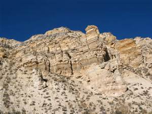
The Green River Formation is the result of all the sedimentation. It is up to ten kilometers in depth, thinner at the margins. At first the lakes were fresh water, but later became saline, leaving large deposits of carbonate rocks. The trona deposits at Green River, Wyoming are some of the richest in the world. The margins are sandstone and conglomerate interlaced with the fine silt that filled most of the basin. The formation is rich in the fossils of the abundant life in the lakes. They are world famous for their variety and abundance.
There was an anoxic layer at the bottom that preserved the organisms settling there. The lakes were abundant in blue-green algae. The remains of the algae are the source of the oil shale deposits the region is known for. The oil shale is there in millions of barrels, but it is expensive to extract the petroleum from the rock. It may never be commercially viable, but the formation has been extensively studied as a result.
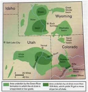
Green River Formation Map
Standing in my home town of Fruita looking north, the white cliffs behind the Book Cliffs are the Green River Formation. The Roan Plateau is huge, but does not attract visitors like the red rock country to the south. A huge exposure is the highlands west of I-70 from Rifle to DeBeque Canyon.
My interest is from visiting ranchers and hunting in the Douglas Pass area in my youth. Most of our visits were to ranches in the Green River Formation. The elevations varied greatly. The ranches were along West Salt Creek, but there were back country roads that went from sagebrush desert to piñon-juniper to oak brush shaly hillsides with sandstone rims to high country timber with world class mud. In fact, the mud is world class everywhere in the region.
Back before four wheel drive became common, there was a pile of rocks at the bottom of every big hill. Load them in the back of your pickup, go where you planned, and unload them on the way home. There is a network of canyons with side canyons branching off. All of it is fine deer habitat. My favorite places were at the head of a canyon with the wind in my face and a view of the LaSal Mountains and the Uncompahgre Plateau in the distance. Flat, wooded country gives me the creeps.
Access to a lot of the country is difficult. Most of the land is BLM land, but the early ranchers homesteaded the choice land that had water. The private land meant locked gates. We knew some of the ranchers, family friends. Hunting season was a big deal. There were maybe a dozen or more people, hunting during the day and drinking and playing poker at night. The big ranch house had a big kitchen with a wood burning stove along with the stove in the big main room. There was a light plant in the shed next to the house. It looked like no generator you see these days. There were also lots of Coleman lanterns when the light plant failed. Good times and lots of venison. The unheated bunkhouse was upstairs.
Douglas pass was up the main road, gravel in those days. It isn’t that high by Colorado standards, but made up for it with the switchbacks up the head of the canyon to the summit up through that shale. When the shale is wet, it moves. The road trapped the runoff, wetting the soft shale, and most every spring one or more places slid. The mountainside now is braided with old road cuts. It wasn’t much of a main road in the 1950’s, but now there is so much oil and gas development that the road is a paved state highway that the highway department spends money on.
The road crosses the desert above the Highline irrigation canal before it goes into the canyon. It is on the Mancos shale, responsible for all that flat desert in Colorado and Utah that turns to grease when it is wet. There was one hill the road went over then descended into the wash on the north side. That meant the road was on a north facing slope for a distance. That hill was named Coyote, because it could bite and gnaw on you if it was wet. A bit farther north was a ten or twelve foot high rock on the side of the road, all by itself.
The county employee maintaining the road in those days had his grader blade scrape on that rock every time he bladed the road. It would leave a bump, so he would have to drag dirt over to level things out. One day he got fed up and dug that rock up and moved it off the road. It was probably a two day project, but he never had to fight that damn rock again.
After I could drive, I ran around that desert quite a bit. I learned how to drive a two wheel drive pickup in that greasy stuff from my father. He was the telephone man in Fruita, responsible for maintaining the toll line as far as Cisco, Utah. That meant navigating two ruts through the cheat grass and sagebrush. He could put a two wheel drive pickup into places that were a challenge for a Jeep. Rocks in the back, chains if needed, put it in second gear and putt along. He seldom used the granny gear or used the gas pedal. Those old Chevy sixes would just lug their way along.
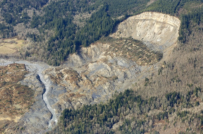
I am as guilty as any back country explorer for spending most of my time in the Rocky Mountains or the Utah red rock country, but the Mancos Shale and the Green River formation are calling me. I just need to see if my tire chains are in good shape. I think I will go over Douglas Pass, loop around and look the Piceance Basin over. From Rifle I will go down to Plateau Creek (my father and grandfather said platoo crick) and up to Collbran to look at the big slide.