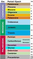
Category Archives: Gold Mining

Kodel’s Canyon

Geologic Time Scale

Growing up in Fruita, Colorado on Colorado’s Western Slope I had rich opportunities for exploration.  The area is amazingly diverse, offering the 10,000 foot elevation Grand Mesa to the east, the stark Bookcliffs to the north, and the spectacular red rock canyons of the Colorado National Monument just south of town.  All this surrounds the Grand Valley where I grew up. These areas and others were within short driving distance, with the Monument in bicycle range just across the Colorado River.

My friends and I used to take our .22s across the river and assault hundreds of rocks.  Our wandering took us across the National Monument boundary into Kodel’s Canyon.  Nobody went there in those days so we didn’t worry about having illegal guns in the park.  The canyon was smaller than the others, but we had the place to ourselves.  The approach is a deeply eroded plain of Dakota Sandstone from the river to the canyon.  The Cretaceous Dakota grades off to the Mancos Shale of the Grand Valley floor.
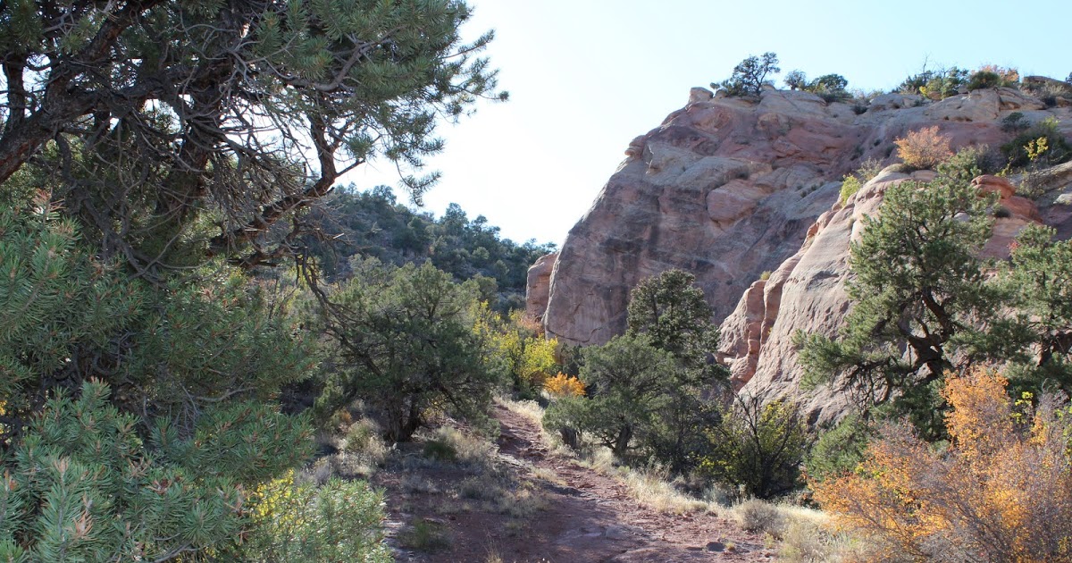
Kodel’s Canyon

That Mancos Shale is usually called Stinking Desert by many.  It is somewhat infertile unless well drained, and results in mostly barren gray flats.  Lots of barren gray flats from central Utah to Delta, Colorado.  With water and good drainage to carry the salt away, it can be farmland.  We would leave home on the valley floor and climb into the red rock Kodel’s Canyon.  At the mouth of the Canyon is the Kodel’s Canyon fault, where the Uncompahgre Uplift shoved all those Older Jurassic red rocks above the Cretaceous Valley.

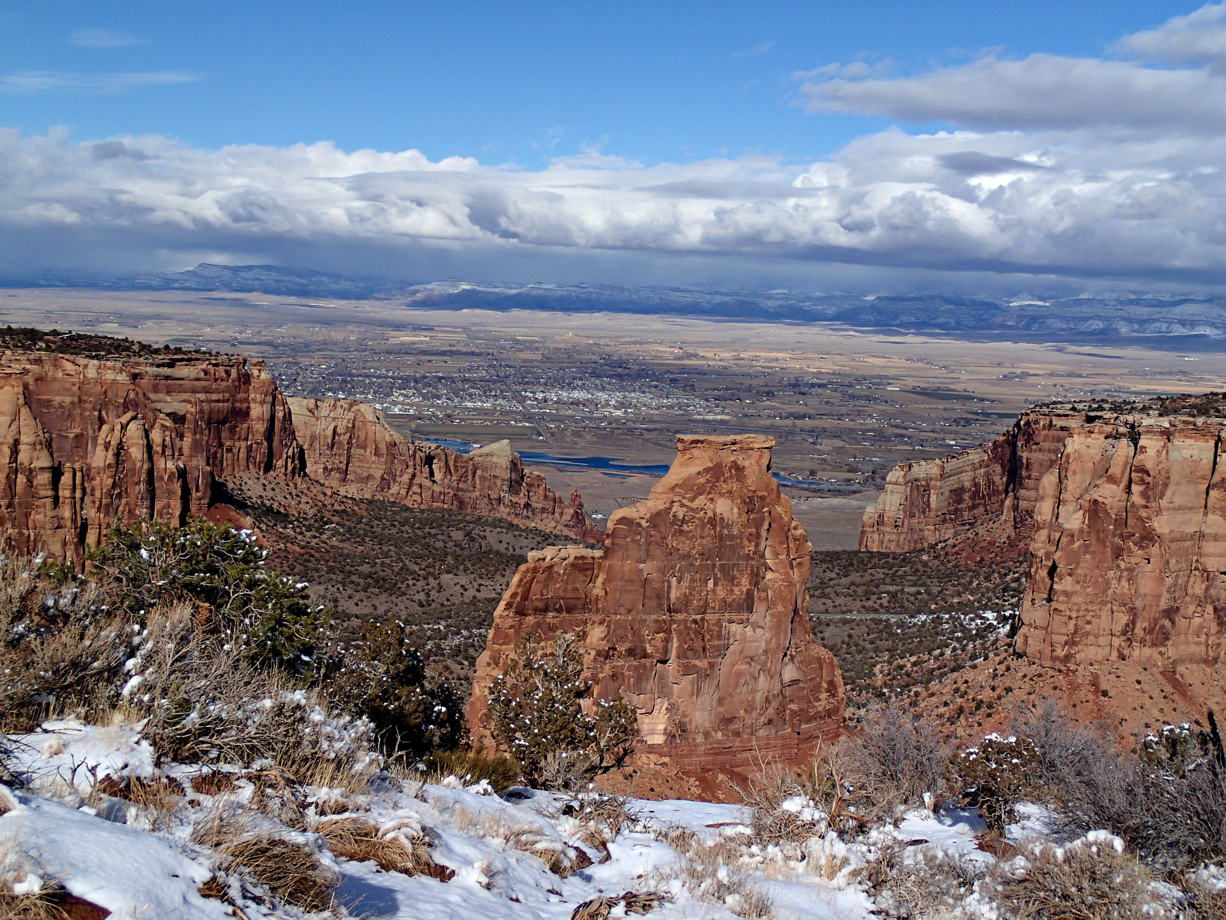
Looking at the Grand Valley from Colorado National Monument

The bottom of the canyon is smooth rounded granite and schist geologists call basement rocks.  They are seldom found exposed on the Colorado Plateau, covered by thousands of feet of sedimentary rocks.  The time gap between those old basement rocks and the sedimentary rocks sitting on them is over a billion years.  It’s called the Great Unconformity, where all the rocks deposited during that billion years were eroded away.  This gap is found in many places worldwide, but there are also many places where the rocks missing in our canyon were deposited and remain to be seen and enjoy.  Think the Flatirons, Red Rocks, and the Garden of the Gods, all Cambrian.  Those rocks sit on Precambrian Gneiss and Schist 1.7 billion years old.

Those old rounded black rocks are great for climbing and we did it.  Today it’s called bouldering.  We didn’t have climbing ropes, so we used our .22s as climbing aids.  Dangerous?  Yes. Fun? You bet.

Among the guys I grew up with, only one had any injury running around across the river.  Jerry had a seriously sprained ankle.  The two guys with him helped him down to the road and help.  He exploited the ankle to excess.  At Boy Scouts we always played Capture the Flag after the meeting.  Jerry would hobble down to get the flag defying anyone to stop him.  I walked over and pushed him down.  I don’t think he ever forgave me.

Leadville

Leadville

Leadville

As part of our week in Breckenridge, we did a day trip to Leadville over Fremont Pass.  This country figures in my life.  My father grew up in Leadville, and I worked at the Climax Molybdenum mine one summer when in college.  Breckenridge is low country, around 9600 feet.  Leadville is over 10,000 feet in elevation, the highest incorporated city in the U.S. Climax is at the summit of Fremont Pass, 11,360 feet in elevation.  Some years, it doesn’t snow in July.   

Climax, Elevation 11,300 Feet

Climax, Elevation 11,300 Feet

Climax is at the foot of Bartlett Mountain, once one of the largest bodies of Molybdenum in the world.  Moly is used in alloying steel and as a lubricant.  Moly alloyed in steel makes it tougher, useful in high stress applications.  It’s first big use was in gun barrels during WWI.  Much of Bartlett Mountain is gone, hollowed out, crushed, had the metals removed, and the tailings dumped into a once beautiful glaciated valley.  Common with most mining operations, Climax has gone through several boom-bust cycles, and is currently just limping along.  Leadville is limping as well, still dependent on mining. 

I worked at the Storke level, 300 feet down the mountain from the original portal and mill.  I lived in a company hotel there. There was once a company town, but it went away as the milling operation took the land.  The store and the beer joint were still there in the mid-1960’s.    

I worked as a miner.  Drill, shoot, and muck.  That’s mining.  The drill was a jack leg, a pneumatic rock drill with a leg attached to be extended as the drill hole got deeper.  It was powered by compressed air, and had a water feed to keep dust down.  Drill holes in the face, load them with explosive, shoot, then remove the broken rock (muck).  I plan to go into the whole operation some time.  I did it for the money, and I can now say I was a miner. 

Leadville is down the pass.  What a place.  First gold, then a lot of silver, then bust as the silver market collapsed.  Mining has always gone on, from small independent operations to massive developments supporting a fairly large town.  My grandfather lived there for about twenty years as a railroader, a good Union job.  Born in 1903, my dad grew up there until 1918 when the railroad went broke and the family moved to Grand Junction.  Growing up, I heard lots of Leadville stories.  I will tell some more sometime.  If you go down the hill from the hotel on Harrison Avenue, the house at the bottom on the right is where my father grew up. 

Mining Hall of Fame

Mining Hall of Fame

When we visited, we drove around and I bored everyone with Leadville stories.  We ate at the Golden Burro, where I ate in the 1960’s, and went to the mining museum.  If you have any interest in mining, that’s the place.  Mostly, mining is taking metals and fuel from the earth and leaving a mess.  Leadville has lots of messes.  The worst ongoing mess is the water.  As it comes out of the mines it is highly acidic and loaded with toxic metals in solution.  It will have to be treated forever, at least in human terms.  Mining built Colorado, and we will always deal with the legacy.  Oh, what a mess we made.

Breckenridge

Breckenridge

Breckenridge

Recently we spent a week in Breckenridge for a family celebration.  There were five of us in one big condo and two studios.  Late October is an interesting time in ski country.  The Quakies have shed their leaves and the only snow on the mountain is what they are making, or trying to make.  We thought the town would be pretty empty, but there crowds on the weekend, mostly from Denver. 

Summit County is one of my favorite mountain resort areas.  There are the old mining towns, Breckenridge, Dillon, and Frisco.  There are the three upstarts, Silverthorne , Copper Mountain, and Keystone, with old Montezuma a few miles up the Snake River.  The Blue River Valley is fairly large, and ringed by mountains.  The view is fine in any direction.  Our condo was just down from the lifts, so our view was east.  One night it snowed a couple of inches, so we got to see the transformation.   

Boreas Pass Road in Fall

Boreas Pass Road in Fall

We could see the Boreas Pass road as it winds up the mountain.  It is the old railroad grade for the Denver, South Park, and Pacific.  Several of those narrow gauge railroads had grand ambitions, looking to the ocean.  The South Park, as people called it, never got past Crested Butte.   

The part we are interested in is the branch that ran from Como in South Park over the Continental Divide to Breckenridge, up the Snake to Montezuma, and up Tenmile Creek to Kokomo.  Kokomo was a silver mining town and now is buried under tailings from Climax.  On the Blue and Snake rivers it was gold.  East of the Snake near Silverthorne are sedimentary rocks, the same as exposed at Dinosaur Ridge in Denver, the difference being a four thousand feet elevation difference.  No gold there.   

Gold Dredge, This One at Fairplay

Gold Dredge, This One at Fairplay

Most of the gold along the Blue River came from the Park Range, with Boreas and Hoosier Passes connecting Summit County with South Park.  Most of the gold from the Park Range came from placer mining, extracted from the gravels eroded from the mountains.  Placer mining started with gold pans, went to rockers and sluice boxes, and when mining became industrialized, big dredges excavated huge amounts of gravel, sluiced the finer dirt, sand, and gravel for the gold, and dumped the leftovers in the river.  The big rocks went out the back of the dredge, creating those huge boulder fields you see below Breckenridge and Fairplay.  Pristine mountain meadows were turned into barren rock fields.   

Above Breckenridge, some hydraulic mining went on.  Mountain streams were diverted into ditches and big canvas hoses with big nozzles. The mountainside was washed down into the sluice boxes for the gold, and everything else was dumped, creating more barren areas. 

Mining developed and scarred Colorado.  The new city of Denver produced much of the machinery making the scars.  The Tenmile range wasn’t heavily mineralized, so remained untouched for later ski area development and scars created by ski runs.  It was the Park Range holding the gold, much of it still there.  Where the Tenmile Range transitions into the Mosquito range, the mountains were again mineralized.  Gold, then silver at Leadville, Molybdenum at Climax (where I worked as a miner one summer), and lead, zinc, and copper most everywhere. 

Next, Leadville.