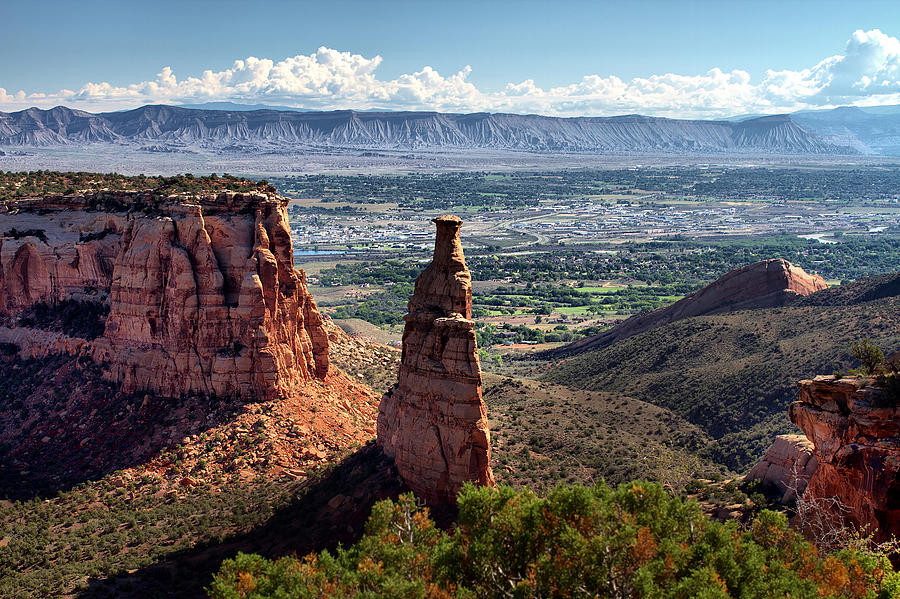
Category Archives: Bookcliffs

The Empty Quarter

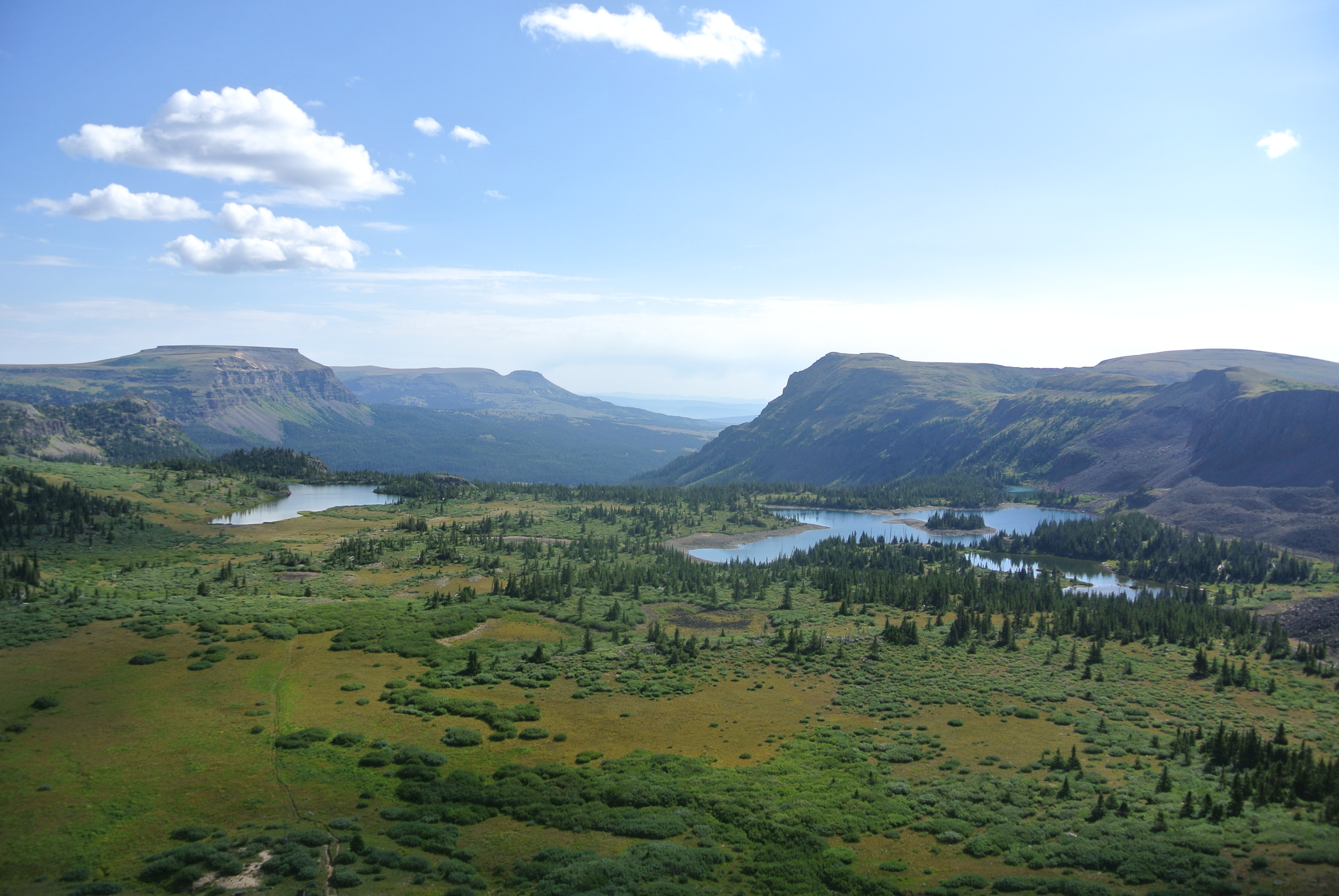
Portion of Flat Tops Wilderness

Well, its not a quarter of Colorado, but it’s big and pretty empty.  North and west of the Colorado River and south and west of the Yampa River, the only towns of any size are Rifle, Silt, Newcastle, and Glenwood Springs along the Colorado; and Meeker in the middle.  Craig and Hayden are on the  Yampa.  I don’t count Rangely on the White River west of  Meeker as a real town.  It is just a bunch of oil field junk with a few forlorn people. I recently traveled through the heart of the region.

I am a Western Slope native, so I have been over the relatively well traveled roads.  I-70 (previously highways 6&24) and SH 13 from Rifle to Craig.  As a kid, I went fishing on Rifle Creek with my parents.  The
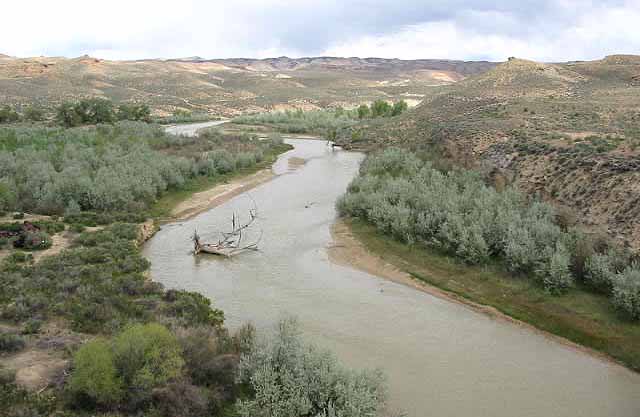
White River

White River drains the White River Plateau and The Flattops.  Piceance Creek drains the Piceance Basin and enters the White between Meeker and Rangely.

Meeker is a pretty town in the valley of the White River.  It’s a farm and ranch town with a sad past.  The Meeker Massacre in 1879 was the end of the Utes huge reservation  lands in Western Colorado. They were shipped to Eastern Utah.  The reason was the systematic U.S. Policy of cooping the Indians up or killing them.  There are grisly details, but it was just another example of the U.S. Policy of mistreating Native Americans that continues to this day.

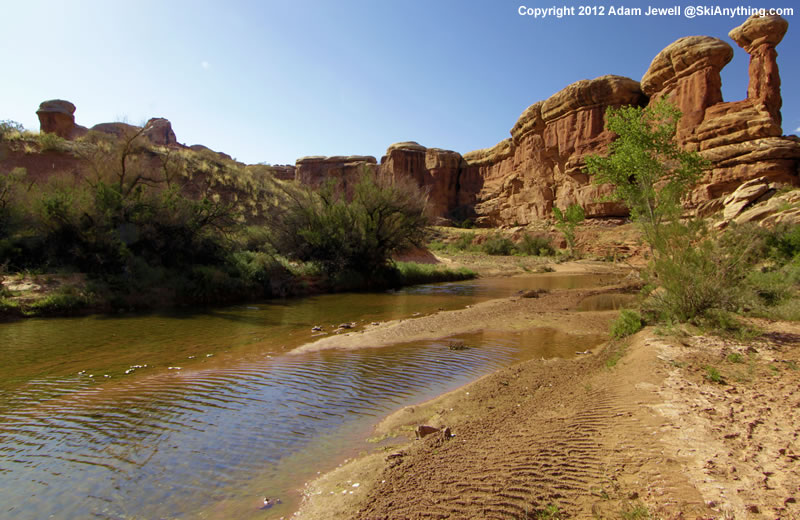
Maybe you have heard of Trappers Lake.  It is an enclave surrounded by the Flattops Wilderness, a huge area of timberland dotted with many small lakes.  The only access is on horseback or backpacking.  It’s wet country, catching the storms as they leave the lower country to the west.  Hunters, fishermen, and tree huggers are the only travelers.

I never backpacked there, but two friends humped there way in years ago.  They talked about the beauty,  but mostly about the rain.  One of them had one of those convoluted open foam pads with no cover.  When the water came into the tent, he was lying on a sponge in a soaked down sleeping bag.  They left early.

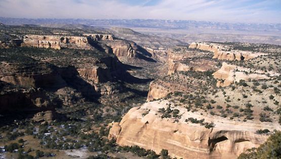
West of SH 13, along the Grand Hogback,

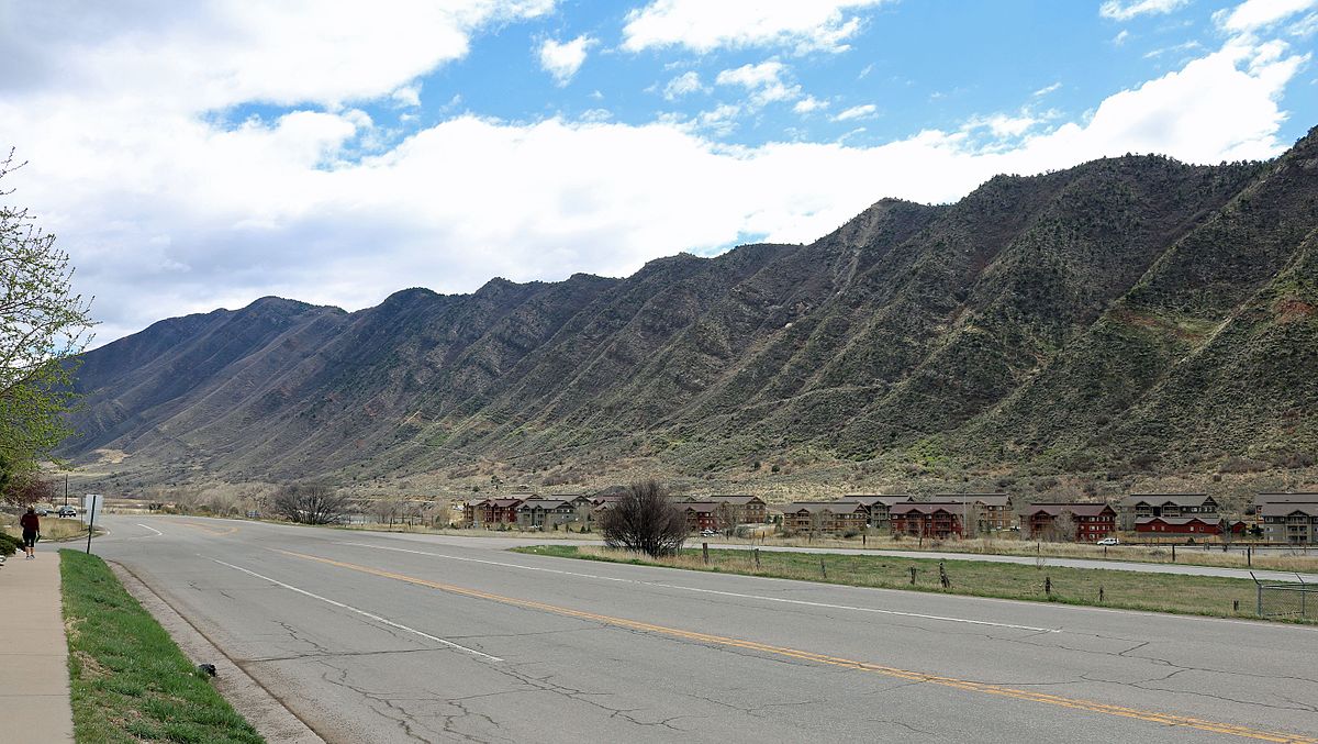
Grand Hogback Between the Colorado Plateau and the Rocky Mountains

you are on the Colorado Plateau.  Go east, and you are in the Rocky Mountains, but not the Rockies you are used to.  The hogback is a remnant of the uplift that formed the Rockies.  The equivalent on the east side are those red rock hogbacks called the Flatirons, Red Rocks, and the Garden of the Gods.

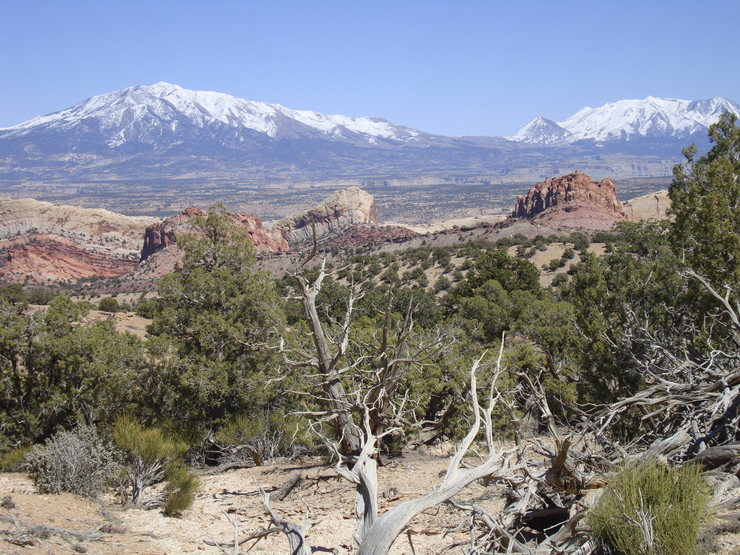
No big mountains here, just a region of high plateaus.  The reason? Volcanism in the form of lava flows.  The White River Plateau was uplifted along with the rest of the Rockies, but instead of being eroded into those jagged peaks we are used to seeing, the basalt from the lava flows formed a resistant, flat caprock.  It’s not rugged mountains, but it has a beauty all it’s own.
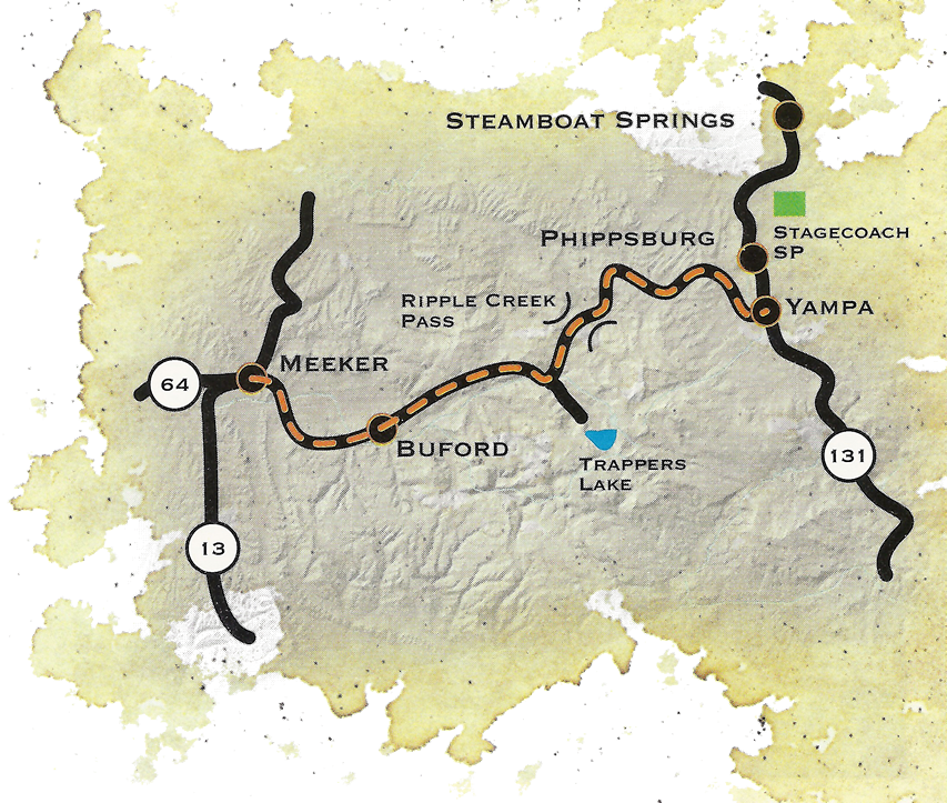
Flat Tops Trail

The is a scenic byway between Meeker and Yampa I took for the first time,  At first, it is in the White River valley, then climbs up on the plateau and heads on east to Yampa.  The view to the south is where the Flattops drop down to the river.  It’s not a gentle slope.  The basalt caprock is underlain by the soft White River Formation.  The steep slope is subject to landslides, leaving large open, green slopes surrounded by timber.  It’s great summer range country for sheep and cattle.  It is also some of the prettiest country in our state.  I think I met two pickups on the road east of Buford, where the road turns off to Trappers Lake.  It’s gravel much of the way, but good gravel.

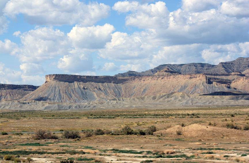
West of SH 13, on the edge of the Colorado Plateau, is the huge Piceance Basin.  It is a Structural basin next door to the Uinta Basin, mostly in Utah.  The basins are separated by the Douglas Arch, crossed by Douglas Pass, country where I spent a lot of time in my youth.  The arch is a western extension of the Laramide Orogeny, the mountain building period that formed the Rocky Mountains.  The edges of mountain ranges usually have foreland basins, areas of subsidence.   I am sitting over the Denver Basin.  The Piceance is the equivalent west of the mountains.  As the mountains rose, the fringes sank, creating huge synclines filled with the erosion products of the mountains.    The basins formed huge inland lakes which filled with sediment that became the Green River Formation, famous for its fossils and oil shale.

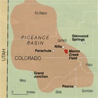
The Greater Piceance Basin

Because of all that rising and sinking, pockets form, trapping reservoirs of gas and oil.  The Piceance is one of the most productive natural gas fields in the country.  Rangely’s oil is also from the Piceance.  I drove the road running along Piceance Creek, which drains the basin to the west.  The area is all about natural gas, with some ranching along the creek.  There is a gas plant every few miles, and lots of truck traffic.  The basin used to be the home of a huge migratory deer herd, the deer summering in the Flattops and wintering in the basin.  The herd is still there, but all the drilling has greatly reduced the numbers.  Lots of elk there as well, their numbers increasing somewhat, probably due to less competition from deer.

The area is known as the Roan Plateau, which drops off to the Book Cliffs, an escarpment runnng from Palisade, CO to well past Greenriver UT.  It feels like home country to me, with memories of deer hunting in the Douglas pass area.  The scenery isn’t as dramatic as the red rock country to the south, but has its own beauty.  Plus, it isn’t as cluttered up with people.

Piceance, Uinta, Roan Plateau, Book Cliffs, all names for roughly the same country.  My list now includes going up into the basin proper, known mostly by Ute Indians, ranchers, oil field people, geologists, and aging wanderers.

The Colorado Plateau Part Two


Colorado Plateau Country

Colorado Plateau Country

There is a lot of beautiful country on the Colorado Plateau, but there is the other side.  The term many use is the stinking desert.  My home town has an annual rainfall of about eight inches.  Before the Utes were run out and ditches were dug, the Grand Valley was a sparse desert.  The irrigation projects made much of the valley green, but north of the Highline Canal is the desert.  It is a fairly barren desert, not like the Sonoran Desert with its green saguaro cactus.

Mancos Shale Soil

Mancos Shale Soil

The soil, if you can call it that, is fairly infertile, high in salts, and high in toxic selenium.  It’s called the Mancos Shale.  The Mancos Shale, called the Pierre Shale east of the Rockies, runs from South Dakota to central Utah.  It is an ancient sea floor, Cretaceous in age, of the inland sea covering much of North America.  Shale is mud rock, laid down as the sea advanced and retreated over millions of years.

The lower part of the Bookcliffs and the valley floors are Mancos Shale.  In its natural state it is a scrub grassland, supporting small populations of deer, antelope, prairie dogs, sage grouse, cottontails, and some Bison.  When the Northern European Americans arrived, they saw grazing land.  The sheep and cattle came.  The ranchers did well for a few years, but their expectations were unrealistic for such a dry area.  Soon, most of the good grass was gone, replaced by cheat grass and sagebrush.

The area between Delta and Grand Junction is a prime example.  My father, born in 1903, lived in Grand Junction after 1918.  He told me that at that time, there were extensive stands of tall bunch grasses.  They are gone.  That desert is one of the most barren stretches I am aware of.  It is hilly, so irrigation water went to flatter areas.  It is close to towns, so lots of ranchers grazed their stock on the land.

Much of the Mancos shale country is BLM land today.  In the old days, the Land Office and the Grazing Service leased land to ranchers.  There were allocations on the number of head allowed on each segment, but there was little enforcement.  The grass mostly disappeared.  Thus, the stinking desert.

I-70 from Palisade to the west of Green River, Utah is on the Mancos.  Highway Six from where I-70 veers south almost all the way to Price is on the Mancos.  Travelers on those highways have the bare Bookcliffs and the bare desert floor to look at for over 200 miles.  Their impression was what tended to keep the canyon country to the south relatively isolated.  Locals had all that magnificent country mostly to themselves.

Art in Salt Creek Canyon

Art in Salt Creek Canyon

The a uranium and oil and gas booms of the 1950s built a large network of roads and opened the canyon country up for tourism.  Those flat deserts remain empty, along with the mostly shale country of the Bookcliffs and the Tavaputs Plateau to the North.

When I went to Arches in the 1950s, we drove down two tracks winding through the sand.  This year during the height of the season, cars were lined up literally for miles.  Canyonlands National Park is also crowded, people lined up.  I remember going there and often seeing no one.

From Green River to Hanksville is mostly flat, dry desert, with 70 miles from the highway turnoff to the Maze District Ranger Station in Canyonlands.  The greater part of Navajo country in southern Utah, New Mexico, and Arizona is fairly flat desert.  Monument Valley is flat desert that happens to have some rocks sticking up.  Have you ever driven from Albuquerque to Flagstaff on I-40?  Flat desert.

Henry Mountains

Henry Mountains

The Colorado Plateau does have some other features.  Mountains, tall, green, and wet, supplying water to the desert.  Three ranges of mountains, the La Sals near Moab, the Abajos, known to locals as the Blues, and the Henry Mountains, near to nowhere.  The La Sals are the tallest, over 12,000 feet.  The Abajos and the Henrys stretch to 11,000 feet.  They stand in contrast to the red rock country surrounding them, and provide a welcome relief.  People go there in summer to cool off and enjoy the wildlife.

Geologically, the mountains are Laccoliths, formed by a neck of molten magma rising to a weaker junction between two layers of sandstone.  At that junction the magma moves laterally, forming a mushroom shaped dome of igneous rock in the domain of sandstone.  The overlying strata usually erode away, leaving the igneous core.  The Henrys are the type location for Laccoliths, being the subjects of the earliest study, and displaying the domed shape.

Salt Creek Canyon

Salt Creek Canyon

The three ranges are important to ranching, providing water, hay farming, and a summer range, with the stock wintering on the desert.  Salt Creek, draining north from the Blues, has a canyon with year-round water, arches, and Ancestral Puebloan ruins and rock art. The canyon also provides access to a park in the midst of the Needles District of Canyonlands.  I like that park because it was never grazed.  It provides a look at the land before cattle came, trampling or eating everything, mangling stream banks, and bringing alien species like cheat grass.  No I won’t tell you where it is.  Go look for yourself.


The Bookcliffs and the River


Bookcliffs

Bookcliffs

The Book Cliffs are the neglected stepchildren of Western Colorado and Eastern Utah. That is somewhat ironic, because they stretch from Palisade and Mt. Garfield about 200 miles to Price, Utah. Rising about 1000 feet from the valley floor, they are the longest escarpment in the world. Above the Book Cliffs is a bench With the Roan Cliffs forming another escarpment  Behind the cliffs is the Roan Plateau, rising to about 8000 feet in elevation. With the wide change in elevation and precipitation from eight inches annually to around thirty, there is wide diversity in plant and animal life. There are energy resources as well. Natural gas, tar sands, oil, coal, and that huge deposit of oil shale.   The region is known as the Tavaputs Plateau.

The plateau is home to the Desolation Canyon Wilderness and due to the wide range in elevation and precipitation, a diverse range of plant and animal life. There are three reasons why the area is not very popular with visitors.

First, look south. Colorado National Monument, Arches, Canyonlands, Capitol Reef, Bryce Canyon, Zion, and Grand Canyon National Parks. There are the three mountain ranges and all that wondrous red rock carved into some of the best scenery on earth.

Next, accessibility. Douglas Pass is the only paved road in the vast area. The many dirt roads are accessible only as long as they are dry. Traditionally, the only people there were stockmen and the Utes on their reservation. In recent times there has been much energy-related activity that comes and goes.

The third reason? Shale. It is not only shale, there are layers of sandstone, even limestone. It’s all gray or shades of tan. Driving on the drab Mancos shale landscape of I-70, looking north you see drab cliffs. More of the same gray rock, just standing up. Roads built on that shale changes into some of the most slippery substances known after a rain or snow.. People are just not inspired to go there.

Growing up in Fruita, Colorado, I spent quite a bit of time in areas on either side of the Douglas Pass road, which was gravel and dust at the time. We had rancher friends, and deer season was a big social scene. It is wild, mostly empty country, home to lots of cattle, some sheep, a few ranchers, and a lot of wildlife. It is also famous for some of the most treacherous mud in the world. There are some sandstone lenses (we called them rims), but it is mostly shale, a former lake bottom that now sits thousands of feet above the Grand Valley, where the people live.

Colorado National Monument.  Bookcliffs on the horizon

Colorado National Monument. Bookcliffs on the horizon

I used to look at the Colorado National Monument with its red rocks to the south. To the north were the relatively drab Bookcliffs with the whitish Roan Plateau above them. Why the difference? The Monument is famous, with lots of information about the Uncompaghre Uplift lifting the Uncompahgre Plateau thousands of feet compared to the Grand Valley. As the plateau, erosion took the more recent rocks off, leaving the more resistant sandstone.

I thought some sort of uplift must have formed the Bookcliffs. Well, partly. When the entire Colorado Plateau was uplifted at the same time as the Rockies, The Colorado River just dug away, carrying the eroded rock to the sea. It is still digging, and is eroding those Bookcliffs to the north. Under the Bookcliffs are the rocks of the Monument. Someday the land will be fairly flat between Grand Junction and Craig. We won’t be around, however. These things take time.

So, the Colorado Plateau was uplifted and after that the Uncompahgre Plateau went up some more and wore down. The rocks exposed at the Monument are, a few miles north, well below the rocks of the Bookcliffs who are headed north as the river gnaws away. The Colorado River rules, it is just a bit slow.