Category Archives: Road Trips

Western Colorado Road Trip

Recently I had a meeting in Gunnison, so I made a short trip of it.  From Denver I went up to Buena Vista and over Monarch Pass, but this time I went over the old Monarch Pass road, abandoned when the highway on upper reaches of the Pass was widened and straightened.  Modern mountain highways are expensive, moving mountainsides and filling low spots.  The older roads tended to follow the lay of the land more closely.  They were cheaper to build but slower and more dangerous.
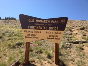
I like the old roads, even more if they aren’t paved.  Old Monarch Pass follows the recipe.  It’s narrow, winds around and goes up and down.  It had about three inches of partially melted snow, making for some slick spots and lots of mud, but not the mud that likes to trap unsuspecting cars.  I was going slow, so I got to enjoy the scenery and a pretty day.  I rolled the windows down, opening up my steel cocoon a bit.  Good thing.

I stayed in Gunnison, and next morning I drove up to Crested Butte, one of my favorite ski towns, with some of the flavor of an old mining town remaining, in contrast to the modern European Chalet style of Vail.  No  McDonald’s, no chain restaurants, and lots of local businesses.  I had coffee in a place without WiFi.

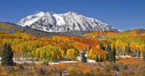
Kebler Pass during the Aspen Color

Next was Kebler Pass, one of the best drives in the state.  It goes from Crested Butte to east of Paonia, and is mixed gravel and pavement.  If you want the best fall aspen viewing in Colorado, Kebler Pass is the place.  Huge stands of quakies with good mountain backdrops.  The leaves were gone on this trip, but the beauty remains.  To the south are the West Elk mountains and and a large, mostly untraveled wilderness area.  The Elk Mountains are North and east, some of the wildest peaks in the state.

I was in big, beautiful, rugged country mostly empty of human development.  Emptiness and solitude, part of why I love Western Colorado.  The road comes out outside of Somerset, a coal mining town between Paonia and McClure Pass above Carbondale.  Big coal mines there, mostly shut down.  That’s mining in Colorado.  Dig lots of stuff, then go broke and leave a big mess behind.

I like Paonia, fruit trees below mountains, no McDonalds, no Walmart, as it should be.  There is lots of pretty farm country from Paonia to the turnoff to Grand Mesa outside Delta.  The Grand Mesa road climbs to the top of the 10000 foot tall flat topped Mesa.  It’s wet country, catching the storms coming across the desert country to the west.  My main memories are going fishing there with my father.  Lots of lakes, mosquitoes, gnats, and

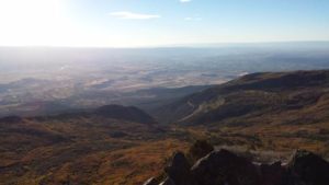
View From Lands End. Impossible to Photograph the Panorama

cold nights.  I did not become a fisherman.  The Land’s End road runs west from the highway to the rim of the Mesa.  The view is unsurpassed.  The San Juan’s to the south, the Uncompahgre Plateau across the Gunnison River valley to the west, and the Grand Valley of the Colorado under the Bookcliffs and the Roan Plateau.  You can see into Utah.  The road winds off the Mesa to Whitewater.  Steep and twisty gravel.  I’m saving that part for next time.

I went on over the mesa to Collbran, where I continued my search for the big landslide off the mesa that killed three men running a mile off the mountain.  I didn’t find it, but ran round some nice farm and ranch country while looking.  When I got home I printed out a map.  Duh.

Colorado River Below Kremmling

That night I stayed in Parachute off I-70 in oilfield country.  Enough about that.  Next day I followed the Colorado River from Dotsero to Highway 40 at Kremmling.   Again, I crossed a lot of wild country with a bit of development in spots.  The river runs in a succession of canyons and narrow valleys.  No spectacular mountains, just lots of good rugged country.

After Kremmling, Highway 40, Granby, Winter Park, and Berthoud Pass to eastern Colorado, and home.
The Empty Quarter

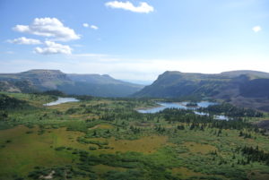
Portion of Flat Tops Wilderness

Well, its not a quarter of Colorado, but it’s big and pretty empty.  North and west of the Colorado River and south and west of the Yampa River, the only towns of any size are Rifle, Silt, Newcastle, and Glenwood Springs along the Colorado; and Meeker in the middle.  Craig and Hayden are on the  Yampa.  I don’t count Rangely on the White River west of  Meeker as a real town.  It is just a bunch of oil field junk with a few forlorn people. I recently traveled through the heart of the region.

I am a Western Slope native, so I have been over the relatively well traveled roads.  I-70 (previously highways 6&24) and SH 13 from Rifle to Craig.  As a kid, I went fishing on Rifle Creek with my parents.  The

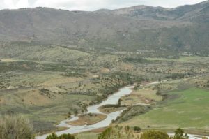
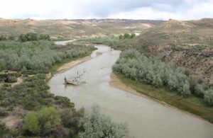
White River

White River drains the White River Plateau and The Flattops.  Piceance Creek drains the Piceance Basin and enters the White between Meeker and Rangely.

Meeker is a pretty town in the valley of the White River.  It’s a farm and ranch town with a sad past.  The Meeker Massacre in 1879 was the end of the Utes huge reservation  lands in Western Colorado. They were shipped to Eastern Utah.  The reason was the systematic U.S. Policy of cooping the Indians up or killing them.  There are grisly details, but it was just another example of the U.S. Policy of mistreating Native Americans that continues to this day.

Maybe you have heard of Trappers Lake.  It is an enclave surrounded by the Flattops Wilderness, a huge area of timberland dotted with many small lakes.  The only access is on horseback or backpacking.  It’s wet country, catching the storms as they leave the lower country to the west.  Hunters, fishermen, and tree huggers are the only travelers.

I never backpacked there, but two friends humped there way in years ago.  They talked about the beauty,  but mostly about the rain.  One of them had one of those convoluted open foam pads with no cover.  When the water came into the tent, he was lying on a sponge in a soaked down sleeping bag.  They left early.

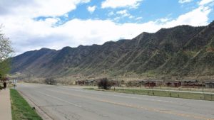
West of SH 13, along the Grand Hogback,

Grand Hogback Between the Colorado Plateau and the Rocky Mountains

you are on the Colorado Plateau.  Go east, and you are in the Rocky Mountains, but not the Rockies you are used to.  The hogback is a remnant of the uplift that formed the Rockies.  The equivalent on the east side are those red rock hogbacks called the Flatirons, Red Rocks, and the Garden of the Gods.

No big mountains here, just a region of high plateaus.  The reason? Volcanism in the form of lava flows.  The White River Plateau was uplifted along with the rest of the Rockies, but instead of being eroded into those jagged peaks we are used to seeing, the basalt from the lava flows formed a resistant, flat caprock.  It’s not rugged mountains, but it has a beauty all it’s own.

Flat Tops Trail

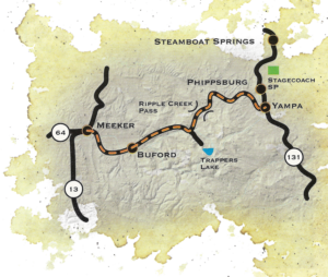
The is a scenic byway between Meeker and Yampa I took for the first time,  At first, it is in the White River valley, then climbs up on the plateau and heads on east to Yampa.  The view to the south is where the Flattops drop down to the river.  It’s not a gentle slope.  The basalt caprock is underlain by the soft White River Formation.  The steep slope is subject to landslides, leaving large open, green slopes surrounded by timber.  It’s great summer range country for sheep and cattle.  It is also some of the prettiest country in our state.  I think I met two pickups on the road east of Buford, where the road turns off to Trappers Lake.  It’s gravel much of the way, but good gravel.

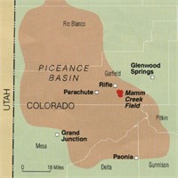
West of SH 13, on the edge of the Colorado Plateau, is the huge Piceance Basin.  It is a Structural basin next door to the Uinta Basin, mostly in Utah.  The basins are separated by the Douglas Arch, crossed by Douglas Pass, country where I spent a lot of time in my youth.  The arch is a western extension of the Laramide Orogeny, the mountain building period that formed the Rocky Mountains.  The edges of mountain ranges usually have foreland basins, areas of subsidence.   I am sitting over the Denver Basin.  The Piceance is the equivalent west of the mountains.  As the mountains rose, the fringes sank, creating huge synclines filled with the erosion products of the mountains.    The basins formed huge inland lakes which filled with sediment that became the Green River Formation, famous for its fossils and oil shale.

The Greater Piceance Basin

Because of all that rising and sinking, pockets form, trapping reservoirs of gas and oil.  The Piceance is one of the most productive natural gas fields in the country.  Rangely’s oil is also from the Piceance.  I drove the road running along Piceance Creek, which drains the basin to the west.  The area is all about natural gas, with some ranching along the creek.  There is a gas plant every few miles, and lots of truck traffic.  The basin used to be the home of a huge migratory deer herd, the deer summering in the Flattops and wintering in the basin.  The herd is still there, but all the drilling has greatly reduced the numbers.  Lots of elk there as well, their numbers increasing somewhat, probably due to less competition from deer.

The area is known as the Roan Plateau, which drops off to the Book Cliffs, an escarpment runnng from Palisade, CO to well past Greenriver UT.  It feels like home country to me, with memories of deer hunting in the Douglas pass area.  The scenery isn’t as dramatic as the red rock country to the south, but has its own beauty.  Plus, it isn’t as cluttered up with people.

Piceance, Uinta, Roan Plateau, Book Cliffs, all names for roughly the same country.  My list now includes going up into the basin proper, known mostly by Ute Indians, ranchers, oil field people, geologists, and aging wanderers.

Minneapolis Road Trip

Corn and Soybeans

Corn and Soybeans

I am back from a road trip to Minneapolis on family business. I will tell the family story later, this is about the road. People say I am a bit weird. I like road trips and enjoy not listening to anything but the sound of Diesel engines as I pass the trucks. I watch, listen, and as much as possible these days, think.

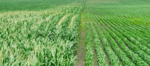
This time I was in a hurry to get there, so it was I-76, I-80, and I-35 to Minneapolis. I have done I-80 for you, and I-35 is more of the same-corn and soybeans. Some of the time it is soybeans and corn. The highway through Dezz Monezz is a bit dodgy, lots of turns and traffic.

The return trip a week later was more fun. I have known various people from Mankato over the years, but had never been there. I have always liked the name. The Native Americans were screwed in southern Minnesota more than many other places, being hauled off to Fort Snelling and imprisoned. We need to keep the memory of what happened to those people, here in the land of the free.

The drive from Minneapolis (I like writing that word, much better than MPLS.) to Mankato follows the Minnesota River for much of the way. The country is hilly and wooded, with farms on every available flat spot. Beautiful. Those of us from the West are a bit snobby about the Midwest, but there is beauty most everywhere you look. Except for the monotonous corn and soybeans. That country must be spectacular in the fall.

Close to Minneapolis, the Minnesota River is navigable. I like seeing ports in the middle of https://en.wikipedia.org/wiki/Valentine,_Nebraskathe country. West of Mankato, one finds corn and soybeans. My next goal was the Nebraska Sand Hill country and the Niobrara River. I followed the River from Niobrara to Valentine. It is farm country, but that River is always right over there.

Niobrara River

Niobrara River

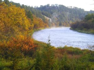
The River is a national treasure. Designated a Wild and Scenic River, it winds through hilly country and is bordered by woodlands. There aren’t many people in that area, another benefit. One can get a sense of what it must have been like before the European Invasion. I am sure it was better then than it is now.

Valentine has 2700 people, but is the commercial center for a wide area. It goes on my list of nice small towns. There are several River outfitters based around there for people doing canoe trips on the Niobrara. I still want to do that in the next few years before I am too decrepit for that sort of thing.


The Sand Hills

The Sand Hills

The Sand Hills. So beautiful I almost ran off the road while taking it all in. It is truly hilly there. The northern Sand Hills get quite a bit of moisture and there is water. Like western South Dakota there is a sense of space. You are in the West, not the corn and soybean Midwest. Do I seem a bit biased?

Cow country. U.S. Highway 83 from Valentine to North Platte is 115 miles of ranch country. Thedford is 58 miles south of Valentine with no towns. There is a school about halfway. There are ranches all along the way, every mile or half mile or so, and lakes. There is a national wildlife refuge there. Sandhill Cranes and a lot of other wildlife. No antelope. There should be, but there are probably too many fences.
As you drive south it dries out. In late August it is green around Valentine, but fairly brown closer to North Platte. We are talking about a huge area of northwest Nebraska, and as good cattle country as anywhere. We should be eating grass fed beef from there rather than corn fed feedlot beef from along the Platte. There would be less corn across the Midwest.

The wind blows out there. I saw five or six huge wind farms making power in Nebraska. There was one in southwest Minnesota. I saw none in South Dakota or Colorado. The sun doesn’t always shine out there, but the wind almost always blows, even at night. All that wind from Wyoming has to go somewhere. I saw a number of trucks hauling those long wind vanes, so the wind power business is growing. Wind makes more sense than solar in more northern parts of the country. Home rooftop solar is good, you can’t have too many wind turbines in town. More wind power, less coal trains rattling through Alliance.

Back in Colorado, along the South Platte, there is lots of history. Gold rush wagon trains, Indian wars, farming and cattle. One of the small towns is Iliff, named for an early rancher who got rich raising beef for the miners. He was another of those Methodists who had a big role in early Colorado. Evans, Chivington. Iliff founded the Methodist seminary at Denver University.

I have to get out to Julesburg and poke around the history there then go up to Scotts Bluff on the North Platte, with a stop at Fort Laramie on the way home. Another road trip.

Boise Road Trip Part Two

In the first installment I got us as far as the Wasatch Front, and warned of the future apocalypse-earthquake waiting to happen there.  I was on the way to Boise, and needed gas.  I took an exit and pumped gas, moved the Tacoma to a parking spot, and went inside.   

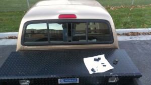
Pried Open Sliding Window

Pried Open Sliding Window

When I came out I saw my keys on the seat.  Oops.  No spare key.  I have done this before, and it usually means breaking a window. The Tacoma has a sliding rear window, useful for ventilation in good weather.  I borrowed a screwdriver from the guys parked next to me.  I figured that was the cheapest window to replace if I had to break it. 

The window has a plastic latch and I pried between the panes there.  The glass bent and the latch popped open.  I have tried those magnetic key holders and they always disappear.  I’ll figure out a stash spot sometime. 

On the road again, I drove through some arid hilly country-cow country, in the wind.  I have always thought that Wyoming is the wind capital, but the wind has to come from somewhere, I guess it is northern Utah and Idaho.

Driving on north, near the Snake River it is irrigated farmland, reminding me of home.  I was getting tired and stayed in Twin Falls.  It’s not that far to Boise, but when I am tired I lose concentration, not good at 70 mph. 

Oregon Trail Ruts

Oregon Trail Ruts

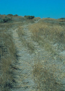
The Oregon-California Trail parallels the Snake in that region, so I went rut hunting.  The Snake runs through a gorge in the Snake River Plain, so the trail left the river if there were alternate water sources.  Those hills Idaho people call mountains also run parallel to the Snake a few miles north, and the trail ran there away from the river. Water was available from springs and creeks at the base of the hills.  The water is gone now, victim of all the groundwater pumping by farmers.  

 The ruts are there, as well as the ruins of an attempt at a resort in the early part of the 20th century.  I like following the trail, thinking about what it was like for the emigrants, traveling 8 to 10 miles per day, hoping for a better life at trail’s end.  Many found the better life, many did not, and many died on the way.   

 On to Boise, seeing people I care about, and searching for Basque food.  Headed home it was back to the Wasatch, then U.S. 40 east.  I had never been west of Vernal, so it was new country for me.  The highway rises through the Wasatch to Heber City, a nice town that reminded me of our Eagle River valley, with all the businesses supporting the ski resorts.  The Wasatch Mountains are rhe easternmost range of the Basin and Range Province.  The Basin and Range is being stretched as the Pacific Plate scrapes northward along the North American plate. 

Uintah Mountains From US40

Uintah Mountains From US40

Leaving the Wasatch Mountains, we are back on the Colorado Plateau, with its northern boundary, the  Uintah Mountains.  The Uintahs are unique among North American mountain ranges, as they run east-west.  They were uplifted at the same time as the Rockies, but I can’t find a good explanation of why they run east-west.  There they are, and I drove east with mountains on the left and desert on the right.  Come to think of it, the Book Cliffs and the Tavaputs Plateau also run east-west, but they aren’t called mountains because they are only 8000 feet high.  The Uintahs have two thirteeners.   

 Highway 40 runs between the Uintahs and the Tavaputs.  The Uintahs are important to the Salt Lake area, providing water for the growing population.They are also pristine, mostly roadless.  The glaciers are gone, but they left dramatic peaks and broad mountain valleys.  The core is the High Uintahs Wilderness,the rest Forest Service land providing summer range for sheep and cattle.   

Next, Vernal. It reminds me of Cortez, Colorado and not in a good way.  It is, however, a good jumping off spot for a lot of interesting country. 

Green River Campground, Dinosaur National Monument

Green River Campground, Dinosaur National Monument

The eastern end of the Uintahs have Dinosaur National Monument, with its fossils and the amazing canyon of the Green River.  I was camping down on the river one time a few years ago.  My neighbors in the campground had some dogs they were letting run loose.  I warned them about the skunk I had seen.  Early next morning they learned about skunks and dogs and I got to hear some morning howls.  I am glad I wasn’t in their car on the way out. 

Maybell, Colorado is next, a ranching town isolated enough that the natives retain the western drawl, a dying accent.  On to Craig with its coal controversy, then Steamboat on the Yampa.  Pretty country.  Then, drive over Rabbit Ears and Berthoud Passes, down to I-70 and a traffic jam.  That meant I was close to home.