Perspective
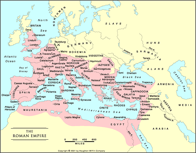
Roman Empire
As I moved along in my history studies I heard a lot about developing a historical perspective. It means acquiring a long view about historical processes. For example, how the civilizations on the Italian peninsula evolved from Etruscan influences to Greek colonies to the start of the Roman city state with a political system somewhat modeled on Greek city-states to a republic, evolving with the growth of the empire and the need to defend the borders which tended to generate a more autocratic government which became increasingly corrupt and unable to check the invasions of Germanic tribes which led to collapse and the Dark Ages. How is that for a synopsis?
Just about every statement I made about Rome has been debated, supported, refuted, and revised for centuries. It is my perspective, however, and provides a framework, however tenuous, for my thinking about the development of European civilization. Many of the conflicts in what was once the Roman Empire and it’s fringes have roots over two thousand years old. I draw on my views of ancient empires in thinking about current developments in our world.
Geology also requires developing perspective; probably more than history because of the vast expanse of time. We think of two thousand years as a long time historically, but it is less than a blink in geologic time. The earth is over four billion years old. What we can think of as written geologic history, the evolution of life forms leaving a fossil record, is 600 million years old. The
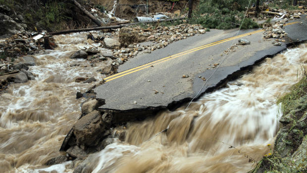
2013 Colorado Flooding
2013 Colorado floods, viewed as a rare catastrophe, is only one of many thousands of similar events that carved canyons, moved rivers, filled basins that continue to subside, and provided habitats for ever-changing life forms. Bring back the mastodon and the Sabre-Toothed Tiger!
Geologists think that Colorado was formed by island arcs similar to those archipelagos south of Asia colliding with the Eurasian continent. Here, island arcs from the south docked on the Wyoming Craton, some of the oldest rocks in North America. This happened a very long time ago, before life emerged. If you want to see this transition I recommend the
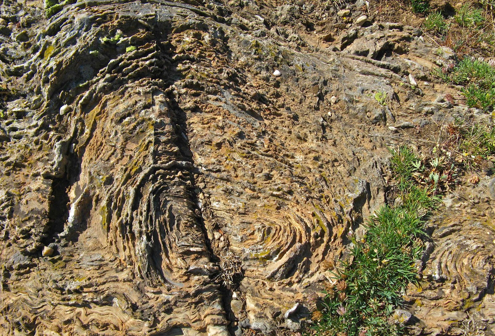
Wyoming Stromatolite
Snowy Range road in Wyoming. You can find stromatolites, fossilized algae. These fossils predate the Paleozoic, and are older than anything in Colorado. Yes, geologists use the word docked, if you can imagine India docking on Eurasia. The transition between the Wyoming Craton and the younger stuff is called the Cheyenne Belt.
Now here is some serious history. Since Colorado became one land mass, mountain ranges have come and gone, oceans have advanced and retreated, new life has evolved and gone extinct, and the whole deal has skidded around on the earth. All the skidding has moved at about the rate your toenails grow. That is not very fast, but after a few million years it begins to add up.
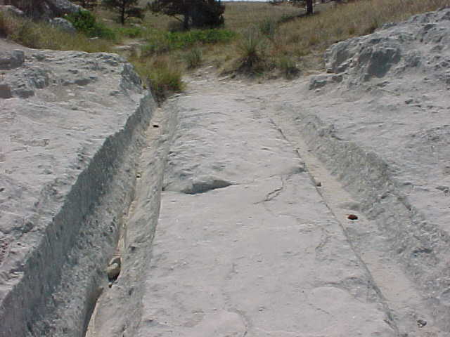
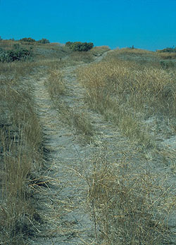
Trail Ruts at Guernsey WY
One of the problems of moving in next to Wyoming is that Yellowstone is there. 200 miles north of Denver is Guernsey, Wyoming, home of some interesting human history. Guernsey is on the Platte River and the Oregon-California Trail. Hundreds of thousands of people traveled the trail seeking new opportunity. The trail stays close to the river in most places, but at one point the banks narrow and the trail climbs up about 20 feet through what looks like soft sandstone. The Rock is so soft the wagon wheels formed axle deep ruts.
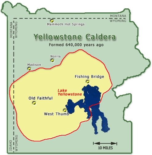
Yellowstone Volcanic Caldera
The rock is not sandstone. It is volcanic tuff, deposited by ash clouds from the last time the Yellowstone Supervolcano blew, about 640,000 years ago. On the highway it is about 380 miles. Four feet of hot ash from 380 miles away. It must have gotten pretty nasty here in Denver. That volcano is going to erupt again. We don’t know when, but the magma continues to bulge and recede in the area around Yellowstone Lake, which formed in the caldera. Now that is historical perspective. I live in a place that is going to be cooked and buried some day.
For those of you in coastal lowlands, along the West Coast, near St. Louis, Salt Lake, or anywhere between Tibet and Australia, there will probably be cataclysms occurring sooner than Yellowstone erupting, but nobody knows for sure.