Tag Archives: Front Range Colorado

The Urban Oil Field

Oil and Gas Wells in Part of Weld County

Weld County, Colorado is one of the richest agricultural counties in the nation.  It is also rich in oil and gas, leading to hundreds of wells extracting petroleum.  With all that money around, Northern Colorado is booming, with people moving and subdivisions being built on what was farmland.  The houses and wells are often neighbors, close neighbors.  As oil companies put profit ahead of proper well management, disasters ensue.  Colorado has lots of fires in the urban-wild land interface.  In Weld County it is the urban-oil field interface.

Colorado is home to 48,000 active wells and 52,000 abandoned wells.  All of them are potential  fire and explosion hazards, and can release methane into the atmosphere.  Think about that when your furnace comes on in the morning before you head out to your car.  We need renewal energy.

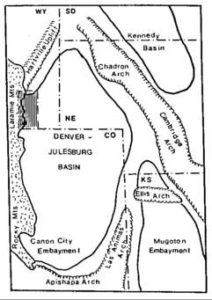
The Denver Basin is a huge geologic feature extending along the eastern front of the Rocky Mountains.  As the Rockies were uplifted, the Denver Basin subsided while filling with debris washing out of the mountains.  There is a 22,000 feet difference between the bottom of the Basin and the summits of the mountains.  That is a lot of gravel.

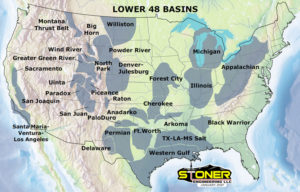
When there is a lot of structure in geologic formations, there is opportunity for oil and gas to migrate into the rocks.  The Denver Basin is one of the largest gas fields in the United States.  Oil and gas extraction started in 1901 in Boulder County.   Trillions of cubic feet of gas and millions of gallons of oil have come out of the ground since then.  Most of the production has come from sandstone or fractured shale.  The development of horizontal drilling and fracking has accelerated the process.  In Weld County, sites with as many as five wellheads and the installations to process the gas are next to residential areas.

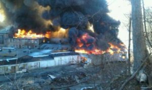
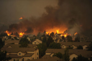
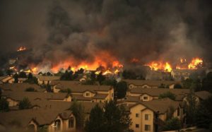
Oil Fire Near Homes

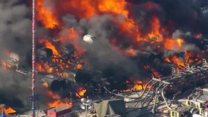
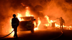
The result is spectacular explosions and fires near where people live.  Local fire departments, once used to fighting grass and barn fires, have sprayed thousands of gallons of firefighting foam on the fires and spent days on the fire scenes.  Attempts to increase regulation of the industry mostly fail due to the political clout of the oil and gas industry.  The politics may change with the election of Democrats to most of the state offices.

Keep in mind the oil bonanza is a major source of Colorado’s economy and growth.  The move to renewables is also a source of revenue to the region, but there will be inevitable disruption during the transition.  The oil and gas industry seems to be focused on keeping the wells flowing, regardless of the environmental consequences.  They do not seem to be shifting into renewals themselves, which may be a death knell.  Market forces will probably prove to accelerate the shift to renewables.  They are much cheaper than dragging fossil fuels out of the ground and pouring tremendous amounts of carbon into the atmosphere.  The remains of dinosaurs and ancient swamps need to stay in the ground.

Notes on Climate Change

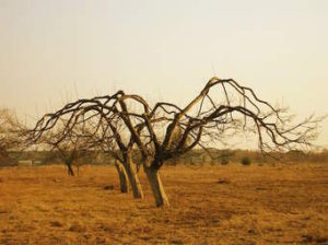
Everyone who thinks is aware of the impact climate change on our weather.  Drought in some places, more violent storms, and water coming out of manholes in South Florida.  Drought may be a cause of the instability in the Middle East.  People forced off the land move to the cities, always hotbeds of turmoil. The west coast of central America has also had a drought resulting in crop failures, with many coffee trees dying.  The people displaced move to the barrios in the cities.  California has had its cycle of wet years followed by drought, fires, and flooding when the rain returns.  The cycle is mostly intact, but extended drought followed by huge fires seems to intensify the cycle.  The rains, when they come, are stronger, with big debris flows devastating large areas.

We are in the anthropocene, a time of massive human impact on the earth.  Climate change is a result of dragging hydrocarbons out of the ground, burning them, and returning carbon dioxide once sequestered to the atmosphere.  Atmospheric CO2 traps heat, warming the oceans.  Warmer water holds less oxygen, meaning many sea creatures are killed.

Permian Temperatures

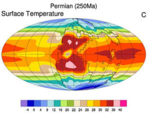
The Permian Extinction was about 252 million years ago.  A major cause was a huge increase in CO2 due to a number of factors, mainly extensive lava flows in Siberia releasing CO2.  Lots of sea life died, but the land got greener and wetter, again sequestering CO2 as coal and petroleum.  There are other factors to the extinction, but the result was 98% of sea life dying, with more than 70% of land life.  It took about 10 million years for life to recover.

We are not going to see a die-off of that magnitude anytime soon, but the climatological and geological records illustrate the risks.  The science is clear, and science offers the remedies, but taking action is a political matter.  Here is where an old adage comes in to play.  “Money Makes the World Go ‘Round.”  Lots of businesses are making money producing and burning hydrocarbons.  Those businesses strongly influence political decision making.  Our Current Leader is mainly motivated by money, so you do the math.

It is getting bad, folks.  It looks like it is going to get worse.  I Hope reason and sanity will prevail in time.

Western Colorado Road Trip

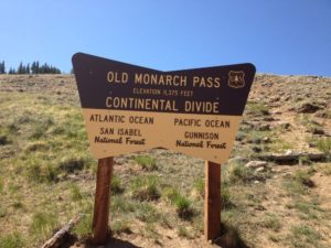
Recently I had a meeting in Gunnison, so I made a short trip of it.  From Denver I went up to Buena Vista and over Monarch Pass, but this time I went over the old Monarch Pass road, abandoned when the highway on upper reaches of the Pass was widened and straightened.  Modern mountain highways are expensive, moving mountainsides and filling low spots.  The older roads tended to follow the lay of the land more closely.  They were cheaper to build but slower and more dangerous.

I like the old roads, even more if they aren’t paved.  Old Monarch Pass follows the recipe.  It’s narrow, winds around and goes up and down.  It had about three inches of partially melted snow, making for some slick spots and lots of mud, but not the mud that likes to trap unsuspecting cars.  I was going slow, so I got to enjoy the scenery and a pretty day.  I rolled the windows down, opening up my steel cocoon a bit.  Good thing.

I stayed in Gunnison, and next morning I drove up to Crested Butte, one of my favorite ski towns, with some of the flavor of an old mining town remaining, in contrast to the modern European Chalet style of Vail.  No  McDonald’s, no chain restaurants, and lots of local businesses.  I had coffee in a place without WiFi.

Kebler Pass during the Aspen Color

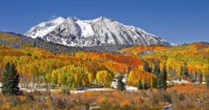
Next was Kebler Pass, one of the best drives in the state.  It goes from Crested Butte to east of Paonia, and is mixed gravel and pavement.  If you want the best fall aspen viewing in Colorado, Kebler Pass is the place.  Huge stands of quakies with good mountain backdrops.  The leaves were gone on this trip, but the beauty remains.  To the south are the West Elk mountains and and a large, mostly untraveled wilderness area.  The Elk Mountains are North and east, some of the wildest peaks in the state.

I was in big, beautiful, rugged country mostly empty of human development.  Emptiness and solitude, part of why I love Western Colorado.  The road comes out outside of Somerset, a coal mining town between Paonia and McClure Pass above Carbondale.  Big coal mines there, mostly shut down.  That’s mining in Colorado.  Dig lots of stuff, then go broke and leave a big mess behind.

I like Paonia, fruit trees below mountains, no McDonalds, no Walmart, as it should be.  There is lots of pretty farm country from Paonia to the turnoff to Grand Mesa outside Delta.  The Grand Mesa road climbs to the top of the 10000 foot tall flat topped Mesa.  It’s wet country, catching the storms coming across the desert country to the west.  My main memories are going fishing there with my father.  Lots of lakes, mosquitoes, gnats, and

View From Lands End. Impossible to Photograph the Panorama

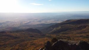
cold nights.  I did not become a fisherman.  The Land’s End road runs west from the highway to the rim of the Mesa.  The view is unsurpassed.  The San Juan’s to the south, the Uncompahgre Plateau across the Gunnison River valley to the west, and the Grand Valley of the Colorado under the Bookcliffs and the Roan Plateau.  You can see into Utah.  The road winds off the Mesa to Whitewater.  Steep and twisty gravel.  I’m saving that part for next time.

I went on over the mesa to Collbran, where I continued my search for the big landslide off the mesa that killed three men running a mile off the mountain.  I didn’t find it, but ran round some nice farm and ranch country while looking.  When I got home I printed out a map.  Duh.

Colorado River Below Kremmling

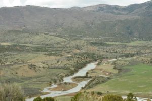
That night I stayed in Parachute off I-70 in oilfield country.  Enough about that.  Next day I followed the Colorado River from Dotsero to Highway 40 at Kremmling.   Again, I crossed a lot of wild country with a bit of development in spots.  The river runs in a succession of canyons and narrow valleys.  No spectacular mountains, just lots of good rugged country.

After Kremmling, Highway 40, Granby, Winter Park, and Berthoud Pass to eastern Colorado, and home.

Wildfire Revisited

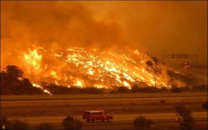
Ventura Fire

Things are hot in Southern California.  Earlier, it was hot in Santa Rosa and the Napa Valley.  When there is a high pressure system over the Great Basin and a low develops off the California Coast, the pressure gradient gives rise to hot downslope winds blowing from east to west.  The Santa Ana.  Wildfires proliferate in the mountainous chaparral country.  As the population continues to grow, the urban areas extend into the brush country.

That Great Basin high is also a fire maker for Colorado, Utah, New Mexico, and Arizona.  Here in Colorado, low pressure systems move down the Plains and the pressure gradient creates winds similar to California’s Santa Ana.  As with most natural phenomena, it is not if, but when.

It’s gonna burn, folks.

The brush country is that way because frequent wildfires prevent any significant tree growth.  When the brush burns, it tends to return in just a few years.  With trees, not so much.

Rawah Burn. Over 100 Years, Trees Have Not Returned

I remember backpacking through a 100 year old burn in the Rawah Wilderness here in Colorado.  The trees had not returned, and the topsoil was eroded away on the hilltops.  Fires in Colorado’s chaparral country such as west of Glenwood Springs burn and in five or ten years the brush is back, ready to burn again.

I have seen this happen in my lifetime.  The  ridges south of the Colorado River and west of Glenwood have burned at least twice.  Lightning causes some of the fires, but once a fire spread from the town dump.  The tragic 1994 fire that killed fourteen firefighters was north of the river and just west of Glenwood.  The fuel load was greater because the area had not burned for some time.


Storm King


If you go back to the Storm King fire area, you will see the brush returning.  It’s not ready to burn yet, but given some time and a few wet years, it will be ready to go again.  The town of Glenwood has built up right to the brush on both sides of the river.

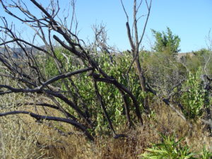
Brush Returning

Back to California, the towns have grown up to the brush and those wanting a view are living in the brushy areas.  The canyons are more heavily wooded and full of houses.  All the coastal mountains from San Diego north are in the chaparral zone.  All the urbanization is also in those areas.  Quick commute? Live just below the hills in a canyon.  Nice view, build your house on the ridge.

Those examples of the urban-woodland interface are not unique to Western Colorado and California.  The Colorado Front Range is another example.  Fires have burned from west of Fort Collins to south of Colorado Springs.

Waldo Canyon Fire


The Waldo Canyon fire burned into town on Colorado Springs’ west side and into Manitou Springs.  The Black Forest Fire was in a different climate zone with Ponderosa Pine , but with lots of brush.  That area is wetter, but is also subject to drought and wildfire, just less often.

Arizona and Utah have similar country, and fire killed 19 firefighters in mixed brush and timber just outside Prescott.  I am waiting for a big fire just west of Denver.  It’s only going to get worse.  People are moving into the brush country in increasing numbers,  if you move to Colorado or California from Chicago, you want the mountain experience.  The jobs are in the cities, and the closest mountain areas are brush country.  Four Mile Canyon outside Boulder and Ojai, California are examples of what fire does to development in the chaparral.

Young people looking for an exciting career should look into wildland firefighting.  It is a growth industry.  Oh, I haven’t even mentioned climate change.  It will increase job opportunities.

Denver Basin

Denver Basin

The Denver Basin is a deep syncline just east of the Southern Rocky Mountains.  It started around 300 million years ago when the Ancestral Rocky Mountains were uplifted.  A little plate tectonics here, folks.  A tectonic plate is a huge plate of rock slowly moving on the earth’s mantle at or near the surface. When two tectonic plates collide, one of them often dives beneath the other.  As the plate subsides, it runs into hotter rocks at depth.  The subsiding plate has lots of water which lowers the melting point of the rock.  Then things really go on the move.

The subsidence zone, usually along a coastline, gets pretty active, meaning earthquakes, volcanos, and the intrusion of huge blobs of granite known as plutons.  New rock coming in from below means the overlying rocks get uplifted into mountain ranges.  The other side of this mountain building is known as the foreland and usually subsides as its mass goes into the new mountains.  As it subsides, the new basin fills with debris eroding from the mountains.

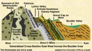
The Flatirons, Dakota Ridge, the Garden of the Gods, all are built from rocks buried thousands of feet deep just a few miles from the outcrops.  I am sitting here writing atop thousands of feet of mountain debris.

The mountains eventually get hauled away in rivers or dumped into the basin.  This happened twice here in my home country.  The second event occurred at the end of the Cretaceous and the early Paleogene, about 60 million years ago.  Our current Rockies came up, known as the Laramide Orogeny, came up again, and the foreland deepened even more.  It ended up being about 13000 feet deep, filled with the stuff washed and blown off the mountains.

This all took a while.  Rivers formed, seas came and went, and lots of life contributed organic material to the basin.  The result?  Coal, oil, and gas.  The first oil well was in Boulder County, producing from fractured Pierre Shale, which was deposited by an inland sea.  Now this Basin is big, extending into Nebraska and Wyoming.  Huge amounts of oil and gas have been produced, and horizontal drilling and fracking are releasing even more.  The Denver Basin is an oil patch.

Water from the mountains also entered the basin, creating aquifers producing lots of water.  We pump the water and because it is in an enclosed basin, it doesn’t recharge as fast as it is pumped.  Douglas County is going to run out of groundwater some day.  Then the water will have to come from the rivers, and the supply is limited.  Thus, seemingly crazy proposals to pump water from Flaming Gorge Reservoir on the Green River in northern Utah to Eastern Colorado.  Problem: California and Arizona also want that water.

Climate change has the potential of reducing the available water as well, eventually ending population growth.  Amazon, Stay Away.  Mining started Colorado development, and today the money still comes from the ground, but is from oil and gas. As we transition to alternate energy sources, where is Colorado’s wealth going to come from?

Wildfire

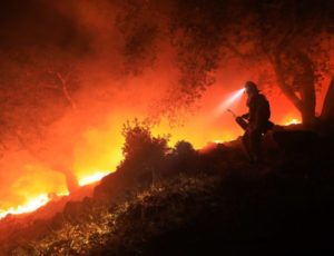
Some of the golden hills of California just turned black.  This time it is north around Santa Rosa and the wine country.  Usually it is the San Gabriel mountains or other Southern California areas.  The conditions leading to destructive wildfire are the same.  There are essentially two seasons; when it rains and when there is no rain.

This year there was a lot of rain in what passes for winter in all of California.  Everything greens up and grows.  It means good feed for cattle, and lots of fuel in the fall when it dries out.  You are probably familiar with the Santa Ana winds in Southern California.  The desert Great Basin east of the mountains cools off, creating an area of high pressure.  The pressure creates west-flowing winds, blowing to the coast.  As the winds hit the mountains, they rise, cool, then flow down the west side of the mountains, warming as they flow west.  Thus the Santa Ana winds, hot dry wind flowing west and drying all that foliage that grew during the rainy season.

In Northern California, the winds are called Diablo winds, after the local Diablo mountains.  The high pressure west of the coastal region originates from high pressure following storms blowing into the basin from the stormy northwest.  The high pressure again creates west flowing wind howling down the west side of the mountains.  The fires are set or lightning started, and burn across the valleys.  That means the golden hills, vineyards, and Santa Rosa suburbs.

The fire triangle: fuel, heat, and oxygen.  The fuel grew, much heat comes with the wind, which also supplies plenty of oxygen.  Add an ignition point, and it burns.  The wind and fire blows down canyons, and people like to live in the canyons.  When all the space in the canyons is full, people move into the hills.  It is called the urban-wildland interface.  The entire American West is growing in population, and the new people moving in want to experience some open space.  The open space is open because it periodically burns, thus no forest, just chaparral and grassland.  And houses.  Destruction.

Is climate change partly responsible?  You decide.  California has always had destructive fire blowing in from the west, but is climate change exacerbating the natural phenomena?

Here in Colorado, we also have destructive wildland fires fanned by downslope winds.  Here the winds are from the west, hit the mountains, rise, cool, and roar down the eastern side of the mountains, fanning fires.  People are moving into the areas where the fires have always burned, and their houses burn.  The Plains east of Denver see huge grassland fires, especially after a wet spring.

Storm King Fire, Glenwood Springs CO

Western Colorado also has wind accelerated fires.  Westerly winds encounter the west side of the Rockies, rise, cool, and descend into the area around Glenwood Springs.  The country is the Colorado equivalent of California Chaparral.  The brush burns got, killing firefighters and threatening towns.  It is only a matter of time before things get hot in Glenwood, Newcastle, and Carbondale.

The West is a wonderful place, with open space, mountains, deserts, and a harsh climate.  People moving there beware, the conditions are more violent than in the well-watered East.  Oh, and don’t forger the landslides and avalanches where it is steep, along with fire.  There is lots of steep country.   There is steep country just west of all the people living along the Front Range.  The fires just might burn into town, just like Santa Rosa.

Waldo Canyon Fire, Colorado Springs

Colorado Springs has seen fire, along with Boulder.  Some day a fire may want to go downtown in a Front Range city. It is also likely a mountain town like Evergreen or Estes Park will burn.  The Mountain Pine Beetle has left a lot of standing dead trees ready to burn.

Why do I seem to be writing about fire, earthquakes, hurricanes, and other means of destruction? Maybe because I am confronting my own mortality.  I just turned 75.  I know it is surprising because I look so young.

Rocky Flats

Rocky Flats

Rocky Flats

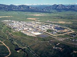
 What is now is the Rocky Flats National Wildlife Refuge once was the Rocky Flats Plant where triggers for nuclear weapons were manufactured.  The main raw ingredient for the triggers was plutonium, one of the most toxic and radioactive substances known, with a half-life of over 4000 years.  During the forty years the plant operated, there were two major fires in glove boxes where plutonium discs were handled.  In this and other incidents, many pounds of plutonium were released.  The Wikipedia article has an excellent summary and bibliography.   

I was talking to a woman recently about Rocky Flats.  Her father worked there for several years when the plant was in full operation.  He had to deal with a glove box where the plutonium had started to burn.  The gloves were so hot he had to wear other gloves before he could put his hands into the glove box gloves to stop the reaction.  He probably saved some lives.  He died of cancer. 

I became more interested in Rocky Flats after reading Full Body Burden, by Kristin Iverson, an English Professor who grew up in the area.  The book is controversial, disagreeing with the environmental assessments by the Colorado Department of Public Health and Environment and the Nuclear Regulatory Commission.  Given all I have read, I am skeptical of the official lint that the area is safe, and exposure to the public was and is minimal.  Decide for yourself. 

Iverson writes that a large area of contaminated topsoil was covered with more topsoil and pronounced safe.  Rocky Flats is aptly named, as millions of tons of glacial erosion products have covered the area with gravel.  The surface is called ground armor, mostly rock, as the high winds in the area have blown much of the finer material away.  That continues, and rodents burrowing bring buried soil to the surface where it blows into the Denver Metro area..  

The nearby Standley Lake, a large irrigation reservoir that provides water to Westminster and Broomfield, allows boating and water skiing but bans swimming because the lake bottom is contaminated with plutonium.  Many experts have advocated banning development in the area, but houses are going up. 

I got interested again recently because the NOAA National Weather Radar website is my go-to means of weather monitoring.  The TV weather people are either warning the apocalypse is imminent or it is fine, no rain, just before a major hailstorm.  Over a period of months I noticed a nearly constant radar image indicating precipitation over the NWR.  Day or night, weekends or weekdays, the image is there.  If it really is rain, the refuge would be a major swamp at the base of the Rocky Mountains.   

Many years ago I was a radar repairman in the Army.  One of the radars we maintained put out so much radio frequency energy it would kill birds flying in front.  We had quite a bit of training about ionizing radiation.  Radars emit radiation, so does decaying plutonium.  I could not come up with any explanation for the radar image other than radioactive decay.  This would be  disastrous, as much of the Denver metro area is downwind of Rocky Flats.   

I sent a number of emails to the NWS, TV stations, and the CDPHE.  I guess I stirred things up a bit, because I got a long, thoughtful letter from CDPHE outlining the investigation I generated.  The conclusion reached is that the radar image is from dust coming from a gravel mining and crushing operation just adjacent to the refuge.   Here is the letter:

Begin forwarded message:

From: “Spreng, Carl” <carl.spreng@state.co.us>
Date: July 13, 2016 at 3:56:58 PM MDT
To: levanks@me.com
Cc: Phillip Peterson – CDPHE <phillip.peterson@state.co.us>, Surovchak Scott <Scott.Surovchak@lm.doe.gov>, “Moritz, Vera” <Moritz.Vera@epa.gov>, Lindsay Masters – CDPHE <lindsay.masters@state.co.us>, Darr Bob <Bob.Darr@lm.doe.gov>, Rob Beierle – CDPHE <robert.beierle@state.co.us>, Smith Warren <warren.smith@state.co.us>
Subject: Rocky Flats

William Shanks

Mr. Shanks,

Your message sent to Phill Peterson in our Radiation Control Program was forwarded to me for response. I discussed your observations with a representative of NOAA. NOAA scientists apparently notice a fairly consistent dust cloud in the Rocky Flats area. This is consistent with the adjacent gravel operations — current and historic. You can observe the dust that rises off these operations as you drive by the site.
During remediation, the source areas of radiological risk in the Central Operable Unit (managed by the US Dept. of Energy) were excavated and shipped out of state. The human health risks inside the Central Operable Unit and the remainder of the site (managed as a refuge by the US Fish and Wildlife Service) were assessed following remediation and risks were found to be very low. A final decision for the site declared that any conceivable use would be appropriate in the Refuge area. That decision was based on an enormous amount of data (surface soil, subsurface soil, groundwater, surface water, air). After the remediation was completed, an aerial survey was conducted using a low-flying helicopter with detectors.
Offsite areas in the vicinity of Rocky Flats are also safe for any use. Numerous offsite surveys confirm the conclusion that only a few samples just east of Rocky Flats detected plutonium concentrations above background levels. You can read more information about the sampling on and around Rocky Flats on the Colorado Dept. of Public Health and Environment’s (CDPHE) web page at:  http://www.cdphe.state.co.us/hm/rf/index.htm.
 
Please contact us again if you have more questions.


Carl Spreng
P 303.692.3358  |  F 303.759.5355  |  C 303-328-7289
4300 Cherry Creek Drive S, Denver, CO  80246-1530
———- Forwarded message ———-
From: Carol Leavenworth <levanks@me.com>
Date: Tue, Jul 5, 2016 at 12:39 PM
Subject: Rocky Flats
To: phillip.peterson@state.co.us


Sir,
I notice there is a consistent radar image over the Rocky Flats NWR when viewing the NOAA national weather radar website.  I am no physicist, but ionizing radiation is detectable by radar.  Is this the case at Rocky Flats?  Is there a radiation hazard outside the closed zone?  Is there a public health risk for the nearby residential areas?I was a radar repairman in the Army in the 1960’s and remain interested in the field.  There weren’t many RF energy safeguards back then and there were nuclear weapons stored where I was stationed in Germany.
Thanks.
William Shanks
2032 S. Logan St.
Denver CO 80210
303-830-0599

After Cleanup

After Cleanup

I was skeptical, so I drove out there.  I made a couple of circuits around the area, passing through new subdivisions where grading was going on and decided that was not the source.  I then turned off SH 93, the road from Golden to Boulder into what used to be the west gate to the bomb plant.  I went past lots of no trespassing signs to a big gravel mining and crushing operation.  The crusher was producing a significant dust cloud.  There were lots of big gravel trucks, indicating a major operation.    

I left without getting stopped for trespassing and made another lap around the refuge.  The gravel operation is to the southwest of the refuge, and I could see the dust cloud from north of the refuge.  Mystery solved.  it is not ionizing radiation creating the radar image, it is dust.  

There is no radioactive cloud coming off Rocky Flats.  There is, however, still a lot of radioactive and chemical pollution out there.  I suggest you not buy one of the nice new houses being built in the area..  

Dirty Denver

Windstorm

Windstorm

The wind blows here in Denver, and it is not all air.  Those mountains just west of us are wearing down.  Most of the sand and dirt ends up in the rivers, put the wind blows some of the mountains away.  If you park your car outside, you already know this.  The dust covers everything on the car, and you have to wash the damn thing.  Mostly the dust is that tan/brown dirt color, but sometimes it is red when parts of Utah decide to take a visit.

The constant deposition of wind-blown dirt is why ancient cities get buried.  The process is slow, but relentless.  Denver is being buried, but we haul a lot of it away.  Our older house has what seems to be sunken sidewalks.  It is the wind- blown dust combined with organic matter (grass clippings) to form topsoil.

Carol likes to say that a lot of the stuff that accumulates is spider legs.  True, along with the exoskeletons of millions of insects.  In geologic terms the rate of deposition of all that stuff is fairly rapid.

Here on Colorado’s Front Range we get wind, but nothing like the mountain winds, unless you live in Boulder or other places at the foot of the mountains.  The mountains are high enough to get some of the higher altitude winds that the flatlands don’t get much of.  Also, when a weather system blows in, the mountains act as a barrier, forcing all that moving air up.  As it rises, it cools, gets more dense, and descends on the lee side of the mountains. As it falls, it gains velocity and tends to warm up, creating our famous chinook winds.

Loess Soil Windblown Dirt

Loess Soil
Windblown Dirt

As the wind moves on the plains, it’s velocity decreases and some of the dirt it carries falls out.  Close to the mountains, a lot of it is sand.  That explains the sand hills we have close to the mountains.  You can identify the sand because it does not support plant growth as well as soil.  Sandy areas are cow country, no farming.  A little farther east, the dirt falls down.  A lot of dirt falls down, forming loess, a German term for wind-blown dirt deposits.  Eastern Colorado has thousands of square miles of loess.  Without irrigation, it is usually planted in wheat.

Of course, all the water or wind-borne sediment is headed for Mississippi, Lousiana, or the gulf.  Most of that Mississippi mud will end up as shale.  At some point plate tectonics will shove it up as dry land and the cycle starts over.  Most of the sand will eventually end up in the streams, get buried, and form sandstone like the Dakota sandstone dinosaur fossils are found in.  In other places, tremendous deposits of wind blown sand accumulate, eventually forming the sandstone that blankets the Colorado Plateau.

That dirt accumulating in your lawn and garden is part of a recycling process going on all over our planet for millions of years.  The process will continue long after we are all gone, as long as there is air and water on the planet.  To me, the whole thing is a miracle, all these geologic processes creating conditions existing long enough for the evolutionary mistake known as humanity to develop.

Weather

Climate Change

Climate Change

2013 Flood

There is currently a lot of controversy about climate change and whether humankind has a role in the warming trend.  While I think it is true that pouring huge amounts of sequestered carbon is the culprit, I don’t think it matters much for us here in Colorado and much of the west. 

We live in a land of extremes except for the rainy Pacific Northwest, but, they have their earthquakes and volcanos.  Here in Colorado, we dwell in a land of extremes.  The west is dry, it snows in the mountains, the Front Range is kind of a mix, and it is pretty dry in the east.  That varies from year to year.  It varies a lot.   

In the late nineteenth century it was a wet cycle in the eastern prairie, and the railroads made millions enticing settlers to buy their land and get rich farming.  The population in eastern Colorado peaked then and has been declining ever since.  The mountain ski areas have lots of snow some years and almost no snow other years.  The western desert country looks dry and desolate most of the time, but I have seen it bloom in a stunning variety of color.   

Then there are the floods, blizzards, and tornados, often followed by drought.  The one thing we can count on is change.  There are long term trends.  Most archeologists think one reason the ancestral Pueblo Indians left southwestern Colorado was a prolonged drought cycle.  Anyone who tries to raise dry land beans in that country can tell you not much has changed. 

2013 Flood

2013 Flood

Here along the base of the mountains we have the extremes as well. There was the drought of 2002, and the floods of 2013.  The mountains create an unusual weather pattern that stalls along the mountain front, bringing more moisture than the land can handle.  That is when lots of the mountains wash out into the flat country.  It has been going on for more than sixty million years.  The gravel in the Platte River in Nebraska is Rocky Mountain gravel.  Some of the Louisiana mud is Long’s peak mud.   

Some climate models say climate change is going to dry Colorado out, other models say it will be wetter.  My money is on more extreme weather.  Longer, more violent wet periods and long droughts.  Look for more frequent floods, not the thirty or forty year cycle we have had since the first European-American settlers and miners arrived.  Think about the tornados and hailstorms recently.   

I like the extremes.  We have our regular four seasons here but the winters are milder than in Iowa.  It can get hot but there are few days over one hundred degrees, but not like southeastern Utah.  I think that may change, hotter in the summer.  I don’t think the winters will be colder.  I can remember forty below in Boulder when I was flunking out of CU.  Twenty below seems to be more the cold winter norm now.  What I do not like is the hailstorms.  I don’t think the insurance companies like them much either.  Homeowners insurance costs keep rising.  That hail is hard on the garden as well. We had only one tomato plant survive last year. 

One of the big impacts of climate change will be on water supplies.  The amount of precipitation may not change, but if it is warmer, the snowpacks will not last as long in the spring.  That means more spring floods and a shorter runoff period, which will impact water storage.  That could be bad news for the populated Front Range.  People keep coming, but there will not be more water, and a lot of the big spring runoff will go out of the state.  That will be good for the Sandhill Cranes in Nebraska, but bad for Parker and Highlands ranch. 

I spent a long time in the water business, and it always disturbed me watching all that high quality drinking water being used to attempt to replicate Surrey or Connecticut foliage in the Great American Desert.   All that bluegrass will have to go. The urban forest will have more drought-hardy trees.  Denver Water’s customers have done a good job of conserving since the big drought of 2002, but the bluegrass model of landscaping continues.  In Denver, daily water consumption is about 110 million gallons per day in winter.  I the hot part of summer, it’s over 400 million gallons per day, most of it run out onto the ground. 
At our house, we have significantly reduced the size of our lawn, but we still have a lot of crabgrass.  It should be buffalo grass and blue grama, both native drought-resistant grasses.  They don’t stay green all summer, so we are stalling and paying the water bill.  Marijuana legalization is bringing lots of people to Colorado, and the economy is booming.  Those people use water, and lots of water is used growing the stuff.  One of the unintended consequences of legalizing pot is increased water consumption. 

Myself, I am not too concerned about climate change for myself.  After all I am 73 years old and don’t live on the coast.  Long term change is a reality, but as John Maynard Keynes said, “In the long range we are all dead”.


Motorcycles

Kawasaki KLR 650

Kawasaki KLR 650

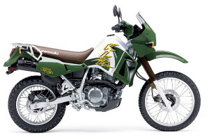
I have owned and ridden three motorcycles.  I like motorcycles. They are as close to flying as one can get on land.  There are challenges, such as trying to stay upright on two wheels. I know people who have never been down on their bikes.  I once fell over right by the front door of the biggest motorcycle accessory shop in Denver.  It trapped my leg and some guy had to lift it off me.  I bet he is still telling that story.

I have crashed on city streets, on a paved canyon road (sand), in parking lots, and an uncountable number of times in the dirt.  Two of my motorcycles were what is now called dual sport; they are able to be used on the street and in the dirt.  They aren’t top notch in either role, but some riders do things most people can’t imagine.  80 mph on the highway, and some challenging back country roads and trails.  Lots of good dual sport roads in Colorado, Utah, New Mexico, and Wyoming, where I traveled.

One of the best grew up riding on the streets of Mexico City, where you have to be good to survive.  I could keep up with him on the highway because we had the same bikes.  In the dirt, he could go places with that fairly heavy thing that I didn’t even dream of.  He and quite a few others have done 50 mountain passes in Colorado in 50 hours.  I am good for about six in a day, and hurt for two days. He also did a lot of single track trails, something I never attempted.

I liked road trips with some gravel or dirt roads thrown in.  Forest Service roads were about as gnarly as I wanted. On the asphalt, it was curves in canyons.  Fortunately, Colorado’s Front Range has lots of canyons.  There was a geological event that bumped the long bench from Conifer to its Estes Park.  That bench was once at Denver’s elevation, but got pooched up to where it is now.  We call the road the Peak to Peak Highway.

Golden Gate Canyon

Golden Gate Canyon

Go up any of the canyons from Deer Creek to the Big Thompson, ride those fast sweeping curves a ways, then down another canyon.  My favorite was Golden Gate Canyon, where I tore my posterior cruciate ligament when I hit some sand on the road.

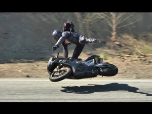
It’s the lean, folks.  Go around a curve on two wheels and you lean.  Go faster, lean more.  Go faster, and crash.  I went fairly slow for a motorcyclist.  I still got some lean, and was able to look at the geology.  A low side crash is when the bike slides out from under you and goes off the road ahead of you.

High Side Crash

High Side Crash

A high side crash is the bad one.  The front wheel starts to slide, then gets traction.  You are flipped off and into the air, while the bike bounces along behind until it lands on you.  Both are bad, but you really do not want to high side.  Some riders get flipped into the guardrail.  Ouch.

My knee wrecking crash was a low side.  My knee was bent, the tibia-fibula stopped on the pavement while the femur went a little farther.  It really hurt.  Hurt bad. I picked the bike up and rode on until I couldn’t stand the pain and called for help.

Aside from the crashes, I loved motorcycling.  Yes, it is dangerous.  Other drivers don’t see you and turn in front of you.  You crash all by yourself.  There is a famous twisty road in North Carolina where a biker went into the bushes. Just in front of him was another motorcycle with the remains of the rider.  He went into the bushes and nobody saw a thing.

Yamaha SR 400

Yamaha SR 400

I always wore all the protective gear.  Those Harley riders who won’t wear a helmet because their balls will protect them are nuts.  Mass delusion, those Harley people.

This spring I got the itch again.  Yamaha makes a single cylinder bike that looks a lot like the classic British thumpers from the 1950s.  It isn’t fast, but sure would be a good canyon bike.  Nah.  Too old and slow myself.  I guess I will stick to four wheeling.


« Older Entries