Tag Archives: Denver History

Rocky Flats

Rocky Flats

Rocky Flats

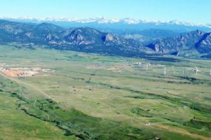
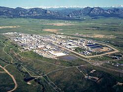
 What is now is the Rocky Flats National Wildlife Refuge once was the Rocky Flats Plant where triggers for nuclear weapons were manufactured.  The main raw ingredient for the triggers was plutonium, one of the most toxic and radioactive substances known, with a half-life of over 4000 years.  During the forty years the plant operated, there were two major fires in glove boxes where plutonium discs were handled.  In this and other incidents, many pounds of plutonium were released.  The Wikipedia article has an excellent summary and bibliography.   

I was talking to a woman recently about Rocky Flats.  Her father worked there for several years when the plant was in full operation.  He had to deal with a glove box where the plutonium had started to burn.  The gloves were so hot he had to wear other gloves before he could put his hands into the glove box gloves to stop the reaction.  He probably saved some lives.  He died of cancer. 

I became more interested in Rocky Flats after reading Full Body Burden, by Kristin Iverson, an English Professor who grew up in the area.  The book is controversial, disagreeing with the environmental assessments by the Colorado Department of Public Health and Environment and the Nuclear Regulatory Commission.  Given all I have read, I am skeptical of the official lint that the area is safe, and exposure to the public was and is minimal.  Decide for yourself. 

Iverson writes that a large area of contaminated topsoil was covered with more topsoil and pronounced safe.  Rocky Flats is aptly named, as millions of tons of glacial erosion products have covered the area with gravel.  The surface is called ground armor, mostly rock, as the high winds in the area have blown much of the finer material away.  That continues, and rodents burrowing bring buried soil to the surface where it blows into the Denver Metro area..  

The nearby Standley Lake, a large irrigation reservoir that provides water to Westminster and Broomfield, allows boating and water skiing but bans swimming because the lake bottom is contaminated with plutonium.  Many experts have advocated banning development in the area, but houses are going up. 

I got interested again recently because the NOAA National Weather Radar website is my go-to means of weather monitoring.  The TV weather people are either warning the apocalypse is imminent or it is fine, no rain, just before a major hailstorm.  Over a period of months I noticed a nearly constant radar image indicating precipitation over the NWR.  Day or night, weekends or weekdays, the image is there.  If it really is rain, the refuge would be a major swamp at the base of the Rocky Mountains.   

Many years ago I was a radar repairman in the Army.  One of the radars we maintained put out so much radio frequency energy it would kill birds flying in front.  We had quite a bit of training about ionizing radiation.  Radars emit radiation, so does decaying plutonium.  I could not come up with any explanation for the radar image other than radioactive decay.  This would be  disastrous, as much of the Denver metro area is downwind of Rocky Flats.   

I sent a number of emails to the NWS, TV stations, and the CDPHE.  I guess I stirred things up a bit, because I got a long, thoughtful letter from CDPHE outlining the investigation I generated.  The conclusion reached is that the radar image is from dust coming from a gravel mining and crushing operation just adjacent to the refuge.   Here is the letter:

Begin forwarded message:

From: “Spreng, Carl” <carl.spreng@state.co.us>
Date: July 13, 2016 at 3:56:58 PM MDT
To: levanks@me.com
Cc: Phillip Peterson – CDPHE <phillip.peterson@state.co.us>, Surovchak Scott <Scott.Surovchak@lm.doe.gov>, “Moritz, Vera” <Moritz.Vera@epa.gov>, Lindsay Masters – CDPHE <lindsay.masters@state.co.us>, Darr Bob <Bob.Darr@lm.doe.gov>, Rob Beierle – CDPHE <robert.beierle@state.co.us>, Smith Warren <warren.smith@state.co.us>
Subject: Rocky Flats

William Shanks

Mr. Shanks,

Your message sent to Phill Peterson in our Radiation Control Program was forwarded to me for response. I discussed your observations with a representative of NOAA. NOAA scientists apparently notice a fairly consistent dust cloud in the Rocky Flats area. This is consistent with the adjacent gravel operations — current and historic. You can observe the dust that rises off these operations as you drive by the site.
During remediation, the source areas of radiological risk in the Central Operable Unit (managed by the US Dept. of Energy) were excavated and shipped out of state. The human health risks inside the Central Operable Unit and the remainder of the site (managed as a refuge by the US Fish and Wildlife Service) were assessed following remediation and risks were found to be very low. A final decision for the site declared that any conceivable use would be appropriate in the Refuge area. That decision was based on an enormous amount of data (surface soil, subsurface soil, groundwater, surface water, air). After the remediation was completed, an aerial survey was conducted using a low-flying helicopter with detectors.
Offsite areas in the vicinity of Rocky Flats are also safe for any use. Numerous offsite surveys confirm the conclusion that only a few samples just east of Rocky Flats detected plutonium concentrations above background levels. You can read more information about the sampling on and around Rocky Flats on the Colorado Dept. of Public Health and Environment’s (CDPHE) web page at:  http://www.cdphe.state.co.us/hm/rf/index.htm.
 
Please contact us again if you have more questions.


Carl Spreng
P 303.692.3358  |  F 303.759.5355  |  C 303-328-7289
4300 Cherry Creek Drive S, Denver, CO  80246-1530
———- Forwarded message ———-
From: Carol Leavenworth <levanks@me.com>
Date: Tue, Jul 5, 2016 at 12:39 PM
Subject: Rocky Flats
To: phillip.peterson@state.co.us


Sir,
I notice there is a consistent radar image over the Rocky Flats NWR when viewing the NOAA national weather radar website.  I am no physicist, but ionizing radiation is detectable by radar.  Is this the case at Rocky Flats?  Is there a radiation hazard outside the closed zone?  Is there a public health risk for the nearby residential areas?I was a radar repairman in the Army in the 1960’s and remain interested in the field.  There weren’t many RF energy safeguards back then and there were nuclear weapons stored where I was stationed in Germany.
Thanks.
William Shanks
2032 S. Logan St.
Denver CO 80210
303-830-0599

After Cleanup

After Cleanup

I was skeptical, so I drove out there.  I made a couple of circuits around the area, passing through new subdivisions where grading was going on and decided that was not the source.  I then turned off SH 93, the road from Golden to Boulder into what used to be the west gate to the bomb plant.  I went past lots of no trespassing signs to a big gravel mining and crushing operation.  The crusher was producing a significant dust cloud.  There were lots of big gravel trucks, indicating a major operation.    

I left without getting stopped for trespassing and made another lap around the refuge.  The gravel operation is to the southwest of the refuge, and I could see the dust cloud from north of the refuge.  Mystery solved.  it is not ionizing radiation creating the radar image, it is dust.  

There is no radioactive cloud coming off Rocky Flats.  There is, however, still a lot of radioactive and chemical pollution out there.  I suggest you not buy one of the nice new houses being built in the area..  
Colorado’s Front Range Floods

2013 flood

2013 Flood

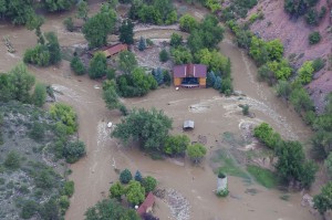
Those of us who live along the eastern base of the Rocky Mountains enjoy a unique set of circumstances; a fine climate, mountain views, a mountain playground, and rivers that provide much of our water needs.  There are millions of people living in an urban area that runs from Pueblo to Fort Collins.

Most of the time, the physical setting and the climate combine to make the Front Range a fine place to live.  There is risk, however.  Most of the time we don’t have quite enough water for every need. The people are along the Front Range, and the water is on the western slope.  On occasion, we have way too much water.  We are subject to drought, our own waste of the water we have, and the floods that come out of the mountain canyons.

To understand these problems requires a look at two histories, the Rocky Mountain history for the last 75 million years and human history from 1859.  Around 75 million years ago the Rockies began to form.  As they grew, they also wore down.  The debris from the mountains spread from their base to as far as Nebraska.

The streams were bigger then.  Drive east to Bijou Creek and see the valley that obviously was not formed by the current flow in the creek.  The wind blew.  It still does, leaving eolian sand deposits.  Sand Creek, draining the area east through Stapleton and into Aurora is appropriately named.  You can identify the sand hills – they are grazing land, not good for farming.  That sand and dirt comes from as far as Utah and coats our cars.


Today, the Rockies are not eroding as fast as they did during the ice ages, but they are still coming down.  Back in the Precambrian when I took geology, the assumption was that erosion was a steady, gradual process.  Taking the long view, that is so, but on a human time scale, erosion is punctuated by periodic floods.  Some of the floods are from spring runoff from wet winters.  The catastrophic floods pound out of the canyons when storms park themselves over an area and it rains.  And rains.  Sometimes it rains more in a few hours than it does in several normal years.  Sometimes the rain is where the people are, just east of the mountains.

Large amounts of moist monsoonal air from the Gulf of Mexico move north along the Rockies and encounter a cold front coming from the west.  Sometimes the rains are short in a fairly small area.  At other times, as in 2013, the rain comes down over a large area, and it rains for days. To humans, these storms seem like unusual events, but they have been happening for millions of years.  Along with normal erosion, they have filled the Denver Basin with 13,000 feet of debris.  That is a lot of rocks and mud.


1864__Cherry-Creek-Flood~p1

1864 Cherry Creek Flood

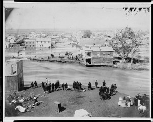
One of the first recorded monsoonal floods was in 1864, not long after Denver was settled.  Cheyenne and Arapaho Indians told the settlers seeking fortune not to build where Cherry Creek and the South Platte meet.  The town builders built there anyway.  It was a logical town site.  Trails met, grass, trees, and water were available, and the gold-rich mountains just a short distance away.  Much of the new town went downstream.


The town was rebuilt in the same place.  Floods came again.  Denver flooded in 1876, 1885, 1894, 1912, 1921, 1933, and 1965.  Pueblo flooded in 1921, the Big Thompson in 1976, Manitou Springs and Colorado Springs in 2013, and much of the Front Range from Denver to Fort Collins in 2013.  The link is from the Atlantic Monthly, with dramatic images from the 2013 flooding.

Most vulnerable are towns at the base of the mountains: Manitou Springs, Palmer Lake, Morrison, Golden, Boulder, Lyons, Loveland, and Fort Collins.  Towns along the South Platte, St. Vrain, Cache La Poudre, and Big Thompson rivers are at special risk.

DSCN0960

Jamestown 2014

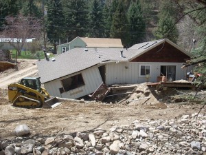
Will people stop building there?  Rebuilding is underway in every area flooded in 2013.  While researching this piece I traveled to Boulder, Jamestown, Lyons, and the farmland along the St Vrain.   I saw travel trailers parked nest to damaged homes with building permits on the flood-damaged houses.

Some actions do prevent floods.  Denver has Cherry Creek, Bear Creek, and Chatfield dams.  They are flood control dams designed to capture floodwaters.  Let’s hope they are big enough.

The photo above has a lot of rock in the foreground.  The rocks range in size from sand and silt to head size.  They were exposed by the 2013 flood, but were deposited by a previous flood that had enough force to carry that debris and dump it there.  upstream, there are narrow gulches with the lower ends scoured down to bedrock.  That debris went further downstream.

The Rocky Mountains are on the way to the Mississippi river delta in Louisiana.  It will take many millions of years, but they will wear down and become Mississippi mud.  Floods will hasten the process.

Four Mile Historic Park


Four Mile

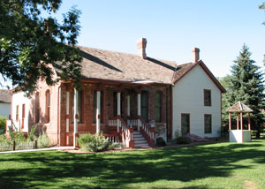
The House at Four Mile

When I give a house tour, I always say, “This is a museum.  What’s the rule?”  “Don’t touch!”  is their response.  All through the house I have to remind them, “Don’t touch.”

I work part time at Four Mile Historic Park.  I help with elementary school field trips and birthday parties.  Four Mile was a stagecoach stop on the Cherokee Trail from the 1859 Pike’s Peak Gold Rush until the railroad came to Denver in 1870.  It is four miles from the Intersection of Colfax Avenue and Broadway, where the Colorado State Capitol building stands.

The Cherokee Trail came down Cherry Creek to Denver, then went north to close to the Wyoming border, then west to Fort Bridger and on to California.  The stage line came west from Leavenworth, Kansas on the Smoky Hill Trail across Kansas to where Limon now is.  It then came across present Elbert County and down Smoky Hill Road to the Cherokee Trail and Denver.

The Four Mile station operated from 1859 to 1870 when the railroad came down to Denver from Cheyenne.  It then was a farm and informal neighborhood center until around 1940.  Today it is owned by the City of Denver and operates as a nonprofit.

The original house dates to 1859 and is the oldest standing structure in Denver.  It is the museum I referred to in the first paragraph.  We have horses and wagon rides, a stagecoach and several other wagons.  There are goats, chickens, a tipi, a trapper’s cabin, wells, barns, gardens, and lots of places to picnic.

Our goal with school trips is to give students a taste of life in the nineteenth century.  They are often shocked to find out that people managed to survive without iPads.  Another goal is for them to have fun doing some of the things children did in the 1860s.  They cook over an open fire, make butter, feed chickens, wash clothes in the washtub, pan for gold (fool’s gold), and play some pioneer games.

I tell stories about my pioneer family, tell them that the horses favorite food is third graders, that trolls live along the creek, and that the children emptied the chamber pots, brought in firewood, carried water, gathered buffalo chips for fuel on the trail, and fed the animals.  Yes, they get some tall tales as well.  Second graders are too little, fourth graders are too tough, but third graders are just right for horse food.  I tell the girls the secret:  “Girls are smarter than boys.”

Four mile is a fun place to work and the kids make it so.  Of the hundreds of kids I have worked, only two seemed like they were headed for big trouble.  I have as much fun as they do.