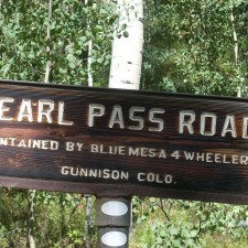
Pearl Pass Part Two

North Side to Summit

North Side to Summit

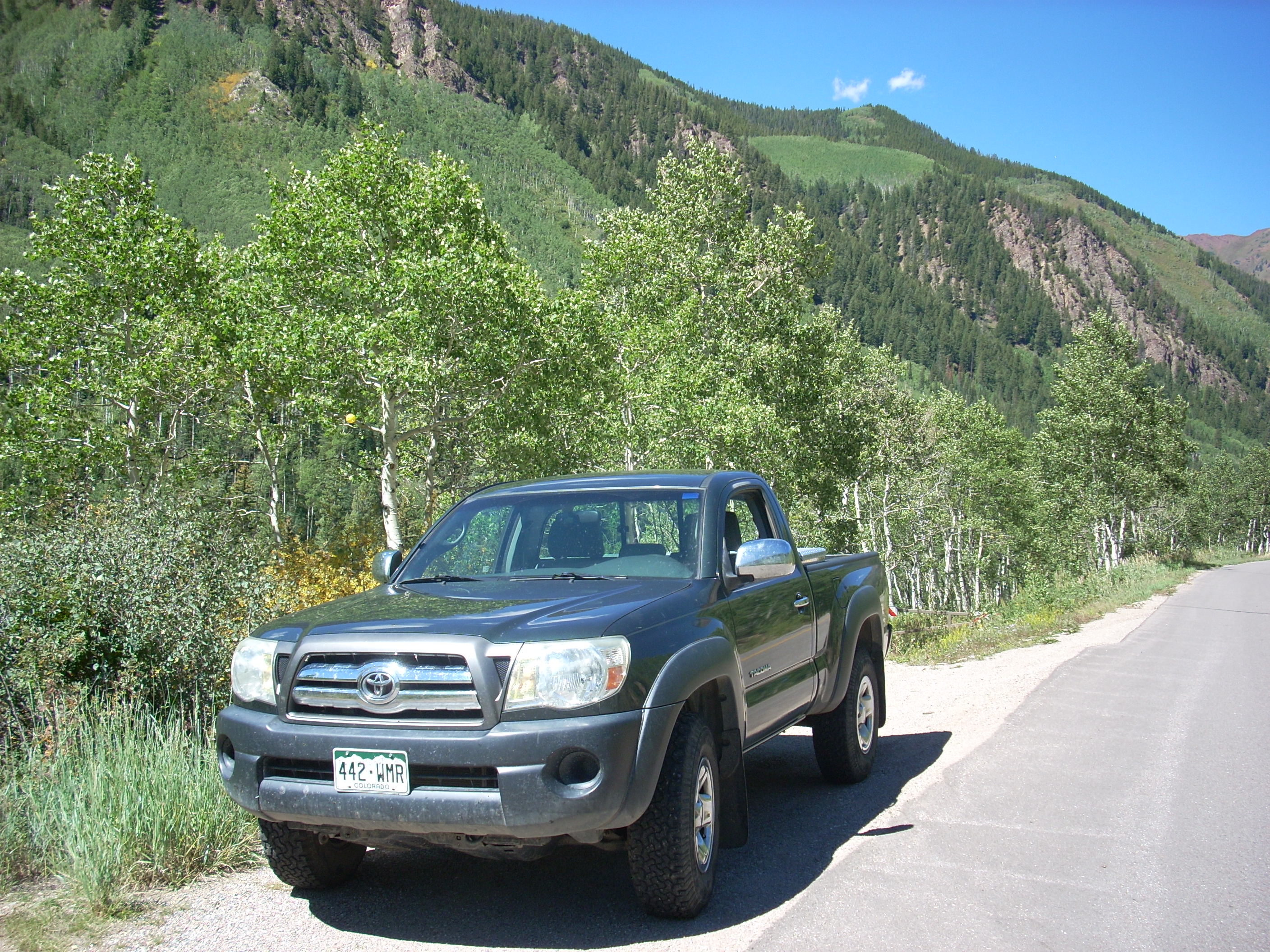
In Part 1 I discussed the history of Pearl Pass and my family connection. I also covered the four wheel drive experience travelers have on the pass.  I have been rambling around the Rocky Mountains most of my life.  There is a lot of good country here.  I am fortunate to have spent time in some of the Rockies from New Mexico to Alberta.

Some of the best pieces of mountain country are the Elk Mountains. I have not spent much time there because of Aspen. A Western Colorado native, for many years I harbored a prejudice against ski area development.  Aspen is the ski town that started the Twentieth Century Gold Rush, this time mining tourist pockets.  The place is just too rich for a small town boy.  Over time I lost my bias, but still tended to avoid the Aspen area.  I have never been to the Maroon Bells.

Living along the Front Range influenced not visiting the Roaring Fork Valley as it is a four hour drive to Aspen from Denver. Rocky Mountain National Park and the Collegiate Peaks are a lot closer.  Recapturing my interest in my family history has drawn me to Pearl Pass.  If Grandmother Pearl could drive a wagon over the pass in 1887, I should do it as well.

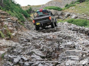
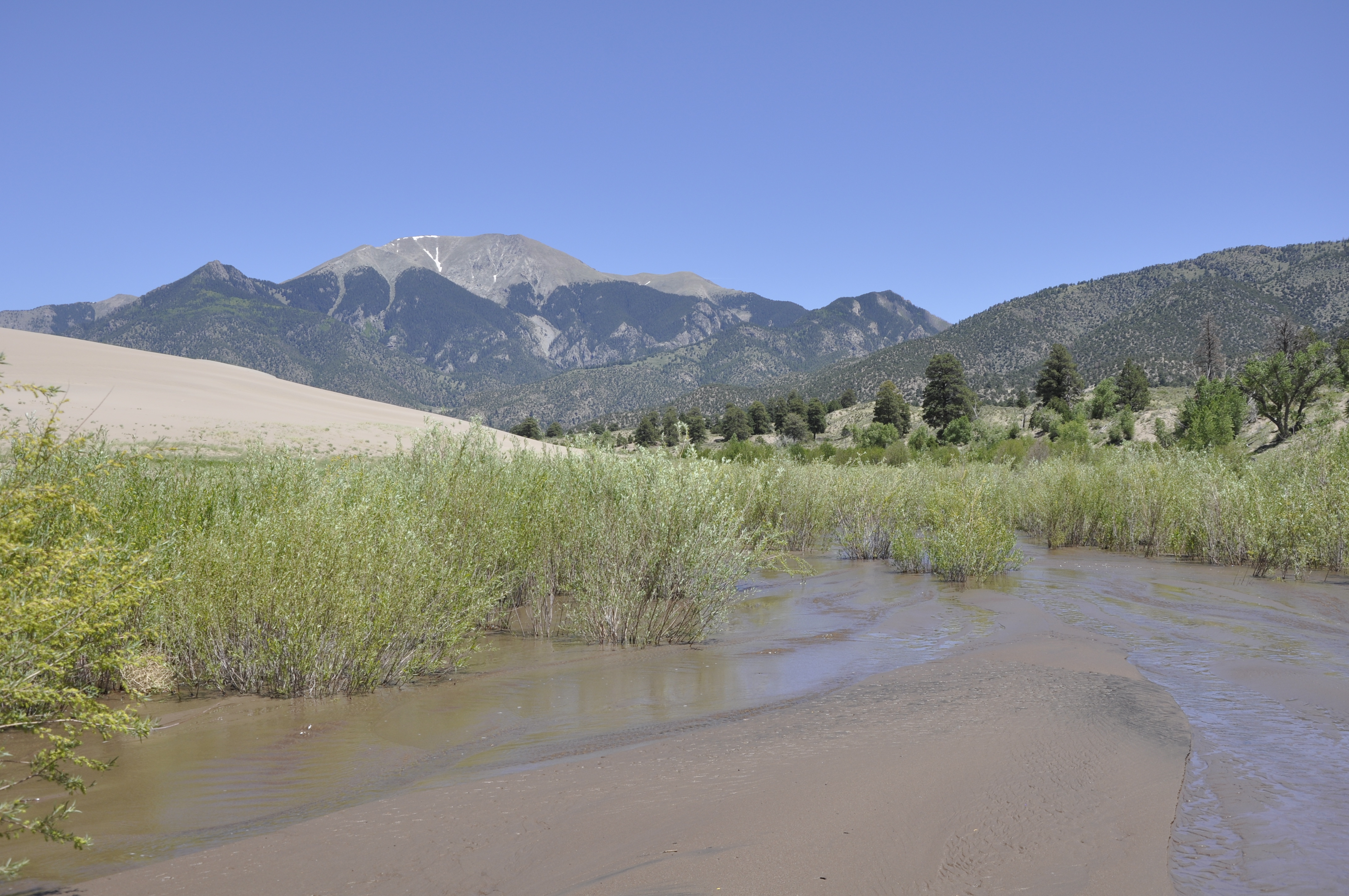
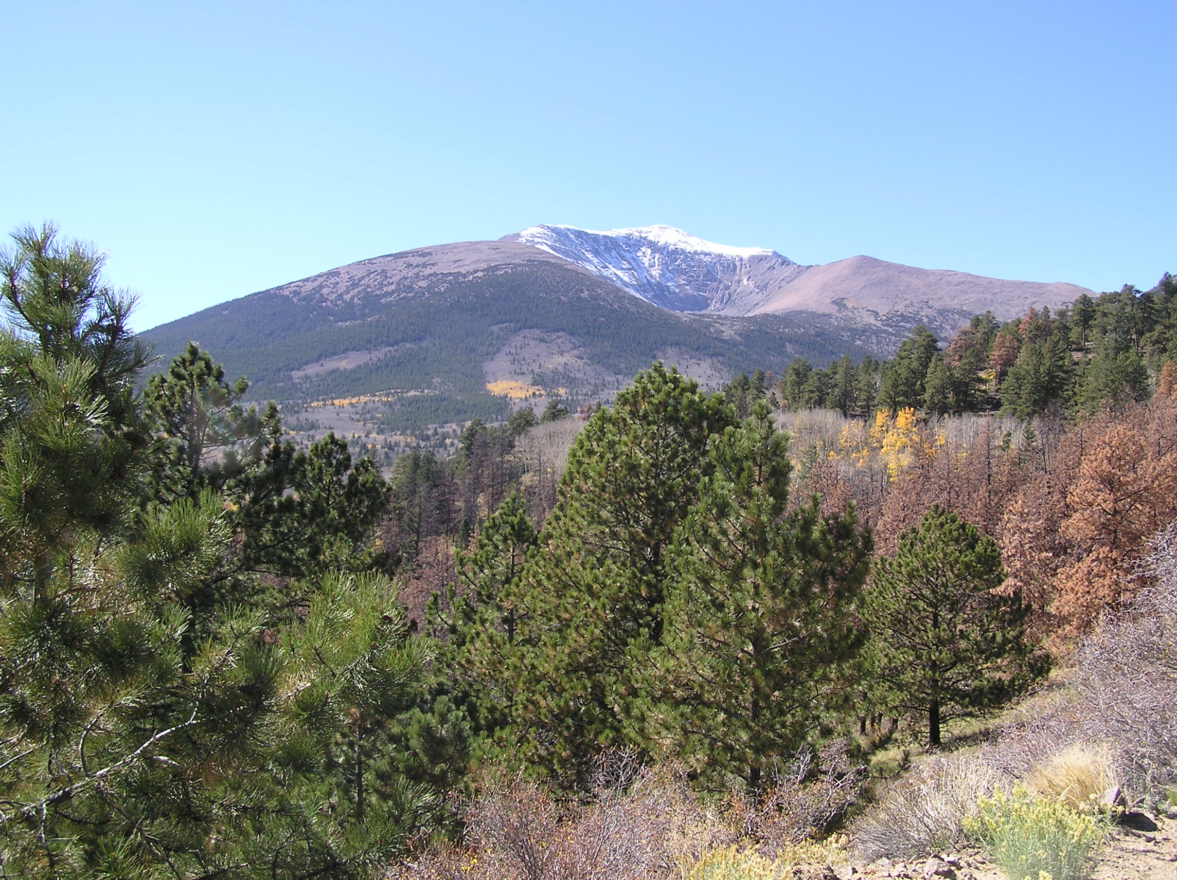
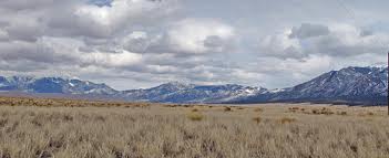
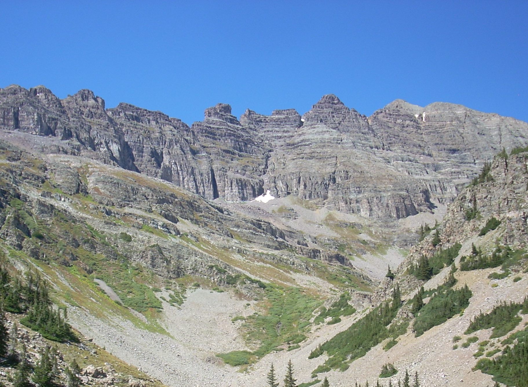
Pearl Pass has seen no change in the last 130 years. Between Aspen and Ashcroft the road is paved and there is development, but once on the four wheel drive road it is as it was.  It goes between the Collegiate Peaks Wilderness and the Maroon Bells Snowmass Wilderness.  Together, they harbor the largest cluster of 14,000 foot high peaks in North America.
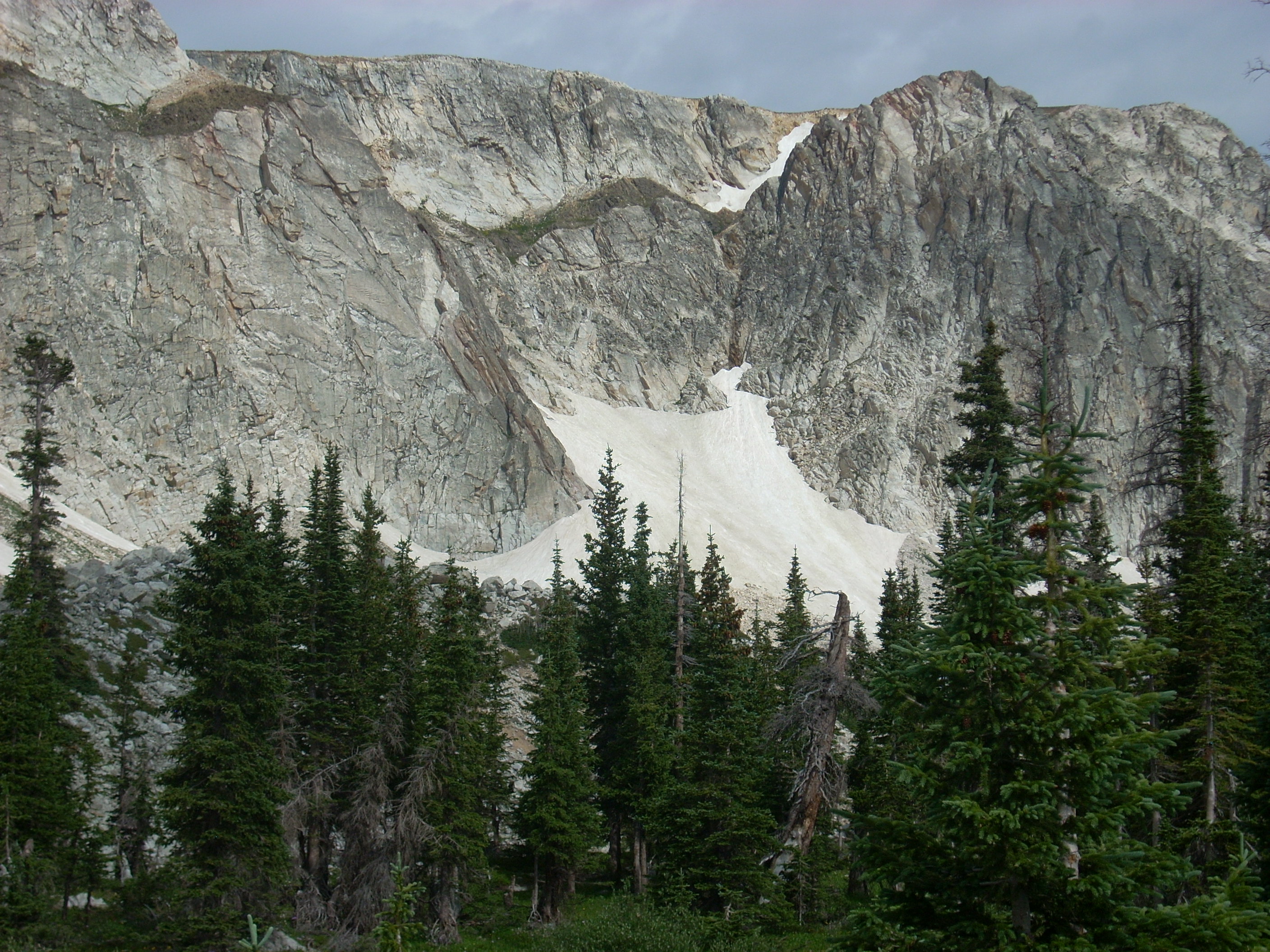
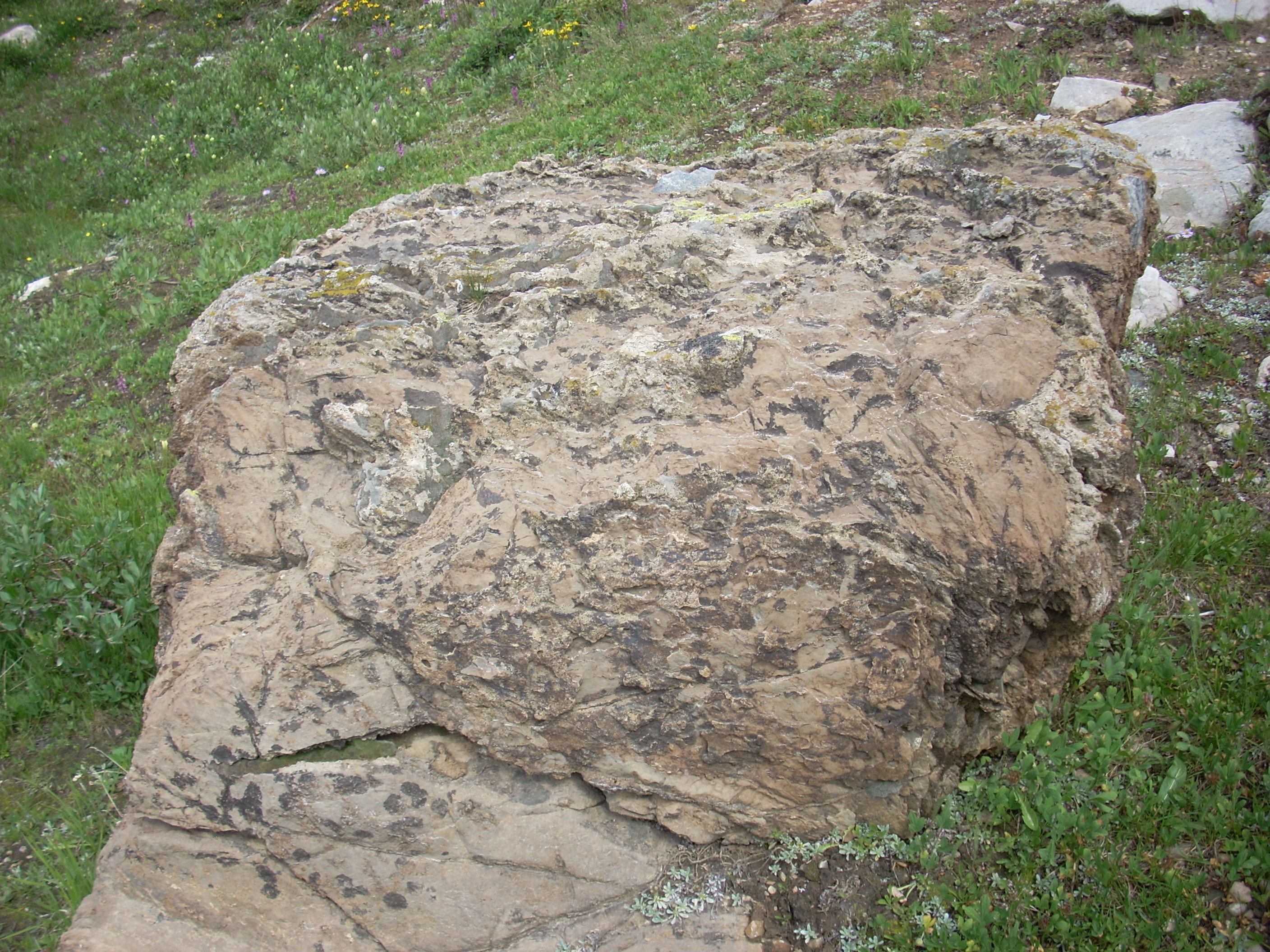
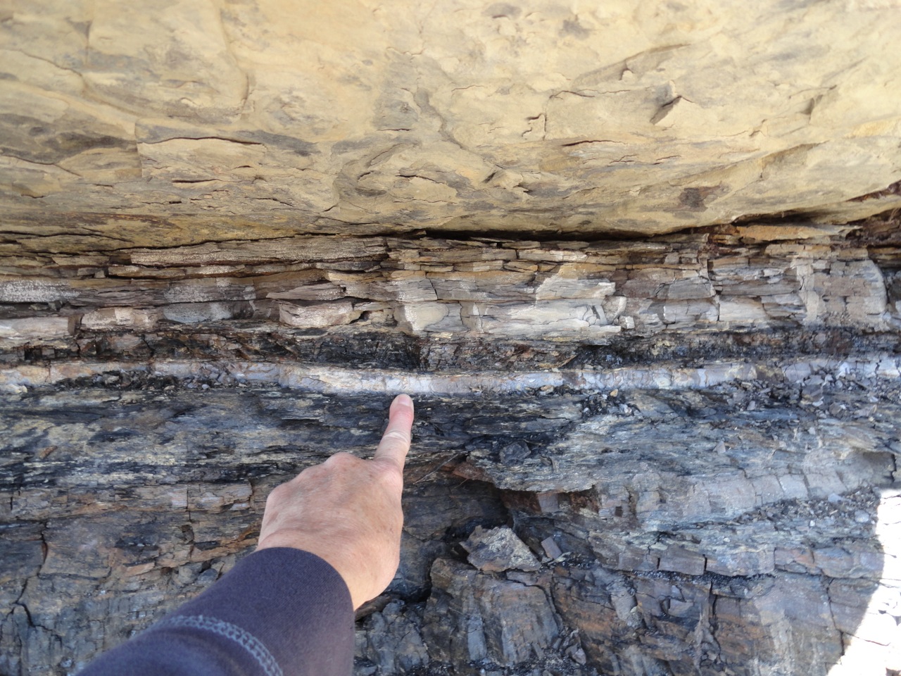
Sandstone

Sandstone

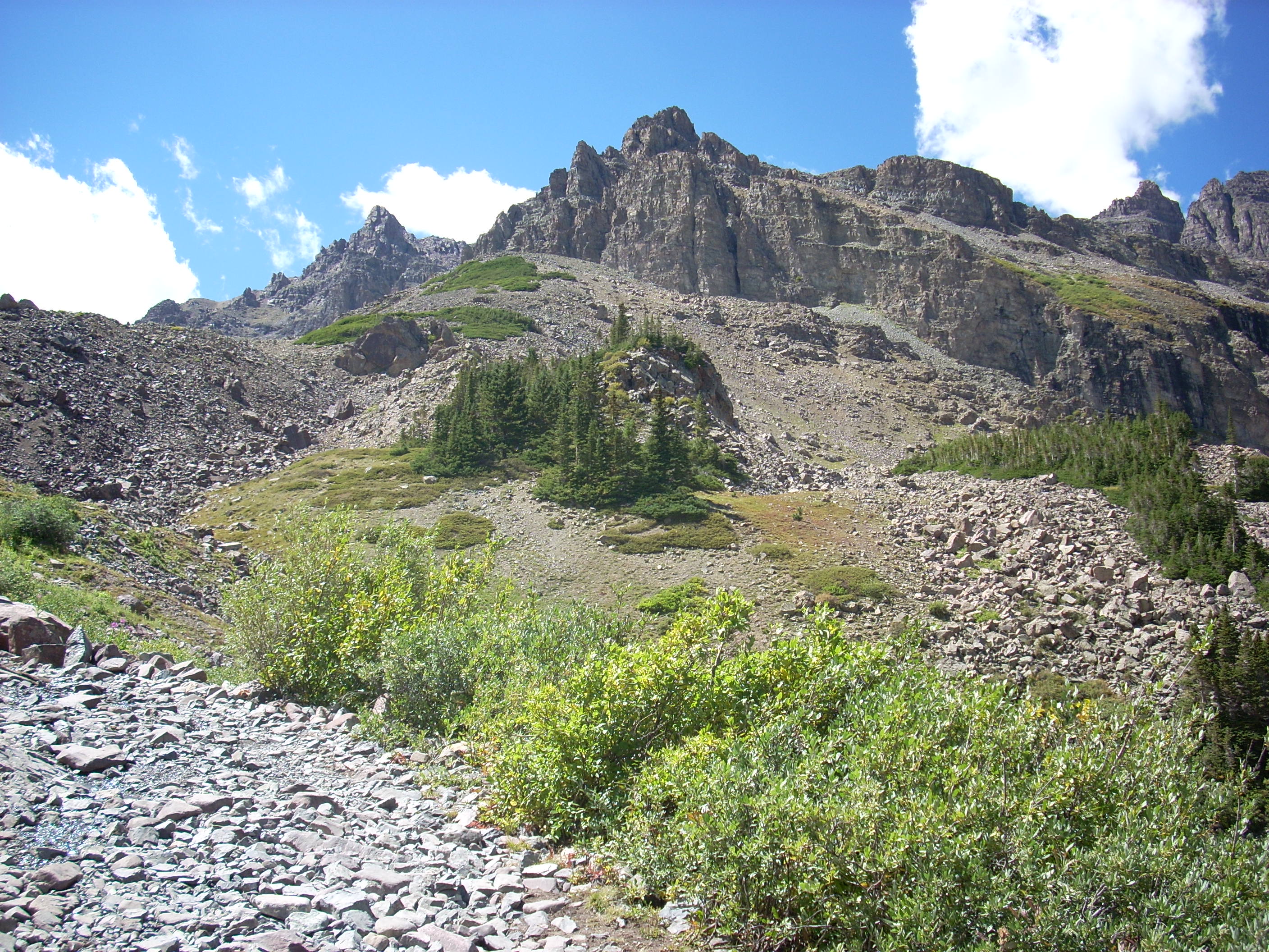
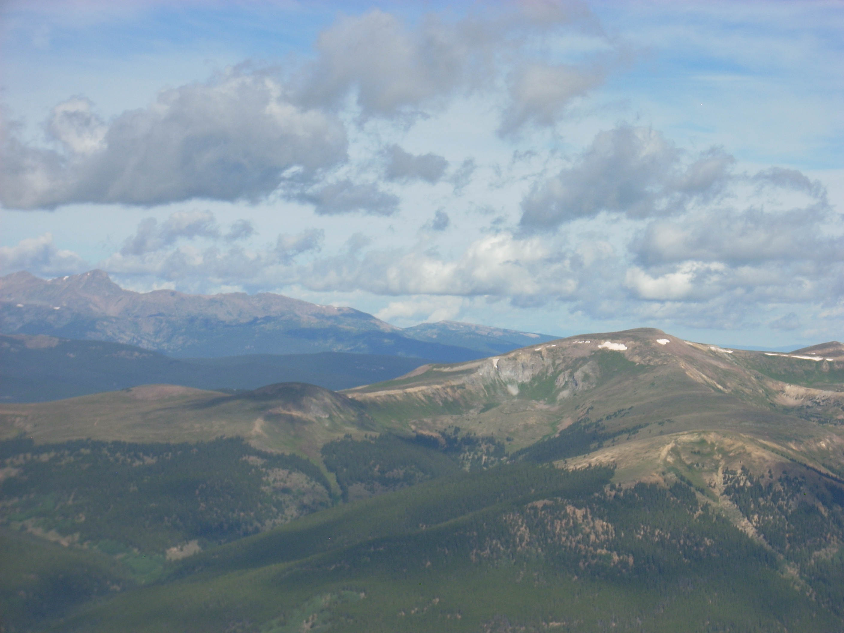
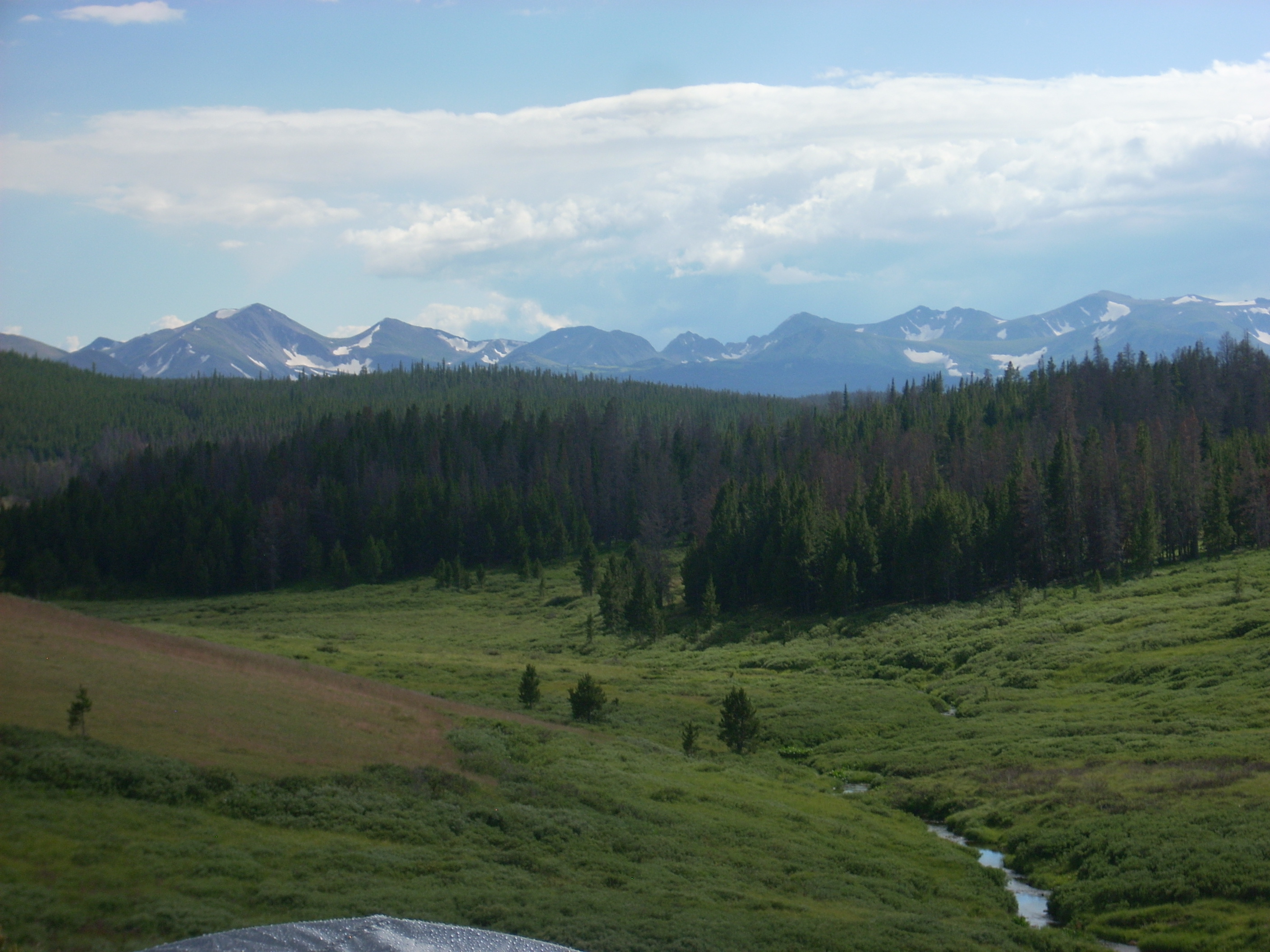
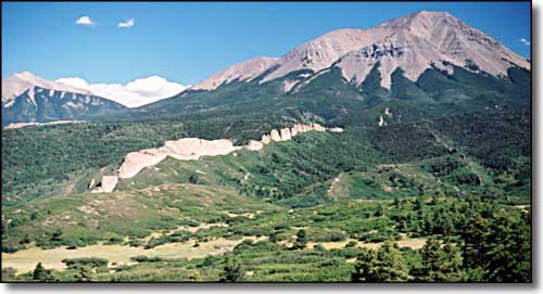
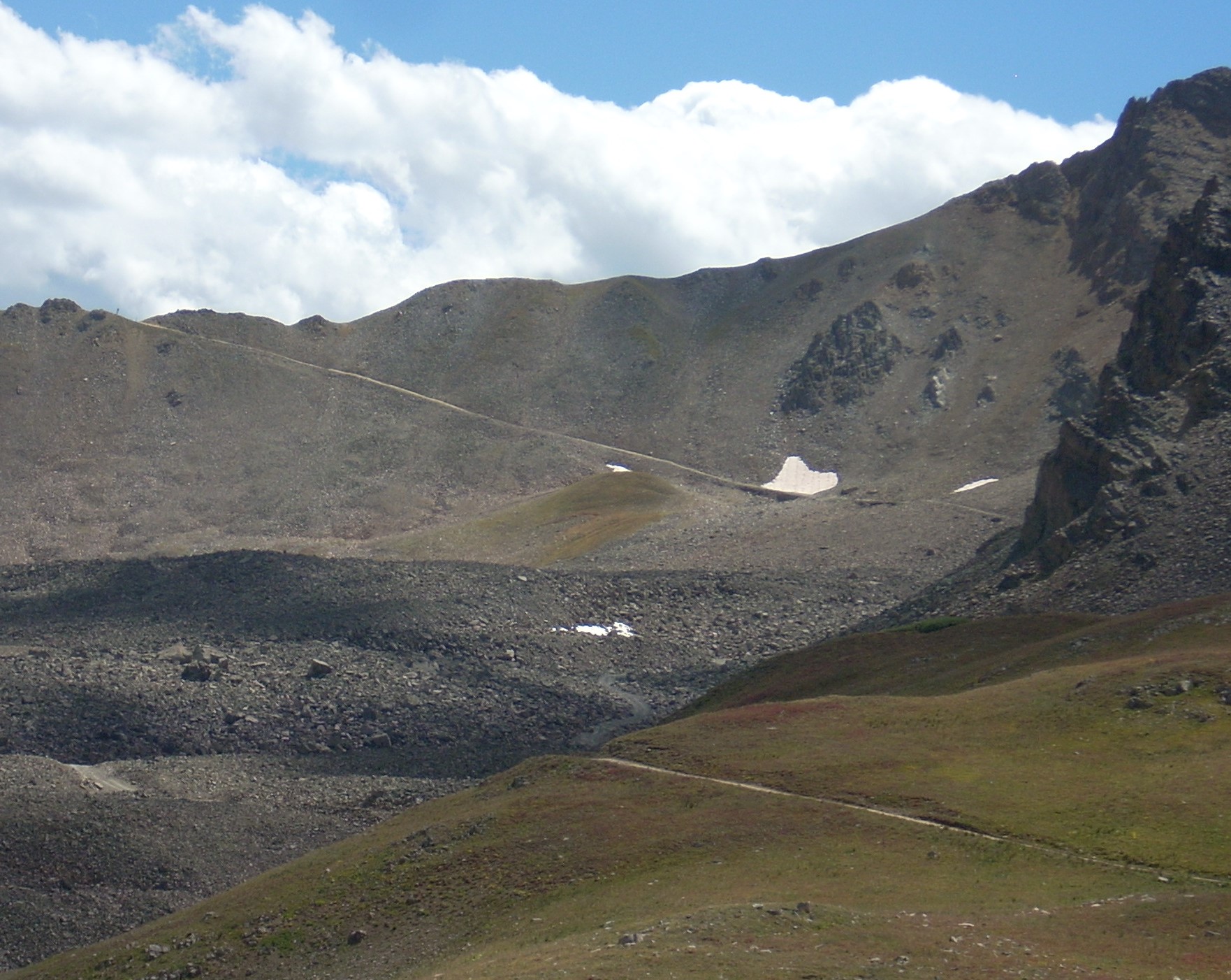
That huge area of high mountain wilderness means wild. Pearl Pass is one of the wildest places I have ever visited.  Up high, what you see is almost all above timberline.  To the east, the mountains are granite, what I am familiar with in Colorado.  To the west is sandstone.  Layered sandstone, capped with basalt.

To me, that layered rock seems wild, out of place. It is gray, with a hint of red.  When I see sandstone I expect red or tan.  The view is so striking and beautiful I am at a loss for words.  I have been trying for days to come up with a description that matches what I saw.  The pictures will give you an idea, but cannot portray the impact of so much wild space with little human influence.

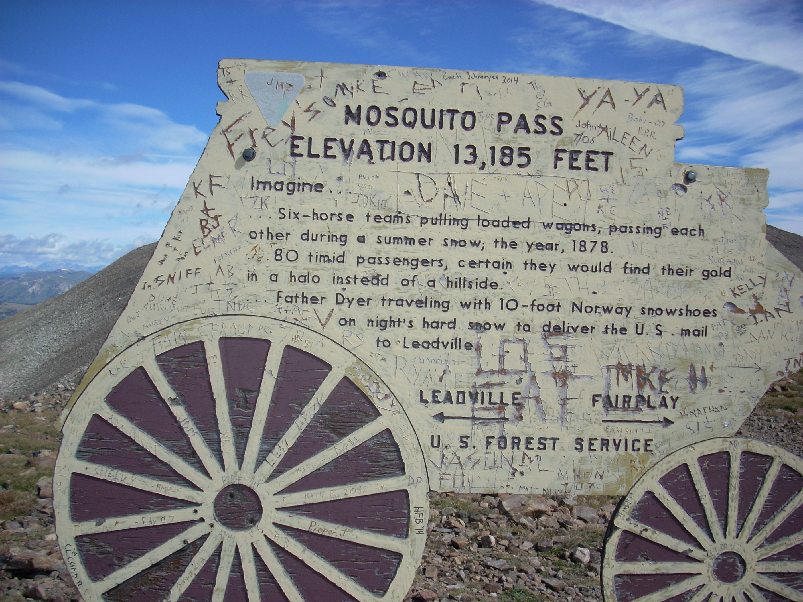
One reason for the view is because the Elk Mountains are west of the central Colorado?????????? Mountains and get more moisture. The glacial cirques are huge, creating a series of basins surrounded by many high peaks 13,000- feet or higher.  The pass itself is 12,700 feet high, surpassed by Mosquito Pass for example, but unsurpassed in sheer majesty.

I am now committed to more exploration of the Elk Mountains. There are Taylor and Schofield Passes that are four wheel drive accessible.  A winter drive to the Maroon Bells is on my list.  I may even break down and get out and walk.  My backpacking days are over, but there are lots of day hikes.  Lots of people on the trails, but most of them are nice people.  The high passes are for solitude.

Pearl Pass Part One

Road to Ashcroft

Road to Ashcroft

On Wednesday, September 3, I drove over Pearl Pass.  Pearl is one of those four wheeling trips that have been on my list for a long time.  My grandmother, Pearl Willits Shanks, drove a team and wagon over the pass when the Willits family moved from north Texas to Colorado in 1887.  Pearl was 12 when she drove over the pass.  She may have been a Texas girl before Pearl Pass, but she was a mountain girl after that.

The road was built as a toll road in the early 1880’s from the railhead in Crested Butte to the newly discovered silver mining area in Aspen.  It was in use until the railroads came to Aspen in the late 1880’s.  The main use was hauling coal from mines at Crested Butte to Aspen.

Today the road is much like it was in the nineteenth century.  From the start of the four wheel drive portion until it drops into the valley on the Crested Butte side it has no dirt, just rock.

Pearl Pass

The Bad Ledge

Fist sized rocks, baby head sized rocks, rock ledges, big rocks in narrow places, and big rocks in the middle of the road. One can grow tired of rock.

It is also narrow, made for wagons a long time ago.  There is no room for error. In reading about the pass, most of the reports involving trouble were where a vehicle got too far to the side.  When that happens, there better be good help available, because it is a long way to the bottom if the vehicle rolls over.

I was able to drive over all those rocks with no real damage to my Toyota Tacoma other than losing a mudflap.  The forest ranger had suggested a Jeep Rubicon.  I find my Toyota does just fine, although I may add a limited slip differential someday.

The Road and a View

The Road and a View

At the Summit

At the Summit

This is probably the most difficult road I have driven.  Steep, narrow, and did I mention rocky? I will do it again.  The history is important to me, the story of my family.  I spent the afternoon on that road marveling that a 12 year old girl from flat Texas could marshal the courage to drive a wagon over that hill.

I don’t know how long the entire trip from Crested Butte to Ashcroft, 10 miles from Aspen, took the Willits family.  I do know that they misjudged the time it would take to get over the highest part and did not get off the hill into Ashcroft until 11:00 PM.

That road is scary enough in daylight.  At night?  It is good that horses are better at seeing at night than we are.  Once I got down into the timber on the Crested Butte side, the alternating sunlight and shadow made it hard to see any serious obstacles. I can just imagine what Pearl was feeling.

I have given you some history and road condition information about Pearl Pass.  My next piece will be about the other big attractions.  The Elk Mountains that the pass traverses are some of the most spectacular and geologically unique mountains in Colorado.  Next time.

Four Wheeling for 65 Years

Camping with my Nissan 4x4 in the Maze District

Camping with my Nissan 4×4 in the Maze District

My first four wheeling memory is from deer hunting season somewhere in the early 1950’s. We were staying at a neighbor’s ranch near Douglas Pass with a large party. We went up a creek in a WWII surplus Jeep. There must have been eight or ten people on and in that Jeep. We got up high on a rough road and a front axle broke. I was too young to know much of what was going on, but I did know the Jeep was broken and we were a long way from the ranch.  A couple of the men were pretty handy and managed to pull the broken axle with a Crescent wrench and a screwdriver, all the tools they had. My father was impressed and we made it back to the ranch.

Other four wheeling trips were to what is now Canyonlands National Park. I don’t remember whose Jeep we were in, but we four wheeled over Elephant Hill into Chesler Park. The Elephant Hill road is still open, but Chesler Park was closed to vehicles many years ago. My father didn’t have a four wheel drive in those years, but we went places in our 1953 Chevrolet pickup that are considered four wheel drive only these days. Many of the roads were to fishing areas on Grand Mesa.

1953 Chevy

1953 Chevy

There just were not many four wheel drive vehicles in those days, so people made do. In the Bookcliffs area, famous for slick shale roads, there were many hills with a pile of rocks at the bottom of the grade. People stopped, loaded the rocks into the bed of the two wheel drive pickup for weight, and climbed the hill and went where they wanted to go, and unloaded the rocks on the way out.

WWII and Modern Jeeps

WWII and Modern Jeeps

Army surplus Jeeps became fairly common in the 1950’s, but they were fairly primitive. 35 miles per hour was about what they would do on the highway unless the owner added a Warn overdrive. They also broke a lot. I remember walking home from across the river from Fruita when the steering linkage fell apart on a surplus Jeep.

Later, in the 1970’s, four wheel drive vehicles became more common. New and modernized Jeeps, International Scouts, Broncos, Blazers, and four wheel drive pickups became fairly common. My father had two Scouts, an early Jeep Cherokee; and his first four wheeler, a 50’s Jeep wagon with a Chevy small block V8.

The first Scout got us into trouble on Elephant Hill. We were coming out after dark and as we got to the top of the hill, bouncing over the slickrock, the engine quit. It would not start, so we walked the four miles or so to the Canyonlands Resort. At that time the owner flew tourists over the canyon country, ran the resort, and flew the occasional polygamist away from the law. We waited for him to finish an enormous plate of venison and biscuits, got into his big Ford ¾ ton pickup, and went to the Scout. He towed the Scout about 50 feet and it started. The carburetor float must have stuck and the bouncing knocked it loose.

When I started buying four wheelers I got Japanese pickups. They cost less, are reliable and capable, and after all, a feller needs a truck. I just don’t like buying lots of gas for a truck. My current ride is a 2009 Toyota Tacoma 4 cylinder standard cab. Toyotas have grown, it barely fits in our new 20 foot garage.

My Taco

My Taco

There are two basic types of four wheelers. There are those who four wheel to go to interesting places that require four wheel drive, and those who enjoy the sport of going to difficult places. There is overlap, but those lifted and modified vehicles are for hard core wheeling and showing off. I have a four wheel drive pickup to go places. My Tacoma is stock.

Southeastern Utah is a favorite destination for both types of four wheelers.  The Moab Rally every spring brings hardcore rock crawlers from all over the country.  There is so much to explore that is accessible because the uranium boom of the 1950’s brought about much road building into areas that had been horseback only.

My favorite area is the Maze District in Canyonlands National Park.  70 miles of dirt road to the ranger station, then many more miles of four wheel drive to places like the Doll House, which has access to the Colorado River just below the confluence with the Green.

This summer seems to be devoted to going over passes. I won’t name them all, but the next one is Pearl Pass. My 12 year old grandmother drove a team and wagon over that pass in 1887. I am a bit older and my team is motorized.

Over Passes and Through Woods

West from Mosquito Pass

West from Mosquito Pass

I have already written about nearly killing myself on Mosca Pass the week of August 24, 2014.  After that little adventure, I continued my trip as planned.  My goal all year is to get over Pearl Pass, the one my grandmother drove a wagon over when she was 12 years old in 1887.

Pearl Pass often does not open until late in the season every year, and 2014 is no exception.  There are two snowdrifts blocking the road just below the summit.  Maybe later in September.

There are lots of other passes, however, and I went over 13 or 14, depending on how you count.  Passes go over the divide between two drainages.  For example, Pearl Pass marks the divide between the Roaring Fork River that goes to the Colorado River in Glenwood Springs, and the Taylor River that drains to the Gunnison River in Gunnison.

The complication is at Ute Pass, which marks the divide between Fountain Creek and the South Platte in South Park.  Right near there is Tracy Hill, not called a pass, but is the divide between the South Platte and the Arkansas Rivers.  So, did I go over one, two, or three passes when I came from Woodland Park to Cripple Creek?

So, here is the list:  Ute Pass, Tracy Hill, Mosca (I just went to the summit), Medano, Poncha, Marshall, Waunita, Cumberland, Cottonwood, Mosquito, Red Hill, Kenosha, and Guanella Passes.  Let’s call it 13 or 14 passes.

From Denver, I went via Deckers (probably going over yet another pass) to Cripple Creek and down the Phantom Canyon Road to Highway 50 outside Florence.  Then I drove to Wetmore (and another pass) and to the wet Mountain Valley and Mosca Pass, where I camped.

Next morning it was Medano Pass, first crossed by Americans in 1807 when Zebulon Pike, searching for the Red River, groped his way into the Rocky Mountains, over the pass, and wintered in the San Luis Valley, mistaking the Rio Grande for the Red.

Medano is interesting and worthwhile, with a long drive through private property to Forest service land and the climb to the summit.  It is four wheel drive, but not too bad, and not marred by those annoying ATV’s buzzing around because they are not allowed into the National Park.

From the summit, the road descends down the

Medano Creek

Medano Creek

Medano Creek canyon, which burned in 2010.  It recovering nicely.  The road crosses the creek several times and is sandy lower down.  I had no problems ignoring the Park service signs telling me to lower the pressure in my tires for better flotation in sand.  I have always thought that is for Californians, not us mountain people.  I met no other cars.

From the sand dunes I went up the vast San Luis Valley and over

Marshall Pass

Marshall Pass

Marshall Pass, the narrow gauge Rio Grande Railroad route into the Gunnison country.  I like old railroad routes.  I then bounced over more bad roads to Taylor Park, intending to go over Taylor Pass.  I started up the steep four wheel drive road, decided my sore body had had enough, turned around, went over Cottonwood, and got a motel in Buena Vista.  That hot shower sure felt good.  I found chicken mole enchiladas in a restaurant there.

The next morning was Leadville and Mosquito Pass.  The Lake County people are missing out not promoting the roads around Leadville for off-roading.  Taylor Park is overrun with ATV’s.  I met no one on the roads above Leadville.  Good for me, bad for depressed Leadville.

Passes 8-14 003Mosquito Pass is world famous, and the road is a challenge.  My stock Tacoma was fine, but the road is steep and very rocky.  They ain’t called the Rocky Mountains for nothing.  It is a spectacular trip, with views of some of the tallest mountains in our state.  I will do it again.

From Mosquito Pass I went down to Fairplay and home via Guanella Pass, another of my favorites.


Incident on Mosca Pass

Mosca

Mosca Pass View

I was camping on Mosca Pass, the first mountain pass over the Sangre de Cristo Mountains north of well-traveled La Veta Pass.  From the Wet Mountain Valley to the summit of the pass is a good road that provided access to an abandoned fire lookout tower just below the summit.  The road is closed from the summit down to the visitor center in Great Sand Dunes National Park.  The road washed out too many times and was abandoned for vehicle travel years ago.

I went there to see the area and find solitude, a scarce thing anywhere near the Front Range cities.  I drove up a short spur road to a good campsite with fine view.  There was even some firewood at the fire ring.  There was no one within miles.  No traffic, just an apparently unoccupied ranch about a mile down the road.

I ate dinner, read until dark and turned in.  I like to sleep outside to see the stars and feel the wind.  My new sleeping bag kept me comfortable, and I went right to sleep.  A few hours later I got up to pee and decided to take a look around.  Looking east and south there are two intermittent creeks about 1/4 mile apart running through a big open park, with mountains all round.  There was a fine view, even during the dark of the moon with only starlight, so I went that way.

The flat spot where I camped ends and dropped down to the open areas not far from my bed.  I walked that way and stepped into a hole right at the edge.  I pitched forward into a big bush lower down and in some rocks.  Head down, butt in the air, feet thrashing, arms entangled, it took a while to free myself.  I had to scramble on hands and knees back up to level ground and in the process lost my glasses.

My forearms were scraped, punctured, and bleeding. I had a scrape on my nose, several bruises, and two big abrasions on my knee.  I had walked out there in the middle of the night with only a t-shirt, underpants, and my shoes on.

Finding the campsite was a little hard.  My dark green truck was backed in between some trees and I didn’t have my glasses on, making it hard to find in the dark.  I went back to bed scared and angry at myself.  The pain from the knee scrapes kept me awake for most of the rest of the night.

I laid there thinking of what could have happened.  If I had injured myself so I couldn’t drive, there is no knowing when someone would find me.  I was well off the road, no cell phone service, almost no traffic, and almost no clothes on.  In Colorado there are several stories every year about someone not returning from a solo trip, the body found days or months later.

What was I thinking?  I obviously was not thinking at all.  People tell me I was lucky.  Maybe so, but I believe I was stupid, just like the others who did not return from a solo trip.  Carol asked me where my flashlight was.  It was in my pack, where it belongs.

In the morning, I looked at my sore knee, cut arms, bloodstained t-shirt, and went to look for my glasses.  No luck; after all I didn’t have my glasses on.  How was I going to see them?  There was nothing to do but have breakfast and get on with my trip.

I had no trouble seeing on the back roads, reading, and looking at the scenery, but reading road signs was pretty tough.  I haven’t gone so long without glasses since I was in the fourth grade.  Two days later I was home and could see again. I spent a day getting a spare pair of glasses fixed and having a grass seed washed out of my ear.

It has taken me a while to sit down and write this.  I have more to say about my trip, so stay tuned.

Freezing on Deadman’s Hill

Deadman's Hill Lookout Tower

Deadman’s Hill Lookout Tower

I did a ramble to Deadman’s Hill and some other places. I did survive, but it was not easy.

Deadman’s Hill is west of Redfeather Lakes on a road that ends on the Laramie River road.  This is one of the more remote mountain areas east of the Continental Divide in Colorado.  Redfeather is a resort community northwest of Fort Collins and north of Rustic, in Poudre Canyon.  There are lakes, a store and post office, a restaurant, and many cabins.  There is a year-round population of about 250 people.  It is a bit funky, and nothing like the ski resorts with their upscale condos.

I went to Colorado State in Ft. Collins, lived there for several years, and never got to the area.  I have had Deadman’s Hill on my list, and tried to go over the road last spring.  Alas, the road is closed from December to June.  I was too early, but not too early to see a bear feeding in a meadow just before the closed gate.

I went back last week, the road was open and well graded.  It climbs through a Lodgepole Pine forest to a spur leading up to a fire lookout tower that has a view of most everything from Rocky Mountain National Park to Wyoming and from the plains to the Rawah Wilderness in the Medicine Bow mountains.

From the lookout tower I went down the hill a ways to a long meadow looking right at the Rawahs.  A little creek ran through the meadow and a pair of bull moose would drift out of the timber, feed for a while, and move back into the trees.

Meadow With the Rawah Mountains

Meadow With the Rawah Mountains

I got the tent up just in time for the first rainstorm, and had another storm a couple of hours later.  A pleasant and lovely late afternoon, with the solitude I always seek in the back country.

If it is not raining steadily, I set up my cot outside, with the sleeping bag inside a canvas bedroll along with a wool blanket.  I slept for a short while, got up to pee, got cold and stayed that way for the rest of the night.  I reached outside the bedroll and felt a layer of ice.  It seemed like my feet were as cold as those snowfields on the flanks of the Rawahs, and the rest of me had just come out of the water draining the snowfields.

I tried a few things that helped my body a little, but my feet got colder every time I left the sleeping bag.  Oh, and the sleeping bag zipper jammed.  No sleep, much misery.  At about 4:30 AM I climbed into my pickup and ran the heater to warm up.  Everything in the cab of that truck is lumpy or pokes you if you are trying to sleep.

At 5:30 I threw everything into the bed of the truck and went down the hill to the Laramie River road.  From there I went north to Woods Landing Wyoming, hoping to find coffee and food.  Closed.  On to Mountain Home, Wyoming, nothing there.  I went west to the road from North Park Colorado into Wyoming and south to Walden.

I found coffee, heat, food, and a semblance of civilization.  There were four old guys, retired ranchers from the look of them, sunning themselves on the patio in the 45 degree morning.  I saw some bicycles parked nearby and asked them if the bikes were theirs.  One shook his head, taking me literally at first.  None of them had been on a bicycle in at least 60 years.  You don’t ride bicycles if your headgear is a cowboy hat and your shirts have snaps, not buttons.

The bicycles belonged to some city folk having breakfast and fixing a flat tire.  They were in their 60’s.  Hardy people there, in Jackson County.

From Walden I went back north along the North Platte River into Wyoming.  The Platte and Laramie River valleys are what I think of as mountain ranch country.  Irrigated hayfields and pastures flanked by sagebrush hills rising into the timber.  Everyone waves at you.

Snowy Range

Snowy Range

I then went east over the Medicine Bow Mountains, capped by the Snowy Range.  This is one of my favorite drives.  The mountains are snowy white, jagged, and have lovely lakes at their base.  The white rock is 4 billion year old quartzite, older than anything in Colorado.  Just off the highway on the way to a campground are some stromatolites, or petrified algae, some of the oldest evidence of life on earth.Deadmans Hill 2014 012

I had lunch in Laramie and decided to return to Redfeather and get a cabin for some sleep.  There were no cabins available, so I went to Poudre Canyon, where a cabin was too expensive.  By that time I was so tired I just went home.  A tired, cold trip in some fine country.

Geology on The Highway of Legends

Spanish Peaks and a Dike

Spanish Peaks and a Dike

I went on a tour of Southern Colorado’s Highway of Legends with a group from Colorado’s Cherokee Trail chapter of the Oregon California Trail Association. Berl Meyer, our chapter president, summers in Cotopaxi, on the Arkansas River.  He rambles around Colorado looking at the geology and the mountains.  He is from Kentucky, so has a need to get away from relentless green.

Berl organized the trip, having us meet in La Veta.  For me the trip had two segments.   Colorado geology is one of my interests, and the Highway of Legends country has some world famous geology.

The Spanish Peaks south of La Veta, are relatively recent (geologically) igneous intrusions that rise to over 12,000 feet in elevation.  Located fairly far east for the Rockies, they served as important landmarks for early explorers and travelers.  When the intrusions barged in, they bulged and fractured the existing rock layers, and a series of vertical dikes radiate from the mountains.

Cucharas Pass is between the Spanish Peaks and the Sangre de Cristo mountains.  At 9,995 feet, it is another lovely Colorado mountain pass.  There are lots of dikes, and on the south side of the pass is Stonewall, at first look another dike, but this feature is a vertical wall of Dakota sandstone, pushed on edge by the Spanish Peaks uplift.

???????????????????????We had a startling encounter at Stonewall.  We had stopped for a break and to look the stone wall over when we had a visit from a Greek god.  Most people don’t know, but the gods are still with us.  They travel the world keeping track of events and people.  This particular Greek god is one of the lesser ones, namely Hermes’ great uncle.  The photo shows him as he was leaving.

The road then enters the coal country west of Trinidad.  There is lots of history in that area, and a world famous geological feature.  On the road to Trinidad Lake just outside Trinidad is  an exposure of the K-P (formerly K-T) boundary that marks the end of the Mesozoic era and the beginning of the Cenozoic, or modern era.  It is called the K-P because it is the boundary between the Cretaceous period and the Paleogene period.  Below the boundary, dinosaurs.  Above the boundary, no dinosaurs.K-T Boundary

The boundary is a narrow band of whitish clay that fell when an asteroid struck off Yucatan and threw a tremendous cloud of material into the atmosphere, blocking the sun and cooling the entire planet.  75% of life on earth perished, including the dinosaurs.  In a road cut on the way to the lake you can put your hand on the boundary.

There are exposures in many places around the world, including North Table Mountain in Golden, but this one is the most accessible.  I have wanted to go there for a long time.

We went to the San Luis Valley, over La Veta Pass from La Veta.  The valley is our own rift valley, formed as the movement of the Pacific tectonic plate drags some of the North American plate north.  The motion pulls things apart, and a big block subsided, forming the rift valley.  The Arkansas River north of Poncha Pass and the Rio Grande River mark the rift. (Real geologists, including Berl, don’t get the vapors at this explanation.)

Great Sand Dunes

Great Sand Dunes

On the east side of the San Luis Valley is The Great Sand Dunes National Park, another world famous geological feature.  The sand for the dunes comes from the San Juan Mountains to the west.  Normally, the sand would just keep going, blown over the Sangres to the plains farther east.  In this case, a creek picks up the sand blown off the dunes and carries it back to the other side, replenishing them every spring.  The result is a mammoth dune field, good for viewing, climbing, and tumbling down.  The creek is good for play as long as it lasts into the summer.

Good geology, good scenery, and a good time.  The geology is not a legend, however.  It is the real thing, and students from geology departments all over the country visit and study in Colorado.


New Garage

New Garage

New Garage

Our new garage is finished.  The old one car garage was designed for a 1936 Ford.  We never parked a car there.  The new one is 22’ by 20’ and will just barely hold both cars.  There is also room for stuff.  It is YELLOW.

Solar panels will be on the garage roof, so it was built with rafters instead of trusses to give a better angle for the panels.  There is storage space in the rafter area for things we don’t use very often.  The fencing is up, and I spread five cubic yards of dirt in the low spot where our patio is going.

Workshop

Workshop

The next step is landscaping.  We hear that landscapers are hard to get, so we will see.  We hope to have the entire project finished this year.

Bad Words

The title is a bit misleading.  I like to write, and attempt to avoid words, phrases, and acronyms that are overused.  I understand the overuse, it is a way of conveying something without much thought.  It is not difficult to find another word or phrase, but many fail to do so.

Here is a list, somewhat incomplete, of those words, etc. that annoy me.

Words, phrases, and acronyms that need to fall into disuse:

Adorable                                             Compelling

Awesome                                            Momentarily

Tons                                                    OMG

Long since                                           Hopefully

Selfie                                                   Big time

My bad                                                Calling out

24/7                                                    Just saying

Iconic                                                  IMHO

Baby Bump                                          Shortly

And More!                                            Epic

LOL                                                     Kardashian

Majorly                                                So last …

Whenever                                            Viral

So over                                               Jenner

One Moment                                        One second

Back in the day                                    Each and every

At this point in time                              Breaking news

Upgrade                                               The proper…


Please add to the list.

Cancer

The Fault in Our Stars

The Fault in Our Stars

Carol and I went to the movies!  We don’t do that a lot; we usually watch them at home.  This one, however, drew me to the theater and I drug Carol along.  “The Fault in our Stars”‘ is a romance and story about cancer and dying young.  I rate movies by how much I find myself thinking about them.  I am still thinking about this one days later.


It has a fine story, good directing and photography, and a great cast.  Shailene Woodley has the main role.  A reviewer said she is as lovely as a June day, and the woman can act.  The other cast members are good, but they are playing backup.


Two teens with cancer meet at a support group, and they fall in love.  The power of the movie is in exploring how a terminal illness forces one to explore meaning, pain, death, and love in an intensely personal way.  Gus and Hazel are bright and funny as they confront the tragedy in their young lives.


The movie is a tearjerker, a sick flick, sentimental, and somewhat too right.  With that, it is honest, fun, sad, and lovely.  If you can’t get to the theater, put it in your queue.  I doubt if I will read the book.


The movie has more significance for me because I lost my mother to cancer when I was a junior in high school.  She was stricken with ovarian cancer at menopause.  Initially diagnosed as an ulcer because of her abdominal pain, our family doctor missed the cancer because he was dealing with a paranoid psychosis.


By the time my parents realized what was wrong and sought out the best cancer doctor in Grand Junction, it was too late.  Given the state of cancer treatment in the 1950’s, it was probably too late anyway.  The standard routine ensued, surgery, radiation, some primitive chemotherapy, and over a year of debility, pain, and wasting.


My family did not deal with cancer as well as Gus, Hazel, and their families.  Our strategy was denial.  Just act like nothing is wrong.  The elephant is rotting in the corner of the room, but ignore it.  I would come home from school, go into the bedroom where she lay wasting away, give a upbeat account of my day, and stay away.


It took well over a year for her to die.  The day she died, my father called me out of an assembly at school.  I had to walk from the front of the auditorium to the exit with everyone’s eyes on me.  I went numb.  I stayed numb.  No conversations about anything.  The only genuine expression of sympathetic came from the football coach.  I am so grateful for what he said, more than fifty years later.


I floundered.  I listened to jazz, Tchaikovsky’s Sixth, and read existentialists.  I flunked trigonometry my senior year, explored religion (didn’t work), flunked out of the University of Colorado, tried Mesa College, drank a lot, and joined the Army.  Time does heal, and the Army gave me some sense of purpose while I grew up.


I didn’t deal with the loss of my mother until I saw “Brian’s Song” in 1971.  Watching that movie, about Brian Piccolo and his great friend Gayle Sayers, the floodgates opened up.  I did not cry when my mother died, I was shut down emotionally.  Years later, I cried.  What a release.  I mourned her loss for the first time.  The lesson: deal with the feelings when it is happening.  The more painful the feelings are the more important it is.  Talk about it.  That is what happened in “The Fault in our Stars”.  It did not happen in my life and I paid for it for years.

« Older Entries Recent Entries »