Category Archives: Stories

Fantasy Football

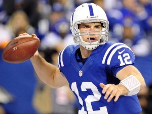
Andrew Luck, no luck for us.

Andrew Luck, no luck for us.

This year Carol and I played fantasy football with some friends and family members.  High rollers, the entry fee was ten bucks.  Our team was The Front Range Fogies.  We are not big football fans.  Here in Denver it is necessary to follow the Broncos out of self defense and Carol lived in Green Bay for a while.  I don’t think I could tell you the names of all the latest expansion teams.

I was resistant to the idea at first, remembering the guys at work spending hours poring over injury reports in order to come up with a team each week.  The big change since then is the software.  We used ESPN’s program.  It does the record keeping and scoring for you, provides team rosters and available players, and informed information on players.  We also got a good app that is great at comparing prospective players.

Given all that we lost big.  We just didn’t quite know what we were doing and the results showed.  The season was quite a process, however.

First, the draft.  The usual strategy is to choose running backs and wide receivers because they are the point producers and the high injury turnover.  We didn’t know that and picked Andrew Luck, theoretically the best quarterback in the league.  Not so this year.  We also had Peyton Manning for a while. Wrong.  I don’t even know who we ended up with.  We picked the Bronco defense and kicker, fairly good choices. We were weak in running backs and wide receivers out of ignorance and inexperience.  We stayed weak there.

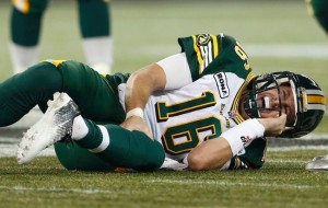
Injured

Injured

I came away from the season with two insights.  One, fantasy football is fun, and we watched a lot of football.  It is a great way to stay in touch with others without having to talk about who is sick or did something stupid.

Two, the injuries.  NFL Football has a one hundred percent injury rate.  The injury rate for the wide receivers and running backs is just appalling.  We spent a lot of time searching for uninjured players we could pick up.  The durable players were already on the other team’s rosters.  Of course we also lost Luck and Manning.  There is a lot of press about head injuries, but they are just on the top of the list.  Modern gladiators, those players, sacrificing their bodies and brains for money.

Change in that area will be slow, because the violence is what appeals to a lot of the fans, and the fan’s money is what drives this huge industry.  Fifty dollars per seat, 80,000 seats, you do the math.  TV also provides a huge amount to the teams, and the networks sell lots of ads.  The players are just raw material.

Of course, the players make lots of money but the price is the damage to their bodies and brains.  Seldom does a player go all season without an injury.  Seldom does a player last more than three or four years.  We hear about the Mannings and Bradys, but they are the exceptions.  The players with the press are survivors.  The rest are the victims.

So, will we do fantasy football again?  Probably, it gives us contact with friends and family in a low key competition.  Are we as fans part of the problem with football?  Our money certainly is.

February 8, the Broncos won the Super Bowl.  We are happy.  The whole NFL business is still crazy.  $28.00 for a t-shirt?
Radicals

Radicalism seems to be common among Republican Presidential candidates.  Radicals want to make sweeping changes in government rapidly rather than progressive change. 

The most radical is Donald Trump.  He seems to want to create a warring dictatorship, with no room for dissent.  The word for that is fascism, accompanied with the lowest form of demagoguery.  There is precedent for those people in American politics.  George Wallace, Joe McCarthy, Father Coughlin, David Duke, and Huey Long are examples.  

Trump

Trump

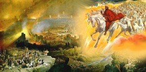
The current crop of radicals have a different agenda.  They are fundamentalist Christians who are believers in a doctrine common for over two thousand years.  They see the turmoil of human affairs as signs that we are in the end times.  The turmoil will escalate into the battle of Armageddon, followed by the rapture and the second coming. 

Apocalyptic literature has always been with us, but The Judeo-Christian literature is especially rife with dire prophesies.  Today’s Christian radicals take most of their inspiration from the books of Revelation and Matthew, written around the end of the first century predicting the fall of the Roman Empire.   There is a lot of ancient apocalyptic literature, the Bible is not unique in this.  There is also a lot of allegory not exclusive to the Bible.   

When I was engaged in extensive Bible study, I also watched televangelists talking about the end times, and how biblical prophesy is about to be fulfilled.  People have been talking about the end times since the latter part of the first century, when the New Testament was written.  Rome destroyed the Temple in 70 AD.  That catastrophe was the beginning of the Jewish diaspora, and turmoil continued in Palestine.  The prophesies were written then, and referred to Rome.   

Biblical Battle of Armageddon

Biblical Battle of Armageddon

My view is that attempting to apply those prophesies to today is repeating the mistake Christians have been making since the New Testament was written.  There was end time hysteria in the first and second centuries, around 1000 AD, and beginning in the nineteenth century when mostly American writers began looking into biblical prophesy.  Many dates chosen for the rapture, Armageddon, and the Second Coming have come and gone.  Christ continues to tarry.  The establishment of the State of Israel was seen as the biggest portent, and that it would all happen within a generation.  Nope. 

Now it is the continuing conflict in the Middle East which will culminate in a climactic battle between the U.S. and Russia at Megiddo.  This is the reason for fundamentalist support for Israel.  They see Israel as the flash point for a general war and then Armageddon. 

 Michelle Bachmann, Oral Roberts University Law School

Michelle Bachmann, Oral Roberts University Law School Graduate

Most of the Republican candidates subscribe to this view.  Michelle Bachmann and Sarah Palin have spoken explicitly about this view.  Most of the current candidates who call themselves evangelicals believe in the end times, but don’t talk about explicitly, remembering what happened to Bachmann and Palin. 

Radicalism dominates Republican Presidential nomination campaigning.  The idea is as radical as forming European Christian armies to take Jerusalem in 1099 AD.  The enemy is the same, Islam.  The goal is the same, establishing Christian rule.   A secondary goal is establishing a Christian theocracy in the U.S.  We don’t hear a lot of talk about these overall strategies, but the specific policy statements point in that direction.  Abortion, gay marriage, invading Iraq and Syria to destroy ISIS and confront Putin, increasing defense spending, and defunding the opposition (Working People), are the real goals.  Oh, and making rich people richer.

Watch out, folks, read between the lines, and watch Trump confound everyone with his flag waving racism.  Be especially aware of the prophesy believers.  They want to impose their religious beliefs on the world.

Perspective

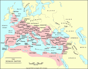
Roman Empire

Roman Empire

As I moved along in my history studies I heard a lot about developing a historical perspective.  It means acquiring a long view about historical processes.  For example, how the civilizations on the Italian peninsula evolved from Etruscan influences to Greek colonies to the start of the Roman city state with a political system somewhat modeled on Greek city-states to a republic, evolving with the growth of the empire and the need to defend the borders which tended to generate a more autocratic government which became increasingly corrupt and unable to check the invasions of Germanic tribes which led to collapse and the Dark Ages.  How is that for a synopsis?

Just about every statement I made about Rome has been debated, supported, refuted, and revised for centuries.  It is my perspective, however, and provides a framework, however tenuous, for my thinking about the development of European civilization.  Many of the conflicts in what was once the Roman Empire and it’s fringes have roots over two thousand years old.  I draw on my views of ancient empires in thinking about current developments in our world.

Geology also requires developing perspective; probably more than history because of the vast expanse of time.  We think of two thousand years as a long time historically, but it is less than a blink in geologic time.  The earth is over four billion years old.  What we can think of as written geologic history, the  evolution of life forms leaving a fossil record, is 600 million years old.  The

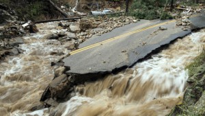
2013 Colorado Flooding

2013 Colorado Flooding

2013 Colorado floods, viewed as a rare catastrophe, is only one of many thousands of similar events that carved canyons, moved rivers, filled basins that continue to subside, and provided habitats for ever-changing life forms.  Bring back the mastodon and the Sabre-Toothed Tiger!

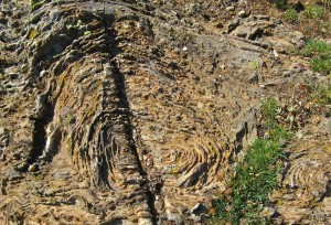
Geologists think that Colorado was formed by island arcs similar to those archipelagos south of Asia colliding with the Eurasian continent.  Here, island arcs from the south docked on the Wyoming Craton, some of the oldest rocks in North America.  This happened a very long time ago, before life emerged.  If you want to see this transition I recommend the

Wyoming Stromatolite

Wyoming Stromatolite

Snowy Range road in Wyoming.  You can find stromatolites, fossilized algae.  These fossils predate the Paleozoic, and are older than anything in Colorado.  Yes, geologists use the word docked, if you can imagine India docking on Eurasia. The transition between the Wyoming Craton and the younger stuff is called the Cheyenne Belt.

Now here is some serious history.  Since Colorado became one land mass, mountain ranges have come and gone, oceans have advanced and retreated, new life has evolved and gone extinct, and the whole deal has skidded around on the earth.  All the skidding has moved at about the rate your toenails grow.  That is not very fast, but after a few million years it begins to add up.

Trail Ruts at Guernsey WY

Trail Ruts at Guernsey WY

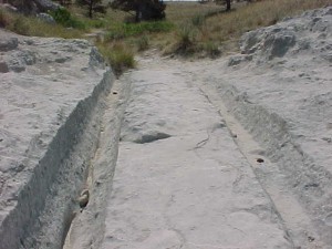
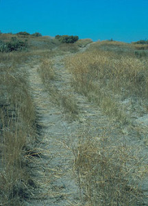
One of the problems of moving in next to Wyoming is that Yellowstone is there.  200 miles north of Denver is Guernsey, Wyoming, home of some interesting human history.  Guernsey is on the Platte River and the Oregon-California Trail.  Hundreds of thousands of people traveled the trail seeking new opportunity.  The trail stays close to the river in most places, but at one point the banks narrow and the trail climbs up about 20 feet through what looks like soft sandstone.  The Rock is so soft the wagon wheels formed axle deep ruts.

Yellowstone Volcanic Caldera

Yellowstone Volcanic Caldera

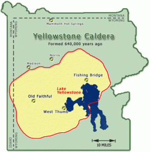
The rock is not sandstone.  It is volcanic tuff, deposited by ash clouds from the last time the Yellowstone Supervolcano blew, about 640,000 years ago.  On the highway it is about 380 miles.  Four feet of hot ash from 380 miles away.  It must have gotten pretty nasty here in Denver.  That volcano is going to erupt again.  We don’t know when, but the magma continues to bulge and recede in the area around Yellowstone Lake, which formed in the caldera.  Now that is historical perspective.  I live in a place that is going to be cooked and buried some day.

For those of you in coastal lowlands, along the West Coast, near St. Louis, Salt Lake, or anywhere between Tibet and Australia, there will probably be cataclysms occurring sooner than Yellowstone erupting, but nobody knows for sure.

Boise Road Trip Part Two

In the first installment I got us as far as the Wasatch Front, and warned of the future apocalypse-earthquake waiting to happen there.  I was on the way to Boise, and needed gas.  I took an exit and pumped gas, moved the Tacoma to a parking spot, and went inside.   

Pried Open Sliding Window

Pried Open Sliding Window

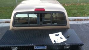
When I came out I saw my keys on the seat.  Oops.  No spare key.  I have done this before, and it usually means breaking a window. The Tacoma has a sliding rear window, useful for ventilation in good weather.  I borrowed a screwdriver from the guys parked next to me.  I figured that was the cheapest window to replace if I had to break it. 

The window has a plastic latch and I pried between the panes there.  The glass bent and the latch popped open.  I have tried those magnetic key holders and they always disappear.  I’ll figure out a stash spot sometime. 

On the road again, I drove through some arid hilly country-cow country, in the wind.  I have always thought that Wyoming is the wind capital, but the wind has to come from somewhere, I guess it is northern Utah and Idaho.

Driving on north, near the Snake River it is irrigated farmland, reminding me of home.  I was getting tired and stayed in Twin Falls.  It’s not that far to Boise, but when I am tired I lose concentration, not good at 70 mph. 

Oregon Trail Ruts

Oregon Trail Ruts

The Oregon-California Trail parallels the Snake in that region, so I went rut hunting.  The Snake runs through a gorge in the Snake River Plain, so the trail left the river if there were alternate water sources.  Those hills Idaho people call mountains also run parallel to the Snake a few miles north, and the trail ran there away from the river. Water was available from springs and creeks at the base of the hills.  The water is gone now, victim of all the groundwater pumping by farmers.  

 The ruts are there, as well as the ruins of an attempt at a resort in the early part of the 20th century.  I like following the trail, thinking about what it was like for the emigrants, traveling 8 to 10 miles per day, hoping for a better life at trail’s end.  Many found the better life, many did not, and many died on the way.   

 On to Boise, seeing people I care about, and searching for Basque food.  Headed home it was back to the Wasatch, then U.S. 40 east.  I had never been west of Vernal, so it was new country for me.  The highway rises through the Wasatch to Heber City, a nice town that reminded me of our Eagle River valley, with all the businesses supporting the ski resorts.  The Wasatch Mountains are rhe easternmost range of the Basin and Range Province.  The Basin and Range is being stretched as the Pacific Plate scrapes northward along the North American plate. 

Uintah Mountains From US40

Uintah Mountains From US40

Leaving the Wasatch Mountains, we are back on the Colorado Plateau, with its northern boundary, the  Uintah Mountains.  The Uintahs are unique among North American mountain ranges, as they run east-west.  They were uplifted at the same time as the Rockies, but I can’t find a good explanation of why they run east-west.  There they are, and I drove east with mountains on the left and desert on the right.  Come to think of it, the Book Cliffs and the Tavaputs Plateau also run east-west, but they aren’t called mountains because they are only 8000 feet high.  The Uintahs have two thirteeners.   

 Highway 40 runs between the Uintahs and the Tavaputs.  The Uintahs are important to the Salt Lake area, providing water for the growing population.They are also pristine, mostly roadless.  The glaciers are gone, but they left dramatic peaks and broad mountain valleys.  The core is the High Uintahs Wilderness,the rest Forest Service land providing summer range for sheep and cattle.   

Next, Vernal. It reminds me of Cortez, Colorado and not in a good way.  It is, however, a good jumping off spot for a lot of interesting country. 

Green River Campground, Dinosaur National Monument

Green River Campground, Dinosaur National Monument

The eastern end of the Uintahs have Dinosaur National Monument, with its fossils and the amazing canyon of the Green River.  I was camping down on the river one time a few years ago.  My neighbors in the campground had some dogs they were letting run loose.  I warned them about the skunk I had seen.  Early next morning they learned about skunks and dogs and I got to hear some morning howls.  I am glad I wasn’t in their car on the way out. 

Maybell, Colorado is next, a ranching town isolated enough that the natives retain the western drawl, a dying accent.  On to Craig with its coal controversy, then Steamboat on the Yampa.  Pretty country.  Then, drive over Rabbit Ears and Berthoud Passes, down to I-70 and a traffic jam.  That meant I was close to home.

Road Trips, Denver to Boise Part One

It is road trip time.  I went to my 55th high school reunion in Fruita, then went to Boise on family business.  Good reunion with old friends, and a good hike to Devil’s kitchen in the Colorado National Monument.

La Sal Mountains and Arches

La Sal Mountains and Arches

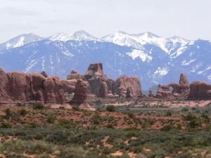
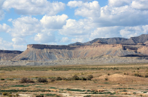
From the reunion it was west and north to Boise.  Many people find the drive from Fruita boring. The highway is fairly flat and on the Mancos Shale, ancient sea floor mud made rock, sort of.  Poor soil, it is mostly sagebrush and cheat grass.  South is the red rock country and the La Sal Mountains.  The La Sals are weathermakers for Fruita during the August thunderstorm season.

North of the highway it’s the Book Cliffs, more shale with sandstone rims.  Don’t go there after a lot of moisture.  Some of the slipperiest roads anywhere are up there.  Good cow country, though.  Oil, gas, and oil

Book Cliffs

Book Cliffs

shale make the country vulnerable to destruction.

Price and Helper signal the end of the Mancos, but not without a lot of coal.  The shoreline of the ancient sea was here.  The highway goes up through a canyon to higher country. Cow country again, until it turns to city.

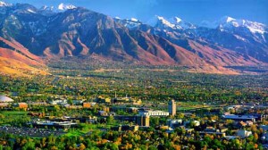
It is urban sprawl from outside Provo to where the highway branches off into Idaho.  This is the Wasatch Front, Brigham’s Place.  Good land, water, and a place to build.  Built it is.  Big City.  It is much like Colorado’s Front Range.  The difference, the Rocky Mountains are mostly finished rising.  The Wasatch Range is not.

The Wasatch Front

The Wasatch Front

All along the Wasatch, one can see the scarp formed by the Wasatch Fault.  The mountains are on the way up, and they jerk upward along the fault.  The fault is overdue to jerk upward again.  When it does, Salt Lake and the other cities are in trouble.  There are four major earthquake zones in the U.S.  Everyone knows about the San Andreas in California; the Cascades are another, with Portland and Seattle overdue for a big quake.

Bonneville Shoreline Terraces

Bonneville Shoreline Terraces

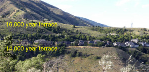
Another feature of the Salt Lake Valley is the Lake Bonneville shoreline.  When the ice age glaciers melted, a huge lake formed in that basin.  It was so big that it overflowed into the Snake River in Idaho.  The ancient shoreline terrace is visible all long the Wasatch front.

There was a wet period in the 1980’s when the Great Salt Lake grew, attempting to relive past glory.  Fortunately for the city it receded.  but, another problem.  The Wasatch mountains are still rising.  The fault at the base, the eastern edge of the city, is locked.  It hasn’t shaken in a long time in human terms.

Uplifting mountains don’t rise in a steady fashion.  It happens in jumps and jerks. called earthquakes.  The Wahsatch has had hundreds of earthquakes  in the last few million years.  It is not a matter of if, but when.  There are hundreds of houses built on the loose stuff that has washed out of the mountains.  Shaking is amplified on that material rather than solid rock.  The destruction will be staggering in impact.  The prediction is the quake will be about 6.5 in magnitude.


Road Trips, New York

It seems to be travel time.  I did a round trip to Boise to see relatives.  For an old guy, a two day drive.  I saw new country and got a road trip in; I like road trips, preferably alone.  The next trip was the big one.  Fly to New York and drive a car back to Denver.

My stepdaughter has a high zoot job and a high zoot apartment in Manhattan.  She is now a confirmed New Yorker and decided to go without a car.  New York is one of the few places in the country where or makes sense to be carless.

2006 BMW 356i

2006 BMW 356i

So, we cashed a bunch of points for a first class ticket to LaGuardia.  I took a cab  to her place, we had aa pizza across the street from her building, slept, and got on the road by 9:00 AM.  She gave us a great deal on her 2006 BMW with 60000 miles on it.  What a machine.  I drive a base model Toyota pickup that is so base it doesn’t have a passenger side door lock.  The BMW has most every option they put on them that year.  I can now operate about twenty percent of the features.

I drove north up the Roosevelt Parkway, went across the George Washington Bridge to I-80, and rolled west.  The portion of New Jersey I crossed is truly the Garden State.  There were lots of trees displaying their fall colors, a nice rural area.  Soon, I was in

Pretty Pennsylvania

Pretty Pennsylvania

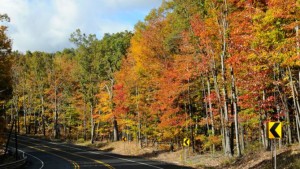
Pennsylvania.  I like that state.  Hilly, wooded, nice farms, and striking fall colors.  Green, gold, red, gold, brown, and a lovely Crimson.  Pennsylvania has lots of wildlife, and the traffic takes its toll. There are solutions for the road kill problem, but they are expensive, so change is slow.

Next is Ohio, and I-80 swarming with cops.  I saw many more patrol cars in Ohio than the rest of the route.  The state is flat, with the American monoculture: corn.  The truck traffic on I-80 is dense and fast moving.  Everyone scoots along at 5mph over the limit until a truck decides to pass another and it is time to slow down.

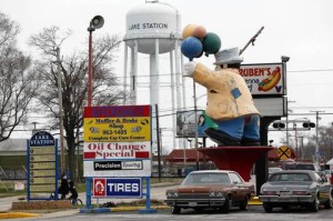
I stayed in a hotel outside Sandusky, one of the cities on Lake Erie.  Next day, the rest of Ohio, then Indiana.  I liked Indiana, farms, hills, and colorful woods.  Then, the flat tire alarm came on.  The Beemer has run flat tires and no spare.  I tried airing the tire with no luck, so I turned off to Lake Station, a town just east of Hammond.

Lake Station, Indiana

Lake Station, Indiana

What a place.  I stopped at the first repair shop and they confirmed the tire was so worn it would not hold air.  They didn’t have a replacement; the BMW has rare low profile sporty tires.  They sent me into town where there were several tire shops.  Wow, what a place.  The town is not at the top of the economic ladder; in fact it is on the bottom rung.  The newest buildings on the Main Street were the dollar store and the big, new county library.

I went to four tire shops , none of them sold new tires.  In one shop I had to yell into the back to get someone to come out.  The guy was a meth head, with sores all over his face and an empty look in his eyes.  Another didn’t have the size I needed.  I finally went to a busy shop with a Hispanic staff and the tire I needed.  Nice guys working there and the right tire.  They got me going again for less than sixty bucks.

I then entered Chicagoland.  There seems to be a trend to do construction work on highways in any metropolitan area.  Miles of cones closing a lane with nothing going on, then a short distance where the work is happening.  I got through the mess OK, and stayed at a hotel just west of the Quad Cities.

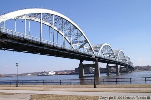
Mississippi River Bridge

Mississippi River Bridge

I got to cross the Mississippi.  It is big there, even above the Ohio and the Missouri.  The Missouri was narrow and looked deep.  The Platte was a real contrast, wide and shallow with lots of islands and sand bars.

I like Iowa, probably because I am from farm country.  I stayed in a nice hotel and had a real dinner instead of drive-up junk.  There was a big AA-AlAnon conference going on, so not many drunks.  Iowa has less trucking, and the road kill animals are smaller than in Pennsylvania.

That BMW is a great road car.  When my back started hurting, I would sit up straight until my butt started hurting.  No amount of padding helps either condition. My lower spine is a mess, and my butt is skinny-can’t keep my pants up.  The cruise control is easy to use and was a big help.  Cruise in the rural areas, alert and careful in the cities.

It was a long day across Iowa and Nebraska.  In my younger days I would have gone on to Denver, but the old guy stayed in North Platte.  We have two Cabelas here so there was no temptation to go to Sidney.  I-76 goes right to Denver.  Home just after noon.

Now, Carol and I are learning how to use all the features on the car.  Our next task is deciding what to do with three cars.  What to keep, what to sell?  The BMW is high maintenance, the Matrix is getting old, and my 4×4 Tacoma is so cheap it doesn’t have an outside lock on the passenger side,  the seat is hard, and the only amenities are air conditioning and a decent sound system.

We have more road trips coming up, and the BMW is great, but rear wheel drive. The Matrix is still decent, and the Taco sucks for long distances.  What to do?


The Colorado Plateau Part Two


Colorado Plateau Country

Colorado Plateau Country

There is a lot of beautiful country on the Colorado Plateau, but there is the other side.  The term many use is the stinking desert.  My home town has an annual rainfall of about eight inches.  Before the Utes were run out and ditches were dug, the Grand Valley was a sparse desert.  The irrigation projects made much of the valley green, but north of the Highline Canal is the desert.  It is a fairly barren desert, not like the Sonoran Desert with its green saguaro cactus.

Mancos Shale Soil

Mancos Shale Soil

The soil, if you can call it that, is fairly infertile, high in salts, and high in toxic selenium.  It’s called the Mancos Shale.  The Mancos Shale, called the Pierre Shale east of the Rockies, runs from South Dakota to central Utah.  It is an ancient sea floor, Cretaceous in age, of the inland sea covering much of North America.  Shale is mud rock, laid down as the sea advanced and retreated over millions of years.

The lower part of the Bookcliffs and the valley floors are Mancos Shale.  In its natural state it is a scrub grassland, supporting small populations of deer, antelope, prairie dogs, sage grouse, cottontails, and some Bison.  When the Northern European Americans arrived, they saw grazing land.  The sheep and cattle came.  The ranchers did well for a few years, but their expectations were unrealistic for such a dry area.  Soon, most of the good grass was gone, replaced by cheat grass and sagebrush.

The area between Delta and Grand Junction is a prime example.  My father, born in 1903, lived in Grand Junction after 1918.  He told me that at that time, there were extensive stands of tall bunch grasses.  They are gone.  That desert is one of the most barren stretches I am aware of.  It is hilly, so irrigation water went to flatter areas.  It is close to towns, so lots of ranchers grazed their stock on the land.

Much of the Mancos shale country is BLM land today.  In the old days, the Land Office and the Grazing Service leased land to ranchers.  There were allocations on the number of head allowed on each segment, but there was little enforcement.  The grass mostly disappeared.  Thus, the stinking desert.

I-70 from Palisade to the west of Green River, Utah is on the Mancos.  Highway Six from where I-70 veers south almost all the way to Price is on the Mancos.  Travelers on those highways have the bare Bookcliffs and the bare desert floor to look at for over 200 miles.  Their impression was what tended to keep the canyon country to the south relatively isolated.  Locals had all that magnificent country mostly to themselves.

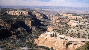
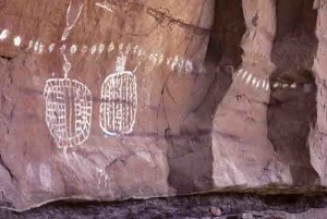
Art in Salt Creek Canyon

Art in Salt Creek Canyon

The a uranium and oil and gas booms of the 1950s built a large network of roads and opened the canyon country up for tourism.  Those flat deserts remain empty, along with the mostly shale country of the Bookcliffs and the Tavaputs Plateau to the North.

When I went to Arches in the 1950s, we drove down two tracks winding through the sand.  This year during the height of the season, cars were lined up literally for miles.  Canyonlands National Park is also crowded, people lined up.  I remember going there and often seeing no one.

From Green River to Hanksville is mostly flat, dry desert, with 70 miles from the highway turnoff to the Maze District Ranger Station in Canyonlands.  The greater part of Navajo country in southern Utah, New Mexico, and Arizona is fairly flat desert.  Monument Valley is flat desert that happens to have some rocks sticking up.  Have you ever driven from Albuquerque to Flagstaff on I-40?  Flat desert.

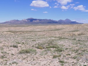
Henry Mountains

Henry Mountains

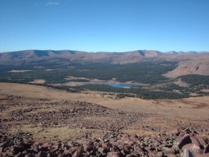
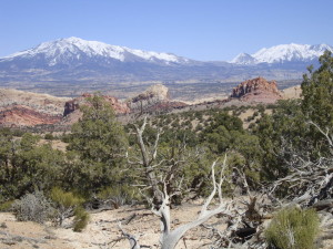
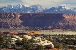
The Colorado Plateau does have some other features.  Mountains, tall, green, and wet, supplying water to the desert.  Three ranges of mountains, the La Sals near Moab, the Abajos, known to locals as the Blues, and the Henry Mountains, near to nowhere.  The La Sals are the tallest, over 12,000 feet.  The Abajos and the Henrys stretch to 11,000 feet.  They stand in contrast to the red rock country surrounding them, and provide a welcome relief.  People go there in summer to cool off and enjoy the wildlife.

Geologically, the mountains are Laccoliths, formed by a neck of molten magma rising to a weaker junction between two layers of sandstone.  At that junction the magma moves laterally, forming a mushroom shaped dome of igneous rock in the domain of sandstone.  The overlying strata usually erode away, leaving the igneous core.  The Henrys are the type location for Laccoliths, being the subjects of the earliest study, and displaying the domed shape.

Salt Creek Canyon

Salt Creek Canyon

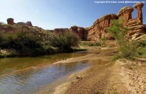
The three ranges are important to ranching, providing water, hay farming, and a summer range, with the stock wintering on the desert.  Salt Creek, draining north from the Blues, has a canyon with year-round water, arches, and Ancestral Puebloan ruins and rock art. The canyon also provides access to a park in the midst of the Needles District of Canyonlands.  I like that park because it was never grazed.  It provides a look at the land before cattle came, trampling or eating everything, mangling stream banks, and bringing alien species like cheat grass.  No I won’t tell you where it is.  Go look for yourself.


The Colorado Plateau Part One

Colorado Plateau Scenery

Colorado Plateau Scenery

I am a child of the Colorado Plateau.  I was born and grew up in Fruita, Colorado, and still think of Fruita as home, although I have lived along the Front Range of Colorado most of my life.  The Grand Valley of the Colorado River is near the Grand Hogback, the eastern extent of the plateau in that area.  The Grand Valley is green due to irrigation, but the annual precipitation averages around eight inches a La year, fairly typical of the Plateau.

I am sure that the center of the universe (well, my universe) is somewhere within 100 miles from the confluence of the Green and Colorado rivers.  It is fitting, therefore that the Plateau is somewhat unique geologically.  All those striking layers of varicolored rock formed into spectacular scenery by the work of the Colorado River and its tributaries are relatively undisturbed compared to the Plateau’s neighbors, the Rocky Mountains,  the Basin and Range, the Wasatch and Uintah mountains and the  Mogollan Rim in Arizona.   Pretty neat neighbors, eh?

Those places have been folded, faulted, stretched lifted, collapsed, and otherwise deformed.  The Plateau, on the other hand has remained relatively stable through much of geologic time.  It is this big slab, poked, lifted, twisted, drowned, buried, and eroded several times but still mostly intact.  There were just enough deformation and intrusion to make things interesting.

The reasons for this stability are still somewhat controversial, bit have to do with the Pacific Plate coming our way and north at about the rate your fingernails grow, and the North American Plate headed west at about the same speed.  At different times they have behaved in different ways that, coupled with the somewhat thicker crust under the Plateau, have resulted in this unique region.  I don’t have the space or understanding to explain all those processes, but we can see the result.

An interesting fact is that the entire plateau seems to be rotating clockwise as the Pacific Plate grinds along northward.  That movement is also what is pulling the Basin and Range province apart.  Don’t look for any big changes next week.  This process is really slow.  While all this plate movement is going on, our friends the Green and Colorado rivers just keep digging.  On rare occasions you can see the digging, when there are exceptionally big thunderstorms during the summer monsoon.  A lot of stuff goes into the rivers then.  Today, Lake Powell is catching it, and will become one huge mud flat until the dam eventually fails.

Looking at all these processes requires a different sense of time than how we live from day to day.  In geologic terms, sixty million years (60ma) is relatively brief.  We think of our world as stable (unless you live in the Bay Area) but in truth, everything is on the move, it is just a bit slow.

Upheaval Dome

Upheaval Dome

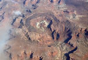
The Colorado River will eventually bring the entire plateau down to sea level.  Look at Grand Canyon or any of the tributary canyons to see how it works.  My favorite is the San Juan.  Some fine canyons and not as cluttered up with people.  Another place to see the processes of change is Upheaval Dome in Canyonlands National park.  A great big rock came along and smashed down, forming a huge crater and shaking everything up for a long way around.  You can see rocks turned to waves from that hit all the way to Dewey Bridge.

That big crater tried to form a lake, but it is dry there.  The water did make its way to the river, cutting as it went, and now the crater has an outlet.  The crater will get bigger as the cliffs erode back until it is just a depression, then, gone.

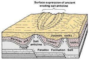
There is a plug of gypsum in the crater.  When all that rock was blown out by the impact, the pressure on the stuff under the crater was lowered.  Some of that stuff down there is salt, known as the Paradox Formation, which can flow.  The salt goes into the river, but gypsum isn’t quite as soluble and there it is.  The salt is from an ancient sea that alternated between filling and drying up as sea level rose and fell.  That left a lot of salt which was then buried under a lot of rock.

The Dolores River Leaving the Paradox Valley

The Dolores River Leaving the Paradox Valley

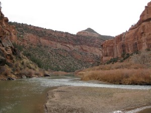
That salt moving around and being dissolved is responsible for much of the scenery in the Moab and surrounding areas.  As it dissolves, some of the overlying rock drops down, creating some fairly large valleys.  Paradox Valley, Sinbad Valley, Lisbon Valley (uranium, oil, and gas), Spanish Valley (Moab), Castle Valley, Fisher Valley, are all big grabens.  They are big blocks that dropped down as the salt leached away. Paradox Valley and Spanish Valley have rivers coming out of a canyon on one side, and going across the valley into a canyon on the other side.  Moab has the Colorado, Paradox has the Dolores.  That makes for some fine scenery.

Paradox Salt Disrupting Things

Paradox Salt Disrupting Things

The fins and arches in Arches and Canyonlands come from the same process on a smaller scale.  All that magnificent scenery is a result of that ancient sea floor full of salt being buried by a colorful succession of rocks that the rivers and the wind could work on.

An exception to the salt influencing the process resulting in fins and arches is Rattlesnake Canyon in Colorado near Fruita.  The river is solely responsible for the work.  The arches are just as cool, and not all full of people.

Next time, some of the other interesting things about the Colorado Plateau, one of the most interesting places on the planet.

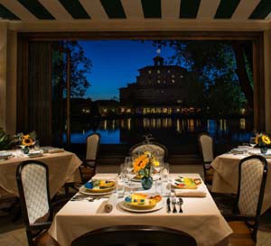
The Broadmoor


The Broadmoor

The Broadmoor

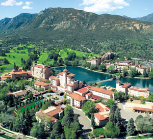
Recently we were at the Broadmoor Hotel in Colorado Springs for a family celebration.  I used to live in the Springs and we would go there for dinner or a Colorado College hockey game at the old World Arena.  I saw some world class figure skating there as well.  Over 20 years ago we were there for the Christmas package deal.  A room, show, and dinner for a good price.

Back then, the Broadmoor was five star, but beginning to get a bit frayed around the edges.  It is not frayed now.  Millions have been spent on renovations, a new golf club, the Broadmoor West hotel, amazing landscaping, new restaurants, attentive and helpful service, and a host of other amenities.  The old World Arena is gone, but the Broadmoor now owns the new World Arena about five minutes from the hotel.  There is a new golf course, a big back country lodge, and bird shooting along the South Platte River.

Great Beds

Great Beds

The Penrose Room, the formal dining room, the Golden Bee pub, and the Taverna remain for the traditionalists.  One of my guidelines for assessing a facility is the attitude of the staff.  The Broadmoor is five star.  The staff is trained to be friendly with guests, but their attitudes seemed genuine.  I think they like their jobs.

The setting is outstanding as well.  Cheyenne Mountain is the backdrop and in this wet summer is just beautiful.  The neighborhood is beautiful as well, upscale homes with mature manicured landscaping.  Colorado Springs is a fine city, with that mountain looking down on everything.

Room rates are somewhere from $300 per night up, with charges for everything.  It costs $24.00 per night to park your car.  Entrees in the dining rooms start at $15.00 and go up.  Way up.  The food is excellent, although I had a fennel dish that did not measure up.  There was also some confusion with our room reservations which should not have happened.  The bed in our elegant room was the best I have slept in.

broadmoor4We had dinner in the Italian Restaurant in the west hotel.  We were lucky to have perfect weather, and the dining room opened up to the lake that was staggering in its beauty.  Truly a world class setting for a world class resort.  We had drinks on the patio at sundown and listened to the bagpipes.

The Broadmoor’s history is connected with the Pikes Peak region history.  The gold from Cripple Creek made Spencer Penrose’s fortune, and mouth of it went into the hotel. A few men made a lot of money from the mines, and a lot of it went into making Colorado Springs a lovely city (at least the older parts).

A lot of that history is depicted in the photographs and art in the hotels.  The hotel also has a good collection of Western art.  For example there is a painting from the 1840’s that depicts a wagon train just ready to go on the trail.  For this history buff, I learned some things from that painting. The bronze sculptures range from famous Fredrick Remingtons to romantic kitsch, typical of western art in general.  There is a fascinating display of wine and liquor bottles dating from the  prohibition era.  It seems that if you were rich enough, the rules didn’t apply.

I have stayed at the Brown Palace and the Ritz-Carlton at Half Moon Bay.  I prefer the Broadmoor.  I think we will have to go back at least once.


Small Towns

Paonia

Paonia

I am a city boy now.  After leaving Fruita to go to college in Boulder, I have mostly lived in cities.  I like the culture, the business, and the amenities that come with the city.  Here I am in the coffee shop right nest to the Denver University campus, with the energy those young people bring.  It helps my writing.

I grew up in a small town, and they still exert a pull on me.  I spent a couple of summers in Keystone, South Dakota peddling turquoise jewelry to the tourists.  I got to know some of the locals during that brief time and enjoyed the Black Hills culture.  I get back to Fruita some, my 55th reunion is coming up, and like rekindling old friendships.

Last weekend I made a quick trip to Grand Junction and Fruita on family business.  There are a lot of memories there, and I enjoyed the feel of a much larger town than it was all those years ago.  Bad news: the pool halls are gone.  Good news:  you don’t have to settle for chicken fried steak in the restaurant.


After my adventure in Rattlesnake Canyon the day before, I decided to take a scenic route back to Denver.  My first stop was Collbran, a town on Plateau Creek I have always liked.  I was looking for the landslide that killed three men last spring, but went up the wrong creek (story of my life).  At the gas station, a local rancher and his son had their rubber boots, so we talked about irrigating for a while.

I went over Grand Mesa and drove through Cedaredge, another favorite small town.  I like Cedaredge for the view of the Uncompahgre Valley, the Uncompahgre Plateau,and the San Juans.  No view last Sunday, the smoke from all the fires in the northwest obscuring everything.  Cedaredge and Eckert right down the road are nice towns, but the highway runs right through town, as it does in Collbran.  The roads are noisy, busy, and sort of split the town.

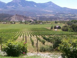
I had lunch in Paonia, just about my all-time favorite town but for the fact that they usually killed us in football.  My senior year we lost so badly that I even got to play.  Paonia is off the highway and is the home of High Country News, a great magazine about the west.  The West Elk Mountains are just out of town, but the area’s economy is mostly farming and ranching.  They grow peaches, cherries, apples, and lately, wine grapes.  They have a nice mild climate right at the foot of the mountains.

I had a good hamburger in one of the restaurants and drove around a bit (that takes about fifteen minutes).  I was struck by the life in the town.  OnSunday morning families were out walking and kids from age six on up were riding their bikes all over town.  The last town I remember seeing that was Winslow, Arizona.

So, my main criteria for a good small town are no McDonalds, no Walmart, a farming economy, and school age kids on bicycles.  I don’t think I will ever leave the city, but if I do, it will be to a town like Paonia.

« Older Entries Recent Entries »