Category Archives: My Story

Writing Short Essays

You have seen my ravings on this site for some time now.  I have written about not being able to write for many years, which I attribute to my Attention Deficit Disorder. I just did not have the focus.  Getting a diagnosis and treatment changed my life.  The ADD is still enough of a problem that I don’t think I have a novel or long nonfiction book in me. Maybe I could come up with a long piece on regional geology, but it has been done many times.  Someday, maybe.  

I love writing these short pieces.  I have wide interests, and there is no one telling me what to write.  I do think I will do some independent reporting the next time we have a big geology related event.  A good flood, landslide, or dam burst will do fine.  There is an opportunity to write for our neighborhood association, but I will not sit through meetings. 

Why not fiction?  I probably have as many ideas for fiction as nonfiction, but the craft is more demanding.  I can hammer out 500 to 1000 words in an hour or two, revising as I go, and it usually works just fine. I have a good editor/wife that straightens me out from time to time.   

I have always had some talent and encouragement from teachers in high school and college about my writing.  In college, I made some money writing papers for people for $10.00 a page.  It had to be a subject I liked and knew something about.  My best customers were forestry majors, who seemed to be only semi-literate.      

Now, with the help of a lot of stimulation in the coffee shop, I can scratch some things out.  My pieces seem to be getting longer, not because of any design on my part.  I also plan to write more.  No shortage of topics.  I just hope I can avoid politics for the most part.  Trevor Noah and Steven Colbert help me discharge most of my disgust for the current political climate. 

I would like to do more humor, but I don’t seem to have the reservoir of funny stuff people like Dave Barry seem to have.  People do tell me I am good at smart-ass remarks, however.  My favorite writer is John McPhee, who is the best expository writer in the business.

I have been published.  I wrote a book review for the journal of the Oregon-California Trails Association.  I plan to do more writing about pioneer trails and history.  The Western History section at the Denver Public Library is a good resource, but they won’t let you check anything out.  It is necessary to go there, and they don’t have a coffee shop. 

One thing is sure, I will keep inflicting my writing on you as long as there are a few of you to read my writing.  I would like more feedback and criticism, however.  Also, tell others about dofbill.com.  It’s easy to remember, dof stands for doddering old fart.  I started this with around thirty readers.  Now I average about 100 hits every week.  No Pulitzer yet, but I would write for just myself if that was it.  Extroverts do like an audience, however.

Engineers

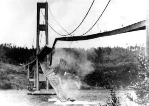
Tacoma Narrows Bridge Collapse, 1940. The engineer commited suicide.

Tacoma Narrows Bridge Collapse, 1940. The engineer commited suicide.

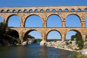
Engineers design things.  It may be lines of code for a computer application or the Golden Gate Bridge.  They have been at it for a long time.  Stonehenge, the pyramids, Petra, Roman roads, bridges, and aqueducts; all started as an idea in someone’s mind.  He then added the details to make the thing work.   

The details.  You can conceive of a bridge over a stream, but it has to be assembled, stay in one piece, support the loads going over it, and hold back the flood.  It would be nice if it looks good.  In addition it should not cost more than is necessary.  That is asking a lot, and in most cases the product is good at its job.  Think of it, are the stream banks solid rock or mud?  How deep is it, how do you support the bridge as it is being built?  What material to use?  Stone, wood, steel, iron?  What about the approaches?  How do you get the rainwater or snow off?   

Roman Aqueduct

Roman Aqueduct

There are lots of questions to be asked, and the answers have to be backed up by the numbers.    Stress, load, vibration, weather, wind, soil characteristics, and myriad other details have to be calculated.  Calculations can be avoided only if the thing is so overbuilt that little harm can come to it.  It is hard to do stress analysis with Roman numerals, thus things were overbuilt enough that they are still in service today.   

Currently, overbuilding is not an option due to cost considerations.  The thing has to do its job, last for its design life, be easy to work with, and not cost too much.  I spent thirty years in the water treatment business, and everything in the business has engineering behind it.  Most of the time everything works fine.  But, engineers make mistakes.  Walls collapse, processes don’t work, the power to a pump shorts out, the concrete leaks.  When you turn the new thing on, the software may not work.  All the engineering is critical, because the water has to go down the pipe to the customer, safely. 

For thirty years, I treated water using the engineers products.  Sometimes the product was faulty, but we had to make it work anyway.  The net result of this is that after working with the mistakes for so long, I have a deep, strong, profound anti-engineer bias.  In addition, engineers tend to be serious nerds.  They often are weak in social skills, and have difficulty communicating with others.  Lots of them know they are right, and refuse to listen to input from others who are not engineers.  Mistakes get perpetuated.  I must concede, however, that their stuff mostly works. 

The problems can be minor, like not putting the drains in the low spot to forgetting to account for water hammer in a piping system and pipes separate, flooding things.  A big problem we had to deal with was leaking concrete.  Denver Water has been pouring concrete since about 1900.  A lot of experience is in the specifications provided to the contractor building a new plant.  The contractor failed to follow those specifications and water poured out of the filter walls.  Water also came up through the floor from the channel bringing water into the plant.  It was necessary to take the plant out of service, drain the tanks, clean the walls, and coat them with epoxy.  That epoxy will not last as long as the concrete. 

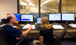
There was one major exception to my dislike for engineers.  The plant where I worked had elements dating back to the 1920s as well as new construction.  Part of the new project was automating the entire plant.  There are lots of valves, motors, pumps, blowers, and other equipment, all interdependent.   

The software developers worked for months writing the programs to run everything.  There were twelve foot diameter valves, 400 horsepower motors, sensors monitoring every process, and it all had to work.

Water Plant Control Room With My Doppleganger

Water Plant Control Room With My Doppleganger

When we turned the plant on for the first time, it worked.  Everything did what it was supposed to.  This in a three hundred million gallons per day water plant.  In contrast, I started up a 10 MGD plant that just barely worked.  The biggest design flaw was a tank that was supposed to even out the water flow coming from the watershed to the water demand of the plant, which tended to fluctuate.  There were valves at the intake up the mountain, at the tank outlet, and at the plant.  The tank was too small to handle the fluctuations.  The plant was either starved for water or the tank was spilling.  There was software to sense tank level and flows, but it could not keep up.  The tank should have been at least twice the size.   

Don’t get me wrong, the work was challenging, interesting, and sometimes even fun.  There was enough variety to keep boredom at bay, and those engineering mistakes added to the challenge.  What the engineers did right, we just took for granted. 

The Colorado Plateau Part Two


Colorado Plateau Country

Colorado Plateau Country

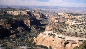
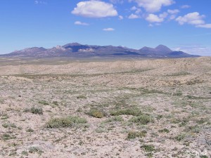
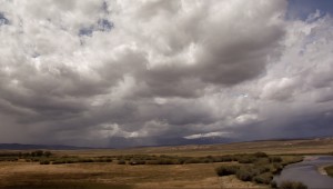
There is a lot of beautiful country on the Colorado Plateau, but there is the other side.  The term many use is the stinking desert.  My home town has an annual rainfall of about eight inches.  Before the Utes were run out and ditches were dug, the Grand Valley was a sparse desert.  The irrigation projects made much of the valley green, but north of the Highline Canal is the desert.  It is a fairly barren desert, not like the Sonoran Desert with its green saguaro cactus.

Mancos Shale Soil

Mancos Shale Soil

The soil, if you can call it that, is fairly infertile, high in salts, and high in toxic selenium.  It’s called the Mancos Shale.  The Mancos Shale, called the Pierre Shale east of the Rockies, runs from South Dakota to central Utah.  It is an ancient sea floor, Cretaceous in age, of the inland sea covering much of North America.  Shale is mud rock, laid down as the sea advanced and retreated over millions of years.

The lower part of the Bookcliffs and the valley floors are Mancos Shale.  In its natural state it is a scrub grassland, supporting small populations of deer, antelope, prairie dogs, sage grouse, cottontails, and some Bison.  When the Northern European Americans arrived, they saw grazing land.  The sheep and cattle came.  The ranchers did well for a few years, but their expectations were unrealistic for such a dry area.  Soon, most of the good grass was gone, replaced by cheat grass and sagebrush.

The area between Delta and Grand Junction is a prime example.  My father, born in 1903, lived in Grand Junction after 1918.  He told me that at that time, there were extensive stands of tall bunch grasses.  They are gone.  That desert is one of the most barren stretches I am aware of.  It is hilly, so irrigation water went to flatter areas.  It is close to towns, so lots of ranchers grazed their stock on the land.

Much of the Mancos shale country is BLM land today.  In the old days, the Land Office and the Grazing Service leased land to ranchers.  There were allocations on the number of head allowed on each segment, but there was little enforcement.  The grass mostly disappeared.  Thus, the stinking desert.

I-70 from Palisade to the west of Green River, Utah is on the Mancos.  Highway Six from where I-70 veers south almost all the way to Price is on the Mancos.  Travelers on those highways have the bare Bookcliffs and the bare desert floor to look at for over 200 miles.  Their impression was what tended to keep the canyon country to the south relatively isolated.  Locals had all that magnificent country mostly to themselves.

Art in Salt Creek Canyon

Art in Salt Creek Canyon

The a uranium and oil and gas booms of the 1950s built a large network of roads and opened the canyon country up for tourism.  Those flat deserts remain empty, along with the mostly shale country of the Bookcliffs and the Tavaputs Plateau to the North.

When I went to Arches in the 1950s, we drove down two tracks winding through the sand.  This year during the height of the season, cars were lined up literally for miles.  Canyonlands National Park is also crowded, people lined up.  I remember going there and often seeing no one.

From Green River to Hanksville is mostly flat, dry desert, with 70 miles from the highway turnoff to the Maze District Ranger Station in Canyonlands.  The greater part of Navajo country in southern Utah, New Mexico, and Arizona is fairly flat desert.  Monument Valley is flat desert that happens to have some rocks sticking up.  Have you ever driven from Albuquerque to Flagstaff on I-40?  Flat desert.

Henry Mountains

Henry Mountains

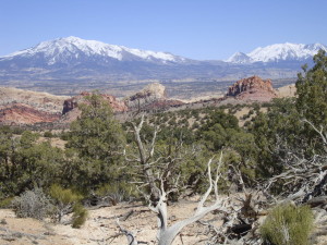
The Colorado Plateau does have some other features.  Mountains, tall, green, and wet, supplying water to the desert.  Three ranges of mountains, the La Sals near Moab, the Abajos, known to locals as the Blues, and the Henry Mountains, near to nowhere.  The La Sals are the tallest, over 12,000 feet.  The Abajos and the Henrys stretch to 11,000 feet.  They stand in contrast to the red rock country surrounding them, and provide a welcome relief.  People go there in summer to cool off and enjoy the wildlife.

Geologically, the mountains are Laccoliths, formed by a neck of molten magma rising to a weaker junction between two layers of sandstone.  At that junction the magma moves laterally, forming a mushroom shaped dome of igneous rock in the domain of sandstone.  The overlying strata usually erode away, leaving the igneous core.  The Henrys are the type location for Laccoliths, being the subjects of the earliest study, and displaying the domed shape.

Salt Creek Canyon

Salt Creek Canyon

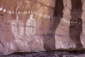
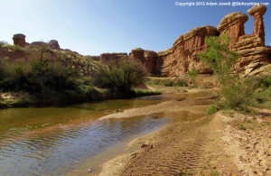
The three ranges are important to ranching, providing water, hay farming, and a summer range, with the stock wintering on the desert.  Salt Creek, draining north from the Blues, has a canyon with year-round water, arches, and Ancestral Puebloan ruins and rock art. The canyon also provides access to a park in the midst of the Needles District of Canyonlands.  I like that park because it was never grazed.  It provides a look at the land before cattle came, trampling or eating everything, mangling stream banks, and bringing alien species like cheat grass.  No I won’t tell you where it is.  Go look for yourself.


Small Towns

Paonia

Paonia

I am a city boy now.  After leaving Fruita to go to college in Boulder, I have mostly lived in cities.  I like the culture, the business, and the amenities that come with the city.  Here I am in the coffee shop right nest to the Denver University campus, with the energy those young people bring.  It helps my writing.

I grew up in a small town, and they still exert a pull on me.  I spent a couple of summers in Keystone, South Dakota peddling turquoise jewelry to the tourists.  I got to know some of the locals during that brief time and enjoyed the Black Hills culture.  I get back to Fruita some, my 55th reunion is coming up, and like rekindling old friendships.

Last weekend I made a quick trip to Grand Junction and Fruita on family business.  There are a lot of memories there, and I enjoyed the feel of a much larger town than it was all those years ago.  Bad news: the pool halls are gone.  Good news:  you don’t have to settle for chicken fried steak in the restaurant.


After my adventure in Rattlesnake Canyon the day before, I decided to take a scenic route back to Denver.  My first stop was Collbran, a town on Plateau Creek I have always liked.  I was looking for the landslide that killed three men last spring, but went up the wrong creek (story of my life).  At the gas station, a local rancher and his son had their rubber boots, so we talked about irrigating for a while.

I went over Grand Mesa and drove through Cedaredge, another favorite small town.  I like Cedaredge for the view of the Uncompahgre Valley, the Uncompahgre Plateau,and the San Juans.  No view last Sunday, the smoke from all the fires in the northwest obscuring everything.  Cedaredge and Eckert right down the road are nice towns, but the highway runs right through town, as it does in Collbran.  The roads are noisy, busy, and sort of split the town.

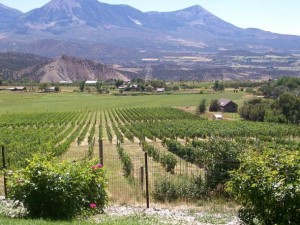
I had lunch in Paonia, just about my all-time favorite town but for the fact that they usually killed us in football.  My senior year we lost so badly that I even got to play.  Paonia is off the highway and is the home of High Country News, a great magazine about the west.  The West Elk Mountains are just out of town, but the area’s economy is mostly farming and ranching.  They grow peaches, cherries, apples, and lately, wine grapes.  They have a nice mild climate right at the foot of the mountains.

I had a good hamburger in one of the restaurants and drove around a bit (that takes about fifteen minutes).  I was struck by the life in the town.  OnSunday morning families were out walking and kids from age six on up were riding their bikes all over town.  The last town I remember seeing that was Winslow, Arizona.

So, my main criteria for a good small town are no McDonalds, no Walmart, a farming economy, and school age kids on bicycles.  I don’t think I will ever leave the city, but if I do, it will be to a town like Paonia.

Rattlesnake Canyon

Dramatic

Dramatic

Rattlesnake Canyon is near Fruita, Colorado, where I grew up.  My friends and I  ran all over the hills north and west of the Colorado National Monument, but I had never been to

Rattlesnake Canyon.  It is a bit too far for kids on foot.  We got into the canyons just east of the canyon, now part of the Black Ridge Wilderness, but I did not know about the arches in Rattlesnake Canyon.

Close to town, the canyon is a bit tough to get to.  The Pollock Canyon trailhead near the river means an overnight backpack to do justice to the country.  The other route follows Black Ridge west from the Glade Park Store, and is for 4×4 vehicles or Subarus you are willing to bash around.  From the trailhead it is about four miles on the trail if you take the shortcut.

I have rambled around the Colorado Plateau off and on all my life.  From the Grand Canyon to Dinosaur and from the Grand Hogback to the Wasatch, the plateau offers some
Rattlesnake Canyon

Rattlesnake Canyon

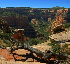
of the most magnificent country anywhere.  Rattlesnake Canyon is up there with the best.  Arches has more arches, and there are bigger canyons (not that many), but Rattlesnake has it all.  The real bonuses are that it is close and not cluttered up with people.  With the exception of Grand Canyon, most anywhere else offered some solitude at one ime.  No longer.  Thirty miles from Grand Junction, with a competent high clearance vehicle you can be in wilderness in view of Fruita.

Ah, the sense of space.  I live in the city and it is impossible to have a sense of space, even with Mt. Evans looking down at you.  From those canyon rims the expanse opens my mind.  Grand Mesa, the Bookcliffs, and the Roan Cliffs rim the Grand Valley, quite a scene by itself.

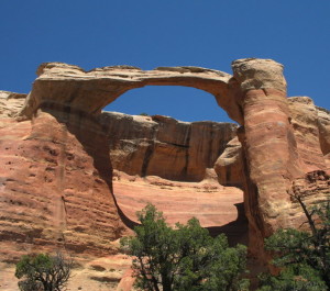
The canyon walls are Wingate sandstone capped by harder Kayenta sandstone.  That cap rock forms a bench with the Entrada sandstone (slickrock) set back from the rim.  Rim Rock Drive in the Monument is mostly on that bench, and the trail to Rattlesnake drops down on the bench and curves around the canyon rim to the arches.  The arches are in the slickrock, ancient sand dunes turned to stone.  It is easy to see the rounded dunes in the rock.  Erosion works its way into the cliffs following the curve of the dunes, forming alcoves.  As the alcoves erode farther, sometimes the back of the alcove drops out, leaving an arch.  I saw six of them. Arches in Colorado, the second largest concentration in the country, maybe the world.

About that trail.  I got away from Denver at 6:00 AM, not my best time of day.  I filled my water bottle and left it on the kitchen counter.  I didn’t realize it until I was at the trailhead at about 1:30 PM.  I am also out of shape, my exercise restricted by a couple of broken ribs for five weeks.  Have I mentioned that I am 72 years old and impulsive?  I looked at the sign, 3 1/2 miles.  It was only 90 degrees or so, a piece of cake.
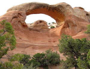
First Arch. Where I climbed up the rock through the arch.

First Arch. Where I climbed up the rock through the arch.

I covered about half of the trail when I realized I was getting a bit dry.  “Keep going, I can drink later”.  The arches were a progression along the bench and close to the trail.  With that row of arches on one side and that magnificent canyon with 400 foot sheer walls branching into side canyons on the other side, I was literally staggered by the beauty.   Well maybe the stagger was because I was tired and thirsty.  I caught up to a party of six people at the last arch, known as First Arch.  At First Arch was the sign saying End of Trail.  I didn’t know that, and by that time I was stopping to rest fairly often, so while resting I watched the party climb up the slickrock through the arch.  I knew the trailhead was only about 1/2 mile from the arch.  So, it was climb up the rock through that impressive arch or backtrack 3 1/2 miles.  I climbed.

I have done a lot of sandstone climbing, and used to be pretty good at it.  That was when I wasn’t 72, tired, getting sore, and thirsty.  I climbed anyway.  I would do about 20 feet, catch my breath, figure out my next moves, and climb again.  The proper way to climb that stuff is on your feet even if it is steep.  Feet have more traction than denim, and the work is easier than trying to slither up.  I slithered.  I was too weak to trust myself trying to walk up those steep slopes.

The rock has curves, little depressions, some tiny ridges, notches, and hollows to give one a way up.  I tried to pick the easiest route, but it was still pretty steep.  My knees paid the price, getting some good scrapes.  Up on the rim, that last half mile was tough.  It was uphill, but not too bad.  I stopped twice and flopped down in the shade for a few minutes while walking slowly back to the truck.

There was about 1/4 of a cup of coffee in the truck that sure tasted good.  I was lightheaded and pretty wobbly during the drive out.  I stopped at the Visitor Center in the Park and drank water for a while.  I got a motel room in Fruita about 6:00 PM, didn’t eat dinner, and drank water until lights out about 9:30.

Sunday morning I had breakfast, drank water, and took the scenic route back to Denver.  I drank water and went up Plateau Creek to Collbran, went over Grand Mesa to Paonia where I had lunch and drank water, then over McClure Pass to Glenwood and home on I-70.  I was fully rehydrated by Monday.
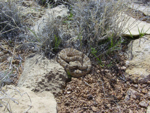
I didn't see a rattlesnake in Rattlesnake Canyon

I didn’t see a rattlesnake in Rattlesnake Canyon

After a few minor incidents in the backcountry over the years, I have developed several rules to follow when Out There.  Take water.  Take enough water for the other persons you come across who didn’t bring enough water.  Be in shape.  Research where you are going so you know what to expect.  Have a map. Carry the ten essentials in case you get into trouble.  Tell people where you are going.  You really should not go alone.  I broke every rule.

What the fuck is wrong with me?  I know.  I am an impulsive ADD.  When I got to the trailhead and saw I had no water I should have driven out.  But, I wouldn’t have this story to tell.  What I did do right was pace myself, not panic, and take my time getting out.  It is just that my brain didn’t kick in until three hours too late.
 

Changes


I am a slow learner, especially when I don’t want to learn what the universe is trying to get across. For some time now, the message is to slow down and act my age. I don’t want to! I want to be younger, stronger, not forgetful, with no signs of aging (well, I’m resigned to being bald).

broken-ribsWell guess what, I’m old, slow, weak, with a bit of a balance problem. In the last couple months I have fallen twice, fell off the ladder, and fell down the last step and broke two ribs. As I mentioned, I’m a slow learner. It’s shocking, I know, but I am going on seventy three years old. After the first two falls I saw my doctor. She gave me a prescription for physical therapy to help my balance. I didn’t go. I then fell off the ladder and down the stairs. Did you know that broken ribs hurt a lot?

After the ribs broke I went into a blue funk. At that point I had no choice. I hurt and couldn’t do anything but read. I can barely stand to watch TV. Then, horror, my iPad died. No Facebook, no words with friends, no left-wing politics, and no Donald Trump news.

Apple Rules! The Apple Store is in Cherry Creek Mall. The Apple Store is full of people, the rest of the mall is virtually empty except for the mall walkers. After the standard long wait I made it to the Genius Bar. The sheer arrogance of that company! The guy was nice and gave the standard digital solution. Reload the operating system, wiping all my data.   Oops, that didn’t work, hardware problem. I walk out of the store with a new iPad.

Most everything transferred over. But. I can’t get to one of my email accounts, Yahoo is unresponsive, I am starting over with Words With Friends, and two days are gone. Computers teach us how to deal with frustration. To a point. I didn’t use the iPad as a Frisbee. The upside? Apple is a bit richer and the process took me off my aging crisis.

The odd thing about aging is that I still feel like me. The same me. Not a old me, just me. But, the body doesn’t feel the same. Even the mind has changed. I forget stuff. I have never been a good rememberer, but I’m worse now. The me I used to be never fell down the stairs. I fell , but not too often, just more than you do. Now I fall a lot more than you.

I know how to fall. Tuck and roll, keep the head up, pick a good spot to land if you can. The skills have served me well. Only two bad ones, one on the motorcycle that finished off my bad knee, and this stair and rib thing. Well, except for the fall that ended up taking my right little finger. For some reason, the universe has chosen falling to convince me that I am no longer the guy I used to be.

A Facebook Friend asked me if there was more damage than the broken ribs. My response: Yes.   I am forced to accept that I am changed. Older. Slower. Weaker. Unbalanced (Wait, that’s always been true.), just not as physically competent as I used to be. A lot of bad stuff is going on. I am not even going to go into the health issues.

I’ve had good changes in recent years. I got my ADD diagnosed and got the medication and cognitive therapy that has changed my life. Just the diagnosis was a big deal. I am no longer a guy with a fatal flaw. I am a guy with ADD. It’s a brain disorder, not just that I am a fuckup.

The biggest change is that with the ADD treatment I now have the focus to write. Other than falling in love and marrying Carol, that is the most profound change in my life. I have two callings, writing and teaching. ADD kept me from both pursuits. Now, however I can write. I may be an old guy, but after all these years I have enough focus to write. After the rib thing I couldn’t write for a while-pain, both physical and mental.

Both kinds of pain are better now. I guess my old guy crisis is not as bad as I thought. The Buddhists say that pain is inevitable but suffering is optional, a choice. For a couple of weeks I suffered. Now my ribs just hurt, but they are feeling better every day. It is mostly over.  I guess it is time to get on with life.

Backpacking

Backpackers

Backpackers

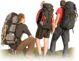
Back in the 1970’s and 1980’s I did a fair amount of backpacking.  I have stumbled around in mountains, up 14000 foot mountains, in the heat of desert summer, and in winter.  I suffered, limped, ate bad food, and drank bad water.  There was joy, serenity, fear, and awe. I can’t backpack now, old and with knee and back problems.  The memories of those trips will be with me always.  There is more satisfaction in accomplishing something that took a lot of work.  The most work was carrying a loaded pack up Mount Princeton and slogging through two feet of fresh spring snow in Loch Vale, Rocky Mountain National Park. Those winter backpacks have additional challenges.  It is dark for a long time and it is cold out there.  The bladder just does not respect any difficulties in getting it drained.  How long can you lay there before struggling out of that warm sleeping bag, covering the feet, donning a coat, and stumbling outside.

Loch Vale

Loch Vale

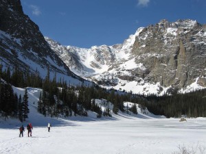
In Loch Vale it snowed a lot of heavy wet snow.  We knocked snow off the tent and listened to the snow slides run.  We had made camp in the dark and didn’t know if we were in a slide area or not.  I guess we weren’t.  It was still snowing without much visibility when we headed for the car.  We made a wrong turn and went down a steep gulch.  Have you ever tried to sidehill in two feet of fresh snow, hardpack underneath, with snowshoes?  At one point I just flopped down in the snow and laid there for a while.

Fiery Furnace

Fiery Furnace

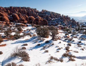
The best winter trip was in the Fiery Furnace, Arches National Park, in February.  Clear weather, no snow, and no one else there.  If you haven’t been to the fiery furnace, go.  There are hoops to jump through with the Park Service these days but it is worth it.  Don’t go in summer.  Another good trip on snowshoes was a spring trip on Grand Mesa.  Longer days, no one around, but the snowmobiles had made a packed trail for us.

North Park is a big, mostly empty place where the North Platte starts its journey north.  The east side has the Rawah Wilderness, while the south rim has the Mt. Zirkle Wilderness.  The Zirkle trip was a lot of fun with good people, but the Rawah trip was something of an adventure. We went with another couple for a several day trip, starting from the Laramie River road north of Cameron Pass.  My wife at the time and I had gained some backpacking experience and were fairly confident in the boonies.

Rawahs

Rawahs

One of the other couple had gone to the National Outdoor Leadership School in Lander.  She was not just a convert to the NOLS way, she was an evangelist. NOLS is a highly respected organization, but Paul Petzolt, the founder had strong opinions about wilderness behavior and equipment.  Most of his ideas have become mainstream, such as Leave No Trace.  His ideas about equipment, however, were a bit old-fashioned (He was in the 10th Mountain Division in WWII.). The equipment was good, but heavier than what people were using thirty years later.

We met several times with them to plan the trip and make up meals.  Most of the food was light weight, but from the grocery store, not the freeze dried stuff.  It meant a lot of measuring, mixing, and packaging.  One of the lunch items was what was a precursor of Power Bars.  Peanut butter, fruit and nuts, oatmeal, and other stuff I don’t remember.  We rolled them into cylinders that looked exactly like turds.  They didn’t taste like that, but I have never had them since.  I think they were a NOLS idea. The other part of those meetings was listening to NOLS stories, and how the school made the graduates wilderness experts.  We heard a lot of stories.  I shudder every time I am near Lander.

Almost all backpacks in Colorado start with a climb.  We started at roughly 8000 feet elevation and made camp just below timberline, which is usually around 11000 feet high.  A good hard climb with a pack on your back.  We made camp, and our NOLS wilderness expert went right to bed with altitude sickness.  She was fine the next morning, and we heard no more about NOLS.  Sometimes altitude sickness can be a blessing.

Here it Comes

Here it Comes

The Rawahs are a long ridge with several peaks in the 12000 feet range.  One day we climbed to the top of the ridge.  A fine view, with North Park below, and the mountains of the Continental Divide to the south, and with the Zirkle across the park. We didn’t stay long.  A huge thunderstorm was headed our way across North Park.  We left in a hurry.  We didn’t make it to timberline before the storm hit.  If you want to experience terror, be in a lightning storm with no place to hide.  Lightning was striking all around us and the noise, with nothing but rock to reflect the sound from the crashes.  The wisdom is to crouch down in a bit of a low spot.  We ran.  I guess we made it. Another time I will write about desert trips.  My favorite part of the world is the Colorado Plateau, probably because I was born there. The two most memorable experiences of all were snow in Loch Vale and lightning in the Rawahs.

Motorcycles

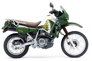
Kawasaki KLR 650

Kawasaki KLR 650

I have owned and ridden three motorcycles.  I like motorcycles. They are as close to flying as one can get on land.  There are challenges, such as trying to stay upright on two wheels. I know people who have never been down on their bikes.  I once fell over right by the front door of the biggest motorcycle accessory shop in Denver.  It trapped my leg and some guy had to lift it off me.  I bet he is still telling that story.

I have crashed on city streets, on a paved canyon road (sand), in parking lots, and an uncountable number of times in the dirt.  Two of my motorcycles were what is now called dual sport; they are able to be used on the street and in the dirt.  They aren’t top notch in either role, but some riders do things most people can’t imagine.  80 mph on the highway, and some challenging back country roads and trails.  Lots of good dual sport roads in Colorado, Utah, New Mexico, and Wyoming, where I traveled.

One of the best grew up riding on the streets of Mexico City, where you have to be good to survive.  I could keep up with him on the highway because we had the same bikes.  In the dirt, he could go places with that fairly heavy thing that I didn’t even dream of.  He and quite a few others have done 50 mountain passes in Colorado in 50 hours.  I am good for about six in a day, and hurt for two days. He also did a lot of single track trails, something I never attempted.

I liked road trips with some gravel or dirt roads thrown in.  Forest Service roads were about as gnarly as I wanted. On the asphalt, it was curves in canyons.  Fortunately, Colorado’s Front Range has lots of canyons.  There was a geological event that bumped the long bench from Conifer to its Estes Park.  That bench was once at Denver’s elevation, but got pooched up to where it is now.  We call the road the Peak to Peak Highway.

Golden Gate Canyon

Golden Gate Canyon

Go up any of the canyons from Deer Creek to the Big Thompson, ride those fast sweeping curves a ways, then down another canyon.  My favorite was Golden Gate Canyon, where I tore my posterior cruciate ligament when I hit some sand on the road.

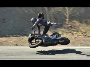
It’s the lean, folks.  Go around a curve on two wheels and you lean.  Go faster, lean more.  Go faster, and crash.  I went fairly slow for a motorcyclist.  I still got some lean, and was able to look at the geology.  A low side crash is when the bike slides out from under you and goes off the road ahead of you.

High Side Crash

High Side Crash

A high side crash is the bad one.  The front wheel starts to slide, then gets traction.  You are flipped off and into the air, while the bike bounces along behind until it lands on you.  Both are bad, but you really do not want to high side.  Some riders get flipped into the guardrail.  Ouch.

My knee wrecking crash was a low side.  My knee was bent, the tibia-fibula stopped on the pavement while the femur went a little farther.  It really hurt.  Hurt bad. I picked the bike up and rode on until I couldn’t stand the pain and called for help.

Aside from the crashes, I loved motorcycling.  Yes, it is dangerous.  Other drivers don’t see you and turn in front of you.  You crash all by yourself.  There is a famous twisty road in North Carolina where a biker went into the bushes. Just in front of him was another motorcycle with the remains of the rider.  He went into the bushes and nobody saw a thing.

Yamaha SR 400

Yamaha SR 400

I always wore all the protective gear.  Those Harley riders who won’t wear a helmet because their balls will protect them are nuts.  Mass delusion, those Harley people.

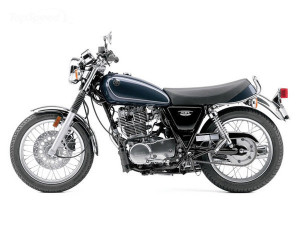
This spring I got the itch again.  Yamaha makes a single cylinder bike that looks a lot like the classic British thumpers from the 1950s.  It isn’t fast, but sure would be a good canyon bike.  Nah.  Too old and slow myself.  I guess I will stick to four wheeling.


Bears in Yellowstone

Scared Babies

Scared Babies

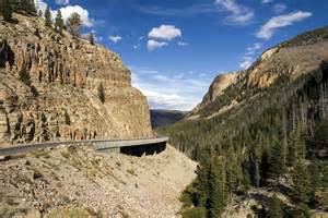
In the 1950’s there were lots of bears in Yellowstone National Park.  Despite warnings, people fed them, got out of their cars to photograph them, and listened to the campground garbage cans being raided.  I saw hundreds of bears in Yellowstone, but have seen only one in the wild elsewhere.

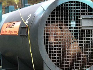
I was never in danger there, but did have a few experiences.  We traveled with a nineteen foot travel trailer, which made camping a lot easier.  On one trip we were in a campground near the Firehole River so my father could fly fish.  A sow and her two cubs had established residence close to all that food in the trash cans.  The Park Service decided it was dangerous to have them in the campground and decided to trap them.  The trap they used was mounted on a trailer.  It was made from a ten foot section of galvanized 48″ culvert, closed at one with a trap door at the other end.  They put bait up near the closed end with a trigger arrangement that closed the door when moved.

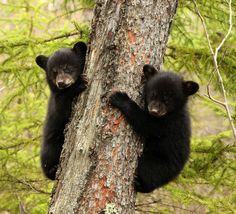
It worked.  It trapped mom, but the cubs were outside.  What a noise!  She sent the cubs up a tree and they cried.  Mom roared.  I don’t remember when she was trapped but it was still dark, and there was no more sleeping for anyone in the campground.  The Rangers showed up around 8:00 AM and stood around trying to decide what to do.  The usual procedure was to haul the bears to a remote area some distance from the capture point and release them there.

Bear in Trap

Bear in Trap

This would not work here, with two howling cubs up a tree.  Why hadn’t they thought of this beforehand?  Three bears making enough noise to be heard at Old Faithful and a couple dozen campers standing around watching the fun.  The Rangers thought about moving the trap across the creek and releasing her there.  Would she charge back on a rampage?  Would she stay there with two cubs across the creek afraid to come out of their tree?  Would she cross the creek, collect the kids send then go on a rampage?

The Rangers were reluctant to release her right there, afraid of a rampage.  Dilemma.  Lots of standing around and talking.  They finally chased all the campers away some distance away and let her loose.  She called the cubs out of the tree but they were reluctant and even noisier, then they came down, and all three left the campground in a hurry.  Everyone was relieved to not have a berserk bear in their midst.

1955 Nash

1955 Nash

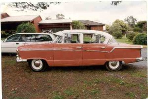
On another trip my friend Mike was along.  There was a bear visiting the campground each night.  My parents were in the trailer, and Mike and I slept on the reclining seats in the 1955 Nash (shudder).  We decided to leave the windows down and shoot the bear with our slingshots when he came around.

We had a metal cooler with lunch food that we kept in the car when traveling.  It was on the ground outside the car with good smells coming from it.  We slept, than something woke me up.  I heard something outside and poked Mike to wake him up.  We loaded our slingshots and looked out.  A BEAR!  Just out the window.  A big bear!  Never have hand cranked windows gone up so fast.  No shooting bears that night.

Backpacking in the San Juans

Getting Off at Needleton

Getting Off at Needleton

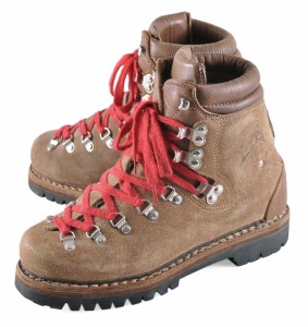
My backpacking days are over.  I’m old, I have a titanium knee, and I hurt in lots of places.  The inspiration for this piece is Reese Whitherspoon’s Wild.  The movie is about a woman who decided to pull her life together by backpacking the Pacific Crest Trail.  She did it and found herself on the way.  I didn’t find myself backpacking, but had some experiences that are still with me.  I even had some parallel experiences, the main one being: don’t go on a long backpack with boots that don’t fit unless you enjoy pain.

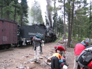
On a long trip through the San Juans, my boots were too small.  We took the narrow gauge train from Durango to Needleton, just a stop on the line halfway to Silverton.  We got quite a few looks from the flatland tourists as we got off for a trail into a canyon a long way from anywhere.  From the trailhead it was several uphill miles to Chicago Basin in the heart of the Needle Mountains, where we planned to spend some time.

Don't Buy Them Too Small

Don’t Buy Them Too Small

About halfway, we came across some guys helping their friend with a badly sprained ankle to get to the railhead.  He was in serious pain, unable to put any weight on his ankle.  His friends were looking pretty strained.  That first trail is where I began learning about my boots.  It was the seventies when you had to have those massive European climbing boots for a walk in City Park.    I think I spent something like $200.00 for them.  I was determined they would fit OK once they were broken in.  Hint: those things could be so worn out the soles are falling off, but they won’t be broken in.  There was only one thing to do, keep walking.

Chicago Basin

Chicago Basin

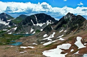
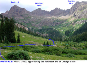
Chicago Basin was miraculous.  It is a large glacial basin ringed by mountains, three of them fourteeners.  Windom Peak, Sunlight Mountain, and Mt. Aeolus.  The area is full of thirteeners, not as famous, but challenging.  It is steep country.  Most of the San Juans are volcanic, but the Needles are the cores of ancient mountains, much older than the relatively recent volcanos.

In the 1970’s, the United States Geological Survey was changing from 15 minute topographical maps to 7 1/2 minute maps.  The map for the Needle Mountains was somewhat behind in the revisions.  It was published in 1900.  No color, no modern changes to man-made features, but still useful for navigation. 7 1/2 minutes is roughly 7 miles.  It is possible to walk through the area covered in one day.  The Needle map was 15 minutes with a note to add eight feet to each elevation.  No GPS in those days, just triangulating from one peak to another.

The Needle Mountains are one of the most remote mountain ranges in Colorado.  A big glacier once sat in that basin at the foot of those mountains and ground away for a long time.  There are lots of places in the Rocky Mountains with great views, and Chicago Basin is right up there.  The other good thing is that it is hard to get to.  Keeps the riffraff out.  We had the basin to ourselves, even during the backpacking boom.

Columbine Pass

Columbine Pass

As a bonus, the weather was good.  When it was time to leave, we thought a good breakfast was in order.  Pancakes and coffee.  Lots of both.  We struck camp and headed over Columbine Pass.  The trail switchbacks up that glaciated wall to a summit over twelve thousand feet high.  Hint number two: don’t climb a steep trail at high altitude with a stomach full of pancakes.  They didn’t feel like pancakes, they felt like lead in there.  I guess suffering is one of the aspects of backpacking.

The descent led us to Vallecito Creek, and a long hike to Vallecito Reservoir, where my father gave us a ride to the car in Durango.  Now, it is day hikes or four wheeling.  The knees are the first to go.

« Older Entries Recent Entries »