Category Archives: Colorado History

Breckenridge

Breckenridge

Breckenridge

Recently we spent a week in Breckenridge for a family celebration.  There were five of us in one big condo and two studios.  Late October is an interesting time in ski country.  The Quakies have shed their leaves and the only snow on the mountain is what they are making, or trying to make.  We thought the town would be pretty empty, but there crowds on the weekend, mostly from Denver. 

Summit County is one of my favorite mountain resort areas.  There are the old mining towns, Breckenridge, Dillon, and Frisco.  There are the three upstarts, Silverthorne , Copper Mountain, and Keystone, with old Montezuma a few miles up the Snake River.  The Blue River Valley is fairly large, and ringed by mountains.  The view is fine in any direction.  Our condo was just down from the lifts, so our view was east.  One night it snowed a couple of inches, so we got to see the transformation.   

Boreas Pass Road in Fall

Boreas Pass Road in Fall

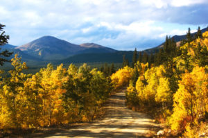
We could see the Boreas Pass road as it winds up the mountain.  It is the old railroad grade for the Denver, South Park, and Pacific.  Several of those narrow gauge railroads had grand ambitions, looking to the ocean.  The South Park, as people called it, never got past Crested Butte.   

The part we are interested in is the branch that ran from Como in South Park over the Continental Divide to Breckenridge, up the Snake to Montezuma, and up Tenmile Creek to Kokomo.  Kokomo was a silver mining town and now is buried under tailings from Climax.  On the Blue and Snake rivers it was gold.  East of the Snake near Silverthorne are sedimentary rocks, the same as exposed at Dinosaur Ridge in Denver, the difference being a four thousand feet elevation difference.  No gold there.   

Gold Dredge, This One at Fairplay

Gold Dredge, This One at Fairplay

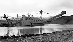
Most of the gold along the Blue River came from the Park Range, with Boreas and Hoosier Passes connecting Summit County with South Park.  Most of the gold from the Park Range came from placer mining, extracted from the gravels eroded from the mountains.  Placer mining started with gold pans, went to rockers and sluice boxes, and when mining became industrialized, big dredges excavated huge amounts of gravel, sluiced the finer dirt, sand, and gravel for the gold, and dumped the leftovers in the river.  The big rocks went out the back of the dredge, creating those huge boulder fields you see below Breckenridge and Fairplay.  Pristine mountain meadows were turned into barren rock fields.   

Above Breckenridge, some hydraulic mining went on.  Mountain streams were diverted into ditches and big canvas hoses with big nozzles. The mountainside was washed down into the sluice boxes for the gold, and everything else was dumped, creating more barren areas. 

Mining developed and scarred Colorado.  The new city of Denver produced much of the machinery making the scars.  The Tenmile range wasn’t heavily mineralized, so remained untouched for later ski area development and scars created by ski runs.  It was the Park Range holding the gold, much of it still there.  Where the Tenmile Range transitions into the Mosquito range, the mountains were again mineralized.  Gold, then silver at Leadville, Molybdenum at Climax (where I worked as a miner one summer), and lead, zinc, and copper most everywhere. 

Next, Leadville.

Rocky Flats

Rocky Flats

Rocky Flats

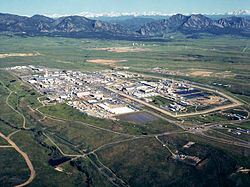
 What is now is the Rocky Flats National Wildlife Refuge once was the Rocky Flats Plant where triggers for nuclear weapons were manufactured.  The main raw ingredient for the triggers was plutonium, one of the most toxic and radioactive substances known, with a half-life of over 4000 years.  During the forty years the plant operated, there were two major fires in glove boxes where plutonium discs were handled.  In this and other incidents, many pounds of plutonium were released.  The Wikipedia article has an excellent summary and bibliography.   

I was talking to a woman recently about Rocky Flats.  Her father worked there for several years when the plant was in full operation.  He had to deal with a glove box where the plutonium had started to burn.  The gloves were so hot he had to wear other gloves before he could put his hands into the glove box gloves to stop the reaction.  He probably saved some lives.  He died of cancer. 

I became more interested in Rocky Flats after reading Full Body Burden, by Kristin Iverson, an English Professor who grew up in the area.  The book is controversial, disagreeing with the environmental assessments by the Colorado Department of Public Health and Environment and the Nuclear Regulatory Commission.  Given all I have read, I am skeptical of the official lint that the area is safe, and exposure to the public was and is minimal.  Decide for yourself. 

Iverson writes that a large area of contaminated topsoil was covered with more topsoil and pronounced safe.  Rocky Flats is aptly named, as millions of tons of glacial erosion products have covered the area with gravel.  The surface is called ground armor, mostly rock, as the high winds in the area have blown much of the finer material away.  That continues, and rodents burrowing bring buried soil to the surface where it blows into the Denver Metro area..  

The nearby Standley Lake, a large irrigation reservoir that provides water to Westminster and Broomfield, allows boating and water skiing but bans swimming because the lake bottom is contaminated with plutonium.  Many experts have advocated banning development in the area, but houses are going up. 

I got interested again recently because the NOAA National Weather Radar website is my go-to means of weather monitoring.  The TV weather people are either warning the apocalypse is imminent or it is fine, no rain, just before a major hailstorm.  Over a period of months I noticed a nearly constant radar image indicating precipitation over the NWR.  Day or night, weekends or weekdays, the image is there.  If it really is rain, the refuge would be a major swamp at the base of the Rocky Mountains.   

Many years ago I was a radar repairman in the Army.  One of the radars we maintained put out so much radio frequency energy it would kill birds flying in front.  We had quite a bit of training about ionizing radiation.  Radars emit radiation, so does decaying plutonium.  I could not come up with any explanation for the radar image other than radioactive decay.  This would be  disastrous, as much of the Denver metro area is downwind of Rocky Flats.   

I sent a number of emails to the NWS, TV stations, and the CDPHE.  I guess I stirred things up a bit, because I got a long, thoughtful letter from CDPHE outlining the investigation I generated.  The conclusion reached is that the radar image is from dust coming from a gravel mining and crushing operation just adjacent to the refuge.   Here is the letter:

Begin forwarded message:

From: “Spreng, Carl” <carl.spreng@state.co.us>
Date: July 13, 2016 at 3:56:58 PM MDT
To: levanks@me.com
Cc: Phillip Peterson – CDPHE <phillip.peterson@state.co.us>, Surovchak Scott <Scott.Surovchak@lm.doe.gov>, “Moritz, Vera” <Moritz.Vera@epa.gov>, Lindsay Masters – CDPHE <lindsay.masters@state.co.us>, Darr Bob <Bob.Darr@lm.doe.gov>, Rob Beierle – CDPHE <robert.beierle@state.co.us>, Smith Warren <warren.smith@state.co.us>
Subject: Rocky Flats

William Shanks

Mr. Shanks,

Your message sent to Phill Peterson in our Radiation Control Program was forwarded to me for response. I discussed your observations with a representative of NOAA. NOAA scientists apparently notice a fairly consistent dust cloud in the Rocky Flats area. This is consistent with the adjacent gravel operations — current and historic. You can observe the dust that rises off these operations as you drive by the site.
During remediation, the source areas of radiological risk in the Central Operable Unit (managed by the US Dept. of Energy) were excavated and shipped out of state. The human health risks inside the Central Operable Unit and the remainder of the site (managed as a refuge by the US Fish and Wildlife Service) were assessed following remediation and risks were found to be very low. A final decision for the site declared that any conceivable use would be appropriate in the Refuge area. That decision was based on an enormous amount of data (surface soil, subsurface soil, groundwater, surface water, air). After the remediation was completed, an aerial survey was conducted using a low-flying helicopter with detectors.
Offsite areas in the vicinity of Rocky Flats are also safe for any use. Numerous offsite surveys confirm the conclusion that only a few samples just east of Rocky Flats detected plutonium concentrations above background levels. You can read more information about the sampling on and around Rocky Flats on the Colorado Dept. of Public Health and Environment’s (CDPHE) web page at:  http://www.cdphe.state.co.us/hm/rf/index.htm.
 
Please contact us again if you have more questions.


Carl Spreng
P 303.692.3358  |  F 303.759.5355  |  C 303-328-7289
4300 Cherry Creek Drive S, Denver, CO  80246-1530
———- Forwarded message ———-
From: Carol Leavenworth <levanks@me.com>
Date: Tue, Jul 5, 2016 at 12:39 PM
Subject: Rocky Flats
To: phillip.peterson@state.co.us


Sir,
I notice there is a consistent radar image over the Rocky Flats NWR when viewing the NOAA national weather radar website.  I am no physicist, but ionizing radiation is detectable by radar.  Is this the case at Rocky Flats?  Is there a radiation hazard outside the closed zone?  Is there a public health risk for the nearby residential areas?I was a radar repairman in the Army in the 1960’s and remain interested in the field.  There weren’t many RF energy safeguards back then and there were nuclear weapons stored where I was stationed in Germany.
Thanks.
William Shanks
2032 S. Logan St.
Denver CO 80210
303-830-0599

After Cleanup

After Cleanup

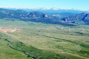
I was skeptical, so I drove out there.  I made a couple of circuits around the area, passing through new subdivisions where grading was going on and decided that was not the source.  I then turned off SH 93, the road from Golden to Boulder into what used to be the west gate to the bomb plant.  I went past lots of no trespassing signs to a big gravel mining and crushing operation.  The crusher was producing a significant dust cloud.  There were lots of big gravel trucks, indicating a major operation.    

I left without getting stopped for trespassing and made another lap around the refuge.  The gravel operation is to the southwest of the refuge, and I could see the dust cloud from north of the refuge.  Mystery solved.  it is not ionizing radiation creating the radar image, it is dust.  

There is no radioactive cloud coming off Rocky Flats.  There is, however, still a lot of radioactive and chemical pollution out there.  I suggest you not buy one of the nice new houses being built in the area..  

More on Discontent

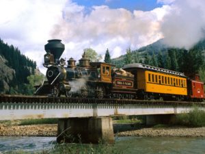
The Age of Steam

The Age of Steam

Our economy has been one of change since the beginning.  When the railroads came to Colorado in 1870, a lot of teamster jobs hauling freight from Omaha and Kansas City went away.  The automobile would not have happened without the new petroleum industry.  Coal retained its strength from powering locomotives, heating homes, and fueling industry.  Industry and manufacturing grew, making the American economy one of the largest in the world.

What a combination, land, natural resources, transportation, a growing population of people with ambition, mobility, and a willingness to try something new.  Some were left behind.  Native Americans, African Americans, and those new citizens in the Southwest who were once part of Mexico with its traditional ways.  As always, immigrants ended up at the bottom because of language and discrimination.

There were troubles.  Low wages, a turbulent labor history, drought, an unstable business cycle creating panics individuals were helpless to influence.  There were some adventures the government engaged in, such as Cuba, the Philippines China, Japan, all the trappings of empire.  In many ways the American West was an empire, won at the expense of those who were living there.

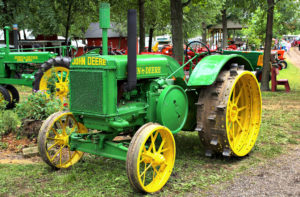
John Deere

John Deere

Agriculture was becoming more mechanized, displacing people who moved to the cities to work in industry.  All the change continues.  There is a tremendous amount of wealth in Silicon Valley, not so much in Michigan.

The West has been boom-bust from the start.  The fur trade collapsed, but the gold rushes started.  The government started giving land to the railroads and individuals.  The short grass prairie boomed with hopeful wheat growers, then the droughts came.  Oil and gas grew and grew, and grew.  As old fields played out, new oil fields were discovered.  A couple of big wars really heated things up.

It all looked great.  Yes, lots of change, but people could find good jobs and things steamed along.  The real upheavals were when the business cycle threw millions out of work.  The 1930’s were a terrible time, but a war healed all that.

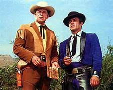
The West That Never Existed

The West That Never Existed

The 1950’s seemed like a golden age.  Lots of jobs, the U.S. Ruled much of the world, and television built a myth of stability, prosperity, and a bright future for everyone.  the myth came from relative prosperity and the ubitiquous westerns on television promoting a life that never existed.

The 1960’s brought social upheaval accompanied by a growing shift in how people made their living.  Steel mills closed, imported cars were on the roads, and computer-driven automation started taking industrial jobs.  The word Yuppie became a term of derision, but the Yuppies were the wave of the future.  They possessed education and a skill set many people could or would not obtain.

The skilled trades fell out of favor. It is college or else.  The trade jobs are filled the way they have always been filled, by immigrants.  This time however, the immigrants are not easily assimilated Europeans.  They are Latin, and and bring their culture with them.  Many are just not as interested in assimilating, and many are undocumented.

All this change leaves a huge segment of our society out of the good life.  Many are rural, where big mechanized farms haven taken jobs.  Many just do not have social and intellectual requirements to move into the new economy.  What’s left?  Low-paying service economy jobs, often for an out of date minimum wage inadequate for one person, let alone a family.  It is hard to build a life mowing lawns and doing kitchen work.  Much of the time jobs that used to be stepping stones have turned into dead ends.

The trouble is just beginning.  Those people marginalized by an economy where they don’t fit can be radicalized and turn to violence and terror or Donald Trump, which may be same thing.  The discontent is just not with the marginalized working class.  There are lots of well-educated people from middle class families making pizzas and living in their parents’ basement.  They thought they were doing the right thing going into debt to get an education and found nobody wants them.

This is still a rich country.  There is a huge imbalance in the distribution of wealth which has to change.  The change agent must be government.  A true progressive tax structure and an end to the massive influence of special interests in government are desperately needed.  The nation has the resources to provide everyone with an income providing them some dignity and the flexibility to enhance their station in life.  Given a decent income, most will seek ways to do even better.

We will always have the wealthy and the poor.  Now, there is too much concentrated wealth for a few and too many poor.  Trying to revert to an American utopia which never existed will only add to social instability.

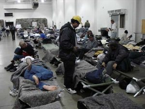
Happy Days Are Here Again

Happy Days Are Here Again

There should be no food banks or coat drives.  There should be no one sleeping on the streets.  People with mental health problems should not be cast out.  Everyone should have the time and resources available to build better lives for themselves rather than being trapped in poverty.

In other words, we need a new time of progressive change, not an attempt to return to a myth.  How to pay for it all?  A realistic progressive tax system to redistribute income.

Our Little Planet

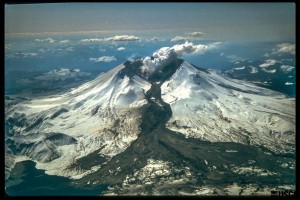
Mt. St. Helens showing a Lahar, a mud and ash flow that ran 50 miles downstream during the eruption.

Mt. St. Helens showing a Lahar, a mud and ash flow that ran 50 miles downstream during the eruption.

Stephen Hawking says we need to have to develop means to get off the planet when the Big One, whatever it is, is about to strike.  That is not terribly realistic, relocating several billion people to a place light-years away.  In other words, life on earth is toast.  Someday.In the meantime, life goes on.  It is spooky how we are fouling the planet.  We humans may create the need to get off this little ball without the means to do so.  In other words, life on earth is toast.  Sometime, maybe sooner.So, let’s deal with what we have while we can.  There are things we can do, but the means to act are part of a political process.  As long as politics is motivated by greed at the level it is currently, we are likely toast.  Maybe sooner.
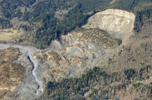
The cliff that collapsed into a massive mudslide is seen covered with felled trees in Oso, Washington March 31, 2014. Recovery teams struggling through thick mud up to their armpits and heavy downpours at the site of the devastating landslide in Washington state are facing yet another challenge - an unseen and potentially dangerous stew of toxic contaminants. REUTERS/Rick Wilking (UNITED STATES - Tags: DISASTER ENVIRONMENT) - RTR3JE4A

The cliff that collapsed into a massive mudslide is seen covered with felled trees in Oso, Washington March 31, 2014. Recovery teams struggling through thick mud up to their armpits and heavy downpours at the site of the devastating landslide in Washington state are facing yet another challenge – an unseen and potentially dangerous stew of toxic contaminants. REUTERS/Rick Wilking (UNITED STATES – Tags: DISASTER ENVIRONMENT) – RTR3JE4A

As individuals, we must do what we can, and get along with our lives.  We can help, and maybe stave off the inevitable to some degree.  We can respond to natural events.  Floods, earthquakes, tornados, landslides, hurricanes, those things we can react to and help.  We must do more than sit in the Lazy-Boy looking at the screen eating Doritos.  We can give money away, stir things up in meetings, vote, and give some time.

Well, we can do things until Yellowstone blows.  It is surprising how resilient humans are.  Ice ages, cataclysms, droughts, they may kill some and move others around, but the species has struggled on through it all.  We haven’t been around very long, however, and haven’t had to deal with any Really Big Ones in the blink of time we have been around.
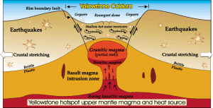
The Yellowstone Caldera

The Yellowstone Caldera

The Park Service says the Yellowstone super-volcano is pretty safe, that most eruptions are limited lava flows.  But, someday, it will be like the last big one that created a caldera almost as large as the park.  The Snake River Plain in Idaho with all those lava flows is the track of the Yellowstone hot spot as the North American Plate traveled west.  The plate moves at about the rate your fingernails grow.  As it moves, it erupts.  It just takes a while.

Hurricanes, tornadoes, floods, drought, all interest me, but I am most interested in geologic cataclysm.  One of my favorite potential geologic disasters is climate-related.  Years ago I read an article proposing that sea level rise could lead to the Gulf Stream moving over the continental shelf and invading the Arctic Ocean.  Europe would cool off with the loss of that warm water and the Arctic Ocean would thaw.  With all that open water in the north, evaporation would increase, snowfall would increase in the Arctic, precipitating a new ice age.

I haven’t seen much on that hypothesis lately.  Researchers seem to be concentrating on the rapid melting going on without Gulf Stream migrations, although the Gulf Stream does seem to be weakening.  There are just so many variables to consider.
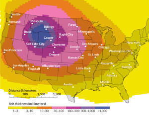
Ash From a Yellowstone Eruption

Ash From a Yellowstone Eruption

With respect to the Yellowstone super volcano exploding and killing most life in North America, there is only one variable: when.  A couple of years ago I was on a ramble in Wyoming.  Fort Laramie was my destination, but on the way I looked for the Oregon-California trail wagon ruts along the Platte outside Guernsey.  The ruts are dramatic, going up from the river bottom to some higher ground.  They are axle-deep in some tan colored rock that looks like sandstone at first glance.  It is volcanic tuff from the last time Yellowstone blew.  The layer is four or five feet deep about 200 miles from Yellowstone.  That is a lot of stuff blown into the atmosphere.  All that material along with the CO2 and SO2 would kill most everything for many hundreds of miles.

The most recent volcanic eruption in Colorado was about 4500 years ago at Dotsero.  The entire San Juan mountain range is volcanic.  Huerfano Butte near Walsenberg is a volcanic neck.  There are eroded lava flows on Trail Ridge Road in Rocky Mountain National Park.  There are lots of hot springs in Colorado.  Where is all that heat coming from?  Will the Glenwood Hot Springs Pool erupt?  Will Steamboat Springs’ boiler explode?

Landslides.  There is even one not far from Fruita on I-70.  Debeque canyon on the Colorado River is famous landslide country.  That landslide that killed three men outside Collbran last year is the same geologically.  Green Mountain in Lakewood has a landslide that destroyed several houses.  The Vail/Eagle River valley is good landslide country.  All it takes is a lot of moisture in spring. The canyons incising the front range are landslide prone.  All that rock will eventually find its way to Louisiana as mud.

The upside of all that landslide country is that it gives geologists and earthmoving contractors work.

There is a radioactive isotope of radon gas that is common in some of our Colorado rocks that houses are built on.  Basements become carcinogenic.  There is an anthropomorphic cause of radioactive basements as well.  In Grand Junction, uranium mill tailings were used as backfill around basements is some subdivisions.  More work for geologists, and a Superfund site.
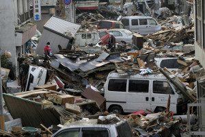
Debris is strewn over an area affected by an earthquake and tsunami in Miyako, Iwate Prefecture, March 14, 2011. REUTERS/Aly Song (JAPAN - Tags: DISASTER ENVIRONMENT)

Debris is strewn over an area affected by an earthquake and tsunami in Miyako, Iwate Prefecture, March 14, 2011. REUTERS/Aly Song (JAPAN – Tags: DISASTER ENVIRONMENT)

Earthquakes.  Again two causes, natural and human-caused.  All those earthquakes in Texas and Oklahoma caused by injecting fracking water back underground have a Colorado history.  Rocky Mountain Arsenal outside Denver was used to manufacture poison gas for military use and later poison gas for agriculture.  They pumped a lot of the toxic wastewater down wells and set off earthquakes.  They stopped that.  The oil companies are not stopping.  Yet.

Colorado is earthquake country.  Making mountains, shoving rock around to make room for more rock shakes things up.  The Flatirons outside Boulder used to be flat.  North and South Table mountains are capped with basalt from lava flows.  These processes are still going on in lots of places.

The Rio Grande Rift is a Rift Valley stretching from Southern New Mexico to north of Leadville.  The earth is pulling apart.  Look at the San Luis valley, that is a lot of pulling.  It is still going on, but slowly in human terms.  There will be earthquakes.  The biggest quake-causing fault near Denver is the Golden Fault, formed when the Rockies were uplifted.  That uplift has happened about three times.  The mountains come up, get eroded down, come up again, get eroded again.  Will it happen again?  There seems to be some weakness in the crust around here.
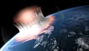
What the Meteor Looked Like Impacting off Yucutan

What the Meteor Looked Like Impacting off Yucutan

There are asteroids out there that have orbits that coincide with the earth’s orbit.  It has happened before, could again.  I saw Charlie Rose interviewing Neil DeGrasse Tyson, and he mentioned the possibility.  We have the technology to deal with the the threat, but it will take a lot of money and cooperation.  Will it happen before we need it?  Will it be too late when the danger is imminent?  Ask a Republican.  I hope you sleep well tonight.


Rock and Roll in the Sticks

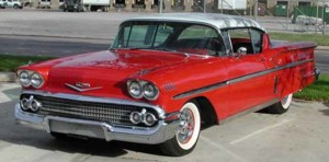
1958 Chevy

1958 Chevy

Western Colorado in the late 1950s and 1960s was a cultural backwater of the first magnitude.  I-70 did not exist, making travel to Denver at least two hours longer than now.  In Grand Junction, there was one television station and two radio stations.  The Junction had the Daily Sentinel newspaper, and Fruita had the Fruita Times, a weekly with stories about the bridge club.

Things were on the move in the land.  Rock and Roll had appeared, but not in our neck of the desert.  The only contact we had was the Ed Sullivan Show, which introduced Elvis to the world.   The local radio stations weren’t interested.  They were making money playing Patti Page, the Andrews Sisters, and Doris Day.  The raciest they got was letting Johnny Ray cry.

At first, we found Lucky Lager Dance Time on KNBC in San Francisco, but you needed a good radio, and there better not be any lightning between the Junction and California.  Then, salvation!  KOMA!  As soon as the sun was down, KOMA boomed in from Oklahoma City.  Rock and Roll ruled the sticks.  And the sticks were extensive.  KOMA dominated Oklahoma, New Mexico, Rural Colorado, Kansas, Nebraska, South Dakota, Wyoming, and neighboring boondocks.

That radio station was our lifeline to the rock and roll youth culture developing in the country.  This was not the Beatles and the Stones.  It was Buddy Holly, Elvis, the Everly Brothers, all those Phil Spector bands, and some R&B, like Chuck Berry and Little Richard.   KOMA was top 40, no obscure bands, just the big stuff.  Yes, there was country and western, and Grand Junction even got a station later, but country was mostly confined to the pool halls and beer joints around 1960.

There was the KOMA band circuit.  There were several rock and roll bands that traveled the region, playing in small town Grange Halls, Legion Halls; anywhere the band could rent a hall.  Sterling, Roswell, Scott’s Bluff, Colby, Torrington, Hot Springs, Alliance, Garden City, Trinidad, all those little towns starved for anything from the outside world.  The only band on the circuit I remember was Spider and the Crabs.  They advertised their gigs on KOMA and kids came to the dances from all over.  KOMA made money from the ads, and bad rock and roll ruled the boondocks.

Several of us would buy a case of Coors bottles, go to Grand Junction, listen to KOMA, cruise all evening drinking beer, and throw the empty bottles at highway signs on the way back to Fruita.

Was that youth misspent?  No, not at all.  I am writing about it now, aren’t I?  Rock and Roll survived, and all was well until the mid-1960s. Here’s to KOMA in Oklahoma!  The station is still in business, still playing rock and roll.

Nuking Western Colorado

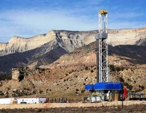
Gas-rigcolorado

In the late 1960’s and early 1970’s, Project Plowshare, a U.S. government program was created to develop peaceful uses for nuclear detonations. The program led to three trials in rural Western Colorado designed to release natural gas from tight geologic formations that contained large amounts of natural gas.  The gas was there, but was difficult to recover because it would not readily flow to wells.  Nuclear fracking, in other words.

The idea was to fracture large amounts of rock releasing the gas for use. Fracking was in use in that era, but the area fractured around a well hole was fairly small, limiting the amount of gas freed.  This would remain the case until horizontal well drilling was developed, resulting in a boom in natural gas production.

The use of atomic explosions somewhat larger than the one that destroyed Hiroshima would fracture a large amount of rock, liberating huge amounts of gas.  There were three experiments.  All three were somewhat successful, yielding gas in recoverable amounts.  Big surprise, the gas was radioactive and remains so.  A study indicated that the level of radioactivity released in a California home, when blended with gas from other sources, would be well below the dose we receive from background radiation. People would have none of it.  No one wanted radioactive natural gas coming into their home at any level.

Western Colorado, source of much of the uranium used in nuclear bombs, had three detonations in a doomed experiment.  The most casual of examinations of the proposal to liberate gas from tight strata would raise the radioactivity question.  It took millions of dollars to prove the obvious: radioactive natural gas.

Some shots were done at the Nevada test site to explore using bombs to excavate.  Huge amounts of radionuclides were released, affecting generations of downwinders, especially in St. George, Utah.  Our nuclear tragedy started in New Mexico with the first Trinity detonation that led to Hiroshima and Nagasaki.  It continues today, with all the radioactive spots around the planet and the people sickened and killed by fallout.

Most historians assert that President Truman’s decision to bomb Hiroshima and Nagasaki ultimately saved lives.  What they did do was trigger the nuclear arms race with its terrible consequences.  Chernobyl and Three Mile Island have shown that nuclear power is risky as well.

My first literary effort was a story I wrote while a student at Mesa College in Grand Junction, Colorado in 1966.  Project Rulison was in the works, and my story depicted an even greater failure.  The blast sent radioactive oil into a previously unknown aquifer that opened into the irrigation canals that provide water to Grand Valley farms.  Radioactive oil in Palisade, Grand Junction, Fruita, and the rest of the valley, rendering it uninhabitable.  Pure fiction, but a fun story.

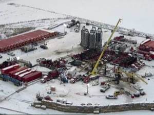
FrackingSite_1415936638313_9585695_ver1_0_640_480Come up to today, and fracking is still controversial. I think the legacy of Project Rulison is stalking the oil and gas industry to this day.  Somehow the industry did not get it that bad practices will catch up with them, despite the API’s slick commercials.

Part Three, the Keystone XL Pipeline

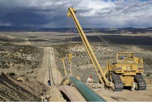
Pipeline Construction

Pipeline Construction

When I was growing up in Fruita, Colorado in the 1950’s, the El Paso Natural Gas Company built a 26″ natural gas pipeline from north to south through Western Colorado. In flat country, laying a pipe is fairly straightforward.  To lay a pipeline, dig, lay pipe, weld, wrap, and backfill.  In the Colorado Plateau, the pipeline not only goes from point to point, it goes up and down.

North of Fruita, The line had to go over Douglas Pass. As Colorado passes go, it is no big deal.   Not that high, but near the top there is steep and unstable ground famous for landslides.  The trenchers, welding machines, side-boom tractors handling pipe, and bulldozers; all had to be winched up and down the mountainside.  That is a slow, expensive process. To us in Fruita, it meant that our little town had lots of pipeliners for several weeks.

I mostly saw the pipeliners in Hill’s Cafe, where we often had dinner. The stereotype is that pipeliners are a wild bunch, but we didn’t see it in the cafe.  They were quiet, well-behaved, some prayed before eating, and I liked them.  After all, if you are from Bald Knob, Arkansas, how wild can you be?

That pipeline brings gas from Wyoming, Western Colorado, and Eastern Utah to markets in Texas and the southwest, including California. To my knowledge, it has few problems and quietly does its job.  I think that pipeline has shaped my thinking about pipelines in general.

Today there is much oil and gas development in North Dakota and Alberta. A pipeline network exists to deliver crude oil from there to the refinery complex on the Gulf Coast.  It can’t deliver all that is being produced.  Proposed is a new line, the Keystone XL Pipeline that would run west of the existing line, picking up crude from the Williston Basin in North Dakota as well as the synthetic crude from the Alberta tar sands.

There is a lot of opposition for several reasons. One reason is fear of leaks.  Big spills, contamination, fire, ground water contamination, and all the risks that go with moving lots of nasty stuff that burns.  That Alberta synthetic crude is even nastier than regular crude.  Its carbon footprint is much higher than oil from traditional sources.  It is thick and has to be heated to separate it from the sand.  Most of the crude oil refined here in Denver is tar sand oil.

Oil Car Train

Oil Car Train

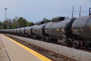
The fact is that as long as demand for petroleum products stays high, that Alberta crude will go south, but in rail cars if the pipeline isn’t built.  Here in Denver, there are many tank car trains headed south, competing with coal trains for right of way.   In the upper Midwest there is so much oil traffic that farmers are having difficulty shipping their grain.  Pipelines are safer than rail cars for shipping petroleum.

Some of the opposition is for environmental reasons. Tar sand crude is bad.  Pipelines are bad.  Fossil fuel is bad.  All true.  The solution is not stopping pipelines, but reducing demand.  How to reduce demand?  Make fossil fuels more expensive with higher taxes.  Use the tax money to develop alternative energy and transportation.  Build rails not freeways.  Tell that to Republican legislators.

In the meantime, I think the pipeline is the best alternative until our energy policies change.

Pearl Pass Part One

Road to Ashcroft

Road to Ashcroft

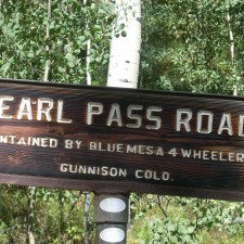
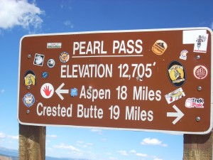
On Wednesday, September 3, I drove over Pearl Pass.  Pearl is one of those four wheeling trips that have been on my list for a long time.  My grandmother, Pearl Willits Shanks, drove a team and wagon over the pass when the Willits family moved from north Texas to Colorado in 1887.  Pearl was 12 when she drove over the pass.  She may have been a Texas girl before Pearl Pass, but she was a mountain girl after that.

The road was built as a toll road in the early 1880’s from the railhead in Crested Butte to the newly discovered silver mining area in Aspen.  It was in use until the railroads came to Aspen in the late 1880’s.  The main use was hauling coal from mines at Crested Butte to Aspen.

Today the road is much like it was in the nineteenth century.  From the start of the four wheel drive portion until it drops into the valley on the Crested Butte side it has no dirt, just rock.

Pearl Pass

The Bad Ledge

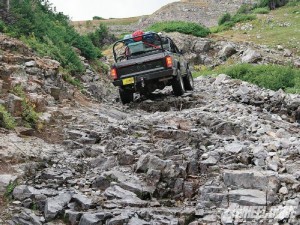
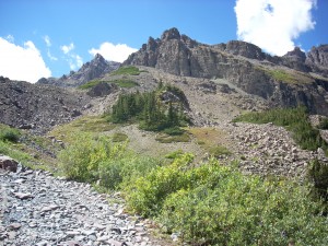
Fist sized rocks, baby head sized rocks, rock ledges, big rocks in narrow places, and big rocks in the middle of the road. One can grow tired of rock.

It is also narrow, made for wagons a long time ago.  There is no room for error. In reading about the pass, most of the reports involving trouble were where a vehicle got too far to the side.  When that happens, there better be good help available, because it is a long way to the bottom if the vehicle rolls over.

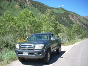
I was able to drive over all those rocks with no real damage to my Toyota Tacoma other than losing a mudflap.  The forest ranger had suggested a Jeep Rubicon.  I find my Toyota does just fine, although I may add a limited slip differential someday.

The Road and a View

The Road and a View

At the Summit

At the Summit

This is probably the most difficult road I have driven.  Steep, narrow, and did I mention rocky? I will do it again.  The history is important to me, the story of my family.  I spent the afternoon on that road marveling that a 12 year old girl from flat Texas could marshal the courage to drive a wagon over that hill.

I don’t know how long the entire trip from Crested Butte to Ashcroft, 10 miles from Aspen, took the Willits family.  I do know that they misjudged the time it would take to get over the highest part and did not get off the hill into Ashcroft until 11:00 PM.

That road is scary enough in daylight.  At night?  It is good that horses are better at seeing at night than we are.  Once I got down into the timber on the Crested Butte side, the alternating sunlight and shadow made it hard to see any serious obstacles. I can just imagine what Pearl was feeling.

I have given you some history and road condition information about Pearl Pass.  My next piece will be about the other big attractions.  The Elk Mountains that the pass traverses are some of the most spectacular and geologically unique mountains in Colorado.  Next time.

Geology on The Highway of Legends

Spanish Peaks and a Dike

Spanish Peaks and a Dike

I went on a tour of Southern Colorado’s Highway of Legends with a group from Colorado’s Cherokee Trail chapter of the Oregon California Trail Association. Berl Meyer, our chapter president, summers in Cotopaxi, on the Arkansas River.  He rambles around Colorado looking at the geology and the mountains.  He is from Kentucky, so has a need to get away from relentless green.

Berl organized the trip, having us meet in La Veta.  For me the trip had two segments.   Colorado geology is one of my interests, and the Highway of Legends country has some world famous geology.

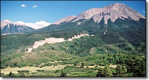
The Spanish Peaks south of La Veta, are relatively recent (geologically) igneous intrusions that rise to over 12,000 feet in elevation.  Located fairly far east for the Rockies, they served as important landmarks for early explorers and travelers.  When the intrusions barged in, they bulged and fractured the existing rock layers, and a series of vertical dikes radiate from the mountains.

Cucharas Pass is between the Spanish Peaks and the Sangre de Cristo mountains.  At 9,995 feet, it is another lovely Colorado mountain pass.  There are lots of dikes, and on the south side of the pass is Stonewall, at first look another dike, but this feature is a vertical wall of Dakota sandstone, pushed on edge by the Spanish Peaks uplift.

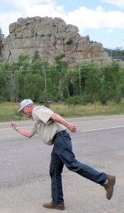
???????????????????????We had a startling encounter at Stonewall.  We had stopped for a break and to look the stone wall over when we had a visit from a Greek god.  Most people don’t know, but the gods are still with us.  They travel the world keeping track of events and people.  This particular Greek god is one of the lesser ones, namely Hermes’ great uncle.  The photo shows him as he was leaving.

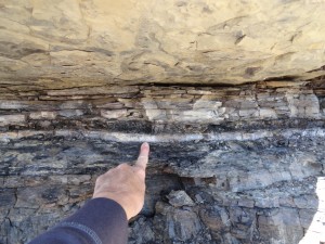
The road then enters the coal country west of Trinidad.  There is lots of history in that area, and a world famous geological feature.  On the road to Trinidad Lake just outside Trinidad is  an exposure of the K-P (formerly K-T) boundary that marks the end of the Mesozoic era and the beginning of the Cenozoic, or modern era.  It is called the K-P because it is the boundary between the Cretaceous period and the Paleogene period.  Below the boundary, dinosaurs.  Above the boundary, no dinosaurs.K-T Boundary

The boundary is a narrow band of whitish clay that fell when an asteroid struck off Yucatan and threw a tremendous cloud of material into the atmosphere, blocking the sun and cooling the entire planet.  75% of life on earth perished, including the dinosaurs.  In a road cut on the way to the lake you can put your hand on the boundary.

There are exposures in many places around the world, including North Table Mountain in Golden, but this one is the most accessible.  I have wanted to go there for a long time.

We went to the San Luis Valley, over La Veta Pass from La Veta.  The valley is our own rift valley, formed as the movement of the Pacific tectonic plate drags some of the North American plate north.  The motion pulls things apart, and a big block subsided, forming the rift valley.  The Arkansas River north of Poncha Pass and the Rio Grande River mark the rift. (Real geologists, including Berl, don’t get the vapors at this explanation.)

Great Sand Dunes

Great Sand Dunes

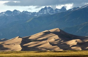
On the east side of the San Luis Valley is The Great Sand Dunes National Park, another world famous geological feature.  The sand for the dunes comes from the San Juan Mountains to the west.  Normally, the sand would just keep going, blown over the Sangres to the plains farther east.  In this case, a creek picks up the sand blown off the dunes and carries it back to the other side, replenishing them every spring.  The result is a mammoth dune field, good for viewing, climbing, and tumbling down.  The creek is good for play as long as it lasts into the summer.

Good geology, good scenery, and a good time.  The geology is not a legend, however.  It is the real thing, and students from geology departments all over the country visit and study in Colorado.


Colorado’s Front Range Floods

2013 flood

2013 Flood

Those of us who live along the eastern base of the Rocky Mountains enjoy a unique set of circumstances; a fine climate, mountain views, a mountain playground, and rivers that provide much of our water needs.  There are millions of people living in an urban area that runs from Pueblo to Fort Collins.

Most of the time, the physical setting and the climate combine to make the Front Range a fine place to live.  There is risk, however.  Most of the time we don’t have quite enough water for every need. The people are along the Front Range, and the water is on the western slope.  On occasion, we have way too much water.  We are subject to drought, our own waste of the water we have, and the floods that come out of the mountain canyons.

To understand these problems requires a look at two histories, the Rocky Mountain history for the last 75 million years and human history from 1859.  Around 75 million years ago the Rockies began to form.  As they grew, they also wore down.  The debris from the mountains spread from their base to as far as Nebraska.

The streams were bigger then.  Drive east to Bijou Creek and see the valley that obviously was not formed by the current flow in the creek.  The wind blew.  It still does, leaving eolian sand deposits.  Sand Creek, draining the area east through Stapleton and into Aurora is appropriately named.  You can identify the sand hills – they are grazing land, not good for farming.  That sand and dirt comes from as far as Utah and coats our cars.


Today, the Rockies are not eroding as fast as they did during the ice ages, but they are still coming down.  Back in the Precambrian when I took geology, the assumption was that erosion was a steady, gradual process.  Taking the long view, that is so, but on a human time scale, erosion is punctuated by periodic floods.  Some of the floods are from spring runoff from wet winters.  The catastrophic floods pound out of the canyons when storms park themselves over an area and it rains.  And rains.  Sometimes it rains more in a few hours than it does in several normal years.  Sometimes the rain is where the people are, just east of the mountains.

Large amounts of moist monsoonal air from the Gulf of Mexico move north along the Rockies and encounter a cold front coming from the west.  Sometimes the rains are short in a fairly small area.  At other times, as in 2013, the rain comes down over a large area, and it rains for days. To humans, these storms seem like unusual events, but they have been happening for millions of years.  Along with normal erosion, they have filled the Denver Basin with 13,000 feet of debris.  That is a lot of rocks and mud.


1864__Cherry-Creek-Flood~p1

1864 Cherry Creek Flood

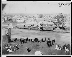
One of the first recorded monsoonal floods was in 1864, not long after Denver was settled.  Cheyenne and Arapaho Indians told the settlers seeking fortune not to build where Cherry Creek and the South Platte meet.  The town builders built there anyway.  It was a logical town site.  Trails met, grass, trees, and water were available, and the gold-rich mountains just a short distance away.  Much of the new town went downstream.


The town was rebuilt in the same place.  Floods came again.  Denver flooded in 1876, 1885, 1894, 1912, 1921, 1933, and 1965.  Pueblo flooded in 1921, the Big Thompson in 1976, Manitou Springs and Colorado Springs in 2013, and much of the Front Range from Denver to Fort Collins in 2013.  The link is from the Atlantic Monthly, with dramatic images from the 2013 flooding.

Most vulnerable are towns at the base of the mountains: Manitou Springs, Palmer Lake, Morrison, Golden, Boulder, Lyons, Loveland, and Fort Collins.  Towns along the South Platte, St. Vrain, Cache La Poudre, and Big Thompson rivers are at special risk.

DSCN0960

Jamestown 2014

Will people stop building there?  Rebuilding is underway in every area flooded in 2013.  While researching this piece I traveled to Boulder, Jamestown, Lyons, and the farmland along the St Vrain.   I saw travel trailers parked nest to damaged homes with building permits on the flood-damaged houses.

Some actions do prevent floods.  Denver has Cherry Creek, Bear Creek, and Chatfield dams.  They are flood control dams designed to capture floodwaters.  Let’s hope they are big enough.

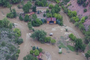
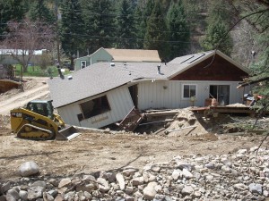
The photo above has a lot of rock in the foreground.  The rocks range in size from sand and silt to head size.  They were exposed by the 2013 flood, but were deposited by a previous flood that had enough force to carry that debris and dump it there.  upstream, there are narrow gulches with the lower ends scoured down to bedrock.  That debris went further downstream.

The Rocky Mountains are on the way to the Mississippi river delta in Louisiana.  It will take many millions of years, but they will wear down and become Mississippi mud.  Floods will hasten the process.