Backpacking
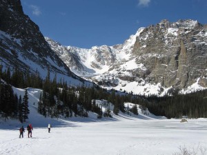
Back in the 1970’s and 1980’s I did a fair amount of backpacking. I have stumbled around in mountains, up 14000 foot mountains, in the heat of desert summer, and in winter. I suffered, limped, ate bad food, and drank bad water. There was joy, serenity, fear, and awe. I can’t backpack now, old and with knee and back problems. The memories of those trips will be with me always. There is more satisfaction in accomplishing something that took a lot of work. The most work was carrying a loaded pack up Mount Princeton and slogging through two feet of fresh spring snow in Loch Vale, Rocky Mountain National Park. Those winter backpacks have additional challenges. It is dark for a long time and it is cold out there. The bladder just does not respect any difficulties in getting it drained. How long can you lay there before struggling out of that warm sleeping bag, covering the feet, donning a coat, and stumbling outside.
In Loch Vale it snowed a lot of heavy wet snow. We knocked snow off the tent and listened to the snow slides run. We had made camp in the dark and didn’t know if we were in a slide area or not. I guess we weren’t. It was still snowing without much visibility when we headed for the car. We made a wrong turn and went down a steep gulch. Have you ever tried to sidehill in two feet of fresh snow, hardpack underneath, with snowshoes? At one point I just flopped down in the snow and laid there for a while.
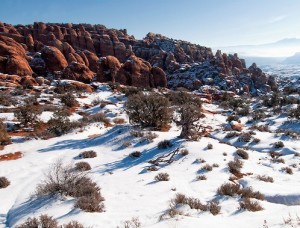
The best winter trip was in the Fiery Furnace, Arches National Park, in February. Clear weather, no snow, and no one else there. If you haven’t been to the fiery furnace, go. There are hoops to jump through with the Park Service these days but it is worth it. Don’t go in summer. Another good trip on snowshoes was a spring trip on Grand Mesa. Longer days, no one around, but the snowmobiles had made a packed trail for us.
North Park is a big, mostly empty place where the North Platte starts its journey north. The east side has the Rawah Wilderness, while the south rim has the Mt. Zirkle Wilderness. The Zirkle trip was a lot of fun with good people, but the Rawah trip was something of an adventure. We went with another couple for a several day trip, starting from the Laramie River road north of Cameron Pass. My wife at the time and I had gained some backpacking experience and were fairly confident in the boonies.
One of the other couple had gone to the National Outdoor Leadership School in Lander. She was not just a convert to the NOLS way, she was an evangelist. NOLS is a highly respected organization, but Paul Petzolt, the founder had strong opinions about wilderness behavior and equipment. Most of his ideas have become mainstream, such as Leave No Trace. His ideas about equipment, however, were a bit old-fashioned (He was in the 10th Mountain Division in WWII.). The equipment was good, but heavier than what people were using thirty years later.
We met several times with them to plan the trip and make up meals. Most of the food was light weight, but from the grocery store, not the freeze dried stuff. It meant a lot of measuring, mixing, and packaging. One of the lunch items was what was a precursor of Power Bars. Peanut butter, fruit and nuts, oatmeal, and other stuff I don’t remember. We rolled them into cylinders that looked exactly like turds. They didn’t taste like that, but I have never had them since. I think they were a NOLS idea. The other part of those meetings was listening to NOLS stories, and how the school made the graduates wilderness experts. We heard a lot of stories. I shudder every time I am near Lander.
Almost all backpacks in Colorado start with a climb. We started at roughly 8000 feet elevation and made camp just below timberline, which is usually around 11000 feet high. A good hard climb with a pack on your back. We made camp, and our NOLS wilderness expert went right to bed with altitude sickness. She was fine the next morning, and we heard no more about NOLS. Sometimes altitude sickness can be a blessing.
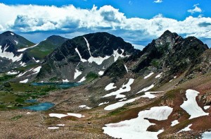
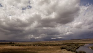
The Rawahs are a long ridge with several peaks in the 12000 feet range. One day we climbed to the top of the ridge. A fine view, with North Park below, and the mountains of the Continental Divide to the south, and with the Zirkle across the park. We didn’t stay long. A huge thunderstorm was headed our way across North Park. We left in a hurry. We didn’t make it to timberline before the storm hit. If you want to experience terror, be in a lightning storm with no place to hide. Lightning was striking all around us and the noise, with nothing but rock to reflect the sound from the crashes. The wisdom is to crouch down in a bit of a low spot. We ran. I guess we made it. Another time I will write about desert trips. My favorite part of the world is the Colorado Plateau, probably because I was born there. The two most memorable experiences of all were snow in Loch Vale and lightning in the Rawahs.
