The Empty Quarter
Well, its not a quarter of Colorado, but it’s big and pretty empty. North and west of the Colorado River and south and west of the Yampa River, the only towns of any size are Rifle, Silt, Newcastle, and Glenwood Springs along the Colorado; and Meeker in the middle. Craig and Hayden are on the Yampa. I don’t count Rangely on the White River west of Meeker as a real town. It is just a bunch of oil field junk with a few forlorn people. I recently traveled through the heart of the region.
I am a Western Slope native, so I have been over the relatively well traveled roads. I-70 (previously highways 6&24) and SH 13 from Rifle to Craig. As a kid, I went fishing on Rifle Creek with my parents. The
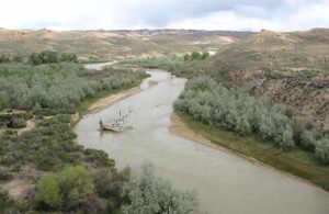
White River drains the White River Plateau and The Flattops. Piceance Creek drains the Piceance Basin and enters the White between Meeker and Rangely.
Meeker is a pretty town in the valley of the White River. It’s a farm and ranch town with a sad past. The Meeker Massacre in 1879 was the end of the Utes huge reservation lands in Western Colorado. They were shipped to Eastern Utah. The reason was the systematic U.S. Policy of cooping the Indians up or killing them. There are grisly details, but it was just another example of the U.S. Policy of mistreating Native Americans that continues to this day.
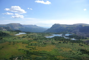
Maybe you have heard of Trappers Lake. It is an enclave surrounded by the Flattops Wilderness, a huge area of timberland dotted with many small lakes. The only access is on horseback or backpacking. It’s wet country, catching the storms as they leave the lower country to the west. Hunters, fishermen, and tree huggers are the only travelers.
I never backpacked there, but two friends humped there way in years ago. They talked about the beauty, but mostly about the rain. One of them had one of those convoluted open foam pads with no cover. When the water came into the tent, he was lying on a sponge in a soaked down sleeping bag. They left early.
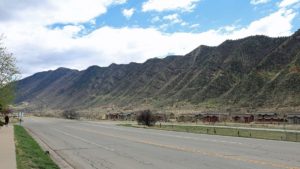
West of SH 13, along the Grand Hogback,
you are on the Colorado Plateau. Go east, and you are in the Rocky Mountains, but not the Rockies you are used to. The hogback is a remnant of the uplift that formed the Rockies. The equivalent on the east side are those red rock hogbacks called the Flatirons, Red Rocks, and the Garden of the Gods.
No big mountains here, just a region of high plateaus. The reason? Volcanism in the form of lava flows. The White River Plateau was uplifted along with the rest of the Rockies, but instead of being eroded into those jagged peaks we are used to seeing, the basalt from the lava flows formed a resistant, flat caprock. It’s not rugged mountains, but it has a beauty all it’s own.
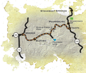
The is a scenic byway between Meeker and Yampa I took for the first time, At first, it is in the White River valley, then climbs up on the plateau and heads on east to Yampa. The view to the south is where the Flattops drop down to the river. It’s not a gentle slope. The basalt caprock is underlain by the soft White River Formation. The steep slope is subject to landslides, leaving large open, green slopes surrounded by timber. It’s great summer range country for sheep and cattle. It is also some of the prettiest country in our state. I think I met two pickups on the road east of Buford, where the road turns off to Trappers Lake. It’s gravel much of the way, but good gravel.
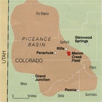
West of SH 13, on the edge of the Colorado Plateau, is the huge Piceance Basin. It is a Structural basin next door to the Uinta Basin, mostly in Utah. The basins are separated by the Douglas Arch, crossed by Douglas Pass, country where I spent a lot of time in my youth. The arch is a western extension of the Laramide Orogeny, the mountain building period that formed the Rocky Mountains. The edges of mountain ranges usually have foreland basins, areas of subsidence. I am sitting over the Denver Basin. The Piceance is the equivalent west of the mountains. As the mountains rose, the fringes sank, creating huge synclines filled with the erosion products of the mountains. The basins formed huge inland lakes which filled with sediment that became the Green River Formation, famous for its fossils and oil shale.
Because of all that rising and sinking, pockets form, trapping reservoirs of gas and oil. The Piceance is one of the most productive natural gas fields in the country. Rangely’s oil is also from the Piceance. I drove the road running along Piceance Creek, which drains the basin to the west. The area is all about natural gas, with some ranching along the creek. There is a gas plant every few miles, and lots of truck traffic. The basin used to be the home of a huge migratory deer herd, the deer summering in the Flattops and wintering in the basin. The herd is still there, but all the drilling has greatly reduced the numbers. Lots of elk there as well, their numbers increasing somewhat, probably due to less competition from deer.
The area is known as the Roan Plateau, which drops off to the Book Cliffs, an escarpment runnng from Palisade, CO to well past Greenriver UT. It feels like home country to me, with memories of deer hunting in the Douglas pass area. The scenery isn’t as dramatic as the red rock country to the south, but has its own beauty. Plus, it isn’t as cluttered up with people.
Piceance, Uinta, Roan Plateau, Book Cliffs, all names for roughly the same country. My list now includes going up into the basin proper, known mostly by Ute Indians, ranchers, oil field people, geologists, and aging wanderers.
