Tag Archives: Geology

John McPhee

John McPhee is my favorite writer.  He writes nonfiction for the New Yorker and has done so for fifty years.  He writes about whatever he wants to.  Alaska, the Pine Barrens, oranges, geology, transportation, and people.  Always, a topic is people.  He decides on a subject and searches out people engaged in his topic and weaves them into the narrative.

I read his stuff because of his subject matter (he has written extensively about geology).  He also has a warm and engaging style, his readers all fall in love with him.  The subject matter is always interesting, often because the people he seeks out are so colorful.

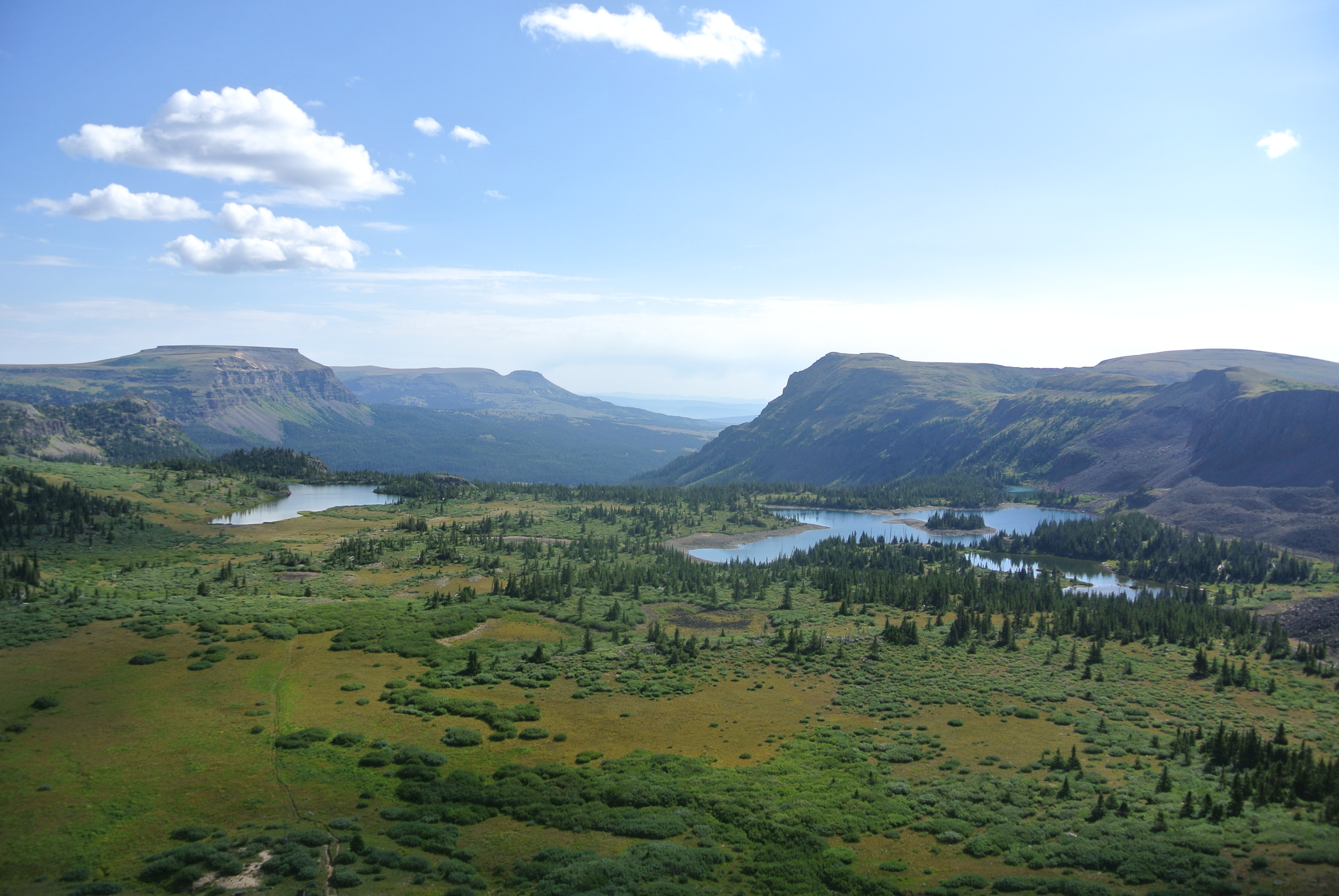
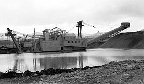
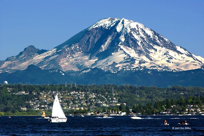
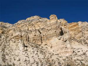
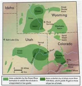
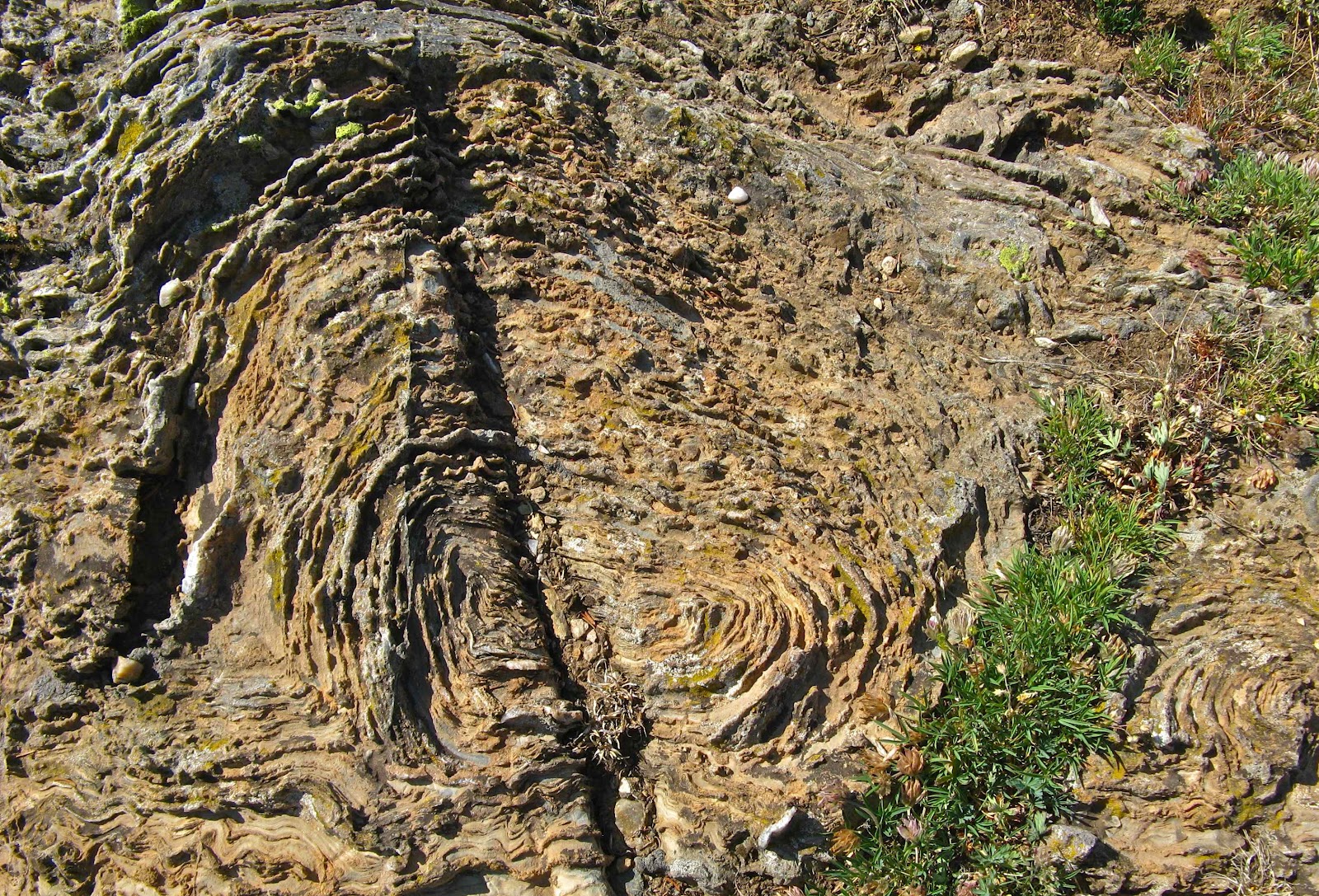
In Rising From the Plains, about Wyoming geology, McPhee found David Love, a USGS geologist from Laramie.  Gone now, Dr. Love was a renowned field geologist, focusing on Wyoming.  His  family is an integral part of Wyoming history.  His father started and ran a sheep outfit on Muskrat Creek in the Gas Hills, one of the most remote places in the lower forty eight.

The way McPhee portrays the man, his career, and Wyoming history makes one of the best books I have ever reread.  And reread, and give away.  If you have even the slightest interest in geology, read the book.  Rising From the Plains is a standalone book, and is part of Annals of the Former World, a collection of long pieces about geology mostly along I-80, skipping over the midwestern mud.  North America has fascinating geology and Annals gives a good overview.

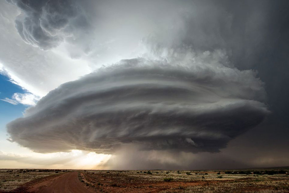
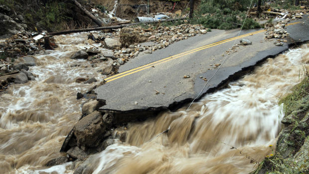
Another book I like is The Control of Nature.  If you want to modify what nature produces, you get politicians to adopt the policy, then hire engineers to figure out what to do, then design the solution.  Sometimes they are asked to do the impossible, like keeping the eroding San Gabriel mountains from filling the Los Angeles Basin or control the lower Mississippi River.  Ask an engineer if something can be done and their answer is always “Yes.”  They make their money building stuff.  They may need lots of money, all the better.  Many of their projects fail at some time.  Don’t move to Morgan City, Louisiana.

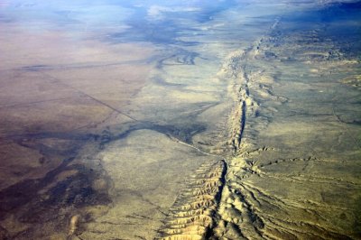
McPhee has a wide range of interests.  He takes his storytelling skills to The Swiss army, to Loch Ness, to the Illinois River, California earthquake country, Alaska, and my least favorite book about a fish called shad. I read the book, but I still don’t care about the clammy, bony, tasteless things.  Not biased, though.

He is well into his eighties, and now writes mostly about writing.  His method is a complex blend of research, note taking, and building a structure to hold the piece together.  He is a real structure freak.  I have an idea, think about it a bit, and rip something out, editing as I go.  Of course he is producing around 50,000 words.  I do 500 to a thousand.  I have a structure as well, as I also learned how make outlines.  I tend to adapt the Army way: tell them what you are going to tell them, tell them, and then tell them what you told them.  I like to introduce the subject, amplify it, then add my personal take.

Unlike McPhee, I tend to drift off topic into a rant or something mostly unrelated, but I like it.  “Oh look, a squirrel!”  Have I mentioned I have ADD?  I sometimes tend to bullshit; McPhee does not.  He has his extensive research and those wonderful New Yorker fact checkers.  I have my broken brain and Google.

Other McPhee assets are his sense of humor and his feel for dialect.  He is easy to read.

The Empty Quarter

Portion of Flat Tops Wilderness

Well, its not a quarter of Colorado, but it’s big and pretty empty.  North and west of the Colorado River and south and west of the Yampa River, the only towns of any size are Rifle, Silt, Newcastle, and Glenwood Springs along the Colorado; and Meeker in the middle.  Craig and Hayden are on the  Yampa.  I don’t count Rangely on the White River west of  Meeker as a real town.  It is just a bunch of oil field junk with a few forlorn people. I recently traveled through the heart of the region.

I am a Western Slope native, so I have been over the relatively well traveled roads.  I-70 (previously highways 6&24) and SH 13 from Rifle to Craig.  As a kid, I went fishing on Rifle Creek with my parents.  The

White River

White River drains the White River Plateau and The Flattops.  Piceance Creek drains the Piceance Basin and enters the White between Meeker and Rangely.

Meeker is a pretty town in the valley of the White River.  It’s a farm and ranch town with a sad past.  The Meeker Massacre in 1879 was the end of the Utes huge reservation  lands in Western Colorado. They were shipped to Eastern Utah.  The reason was the systematic U.S. Policy of cooping the Indians up or killing them.  There are grisly details, but it was just another example of the U.S. Policy of mistreating Native Americans that continues to this day.

Maybe you have heard of Trappers Lake.  It is an enclave surrounded by the Flattops Wilderness, a huge area of timberland dotted with many small lakes.  The only access is on horseback or backpacking.  It’s wet country, catching the storms as they leave the lower country to the west.  Hunters, fishermen, and tree huggers are the only travelers.

I never backpacked there, but two friends humped there way in years ago.  They talked about the beauty,  but mostly about the rain.  One of them had one of those convoluted open foam pads with no cover.  When the water came into the tent, he was lying on a sponge in a soaked down sleeping bag.  They left early.

West of SH 13, along the Grand Hogback,

Grand Hogback Between the Colorado Plateau and the Rocky Mountains

you are on the Colorado Plateau.  Go east, and you are in the Rocky Mountains, but not the Rockies you are used to.  The hogback is a remnant of the uplift that formed the Rockies.  The equivalent on the east side are those red rock hogbacks called the Flatirons, Red Rocks, and the Garden of the Gods.

No big mountains here, just a region of high plateaus.  The reason? Volcanism in the form of lava flows.  The White River Plateau was uplifted along with the rest of the Rockies, but instead of being eroded into those jagged peaks we are used to seeing, the basalt from the lava flows formed a resistant, flat caprock.  It’s not rugged mountains, but it has a beauty all it’s own.

Flat Tops Trail

The is a scenic byway between Meeker and Yampa I took for the first time,  At first, it is in the White River valley, then climbs up on the plateau and heads on east to Yampa.  The view to the south is where the Flattops drop down to the river.  It’s not a gentle slope.  The basalt caprock is underlain by the soft White River Formation.  The steep slope is subject to landslides, leaving large open, green slopes surrounded by timber.  It’s great summer range country for sheep and cattle.  It is also some of the prettiest country in our state.  I think I met two pickups on the road east of Buford, where the road turns off to Trappers Lake.  It’s gravel much of the way, but good gravel.

West of SH 13, on the edge of the Colorado Plateau, is the huge Piceance Basin.  It is a Structural basin next door to the Uinta Basin, mostly in Utah.  The basins are separated by the Douglas Arch, crossed by Douglas Pass, country where I spent a lot of time in my youth.  The arch is a western extension of the Laramide Orogeny, the mountain building period that formed the Rocky Mountains.  The edges of mountain ranges usually have foreland basins, areas of subsidence.   I am sitting over the Denver Basin.  The Piceance is the equivalent west of the mountains.  As the mountains rose, the fringes sank, creating huge synclines filled with the erosion products of the mountains.    The basins formed huge inland lakes which filled with sediment that became the Green River Formation, famous for its fossils and oil shale.

The Greater Piceance Basin

Because of all that rising and sinking, pockets form, trapping reservoirs of gas and oil.  The Piceance is one of the most productive natural gas fields in the country.  Rangely’s oil is also from the Piceance.  I drove the road running along Piceance Creek, which drains the basin to the west.  The area is all about natural gas, with some ranching along the creek.  There is a gas plant every few miles, and lots of truck traffic.  The basin used to be the home of a huge migratory deer herd, the deer summering in the Flattops and wintering in the basin.  The herd is still there, but all the drilling has greatly reduced the numbers.  Lots of elk there as well, their numbers increasing somewhat, probably due to less competition from deer.

The area is known as the Roan Plateau, which drops off to the Book Cliffs, an escarpment runnng from Palisade, CO to well past Greenriver UT.  It feels like home country to me, with memories of deer hunting in the Douglas pass area.  The scenery isn’t as dramatic as the red rock country to the south, but has its own beauty.  Plus, it isn’t as cluttered up with people.

Piceance, Uinta, Roan Plateau, Book Cliffs, all names for roughly the same country.  My list now includes going up into the basin proper, known mostly by Ute Indians, ranchers, oil field people, geologists, and aging wanderers.

Politicians, Geologists, Engineers, and Water

Mosul Dam

Mosul Dam

This story relies on a report by Dexter Filkins in the New Yorker magazine.  Mr. Filkins,  a Pulitzer Prize winner, is one of the best writers covering the Middle East. 

The Fertile Crescent, where civilization developed, exists because the Tigris and Euphrates rivers flow from mountains in Lebanon and Turkey to the Red Sea.  The terrain along and between the rivers is relatively flat making agriculture feasible.  The rivers flood every spring, bringing water and new sediment to the region.  Those conditions support a significant population, but annual fluctuations have always created problems for the people living there.  During drought years, crops fail and famines ensue.  Wet years bring flooding which displaces people and affects farming.   

These conditions prevail in every arid region dependent on irrigation for farming.  The Nile, the Fertile Crescent, and the Colorado river are prime examples.  In all three regions, the political system has chosen to attempt to regulate the annual fluctuations in the river.  The solution?  Dam the river, store water for dry years and catch excessive runoff in wet years.   

Glen Canyon Dam and Hoover Dam on the Colorado,  Aswan High dam on the Nile, and the Mosul dam on the Tigris are the attempts at a solution.  So, they decide on a dam upstream of the people, hire geologists to recommend a good location, and hire engineers to design and build the thing. 

This worked, to a degree, on the Colorado and the Nile.  Not so well on the Tigris.  The geology above Mosul with its 2.5 million people is a jumble of sedimentary rocks formed in conditions similar to today.  That means flat coastal areas are intermittently flooded by the sea or nearby rivers.  The water evaporates, leaving the minerals dissolved in the water.  That means salt, gypsum, limestone, and a mixture of soluble minerals and mud called marl.   

The layers are deposited in flat layers, but Middle East geology is like Middle East politics, a big jumble with forces pushing from several directions.  Above Mosul, it is quite a jumble, but sinkholes have always formed as water dissolves the soluble minerals, leaving voids that collapse.  It is called Karst topography.  Florida is a prime example, a limestone peninsula in a wet climate surrounded by water.  It rains, the water sinks in,  dissolves the limestone, and goes to the sea.  Florida is dissolving, the rock resembling a sponge.   

The rock above Mosul has both limestone and gypsum.  Gypsum is a sulfate mineral that is called plaster if pretty dry, wallboard if more hydrated, goo if very wet, and then dissolves.  The geologists said “No, no dam, it will fail”.  The politicians then talked to the engineers who said “it isn’t good to build here, but we can make it work”. 

Now, engineers make their money by designing and building stuff, whether asphalt, steel, concrete, earth, or software.  They seldom say “no, we can’t do that”. They would be breaking their rice bowl.  So they proposed grouting the rock below and under the dam with concrete to keep reservoir water from dissolving all that gypsum, which is much more soluble than limestone.  They built a grout curtain under the Dam site, but it wasn’t perfect.  There were gaps. They built the dam, and the increased pressure from the water in the reservoir started dissolving the gypsum at a higher rate.   

Sinkholes developed below the dam before it was built.  They put a big long room made of concrete called a gallery at the base of earthfill dam.  Where their tests show a void is developing, they drill a hole in the floor of the gallery.  Water shoots out, confirming there is a big hole down there.  They then use big pumps to pump grout into the hole until it stops, hoping the void is filled.  They then move to the next place. 

This has been going on since the dam was built in the 1980’s.  All that concrete pumped below the dam has not stopped the leakage, it just moves the leaks to another weak spot.  They will never be able to pump enough grout.  An Italian firm is there now, and they are a bit hopeful they can control the leaks.  The confounding variable is the political situation.  ISIS controlled the dam for a while, and grouting mostly halted, but void creation did not.  The battle lines of the war today are within earshot of the dam.  The Iraqi government is unstable, despite support from shifting coalitions.  The grouting program is at risk.  Maybe that doesn’t matter.  The dam will fail, we just don’t know when.   

Sixty feet of water will inundate Mosul.  Refugee camps with 1.2 million people will be affected.  In two days parts of Baghdad would be under sixteen feet of water. Downstream, an even wider area would be flooded with at least six inches of water.  As geologists always say, “It’s not a matter of if, but when.”  Death toll estimates range from 500,000 to 1.5 million souls.  The Iraqi economy will be destroyed.  Moral, listen to the geologists.

Climate Change

Florida Flooding

Florida Flooding

Here it is, the last day of November, and we still have some tomatoes from our garden.  We had the hard freeze a couple of weeks ago, but we brought quite a few in before it froze.  This fall has been the fall of pasta sauce and tomato soup.  Traditionally the first freeze is in September or early October.  Not this year.  Now, just because we have one warm fall doesn’t necessarily mean global warming, it is a matter of relatively long term trends.  That is happening, folks.   

Worldwide, it is about one degree Celsius and climbing.  The culprit is carbon.  We need carbon, our bodies are mostly water, but carbon hangs everything together.  Florida, for example, is mostly calcium carbonate, limestone.  The limestone formed even the peninsula was underwater with a climate encouraging the growth of untold billions of tiny organisms with calcium carbonate shells.  They die, and if whales don’t eat them, their shells sink to the sea floor.  Well, even if they do get eaten, the whale turds are calcareous.   

Porous Limestone

Porous Limestone

Millions of years and sea level change, and Florida emerges.  The cycle doesn’t end there.  It rains on Florida, and the slightly acidic rain starts dissolving the limestone, sending the carbonates back to the sea.  Enough of the limestone has dissolved to make the peninsula a honeycomb.  Sinkholes, underground rivers, high tides bringing ocean water inland and flooding streets in  Broward county.  The southern part of the state is headed back underwater.   The really big deal is that sea level is rising.   

I have given an example of the carbonate cycle, which is going on worldwide.  The other cycle going on is the water cycle.  Our planet is delicately balanced in temperature around the freezing point of water.  The water evaporates, and if it is cool enough, some of it falls as snow and accumulates, mostly in the polar regions.  At times the ice forming from all that snow has made it as far as Central Park in New York,  that is a lot of water tied up on land.  Sea level drops, and Florida emerges.  

Currently, the cycle is going the opposite direction.  The ice is melting, and the process seems to be accelerating.  Why?  Carbon.  Here in Denver, I see huge coal trains hauling coal south to be burned to run air conditioners in Texas.  The coal, carbon, is ripped from the ground where it has lain for millions of years, mostly dead plant life converted into coal.  It is burned, sending carbon into the atmosphere.  I drove here to the coffee shop burning gasoline, which comes from oil made deep underground from what once were living organisms.  The carbon goes into the air, the climate changes due to human activity.  We are in a new epoch, the Anthropocene.

Elemental carbon is fairly rare.  Diamonds, graphite.  Carbon likes to combine with other stuff to make, well, us and other living things.  That carbon gets sequestered in the earth, reducing the amount of carbon available to make new stuff.  There is a cyclical balance, dependent on worldwide temperature and, lately, us.  We burn carbon based fuels and the carbon dioxide goes into the atmosphere.   

The sun shines, warming everything up.  A lot of that heat gets radiated back into space, maintaining a balance favorable to life.  When that radiant heat meets a CO2 molecule, it warms the molecule.  More carbon, more heat in the atmosphere.  That’s greenhouse gas doing its thing.  The global climate warms up, making some regions wetter, some more dry.  We have gotten used to having a relatively stable climate, and we adapt to it in many ways.   

When the rain and snow fall changes, our adaptations stop working so well.  This is especially important in coastal regions, because all that polar ice starts melting and sea level rises.  Most of the population lives near the coast.  With the coasts moving inland, the people and all their stuff will have to move as well.  Battery Park at the southern tip of Manhattan gets flooded in big storms.  The subway tunnels flood, and people have trouble getting around.  The time is coming when they will be living in central New Jersey.  The horror. 

There are lots of people denying all this, saying it is just the normal weather cycle.  That is true, but it is a new normal, and is changing.   What to do? Stop putting so much carbon into the air and start putting it back into the earth.   That means big change in the way we do things, and those getting rich on the status quo don’t want their businesses upset.   Oil and coal, mostly, but they drive all of our economy.  So, they say it isn’t so, and let’s burn, burn, burn.   

What goes around comes around.  It is just a matter of time.

Breckenridge

Breckenridge

Breckenridge

Recently we spent a week in Breckenridge for a family celebration.  There were five of us in one big condo and two studios.  Late October is an interesting time in ski country.  The Quakies have shed their leaves and the only snow on the mountain is what they are making, or trying to make.  We thought the town would be pretty empty, but there crowds on the weekend, mostly from Denver. 

Summit County is one of my favorite mountain resort areas.  There are the old mining towns, Breckenridge, Dillon, and Frisco.  There are the three upstarts, Silverthorne , Copper Mountain, and Keystone, with old Montezuma a few miles up the Snake River.  The Blue River Valley is fairly large, and ringed by mountains.  The view is fine in any direction.  Our condo was just down from the lifts, so our view was east.  One night it snowed a couple of inches, so we got to see the transformation.   

Boreas Pass Road in Fall

Boreas Pass Road in Fall

We could see the Boreas Pass road as it winds up the mountain.  It is the old railroad grade for the Denver, South Park, and Pacific.  Several of those narrow gauge railroads had grand ambitions, looking to the ocean.  The South Park, as people called it, never got past Crested Butte.   

The part we are interested in is the branch that ran from Como in South Park over the Continental Divide to Breckenridge, up the Snake to Montezuma, and up Tenmile Creek to Kokomo.  Kokomo was a silver mining town and now is buried under tailings from Climax.  On the Blue and Snake rivers it was gold.  East of the Snake near Silverthorne are sedimentary rocks, the same as exposed at Dinosaur Ridge in Denver, the difference being a four thousand feet elevation difference.  No gold there.   

Gold Dredge, This One at Fairplay

Gold Dredge, This One at Fairplay

Most of the gold along the Blue River came from the Park Range, with Boreas and Hoosier Passes connecting Summit County with South Park.  Most of the gold from the Park Range came from placer mining, extracted from the gravels eroded from the mountains.  Placer mining started with gold pans, went to rockers and sluice boxes, and when mining became industrialized, big dredges excavated huge amounts of gravel, sluiced the finer dirt, sand, and gravel for the gold, and dumped the leftovers in the river.  The big rocks went out the back of the dredge, creating those huge boulder fields you see below Breckenridge and Fairplay.  Pristine mountain meadows were turned into barren rock fields.   

Above Breckenridge, some hydraulic mining went on.  Mountain streams were diverted into ditches and big canvas hoses with big nozzles. The mountainside was washed down into the sluice boxes for the gold, and everything else was dumped, creating more barren areas. 

Mining developed and scarred Colorado.  The new city of Denver produced much of the machinery making the scars.  The Tenmile range wasn’t heavily mineralized, so remained untouched for later ski area development and scars created by ski runs.  It was the Park Range holding the gold, much of it still there.  Where the Tenmile Range transitions into the Mosquito range, the mountains were again mineralized.  Gold, then silver at Leadville, Molybdenum at Climax (where I worked as a miner one summer), and lead, zinc, and copper most everywhere. 

Next, Leadville.

Arkose, Sand, and Loess

Geologists like to give common things fancy names.  Aeolian Deposition means wind-blown stuff from the mountains on the land.  Here in Eastern Colorado the South Platte and the Arkansas Rivers are in the process of hauling everything to the Mississippi Delta.  This is kind of a slow process, but a lot of stuff is already there.  Lots more is on the way.   

The material coming off the mountains is in three general categories: gravel, sand and dirt.  The stuff gets deposited, may get buried long enough to form rock (Castle Rock), but most of it sits around for a while, maybe millions of years, before it is washed into the streams and heads east. 

Castle Rock

Castle Rock

Along the base of the mountains are two kinds of deposits.  As the Rockies were rising, they eroded almost as fast.  Out mountains are mostly the roots of what was once there.  During wet periods, like when glaciers were melting, the chunks coming down were pretty angular.  The geologists call the deposits arkosic.  The Castle Rock Conglomerate is a good example.  At other times the erosion was so rapid that a mixture of angular rock and rounded river gravel were deposited together.  Rocky Flats between Golden and Boulder is an example.   

There are huge gravel deposits at the mouths of the many canyons emptying onto the flatter land where all the people live today.  Boulder didn’t get its name by accident.  I briefly worked for the telephone company in Boulder.  I was on a crew burying telephone cable in new subdivisions.  I ran a backhoe and a cable plow, a small bulldozer with a ripping tooth in back digging down about thirty inches and paying telephone cable out the back of the tooth (or plow).  In some places, we had to bring in a big D8 Caterpillar dozer with the power to rip through all the hard packed gravel so my little John Deere 450 dozer could do its job.  It’s sort of a Mini Cooper versus a Hummer. 

All those lakes you see near all the streams exiting the mountains are old gravel pits converted into water storage reservoirs.  You can find gravel in the South Platte River bottom in Nebraska that came out of the Rockies.  As the gravel is carried along, it erodes from angular pieces to progressively more rounded rocks, eventually becoming sand, clay, or just plain dirt. 

The flat country at the base of the Rockies is a patchwork of older rocks exposed by erosion, gravels and arkose near the mountains, then lots of sand, then dirt farther out.  A geologic map shows the patchwork.  Nature is relentless in its processes, but they are not uniform. 

Denver's Sand Creek

Denver’s Sand Creek

Eastern Colorado has several Sand Creeks, carrying the sand that blew out onto the flats to the South Platte or the Arkansas.  You can identify the sand deposits in Eastern Colorado because they are cow country, not suitable for farming.  My favorite Sand Creek runs from northern Aurora through some of the old Stapleton Airport property and on west to the Platte.  The Bluff Lake Nature Center can give you a good look at the sand and the loess.  Bluff lake itself is down along Sand Creek where you can play in the sand.  The trail leading down to the creek and lake drops down the bluff from the parking lot.  The bluff is loess.   

Bluff at Bluff Lake Nature Center. Loess

Bluff at Bluff Lake Nature Center. Loess

Under most of the eastern plains is the Pierre Shale or the Ogalla Formation.  The shale can be farmed, and the Ogalla holds all that rapidly diminishing irrigation water.  The surface is mostly stuff the wind blew in.  The dirt the wind carries is called loess, a German word.  The soil is fine, and in some places can be hundreds of feet thick.  That dust on your car after it sits out in Denver?  It will either be Mississippi mud or loess.  Well, even the loess will be mud someday, it is just being delayed for a while.

Dirty Denver

Windstorm

Windstorm

The wind blows here in Denver, and it is not all air.  Those mountains just west of us are wearing down.  Most of the sand and dirt ends up in the rivers, put the wind blows some of the mountains away.  If you park your car outside, you already know this.  The dust covers everything on the car, and you have to wash the damn thing.  Mostly the dust is that tan/brown dirt color, but sometimes it is red when parts of Utah decide to take a visit.

The constant deposition of wind-blown dirt is why ancient cities get buried.  The process is slow, but relentless.  Denver is being buried, but we haul a lot of it away.  Our older house has what seems to be sunken sidewalks.  It is the wind- blown dust combined with organic matter (grass clippings) to form topsoil.

Carol likes to say that a lot of the stuff that accumulates is spider legs.  True, along with the exoskeletons of millions of insects.  In geologic terms the rate of deposition of all that stuff is fairly rapid.

Here on Colorado’s Front Range we get wind, but nothing like the mountain winds, unless you live in Boulder or other places at the foot of the mountains.  The mountains are high enough to get some of the higher altitude winds that the flatlands don’t get much of.  Also, when a weather system blows in, the mountains act as a barrier, forcing all that moving air up.  As it rises, it cools, gets more dense, and descends on the lee side of the mountains. As it falls, it gains velocity and tends to warm up, creating our famous chinook winds.

Loess Soil Windblown Dirt

Loess Soil
Windblown Dirt

As the wind moves on the plains, it’s velocity decreases and some of the dirt it carries falls out.  Close to the mountains, a lot of it is sand.  That explains the sand hills we have close to the mountains.  You can identify the sand because it does not support plant growth as well as soil.  Sandy areas are cow country, no farming.  A little farther east, the dirt falls down.  A lot of dirt falls down, forming loess, a German term for wind-blown dirt deposits.  Eastern Colorado has thousands of square miles of loess.  Without irrigation, it is usually planted in wheat.

Of course, all the water or wind-borne sediment is headed for Mississippi, Lousiana, or the gulf.  Most of that Mississippi mud will end up as shale.  At some point plate tectonics will shove it up as dry land and the cycle starts over.  Most of the sand will eventually end up in the streams, get buried, and form sandstone like the Dakota sandstone dinosaur fossils are found in.  In other places, tremendous deposits of wind blown sand accumulate, eventually forming the sandstone that blankets the Colorado Plateau.

That dirt accumulating in your lawn and garden is part of a recycling process going on all over our planet for millions of years.  The process will continue long after we are all gone, as long as there is air and water on the planet.  To me, the whole thing is a miracle, all these geologic processes creating conditions existing long enough for the evolutionary mistake known as humanity to develop.

Shaking and Baking

As you are aware if you are a regular reader of my ravings, I am a geology buff.  I like the Big Picture, mid-ocean rifts and rises, tectonic plates shoving one another around, places where the hot insides spout out of the ground, mountains rising and being worn away, and the oceans becoming ever more salty.  Most of the time, all this is a slow process, but sometimes all hell breaks loose.   

San Andreas Fault

San Andreas Fault

Just look at that photo of the San Andreas Fault.  Things are clearly on the move and the land is being torn apart.  The Pacific Plate is sliding northward along the North American Plate.  Pasadena will one day be next to Anchorage.  Don’t wait up for it, though.  The Pacific coast of North America is one of the most seismically active regions on the Ring of Fire surrounding the Pacific Ocean.  It shakes, it blows, it smokes, it flows.   

Places like that make nice places to live.  Most of the time.  There is the ocean, lots of pretty landscapes with beautiful mountains nearby,  and places to grow things.  Just look at the Seattle-Tacoma area.  Bays, inlets, rivers, islands, and a big old mountain to look at.  It is easy to forget that mountain is a large volcano just biding it’s time until it lets loose again.  

Mount Rainier. Close to Town

Mount Rainier. Close to Town

If Rainier resembles Mt. St. Helens in the way it erupts, there might be some warning.  What we won’t know is how big, exactly when, and for how long.  There is a lot going on in that area.  Boeing, Microsoft, REI, millions of people, and Starbucks are a few examples.  If a swarm of magnitude four earthquakes begin, what to do?  Shut everything down and evacuate?  Where will everyone go?  What about looting and plundering?  What if it doesn’t erupt for months, if ever?   

Pyroclastic flows of very hot, wet, chunky stuff have flowed off that mountain all the way to the ocean.  The old cliche says “It is not if, but when.”  We just do not know when.  So, life along the Pacific Rim is always something of a gamble.  I have felt small earthquakes and looked into the crater of a Volcano in Costa Rica, a lovely, green, paradise.  Earthquakes destroy roads and railroads, volcanos bury villages, and life goes on.   

Irazu, Costa Rica

Irazu, Costa Rica

Small, poor Costa Rica is one thing, the Seattle-Tacoma area, or Los Angeles, or Portland, or Eugene, or San Francisco are entirely different matters.  No amount of preparation can take into account all the things which might happen.  Prediction is in its infancy.  Mt. St. Helens in hindsight gave lots of warning, but the disaster was huge in a relatively isolated area.  When Rainier or Mt. Hood let go the disaster will be in a heavily populated area with just a few ways out. 

Currently there are lots of earthquakes in the oil field regions of Texas, Oklahoma, and surrounding areas.  I wouldn’t worry too much if I lived there, the odds of a Big One are fairly small.  St. Louis and Salt Lake are at more risk.  The West Coast is the big danger zone.  The earth will keep moving, the plates will continue to slide.  Eruptions and quakes will continue to happen.  My solution?  Don’t live there.  What is your plan?

rat in cage two bottles

The World Famous Green River Formation, for oil shale, not beauty

The World Famous Green River Formation, for oil shale, not beauty

About fifty million years ago the Grand Canyon and the Colorado River did not exist.  The area was surrounded by the Wind River Mountains, the Uintah Mountains, the San Juans, the Uncompahgre Plateau, and the newly formed Rocky Mountains.  This huge area had no outlet to the sea.  The climate was similar to our current Gulf Coast, warm and moist.  During the six million years we are exploring, things changed.  Lakes formed and receded, land rose and subsided, and through all this the surrounding highlands were sending their sediment into the lakes.   

The Green River Formation is the result of all the sedimentation.  It is up to ten kilometers in depth, thinner at the margins.  At first the lakes were fresh water, but later became saline, leaving large deposits of carbonate rocks.  The trona deposits at Green River, Wyoming are some of the richest in the world.  The margins are sandstone and conglomerate interlaced with the fine silt that filled most of the basin.  The formation is rich in the fossils of the abundant life in the lakes.  They are world famous for their variety and abundance.   

There was an anoxic layer at the bottom that preserved the organisms settling there.  The lakes were abundant in blue-green algae.  The remains of the algae are the source of the oil shale deposits the region is known for.  The oil shale is there in millions of barrels, but it is expensive to extract the petroleum from the rock.  It may never be commercially viable, but the formation has been extensively studied as a result.  

Green River Formation Map

Green River Formation Map

Standing in my home town of Fruita looking north, the white cliffs behind the Book Cliffs are the Green River Formation.  The Roan Plateau is huge, but does not attract visitors like the red rock country to the south.  A huge exposure is the highlands west of I-70 from Rifle to DeBeque Canyon. 

My interest is from visiting ranchers and hunting in the Douglas Pass area in my youth.  Most of our visits were to ranches in the Green River Formation.  The elevations varied greatly.  The ranches were along West Salt Creek, but there were back country roads that went from sagebrush desert to piñon-juniper to oak brush shaly hillsides with sandstone rims to high country timber with world class mud.  In fact, the mud is world class everywhere in the region. 

Back before four wheel drive became common, there was a pile of rocks at the bottom of every big hill.  Load them in the back of your pickup, go where you planned, and unload them on the way home.  There is a network of canyons with side canyons branching off.  All of it is fine deer habitat.  My favorite places were at the head of a canyon with the wind in my face and a view of the LaSal Mountains and the Uncompahgre Plateau in the distance.  Flat, wooded country gives me the creeps. 

Access to a lot of the country is difficult.  Most of the land is BLM land, but the early ranchers homesteaded the choice land that had water.  The private land meant locked gates.  We knew some of the ranchers, family friends.  Hunting season was a big deal.  There were maybe a dozen or more people, hunting during the day and drinking and playing poker at night.  The big ranch house had a big kitchen with a wood burning stove along with the stove in the big main room.  There was a light plant in the shed next to the house.  It looked like no generator you see these days.  There were also lots of Coleman lanterns when the light plant failed.  Good times and lots of venison.  The unheated bunkhouse was upstairs. 

Douglas pass was up the main road, gravel in those days.  It isn’t that high by Colorado standards, but made up for it with the switchbacks up the head of the canyon to the summit up through that shale.  When the shale is wet, it moves.  The road trapped the runoff, wetting the soft shale, and most every spring one or more places slid.  The mountainside now is braided with old road cuts.  It wasn’t much of a main road in the 1950’s, but now there is so much oil and gas development that the road is a paved state highway that the highway department spends money on. 

The road crosses the desert above the Highline irrigation canal before it goes into the canyon.  It is on the Mancos shale, responsible for all that flat desert in Colorado and Utah that turns to grease when it is wet.  There was one hill the road went over then descended into the wash on the north side.  That meant the road was on a north facing slope for a distance.  That hill was named Coyote, because it could bite and gnaw on you if it was wet.  A bit farther north was a ten or twelve foot high rock on the side of the road, all by itself.  

The county employee maintaining the road in those days had his grader blade scrape on that rock every time he bladed the road.  It would leave a bump, so he would have to drag dirt over to level things out.  One day he got fed up and dug that rock up and moved it off the road.  It was probably a two day project, but he never had to fight that damn rock again. 

After I could drive, I ran around that desert quite a bit.  I learned how to drive a two wheel drive pickup in that greasy stuff from my father.  He was the telephone man in Fruita, responsible for maintaining the toll line as far as Cisco, Utah.  That meant navigating two ruts through the cheat grass and sagebrush.  He could put a two wheel drive pickup into places that were a challenge for a Jeep.  Rocks in the back, chains if needed, put it in second gear and putt along.  He seldom used the granny gear or used the gas pedal.  Those old Chevy sixes would just lug their way along.   

I am as guilty as any back country explorer for spending most of my time in the Rocky Mountains or the Utah red rock country, but the Mancos Shale and the Green River formation are calling me.  I just need to see if my tire chains are in good shape.  I think I will go over Douglas Pass, loop around and look the Piceance Basin over. From Rifle I will go down to Plateau Creek (my father and grandfather said platoo crick) and up to Collbran to look at the big slide.

Perspective

Roman Empire

Roman Empire

As I moved along in my history studies I heard a lot about developing a historical perspective.  It means acquiring a long view about historical processes.  For example, how the civilizations on the Italian peninsula evolved from Etruscan influences to Greek colonies to the start of the Roman city state with a political system somewhat modeled on Greek city-states to a republic, evolving with the growth of the empire and the need to defend the borders which tended to generate a more autocratic government which became increasingly corrupt and unable to check the invasions of Germanic tribes which led to collapse and the Dark Ages.  How is that for a synopsis?

Just about every statement I made about Rome has been debated, supported, refuted, and revised for centuries.  It is my perspective, however, and provides a framework, however tenuous, for my thinking about the development of European civilization.  Many of the conflicts in what was once the Roman Empire and it’s fringes have roots over two thousand years old.  I draw on my views of ancient empires in thinking about current developments in our world.

Geology also requires developing perspective; probably more than history because of the vast expanse of time.  We think of two thousand years as a long time historically, but it is less than a blink in geologic time.  The earth is over four billion years old.  What we can think of as written geologic history, the  evolution of life forms leaving a fossil record, is 600 million years old.  The

2013 Colorado Flooding

2013 Colorado Flooding

2013 Colorado floods, viewed as a rare catastrophe, is only one of many thousands of similar events that carved canyons, moved rivers, filled basins that continue to subside, and provided habitats for ever-changing life forms.  Bring back the mastodon and the Sabre-Toothed Tiger!

Geologists think that Colorado was formed by island arcs similar to those archipelagos south of Asia colliding with the Eurasian continent.  Here, island arcs from the south docked on the Wyoming Craton, some of the oldest rocks in North America.  This happened a very long time ago, before life emerged.  If you want to see this transition I recommend the

Wyoming Stromatolite

Wyoming Stromatolite

Snowy Range road in Wyoming.  You can find stromatolites, fossilized algae.  These fossils predate the Paleozoic, and are older than anything in Colorado.  Yes, geologists use the word docked, if you can imagine India docking on Eurasia. The transition between the Wyoming Craton and the younger stuff is called the Cheyenne Belt.

Now here is some serious history.  Since Colorado became one land mass, mountain ranges have come and gone, oceans have advanced and retreated, new life has evolved and gone extinct, and the whole deal has skidded around on the earth.  All the skidding has moved at about the rate your toenails grow.  That is not very fast, but after a few million years it begins to add up.

Trail Ruts at Guernsey WY

Trail Ruts at Guernsey WY

One of the problems of moving in next to Wyoming is that Yellowstone is there.  200 miles north of Denver is Guernsey, Wyoming, home of some interesting human history.  Guernsey is on the Platte River and the Oregon-California Trail.  Hundreds of thousands of people traveled the trail seeking new opportunity.  The trail stays close to the river in most places, but at one point the banks narrow and the trail climbs up about 20 feet through what looks like soft sandstone.  The Rock is so soft the wagon wheels formed axle deep ruts.

Yellowstone Volcanic Caldera

Yellowstone Volcanic Caldera

The rock is not sandstone.  It is volcanic tuff, deposited by ash clouds from the last time the Yellowstone Supervolcano blew, about 640,000 years ago.  On the highway it is about 380 miles.  Four feet of hot ash from 380 miles away.  It must have gotten pretty nasty here in Denver.  That volcano is going to erupt again.  We don’t know when, but the magma continues to bulge and recede in the area around Yellowstone Lake, which formed in the caldera.  Now that is historical perspective.  I live in a place that is going to be cooked and buried some day.

For those of you in coastal lowlands, along the West Coast, near St. Louis, Salt Lake, or anywhere between Tibet and Australia, there will probably be cataclysms occurring sooner than Yellowstone erupting, but nobody knows for sure.

« Older Entries Recent Entries »