Tag Archives: Front Range Colorado

Colorado Rain, Ritual

Denver flood
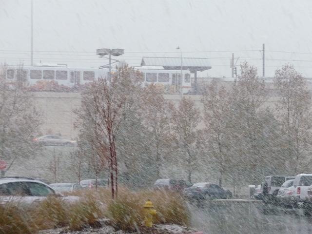
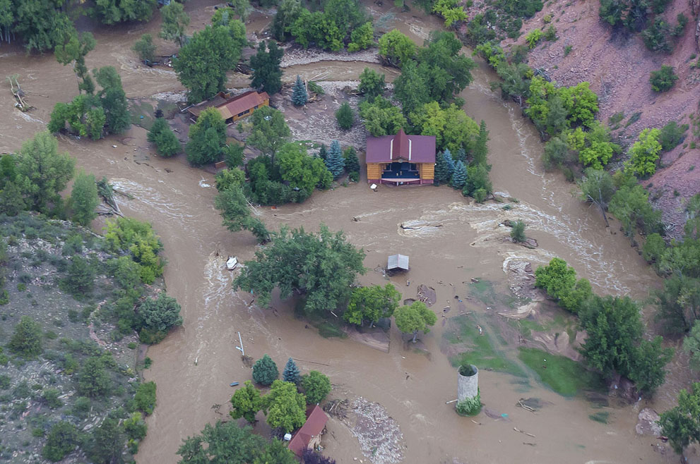
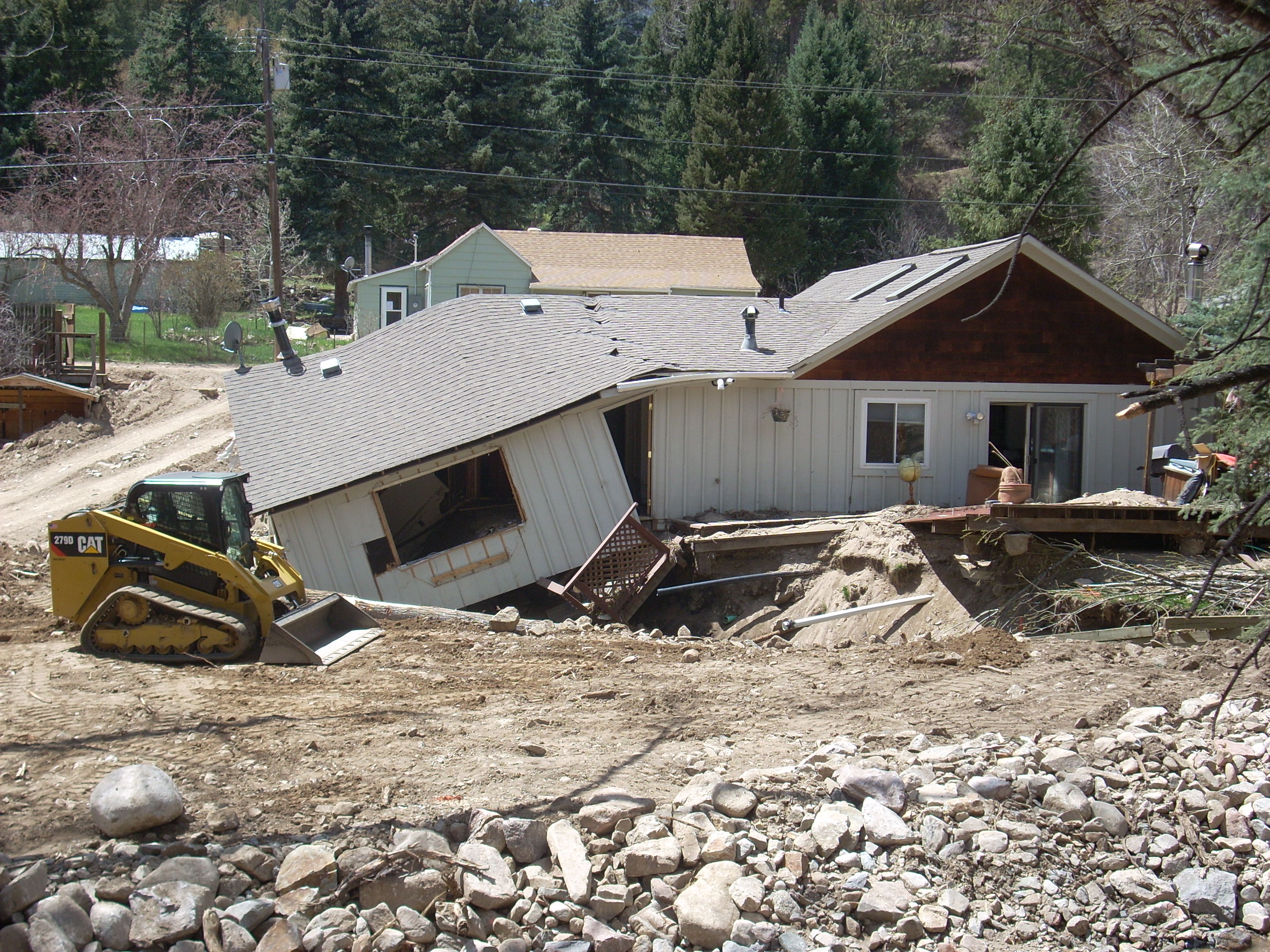
Rain for a month.  In Colorado!  The climate change deniers must be having second thoughts.  It rains on the unrighteous (Republicans) as well as the righteous (me).  The upside is that we have been finishing up our landscaping project which began with our new garage last summer.  There are just a few loose ends, a little planting, support for the raspberry bushes, and cleaning up after the hailstorm.

Some of our new plants are a bit ragged, but I don’t think we lost anything.  Our neighborhood does not seem to get quite the weather extremes as other areas in the metro area.  We have a lot of leaves down I will rake up if it ever dries out.  I had sense enough to put my pickup in the garage before Thursday’s hailstorm.

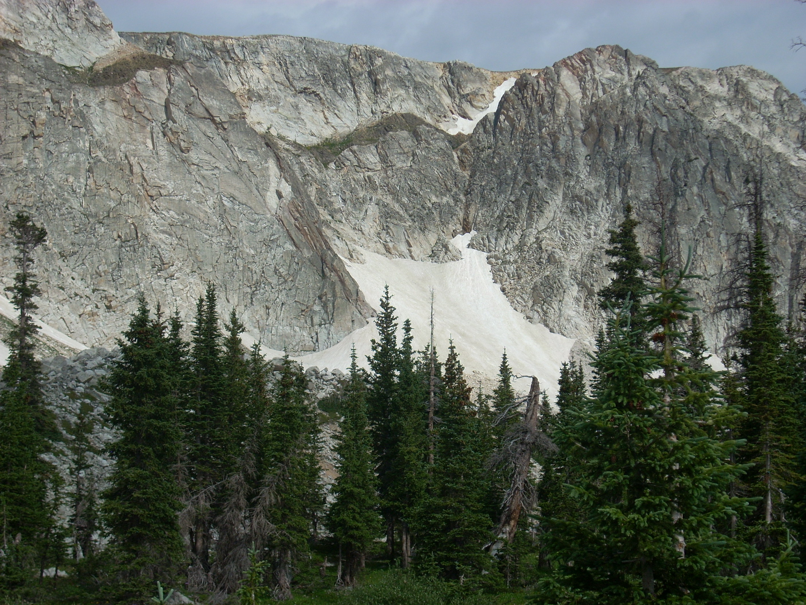
Climate change.  It seems like this area will be wetter with more extreme events than in the recent geologic past.  Our front range mountains are good at catching moisture brought in from both gulfs by a low pressure system south of here.  Some call it the Albuquerque Low.  Unfortunately, it doesn’t bring much rain to California.

This area may become something of an oasis in a growing desert.   What is clear is that we can no longer count on the status quo.  Humanity has to drastically reduce the amount of carbon dioxide we pump into the atmosphere.  Of course, the earth seems to have self-correcting systems that restore a balance.  It takes a long time however, and may mean the extinction of the species responsible for disrupting things.  Once again the adage is proven true:  “In the long run, we are all dead.”

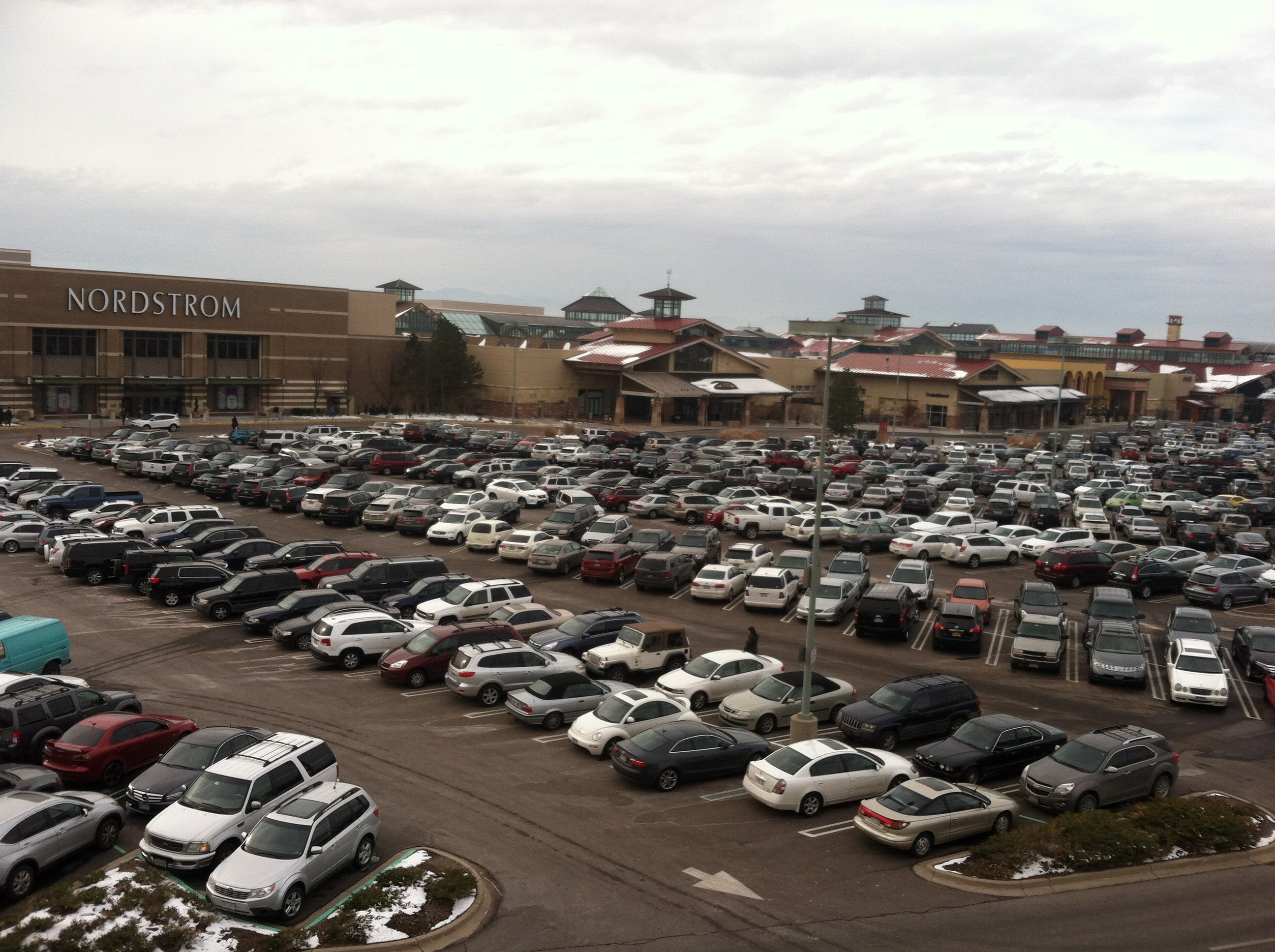
On a completely different subject, I am I the coffee shop right next to the Denver University campus and today is graduation day.  There were all these people all dressed up at 8:00 in the morning.  The woman across from me at the table flew in from L.A. Last night for her best friends graduation.  These rituals were on the wane for lots of years.  I did not even entertain the idea of add ending my graduation from CSU, but of course it was the sixties.  The only important ritual was passing the doobie.
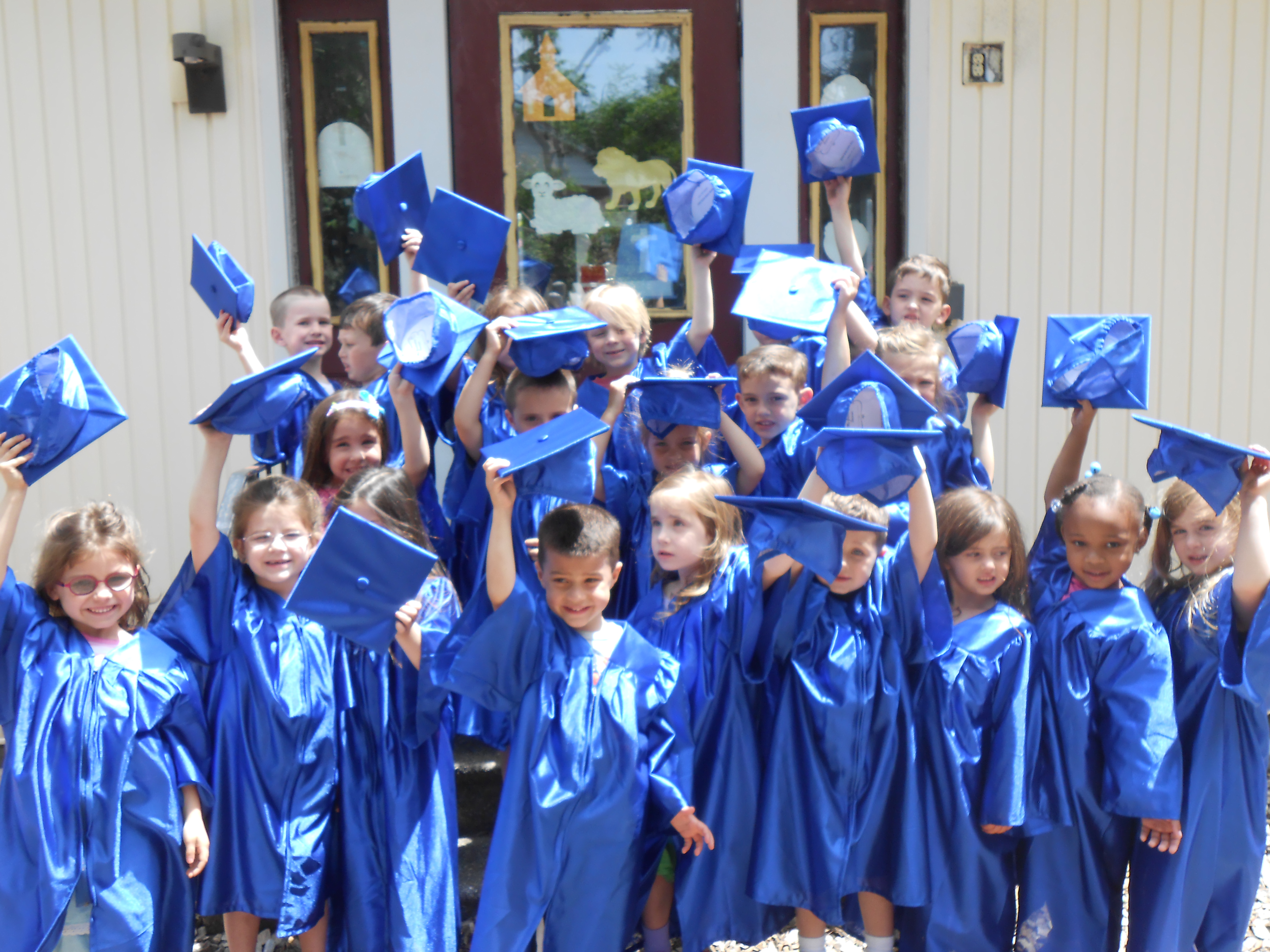
Preschool

Preschool

Now ritual seems to be returning.  The Masons and the American Legion are dying out, but preschoolers are wearing caps and gowns to graduate.  Ritual brings us together, and we need more.  I don’t know what will replace the obsolete organizations, but something will probably happen.  People need one another, and have to come together to reaffirm that need.  Which reminds me, my 55th High School reunion is in September

A Trip to Hell

Hell Frozen Over

Hell Frozen Over

Tuesday I went to Hell.  The other name for Hell in Denver is Park Meadows Mall.  Nothing Dante imagined can compare to the real thing.  Every year I resolve to do all my shopping early and every year I find myself among the throngs.

I had two goals, go to The Tattered Cover Bookstore in Highlands Ranch (Purgatory) and then on to Hell.  I am experiencing something of a seasonal depression and my new meds haven’t kicked in yet.  When I am depressed I am also irritable, which interferes with rational thinking and civilized driving.  I am able to control one, but not both.

I concentrated on my driving behavior and got lost.  It was snowing, and I couldn’t see the mountains.  I have been to the bookstore down there several times, but not Tuesday.  Consult the map or the GPS?  Who, me?

So I wandered through the suburban desert to where I thought Park Meadows should be.  Behold, I was on the wrong side of C-470.  I was able to find Quebec Street and struggle through the traffic to Park Meadows.  If you have never been there, the streets were laid out by Satan.  There is no rational pattern to the traffic flow, especially when every car in the Metro Area was there.   People were pretty nice to one another in their cars, so the Season’s spirit was operating to some degree.

I got lucky and found a good parking place which turned out to be on the opposite side of

Styx

Styx

my destination.  I had the opportunity of traversing the entire place.  Full of people, packed, glutted, overloaded, crammed, and crowded.  Some shopping, many just getting out of the house.  There were lots of young Marines just out of boot camp.  There were probably G.I.’s as well, but with enough sense to be in civilian clothes.

The general mood was festive and happy.  My experience of Cherry Creek Mall is more negative.  People seem more hurried and unfriendly.  I was able to do my shopping and make my way back to my car.  I took secondary streets home to avoid the traffic.  I was even able to calm down a bit.  Still could not find the Tattered Cover.  Look at the map or consult the GPS?  No.

Next day I was able to finish my shopping on Colorado Boulevard, Denver’s busiest street, but less frantic than Hell.  Will I be able to do my shopping earlier next Christmas?  Probably not, but I will do my best to avoid Hell.

Freezing on Deadman’s Hill

Deadman's Hill Lookout Tower

Deadman’s Hill Lookout Tower

I did a ramble to Deadman’s Hill and some other places. I did survive, but it was not easy.

Deadman’s Hill is west of Redfeather Lakes on a road that ends on the Laramie River road.  This is one of the more remote mountain areas east of the Continental Divide in Colorado.  Redfeather is a resort community northwest of Fort Collins and north of Rustic, in Poudre Canyon.  There are lakes, a store and post office, a restaurant, and many cabins.  There is a year-round population of about 250 people.  It is a bit funky, and nothing like the ski resorts with their upscale condos.

I went to Colorado State in Ft. Collins, lived there for several years, and never got to the area.  I have had Deadman’s Hill on my list, and tried to go over the road last spring.  Alas, the road is closed from December to June.  I was too early, but not too early to see a bear feeding in a meadow just before the closed gate.

I went back last week, the road was open and well graded.  It climbs through a Lodgepole Pine forest to a spur leading up to a fire lookout tower that has a view of most everything from Rocky Mountain National Park to Wyoming and from the plains to the Rawah Wilderness in the Medicine Bow mountains.

From the lookout tower I went down the hill a ways to a long meadow looking right at the Rawahs.  A little creek ran through the meadow and a pair of bull moose would drift out of the timber, feed for a while, and move back into the trees.

Meadow With the Rawah Mountains

Meadow With the Rawah Mountains

I got the tent up just in time for the first rainstorm, and had another storm a couple of hours later.  A pleasant and lovely late afternoon, with the solitude I always seek in the back country.

If it is not raining steadily, I set up my cot outside, with the sleeping bag inside a canvas bedroll along with a wool blanket.  I slept for a short while, got up to pee, got cold and stayed that way for the rest of the night.  I reached outside the bedroll and felt a layer of ice.  It seemed like my feet were as cold as those snowfields on the flanks of the Rawahs, and the rest of me had just come out of the water draining the snowfields.

I tried a few things that helped my body a little, but my feet got colder every time I left the sleeping bag.  Oh, and the sleeping bag zipper jammed.  No sleep, much misery.  At about 4:30 AM I climbed into my pickup and ran the heater to warm up.  Everything in the cab of that truck is lumpy or pokes you if you are trying to sleep.

At 5:30 I threw everything into the bed of the truck and went down the hill to the Laramie River road.  From there I went north to Woods Landing Wyoming, hoping to find coffee and food.  Closed.  On to Mountain Home, Wyoming, nothing there.  I went west to the road from North Park Colorado into Wyoming and south to Walden.

I found coffee, heat, food, and a semblance of civilization.  There were four old guys, retired ranchers from the look of them, sunning themselves on the patio in the 45 degree morning.  I saw some bicycles parked nearby and asked them if the bikes were theirs.  One shook his head, taking me literally at first.  None of them had been on a bicycle in at least 60 years.  You don’t ride bicycles if your headgear is a cowboy hat and your shirts have snaps, not buttons.

The bicycles belonged to some city folk having breakfast and fixing a flat tire.  They were in their 60’s.  Hardy people there, in Jackson County.

From Walden I went back north along the North Platte River into Wyoming.  The Platte and Laramie River valleys are what I think of as mountain ranch country.  Irrigated hayfields and pastures flanked by sagebrush hills rising into the timber.  Everyone waves at you.

Snowy Range

Snowy Range

I then went east over the Medicine Bow Mountains, capped by the Snowy Range.  This is one of my favorite drives.  The mountains are snowy white, jagged, and have lovely lakes at their base.  The white rock is 4 billion year old quartzite, older than anything in Colorado.  Just off the highway on the way to a campground are some stromatolites, or petrified algae, some of the oldest evidence of life on earth.Deadmans Hill 2014 012

I had lunch in Laramie and decided to return to Redfeather and get a cabin for some sleep.  There were no cabins available, so I went to Poudre Canyon, where a cabin was too expensive.  By that time I was so tired I just went home.  A tired, cold trip in some fine country.

Colorado’s Front Range Floods

2013 flood

2013 Flood

Those of us who live along the eastern base of the Rocky Mountains enjoy a unique set of circumstances; a fine climate, mountain views, a mountain playground, and rivers that provide much of our water needs.  There are millions of people living in an urban area that runs from Pueblo to Fort Collins.

Most of the time, the physical setting and the climate combine to make the Front Range a fine place to live.  There is risk, however.  Most of the time we don’t have quite enough water for every need. The people are along the Front Range, and the water is on the western slope.  On occasion, we have way too much water.  We are subject to drought, our own waste of the water we have, and the floods that come out of the mountain canyons.

To understand these problems requires a look at two histories, the Rocky Mountain history for the last 75 million years and human history from 1859.  Around 75 million years ago the Rockies began to form.  As they grew, they also wore down.  The debris from the mountains spread from their base to as far as Nebraska.

The streams were bigger then.  Drive east to Bijou Creek and see the valley that obviously was not formed by the current flow in the creek.  The wind blew.  It still does, leaving eolian sand deposits.  Sand Creek, draining the area east through Stapleton and into Aurora is appropriately named.  You can identify the sand hills – they are grazing land, not good for farming.  That sand and dirt comes from as far as Utah and coats our cars.


Today, the Rockies are not eroding as fast as they did during the ice ages, but they are still coming down.  Back in the Precambrian when I took geology, the assumption was that erosion was a steady, gradual process.  Taking the long view, that is so, but on a human time scale, erosion is punctuated by periodic floods.  Some of the floods are from spring runoff from wet winters.  The catastrophic floods pound out of the canyons when storms park themselves over an area and it rains.  And rains.  Sometimes it rains more in a few hours than it does in several normal years.  Sometimes the rain is where the people are, just east of the mountains.

Large amounts of moist monsoonal air from the Gulf of Mexico move north along the Rockies and encounter a cold front coming from the west.  Sometimes the rains are short in a fairly small area.  At other times, as in 2013, the rain comes down over a large area, and it rains for days. To humans, these storms seem like unusual events, but they have been happening for millions of years.  Along with normal erosion, they have filled the Denver Basin with 13,000 feet of debris.  That is a lot of rocks and mud.


1864__Cherry-Creek-Flood~p1

1864 Cherry Creek Flood

One of the first recorded monsoonal floods was in 1864, not long after Denver was settled.  Cheyenne and Arapaho Indians told the settlers seeking fortune not to build where Cherry Creek and the South Platte meet.  The town builders built there anyway.  It was a logical town site.  Trails met, grass, trees, and water were available, and the gold-rich mountains just a short distance away.  Much of the new town went downstream.


The town was rebuilt in the same place.  Floods came again.  Denver flooded in 1876, 1885, 1894, 1912, 1921, 1933, and 1965.  Pueblo flooded in 1921, the Big Thompson in 1976, Manitou Springs and Colorado Springs in 2013, and much of the Front Range from Denver to Fort Collins in 2013.  The link is from the Atlantic Monthly, with dramatic images from the 2013 flooding.

Most vulnerable are towns at the base of the mountains: Manitou Springs, Palmer Lake, Morrison, Golden, Boulder, Lyons, Loveland, and Fort Collins.  Towns along the South Platte, St. Vrain, Cache La Poudre, and Big Thompson rivers are at special risk.

DSCN0960

Jamestown 2014

Will people stop building there?  Rebuilding is underway in every area flooded in 2013.  While researching this piece I traveled to Boulder, Jamestown, Lyons, and the farmland along the St Vrain.   I saw travel trailers parked nest to damaged homes with building permits on the flood-damaged houses.

Some actions do prevent floods.  Denver has Cherry Creek, Bear Creek, and Chatfield dams.  They are flood control dams designed to capture floodwaters.  Let’s hope they are big enough.

The photo above has a lot of rock in the foreground.  The rocks range in size from sand and silt to head size.  They were exposed by the 2013 flood, but were deposited by a previous flood that had enough force to carry that debris and dump it there.  upstream, there are narrow gulches with the lower ends scoured down to bedrock.  That debris went further downstream.

The Rocky Mountains are on the way to the Mississippi river delta in Louisiana.  It will take many millions of years, but they will wear down and become Mississippi mud.  Floods will hasten the process.

Recent Entries »