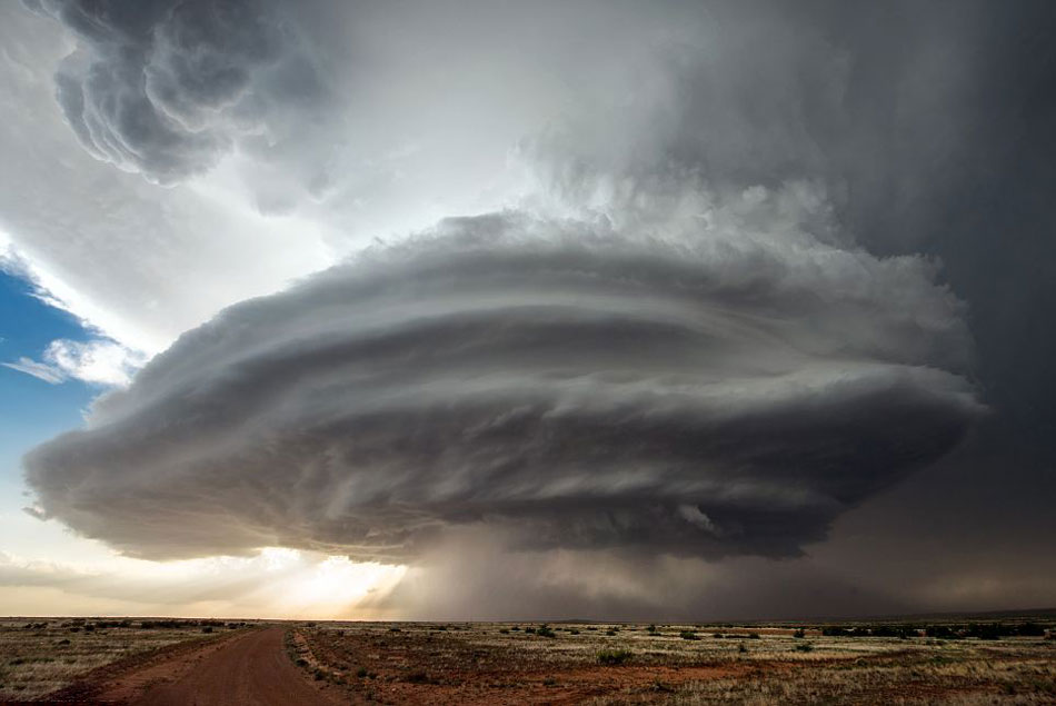
Tag Archives: Erosion

Dirty Denver

Windstorm

Windstorm

The wind blows here in Denver, and it is not all air.  Those mountains just west of us are wearing down.  Most of the sand and dirt ends up in the rivers, put the wind blows some of the mountains away.  If you park your car outside, you already know this.  The dust covers everything on the car, and you have to wash the damn thing.  Mostly the dust is that tan/brown dirt color, but sometimes it is red when parts of Utah decide to take a visit.

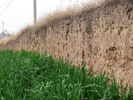
The constant deposition of wind-blown dirt is why ancient cities get buried.  The process is slow, but relentless.  Denver is being buried, but we haul a lot of it away.  Our older house has what seems to be sunken sidewalks.  It is the wind- blown dust combined with organic matter (grass clippings) to form topsoil.

Carol likes to say that a lot of the stuff that accumulates is spider legs.  True, along with the exoskeletons of millions of insects.  In geologic terms the rate of deposition of all that stuff is fairly rapid.

Here on Colorado’s Front Range we get wind, but nothing like the mountain winds, unless you live in Boulder or other places at the foot of the mountains.  The mountains are high enough to get some of the higher altitude winds that the flatlands don’t get much of.  Also, when a weather system blows in, the mountains act as a barrier, forcing all that moving air up.  As it rises, it cools, gets more dense, and descends on the lee side of the mountains. As it falls, it gains velocity and tends to warm up, creating our famous chinook winds.

Loess Soil Windblown Dirt

Loess Soil
Windblown Dirt

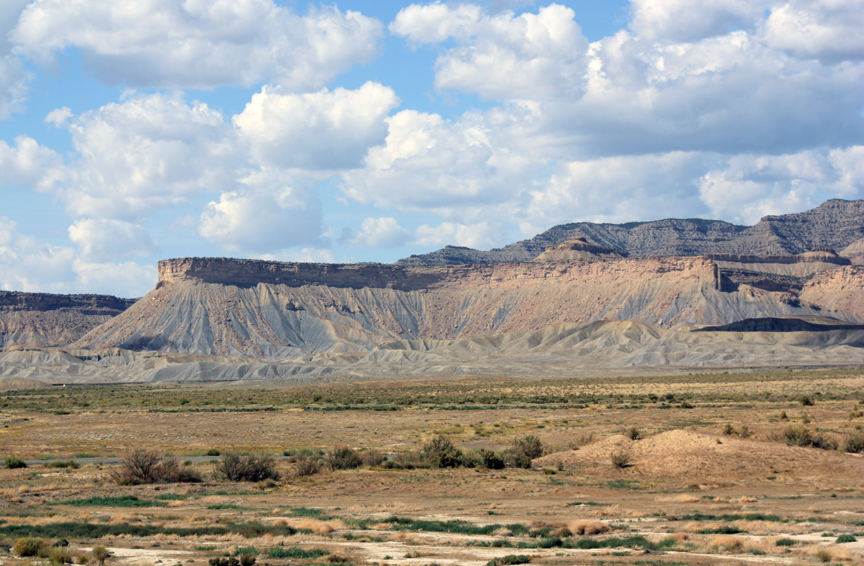
As the wind moves on the plains, it’s velocity decreases and some of the dirt it carries falls out.  Close to the mountains, a lot of it is sand.  That explains the sand hills we have close to the mountains.  You can identify the sand because it does not support plant growth as well as soil.  Sandy areas are cow country, no farming.  A little farther east, the dirt falls down.  A lot of dirt falls down, forming loess, a German term for wind-blown dirt deposits.  Eastern Colorado has thousands of square miles of loess.  Without irrigation, it is usually planted in wheat.

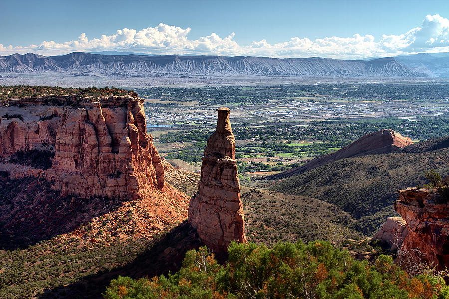
Of course, all the water or wind-borne sediment is headed for Mississippi, Lousiana, or the gulf.  Most of that Mississippi mud will end up as shale.  At some point plate tectonics will shove it up as dry land and the cycle starts over.  Most of the sand will eventually end up in the streams, get buried, and form sandstone like the Dakota sandstone dinosaur fossils are found in.  In other places, tremendous deposits of wind blown sand accumulate, eventually forming the sandstone that blankets the Colorado Plateau.

That dirt accumulating in your lawn and garden is part of a recycling process going on all over our planet for millions of years.  The process will continue long after we are all gone, as long as there is air and water on the planet.  To me, the whole thing is a miracle, all these geologic processes creating conditions existing long enough for the evolutionary mistake known as humanity to develop.

The Bookcliffs and the River


Bookcliffs

Bookcliffs

The Book Cliffs are the neglected stepchildren of Western Colorado and Eastern Utah. That is somewhat ironic, because they stretch from Palisade and Mt. Garfield about 200 miles to Price, Utah. Rising about 1000 feet from the valley floor, they are the longest escarpment in the world. Above the Book Cliffs is a bench With the Roan Cliffs forming another escarpment  Behind the cliffs is the Roan Plateau, rising to about 8000 feet in elevation. With the wide change in elevation and precipitation from eight inches annually to around thirty, there is wide diversity in plant and animal life. There are energy resources as well. Natural gas, tar sands, oil, coal, and that huge deposit of oil shale.   The region is known as the Tavaputs Plateau.

The plateau is home to the Desolation Canyon Wilderness and due to the wide range in elevation and precipitation, a diverse range of plant and animal life. There are three reasons why the area is not very popular with visitors.

First, look south. Colorado National Monument, Arches, Canyonlands, Capitol Reef, Bryce Canyon, Zion, and Grand Canyon National Parks. There are the three mountain ranges and all that wondrous red rock carved into some of the best scenery on earth.

Next, accessibility. Douglas Pass is the only paved road in the vast area. The many dirt roads are accessible only as long as they are dry. Traditionally, the only people there were stockmen and the Utes on their reservation. In recent times there has been much energy-related activity that comes and goes.

The third reason? Shale. It is not only shale, there are layers of sandstone, even limestone. It’s all gray or shades of tan. Driving on the drab Mancos shale landscape of I-70, looking north you see drab cliffs. More of the same gray rock, just standing up. Roads built on that shale changes into some of the most slippery substances known after a rain or snow.. People are just not inspired to go there.

Growing up in Fruita, Colorado, I spent quite a bit of time in areas on either side of the Douglas Pass road, which was gravel and dust at the time. We had rancher friends, and deer season was a big social scene. It is wild, mostly empty country, home to lots of cattle, some sheep, a few ranchers, and a lot of wildlife. It is also famous for some of the most treacherous mud in the world. There are some sandstone lenses (we called them rims), but it is mostly shale, a former lake bottom that now sits thousands of feet above the Grand Valley, where the people live.

Colorado National Monument.  Bookcliffs on the horizon

Colorado National Monument. Bookcliffs on the horizon

I used to look at the Colorado National Monument with its red rocks to the south. To the north were the relatively drab Bookcliffs with the whitish Roan Plateau above them. Why the difference? The Monument is famous, with lots of information about the Uncompaghre Uplift lifting the Uncompahgre Plateau thousands of feet compared to the Grand Valley. As the plateau, erosion took the more recent rocks off, leaving the more resistant sandstone.

I thought some sort of uplift must have formed the Bookcliffs. Well, partly. When the entire Colorado Plateau was uplifted at the same time as the Rockies, The Colorado River just dug away, carrying the eroded rock to the sea. It is still digging, and is eroding those Bookcliffs to the north. Under the Bookcliffs are the rocks of the Monument. Someday the land will be fairly flat between Grand Junction and Craig. We won’t be around, however. These things take time.

So, the Colorado Plateau was uplifted and after that the Uncompahgre Plateau went up some more and wore down. The rocks exposed at the Monument are, a few miles north, well below the rocks of the Bookcliffs who are headed north as the river gnaws away. The Colorado River rules, it is just a bit slow.