The Golden Fault
Red Rocks. on the Golden Fault
I live at the base of the Southern Rocky Mountains. The Rockies are a lengthy mountain cordillera running from southern New Mexico to well into Canada; almost in mid-continent. The most dramatic portion is in Colorado in terms of elevation and extent. You may have heard of Pikes Peak, one of sixty three 14,000 feet high mountains.
Usually mountain ranges sit at continental plate boundaries. The Sierra Nevadas, the Cascades, the Andes, the San Gabriels, and the mountains in Central America are an example. The Himalayas are the result of the Indian sub-continent colliding with Eurasia. So, why are the Rockies here? The most accepted theory is the Pacific tectonic plate once failed to subduct at the continental boundary and slid under the continent then dove, pushing the Rockies up.
All the features of mountain building are here, volcanos, lava flows, and a succession of mostly parallel ranges. The anomaly is they are about 800 miles from the coast. Our current Rockies are not the first ones here. The 300 million year old Ancestral Rockies rose, wore away, and were replaced by our modern Rockies, about 64 million years old. The idea is there is some sort of crustal weakness under the Rockies contributing to their birth here.
The western Rockies sort of grade off onto the Colorado Plateau and the Basin and Range province. On the east side, things are more dramatic. Travelers go along the gradually rising Great Plains until wham, the Rockies poke up. Flat country, than mountains. Lots of us live along the base of the mountains. There is water, good soil, nearby timber for building, and a dramatic setting with a somewhat better climate.
The Native Americans often wintered here, returning to the plains in spring to hunt buffalo (Yes, buffalo, not bison. Leave that name for the biology geeks.). The Pikes Peak gold rush meant the end for the Indians. By 1870, the plains Indians were gone from Colorado. The miners and the followers stayed, and the Front Range Urban Corridor grew to the crowded area we get stuck in traffic today.
Just west of Denver is the Golden Fault. The big crack of the fault along the base of the mountains west of Denver dived westward under the mountains when the Rockies rose during the Laramide Orogeny, about 64-67 million years ago. The uplift along the fault exposed rocks that are buried 14,000 feet down east of the fault. The San Andreas Fault can’t match that one. In addition, the mountains slid about one and a half miles over the plains.
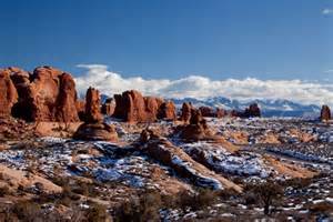
Red Rocks Park, home of many rock concerts, is composed of the Fountain Formation, about 300 million years old, formed of debris shed off the Ancestral Rockies. Just to the west are what geologists call basement rocks, 1.7 billion years old. The gap is the Great Unconformity, with the geologic record missing. All that time is gone due to erosion. Those basement rocks are highly modified remnants of an island arc which drifted north across an ancestral ocean and collided with the older rocks of the Wyoming Craton. The same process is going on today as the Phillipines, Java, Taiwan, and the other islands are headed to a collision with Asia. Listen for the noise from the smash.
Another benefit of the Golden Fault for us is all the interesting rocks tilted up by the fault. Red Rocks, Dinosaur Ridge, Lookout Mountain, Green Mountain, and North and South Table mountains all owe their origin to the fault. The last three are with us because of a lava flow originating from north of Ralston creek.
Another fun feature is the erosion which wore the Rockies down at almost the rate they were uplifted. The result was a gradual plain sloping off the mostly buried mountains to the prairie. Then, Monument Creek, the South Platte, Clear Creek, the Big Thompson, and the Cache La Poudre, and their tributaries went to work, along with some more uplift. The erosion created the canyon-carved escarpment we have today. The Rocky Mountain Erosion Surface is the result of the river’s work. From Green Mountain Falls to Estes park is a bench marking the ancient surface. The Rampart Range road and the Peak to Peak highway run along the surface, with scenic canyons carved into the rock. Deer Creek Canyon, Clear Creek Canyon, Golden Gate Canyon, and Coal Creek Canyon are some of the canyons we can drive down today. Thank the South Platte River and Monument Creek for the scenery.
The Laramide Orogeny uplifted the Rockies, with the now buried Golden Fault being a major feature and result of the bulging, and the later exhumation created the landscape those of us living on the foreland enjoy today. The Rockies may still be rising, but it is slow compared to the coastal mountains. The South Platte just keeps on digging.
If you feel some shaking of the earth, it may be from the southern San Andreas fault letting go. It is locked, but there is about 100 feet of movement between the Pacific and North American plates ready to happen. Another earthquake source is the New Madrid Fault south of St. Louis. As they say, it is not if they will move, but when.